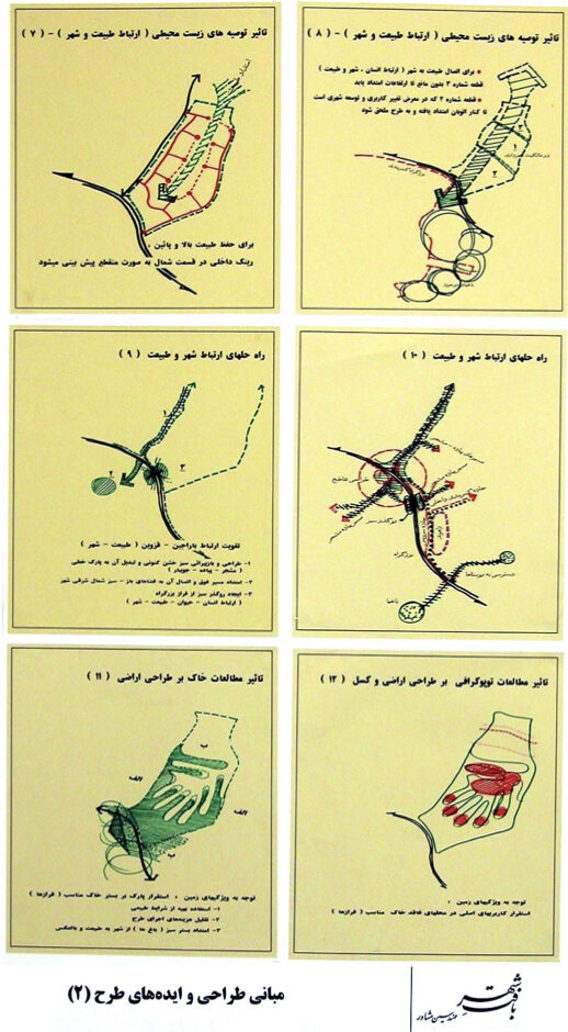
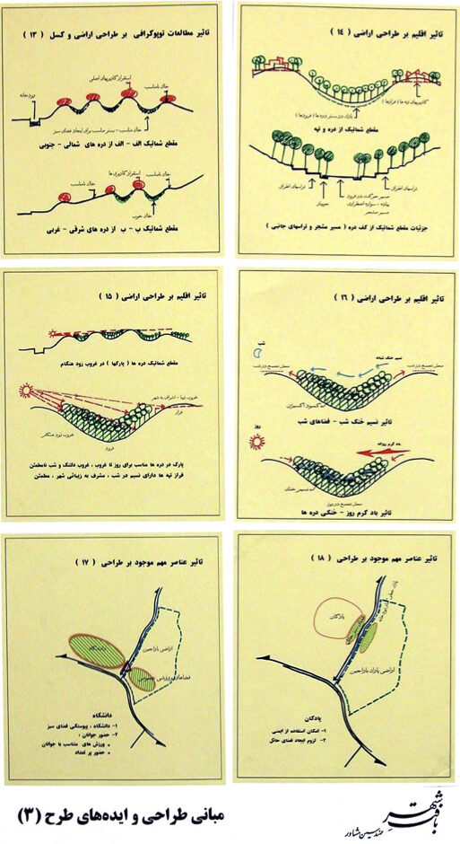
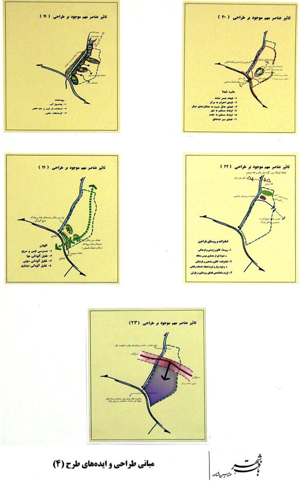
رویکرد پایدار
طراحی شهری - محیطی برای توسعه پایدار شهر
( نگهبانی، زنده سازی و بهره برداری درست از داشتههای طبیعی شهر)
پیشگفتار:
کشور ما در سرزمینی خشک و کمباران قرار دارد، با کویری بزرگ در میانه آن. ادامه حیات بسیاری از شهرهای ما به یک یا چند گوهر طبیعی وابسته است و در تعامل دوطرفه با آنها قرار دارد.
نیاکان خردمند ما با شناختی ژرف از ساختارهای مؤثر، ارتباط انسان و شهر را با طبیعت درون و پیرامون بهگونهای هوشمندانه و آیندهنگرانه سامان میدادند، بهطوریکه همزمان با نگهبانی از این گوهرهای(داشته ها) طبیعی، بهرهبرداری از آنها نیز هماهنگ با ظرفیت و شرایط محیطی انجام میشد تا از تخریب تدریجی آنها جلوگیری شود.
تا قرن گذشته، این رابطه متعادل و پایدار میان شهر، انسان و طبیعت در کشور ما حفظ شده بود. اما در دهه های نزدیک، طرحهای توسعه شهری، با رویکردی که بر گسترش کالبدی اهمیت بیشتری میداد تهیه شدند و در آنها راهکار های آینده نگرانهای برای نگهبانی از گوهرهای طبیعی شهرها ارائه نگردید. بهویژه در چهار دهه اخیر، به دلیل مدیریت ناآگاه و منفعت طلب ، روند تخریب این منابع ارزشمند شدت یافت.
از جمله:
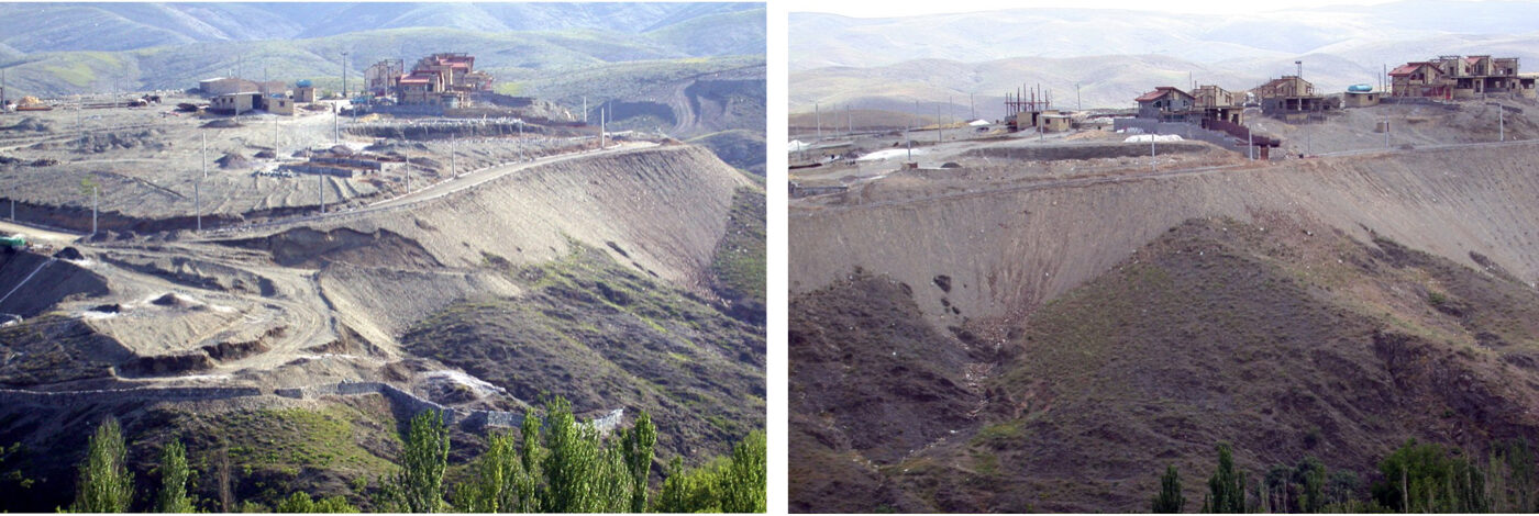
کوهها و تپهها: بهمنظور توسعه شهری، کاربریهای نظامی، تفریحی، آموزشی و مسکونی در آنها مستقر شدند. سطح آنها برای سهولت ساختوساز تراشیده شد و خاک تخریب شده به دره ها و زمینهای پایین دست ریخته شد.
زمینهای پایکوهی: در گسترش بافت شهری به کار برده شدند.
پیرامون و درون درهها:بهعلت خاک حاصلخیز و دسترسی به آب، ابتدا تبدیل به باغ خصوصی، سپس باغویلا، و در نهایت محل آپارتمانسازی شدند.
آبراههها: با خاک ناشی از تراش کوهها پر یا دچار فرسایش و ناپایداری شدند.
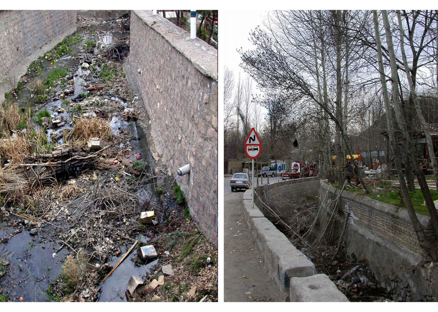
روددرهها: با اجرای قانونهایی بدون ملاحظات محیطزیستی، بستر طبیعی آنها با کانال بتنی جایگزین شد. این مسیرها به محل دفع پسماند تبدیل و زمینهای باقیمانده به فروش رسیدند.
رودخانهها: به دلیل عدم اجرای کامل شبکه فاضلاب شهری، فاضلابها مستقیماً به رودخانهها وارد شده و آنها را به مسیر آلوده کننده دریاچهها و دریا تبدیل کردند.
چشمهها: ساخت وسازهای مجاز و غیرمجاز در بالادست باعث کاهش کیفیت و آلودگی آب چشمهها شد.
دریا و کرانهها: کرانهها پاکی و ارزش طبیعی خود را از دست دادند و دریا به مخزن فاضلاب شهری تبدیل شد.
دریاچهها: سدسازیهای غیراصولی موجب خشکشدن دریاچهها شد.
کاریزها (قنات): ساختوساز در حریم آنها، برداشت غیرمجاز آب و ورود فاضلاب، این میراث گرانبهای مهندسی را نابود کرد.
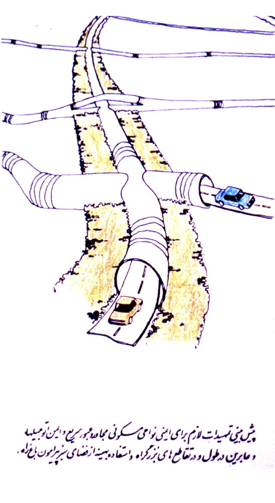
آبهای زیرزمینی: اجرای بزرگراهها و تونلها بدون پیشبینی مسیرهای عبور آبهای زیرزمینی باعث انسداد یا تخریب آنها شد.
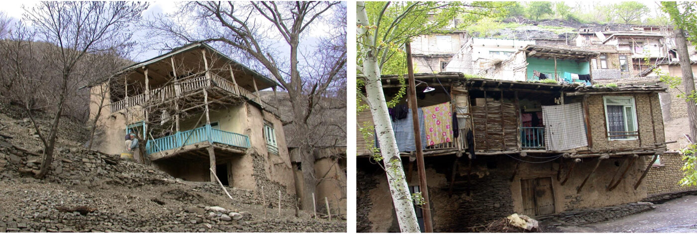
باغها: باغها که از عناصر هویتی شهرهای ما هستند، بهدلیل قطع مسیرهای آب، تخریب کاریزها، آلودگی و افزایش تراکم ساختوساز، تابآوری خود را از دست دادهاند و در حال نابودی هستند.
نتیجهگیری:
نمونه های یاد شده بالا نشان میدهد که چگونه منابع طبیعی و میراث محیطی، پس از قرنها پایداری، توسط نسل ما در معرض نابودی قرار گرفتند. در این شرایط، کارشناسان و دوستداران طبیعت تلاش نمودند راهکارهایی برای توقف این روند و ایجاد شرایط مناسب ارائه دادهاند. اینجانب نیز در حد توان، بههمراه دیگرهمکاران دلسوز، و با اتکا به تجربه طرحهایی که بر بستر طبیعت اجرا شدهاند، نظریه طراحی شهری - محیطی را ارائه نمودم؛ نظریهای که میتواند با درنگ در روند تخریب، بهرهبرداری درست از این گوهرها را ممکن ساخته و در جهت توسعه پایدار شهر و کشور موثر واقع شود. امید است این تلاش بتواند در تحقق اهداف خود نقشی مثبت ایفا کند.
تعریف طراحی شهری – محیطی:
هر جا که شهر در درون یا پیرامون خود بر یک گوهر(عنصر) طبیعی تأثیرمی گذار و یا از آن تأثیر میپذیرد، درهرگونه طراحی، اولویت با قوانین و ضوابط و دستورالعملهایی است که بر پایه مطالعات محیط زیست، طراحی محیط و دانشهای مرتبط استوارهستند و باید اساس طرحهای توسعه شهر در حوزه شهرسازی، طراحی شهری و رشتههای مرتبط قرار گیرند.
دستاوردهای نظریه طراحی شهری–محیطی در ایران:
در چهار دهه گذشته، افتخار مدیریت مطالعات و طراحی تعدادی از گوهرهای(عناصر) طبیعی ارزشمند در شهرهای مختلف کشور را داشتهام.طرحهای یادشده با اتکا به نظریهی «طراحی شهری–محیطی» تهیه و ارائه شدند و میتوانستند، همزمان با نگهبانی و بالا بردن کیفیت محیطی این گوهرهای طبیعی که ثروت، میراث و پشتوانه ادامهی زندگی سالم در شهرها هستند، امکان استفادهی همسنگ توان و پایدار شهروندان از آنها را فراهم کنند، نگرش و رابطهی مردم با طبیعت را بهبود بخشند و به توسعهی پایدار شهری یاری رسانند.
با این حال، تغییر در بنیان طرح، نیمه تمام ماندن آن، یا اجرای آن بدون مشارکت طراحان و با دستور و دخالت افراد غیر متخصص، سبب میشود طرح از مسیر اصلی خود منحرف شده، حتی اثر منفی بر جای گذارد و از اهداف اولیهاش که همانا نگهبانی از ارزشهای طبیعی و بهرهبرداری پایدار بوده، فاصله بگیرد.
گزارش مطالعات این طرحها، طی سالهای مختلف و در شهرهای گوناگون تهیه شدهاند، در قالب چند صد جلد گزارش تدوین گردیده، با بودجههای کشور و تلاش متخصصان دلسوز، باتجربه و علاقهمند به کشور انجام شدهاند.
گرچه ارایه همه آن گزارشها در اینجا ممکن نیست ولی بیتردید ارائهی خلاصهای از راهبردها، راهکارها، پیشنهادها و... این طرحها برای شهروندان هر یک از شهرها، به ویژه دانشجویان و نسل جوان، میتواند آگاهی از ارزشهای کمنظیر طبیعی و تاریخی شهرها و کشورمان را افزایش داده و زمینه ساز مشارکت آنان در حفاظت از این گوهر های طبیعی و میراث گرانبهای نسل های گذشته باشد.
یادآوری چند نکته درباره طرح ها لازم است:
برخی از راهکارها ، ایدههای عمومی، مانند تسهیل ارتباط انسان و شهر با طبیعت درون وپیرامون شهر، قابلیت استفاده در شهرهای مشابه را دارند. در بسیاری از این شهرها، طرحهای دیگری نیز تهیه شده که در اینجا به آنها اشارهای نشده است. برخی طرحها به علت نبود بودجه ، تغییر مدیریتها و…اجرا نشده یا تنها بخشی از آنها به اجرا درآمده است. در بخش ۸ این وبسایت، توضیحاتی دربارهی 40 طرح طراحی شهری – محیطی در ۱۵ شهر ایران ارائه شده است.
اراک
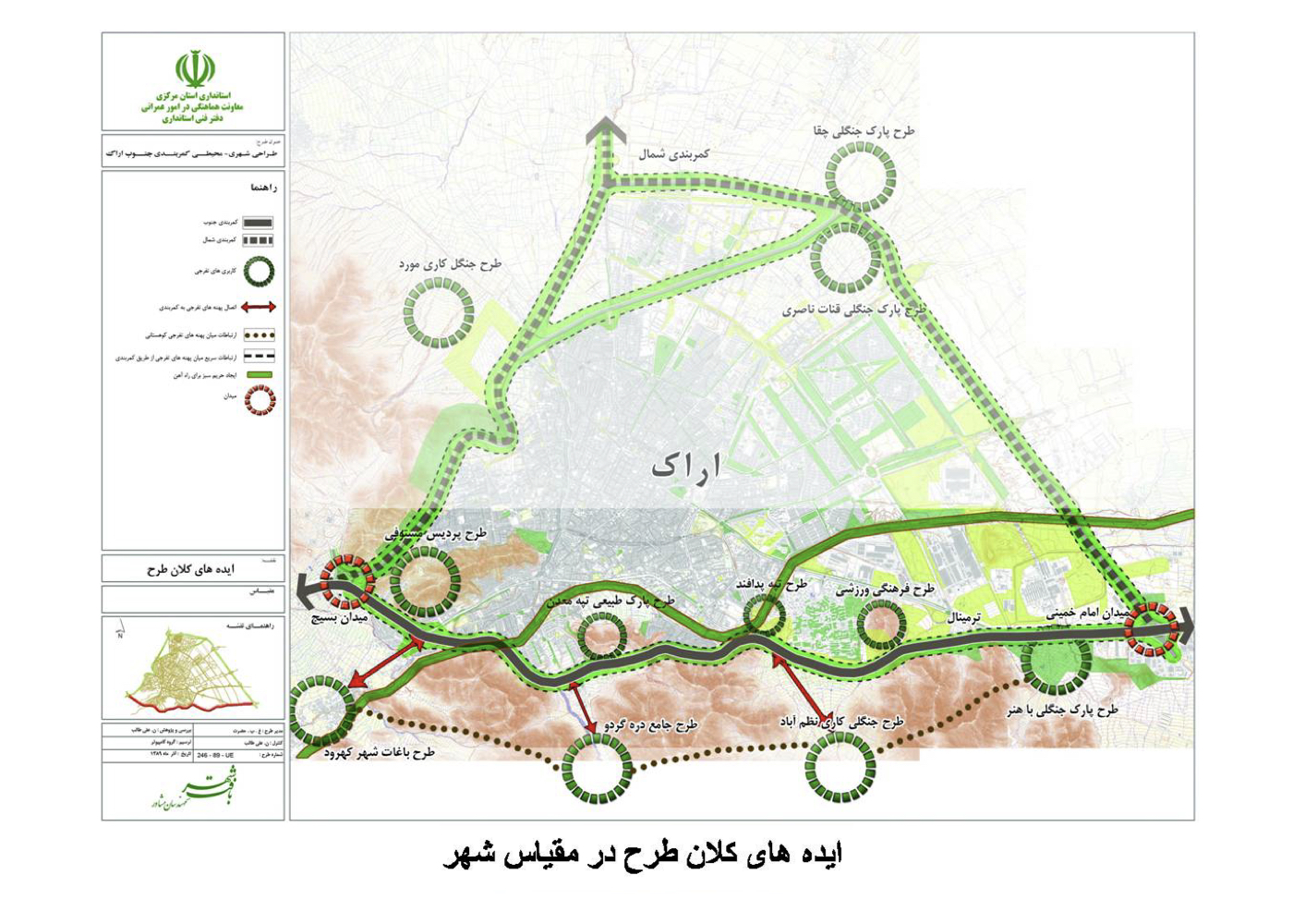
اراک: طراحی شهری – محیطی بزرگراههای کمربندی
پیشینه:
اراک یکی از مراکز صنعتی کشور است و کارخانجات مختلف موجب آلودگی هوای شهر شدهاند، به طوری که مردم با افزایش بیماریهای تنفسی مواجه شدهاند. مقامات شهر و استانداری تلاش مشترکی را برای افزایش فضای سبز شهر در نقاط امکانپذیر به عمل آوردند و از مشاور خواستند که همکاری نماید؛ که با توجه به همه امکانات و محدودیتها، طرحهای زیر تهیه و تصویب شد:
۱. طراحی شهری–محیطی بدنه بزرگراه کمربندی جنوب
2. طراحی شهری–محیطی بدنه بزرگراه کمربندی شمال
3. طراحی شهری–محیطی ورودیهای چهارگانه شهر
۴. طراحی شهری–محیطی کوه مستوفی
۵. طراحی شهری–محیطی کوه گردو (معدن سنگ)
۶. طراحی شهری–محیطی مسیر لوله نفتی در شهر
وضعیت اجرا:
از این طرحها، ده کیلومتر از کمربندی جنوب و کوه مستوفی اجرایی شده، ولی با تغییر مدیران و احتمال کمبود بودجه، تهیه طرحهای اجرایی دیگر پیگیری نشده است.
اهمیت و چشمانداز طرح:
اجرای طرحهای بدنه سبز بزرگراهها میتوانست بهصورت یک کمربند سبز به هم پیوسته در کاهش آلودگی مؤثر باشد، و فضای سبز کوههای نامبرده و مسیر لوله نفتی داخل شهر نیز به پالایش هوا کمک کنند.
در مورد طرحهای شماره ۳، ۴، ۵ و ۶ در بخش معرفی طرحها جداگانه توضیح داده شده است و در مورد شمارههای ۱ و ۲ در همین صفحه نقشههایی ارائه شده است.
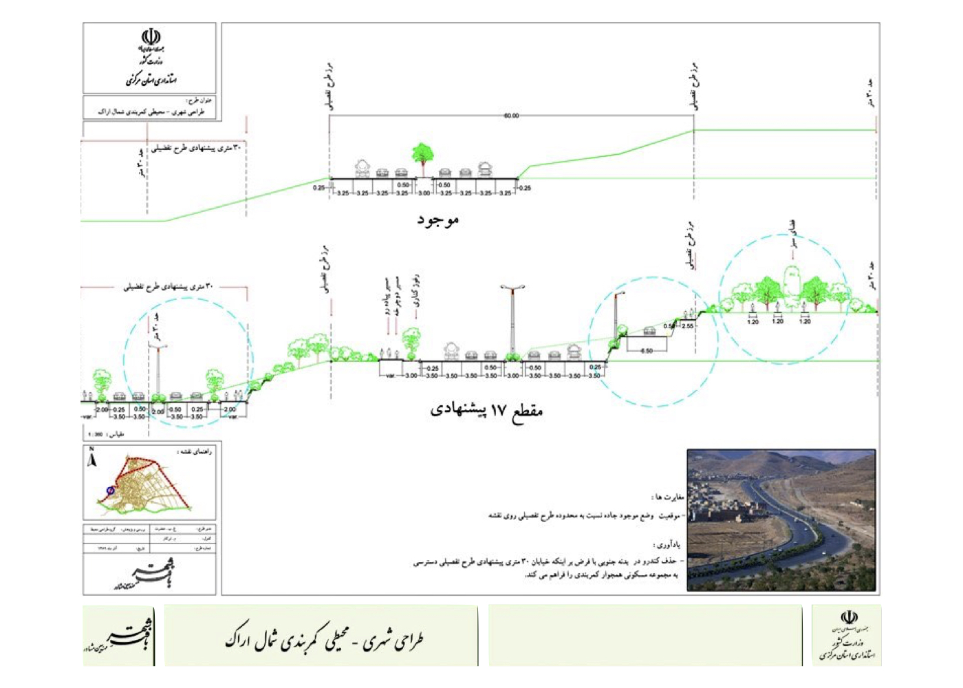
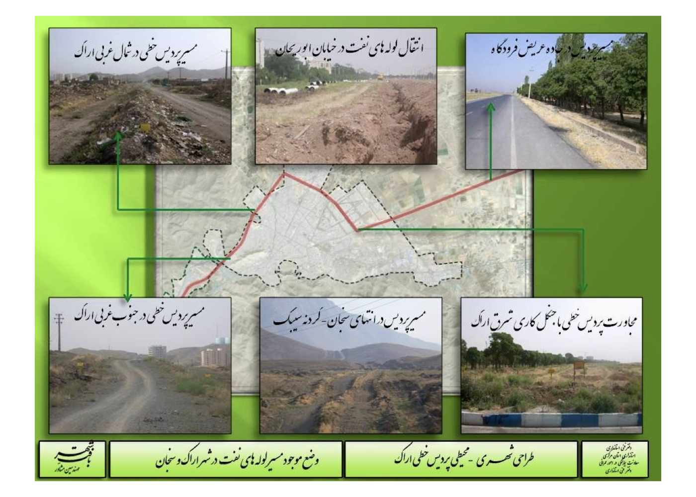
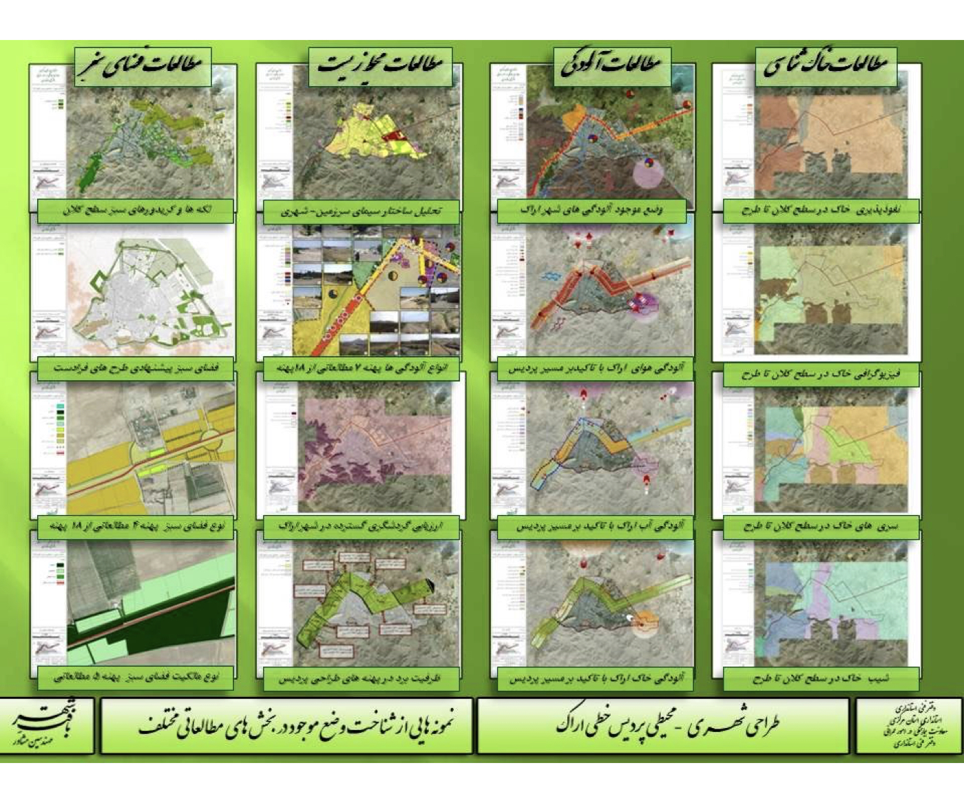
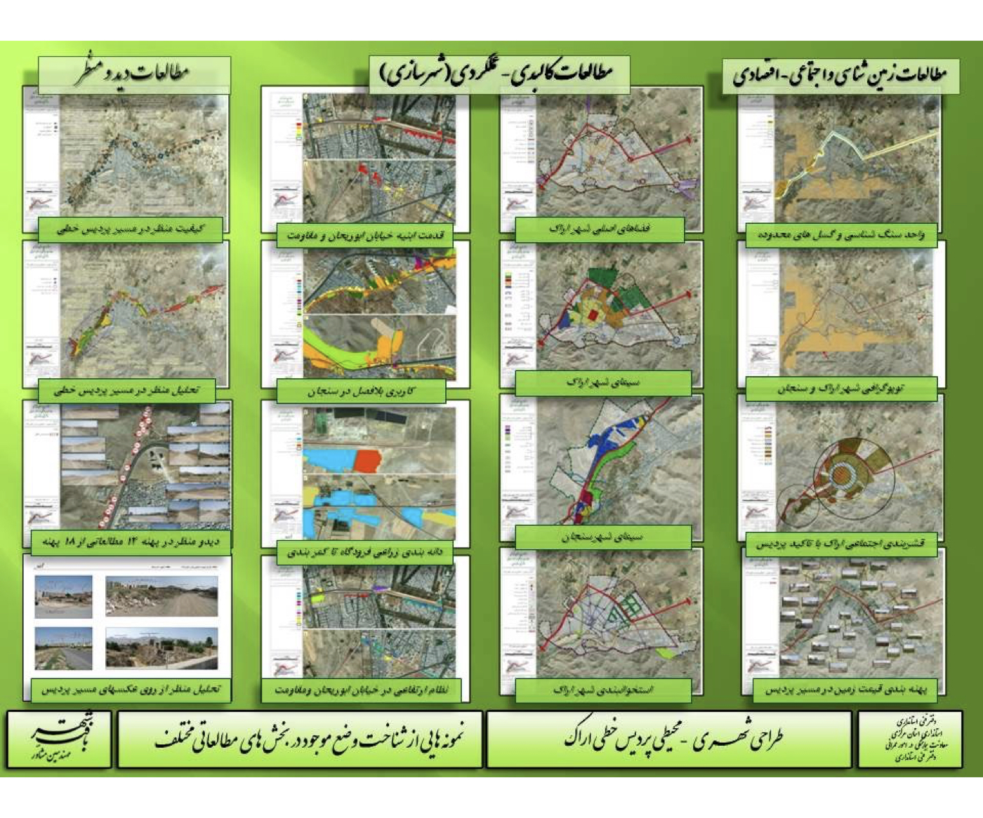
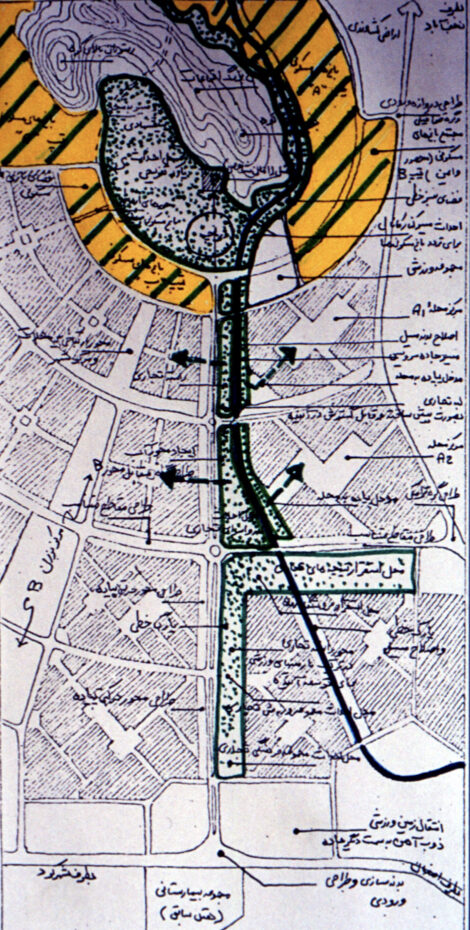
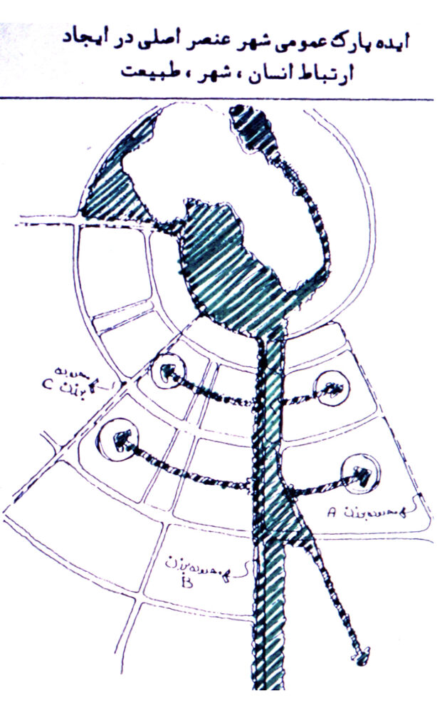
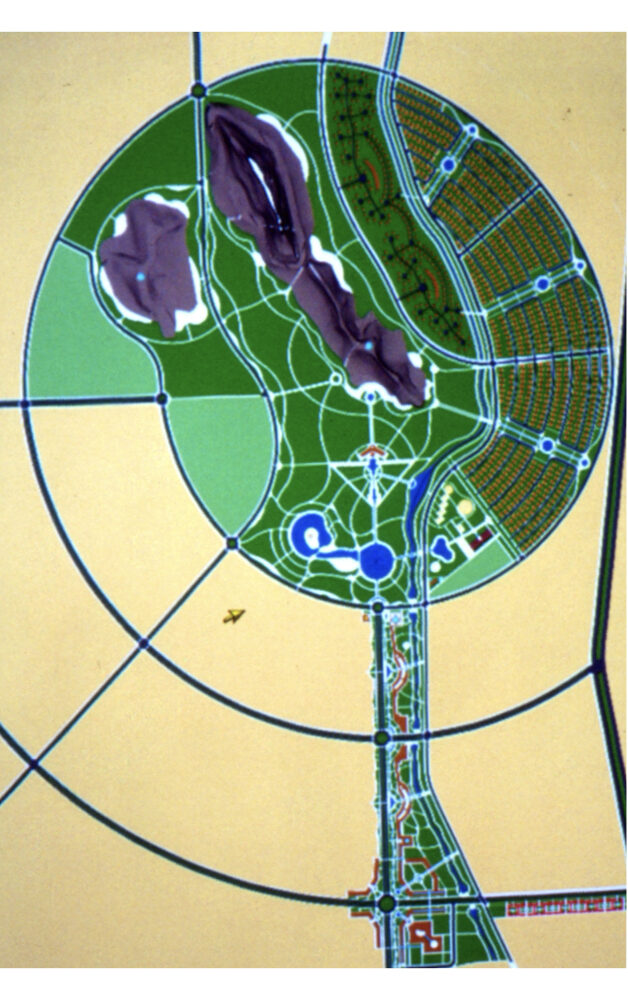
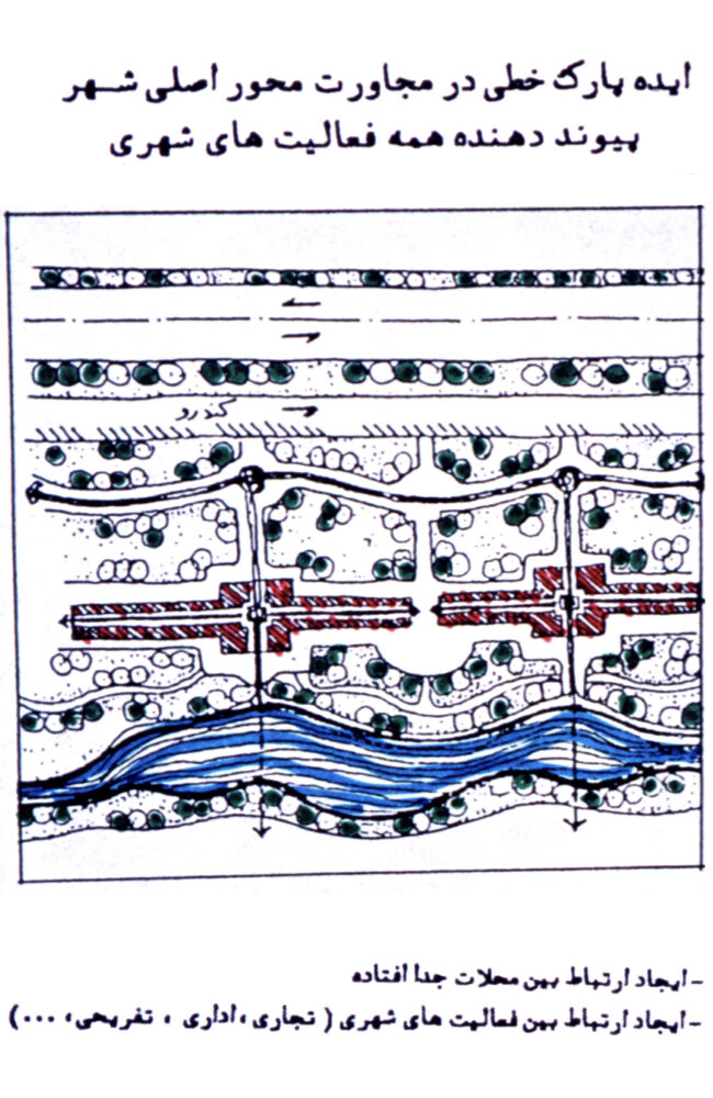
اراک: - طراحی شهری–محیطی پردیس خطی (راهبردی)
فشرده پیشنهادهای طرح:
تبدیل یک محور آلوده و صنعتی به یکی از ارزشهای طبیعی شهر
پیشینه:
در شهر اراک، از دهههای گذشته خط لولهای برای انتقال محصولات نفتی عبور میکرد که با توسعه شهر به نحوی در ارتباط با بافت مسکونی قرار گرفته است نیز موجب آلودگیهایی در سطح و عمق زمین گردیده است.
تانداری و شهرداری تصمیم گرفتند که با جمعآوری این لوله، مسیر آن را به کاربری دیگری اختصاص دهند. مطالعات شهری–محیطی در همه زمینههای مورد نیاز به عمل آمد و پیشنهاد شد که به علت آلودگی هوای شهر اراک، این مسیر به یک پردیس سبز خطی تبدیل شود که تمام محلههای مسیر بتوانند در آن حرکت، گردش و ورزش کنند فضای سبز آن نقش تعدیلکنندهای در هوای شهر به عهده گیرد.
مطالعات طرح درباره زمینشناسی، خاکشناسی، آلودگیهای محیط زیست، فضای سبز، شهرسازی، دید و منظر، ارتباطات و... انجام شد و بر حسب مجموعه شرایط موجود، مسیر در ۸ پهنه مورد ارزیابی قرار گرفت.
راهکارهای زیر طرح تهیه شد و به تصویب رسید:
فشرده پیشنهادها، ایدهها و راهکارهای طرح:
1. اصلاح خاک در مسیر
۲. الحاق لکههای باز رها شده (لچکیها) به مسیر
۳. تأمین ارتباط فضاهای سبز پراکنده شهری با این مسیر برای ایجاد یک شبکه سبز بههمپیوسته و مقاوم در مقابل آلودگی هوا
۴. افزایش تراکم سبز در فضاهای سبز شهری مجاور
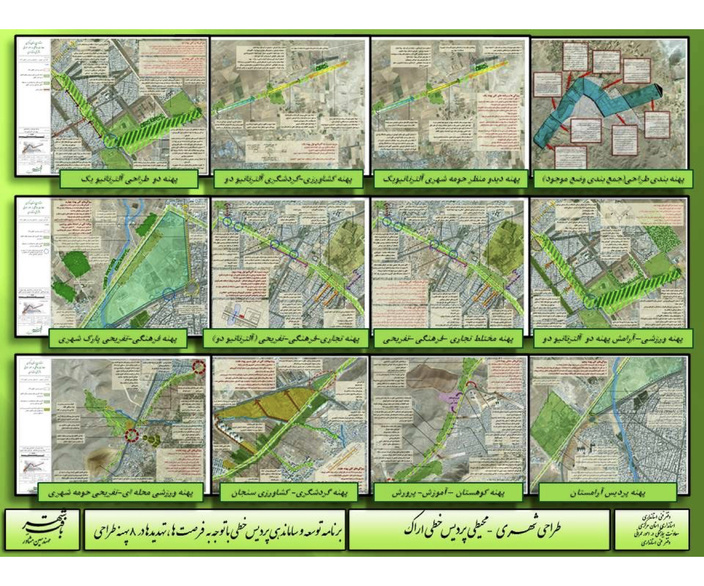
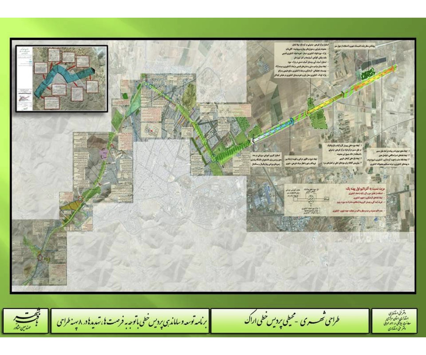
5. احداث چند زمین بازی فوتبال و سایر ورزشها برای تقویت ورزش محوری مسیر
۶. ایجاد ارتباط بین بلوار سنجان و باغهای درههای سنجان از طریق تقویت جایگاه پردیس خطی
۷. ایجاد ارتباط کالبدی–عملکردی پردیس با مرکز شهر اراک
۸. ارائه الگوهای تغییر عرض در مسیر پردیس بر اثر کاربریها، نقاط عطف، تغییرات شبکه دسترسی و
۹. طراحی فضاهای قابل الحاق به پردیس بر اساس مالکیت سازمان مسکن و شهرسازی
۱۰. ارائه الگوهای کاشت (دیوارهای سنگی، شیبها، فضاهای استراحت، مسیر اضطراری و مسیرهای پیاده و دوچرخه، پارکینگها، محل بازی کودکان، نقاط کوهپایهای، پیرامون مراکز درمانی، پوشش تأسیسات شهری، باغ آرامش، پذیرایی و
بندرعباس
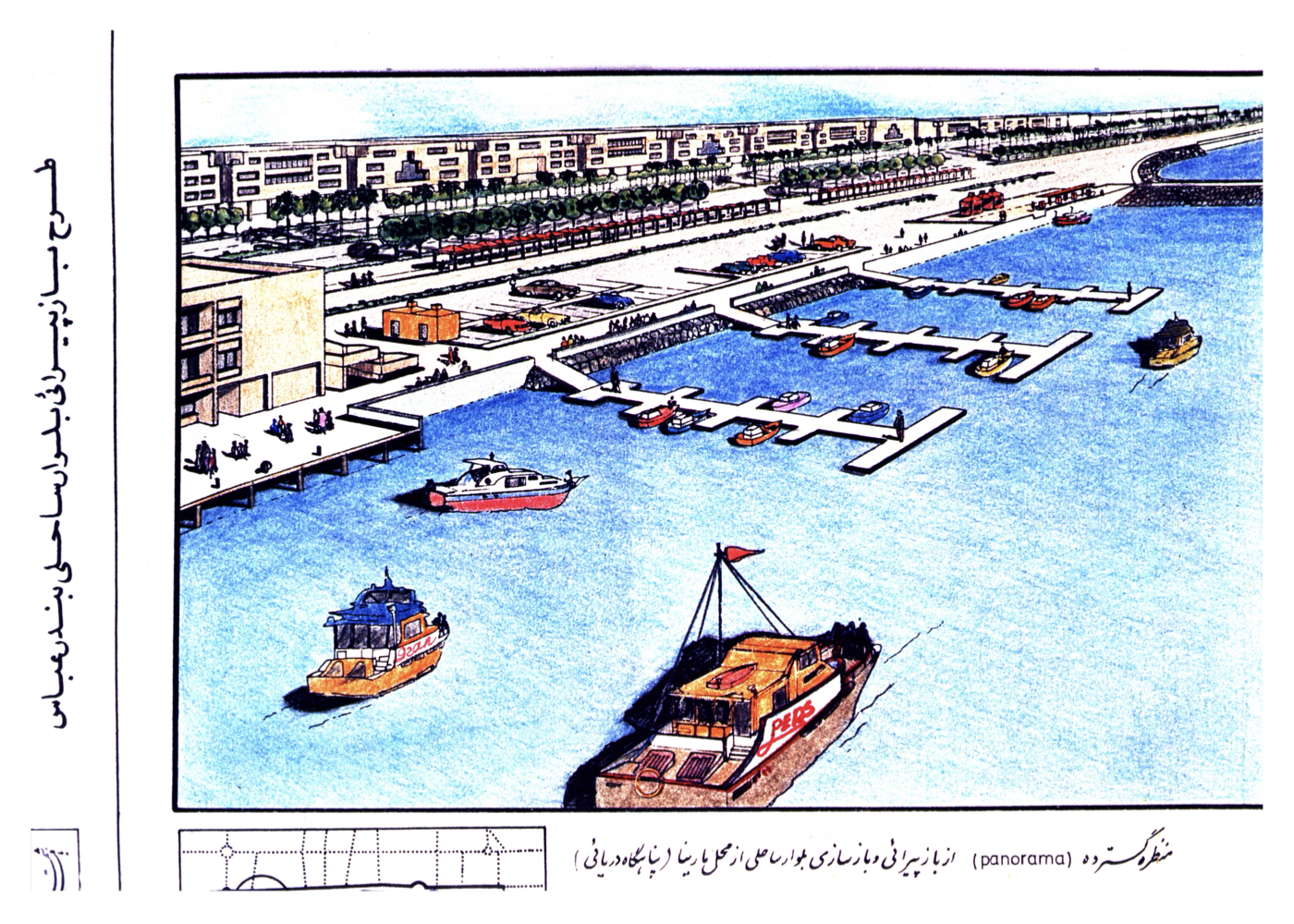
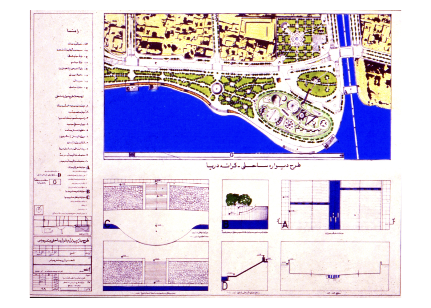
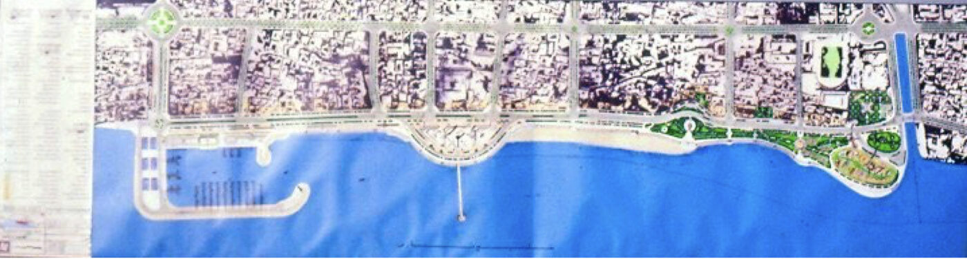
بندرعباس: طرح بلوار ساحلی (مرحله اول)
فشرده پیشنهادهای طرح:
فشرده پیشنهادهای طرح: جلوگیری از پیشرفت تخریب ساحل و تأسیسات شهری، ارتقاء کیفیت محیطی و خدمات گردشگری در شهر
پیشینه:
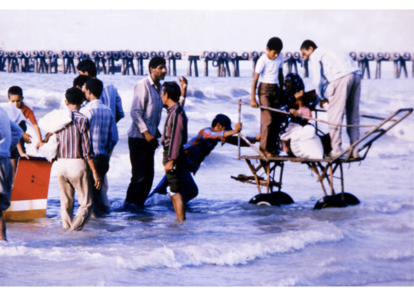
در دهه چهل گذشته برای ساماندهی سواحل، بلواری در مقابل بخش قدیمی شهر اجرا شده و برای تحکیم قسمتی از آن، دیوارهای سنگی احداث شد که در سالهای دهه شصت بهطور دائم توسط امواج تخریب و مجدداً مرمت میشده است. علاوه بر این، فضای سبز بلوار، محل عرضه ماهی، گمرک، فروشندگان دورهگرد، معتادان، بافت فرسوده، منظر نامناسب، نبود تجهیزات گردشگری، از جمله مشکلات جدی این بخش از ساحل بودهاند.
درخواست کارفرما ارائه طرح فضای سبز ساحل بوده، اما مشخص گردید که مسائل بسیار مهمتری پیش از آن باید حل و فصل شوند. علیرغم فقدان آمار و اطلاعات دقیق درباره وضعیت دریا، امواج و جزر و مد، مطالعات مختلف انجام شد و طرحی برای ۲۵۰۰ متر از نوار ساحلی (از بازار ماهی تا خور گور سوزان) تهیه گردید.

فشرده نتایج آن در وضع موجود:
1. دیوار ساحلی موجود، حافظ بلوار ساحل و فضای سبز در برابر امواج است.
۲. این دیوار دائماً توسط امواج تخریب میشود.
۳. تخریب مستمر فضای سبز، آشفتگی بازار ماهی و حرکت قایقها، حضور معتادان و کارتنخوابها، سیمای نامناسب بلوار، و فقدان تجهیزات گردشگری از مشکلات اصلی است.
۴. بالا آمدن سطح آب در اطراف خور گورسوزان ناشی از انسداد جریانهای زهکشی است
فشرده ایدهها و راهکارها:
1. طرح مارینا (حوضچه ایمن) برای قایقها و لنجها در محل بندر سابق گامبرون و اتصال آن به شبکه ارتباطی
۲. استفاده از مارینا برای مدیریت آمد و شد دریایی و کاهش فشار امواج بر ساحل
۳. احداث دیواره جدید بتنی و قطعات شکستموج در نقاط بحرانی
۴. جمعآوری گمرک قدیمی و اسکله مخروبه، و بهرهبرداری مجدد از بخشهای پیشآمده در آب
۵. احداث یک مجموعه تجاری–اداری با استفاده از زمینهای آزادشده
۶. اصلاح دیوارههای خور گورسوزان برای جلوگیری از نفوذ آبهای زیرزمینی به نواحی شهری
۷. ایجاد فضای سبز جدید متناسب با اقلیم بندرعباس
۸. تبدیل بستر بلوار ساحلی به یک باغ خطی ساحلی
۹. تهیه طرح سیمای ساحلی با توجه به معماری بومی و کاربریهای پیشنهادی
۱۰. انطباق طرح با برنامههای جامع و تفصیلی و شرایط محیطی منطقه
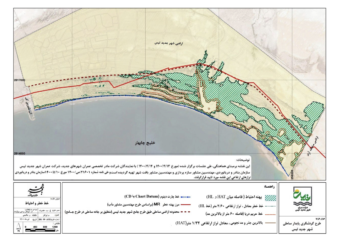
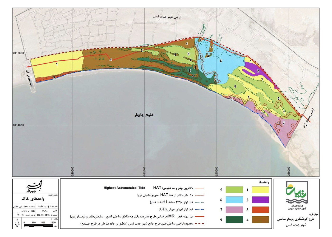
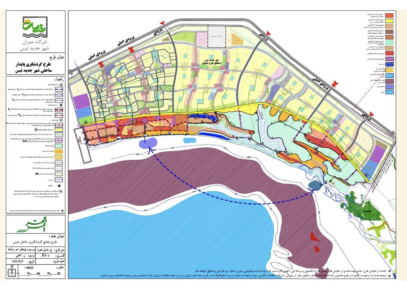
چابهار
چابهار: طراحی شهری–محیطی ساحل شهر جدید تیس (راهبردی)راهبردی)
فشرده پیشنهادهای طرح:
تدوین راهبردهای توسعه پایدار گردشگری در ساحل شهر جدید تیس با تکیه بر تجارب علمی، تحلیل محیطی، و انطباق با طرحهای منطقه آزاد چابهار
پیشینه:
ساحل شهر جدید تیس،با وسعتی چند صد هکتاری در جنوب شهر واقع شده و در شمال خلیج چابهار و در همسایگی ساحل منطقه آزاد قرار دارد. مطالعات قبلی این ناحیه نیز توسط همین مشاور در قالب طرح منطقه آزاد انجام شده بود.
مطالعات این طرح شامل:
۱. زمینشناسی و خاکشناسی
۲. هیدرولوژی و اقلیم
۳. پوشش گیاهی و جانوری
۴. تحلیل آلودگیها و تأثیر صنایع ساحلی
۵. منظر، شهرسازی، معماری
۶. تجارب جهانی و داخلی گردشگری
۷. تحلیل اجتماعی، اقتصادی و ترافیکی
۸. تحلیل روندها، لایههای اطلاعاتی، فرصتها و محدودیتها
ویژگی برجسته طرح:
تدوین سه سناریوی زیست محیطی برای توسعه ساحلی:
تهاجمی، اقتصادی و انطباقی. سناریو درجات متمایزی از شدت استفاده از زمین، تابآوری اکولوژیکی و امکانسنجی توسعه را مشخص کرد.
راهبرد نهایی:
با استفاده از تحلیل یکپارچه دادهها، گزینههای پیشنهادی بر اساس سناریوی انطباقی اولویتبندی شد و در نهایت، راهبردها، سیاستها، ضوابط و توصیههای اجرایی در چارچوب توسعه پایدار گردشگری تدوین و به تصویب رسید.
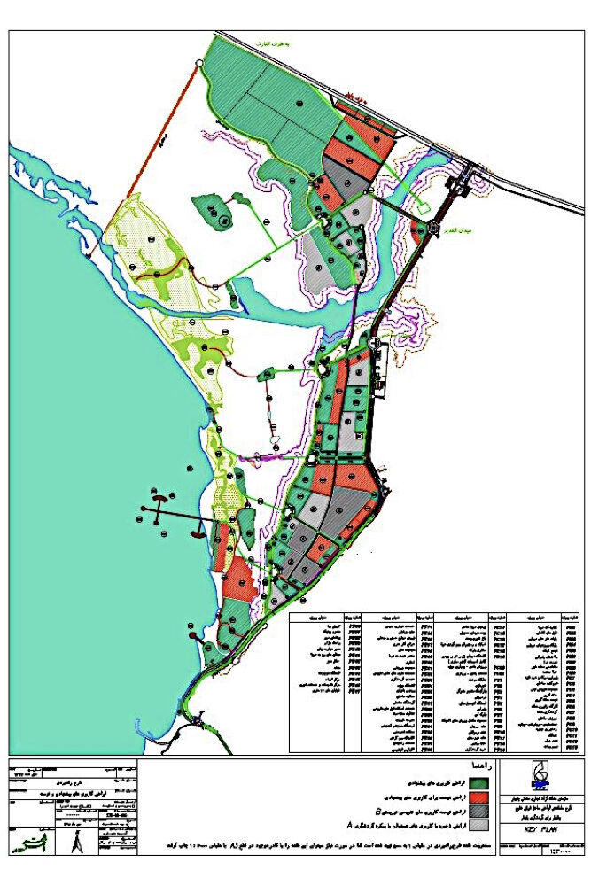
چابهار: طراحی شهری–محیطی ساحل منطقه آزاد (راهبردی)
فشرده پیشنهادهای طرح:
ارائهی یک طرح راهبردی برای توسعه گردشگری چابهار با حفظ ارزشهای طبیعی، محیط زیست و ایمنی در برابر طوفانها و سونامیها
پیشینه:
چابهار یکی از مهمترین بنادر ایران با دسترسی مستقیم به اقیانوس هند است. در یکصد سال اخیر طرحهای متعددی برای توسعهی آن تهیه شد، از جمله ایجاد پایگاه هوایی، منطقه آزاد و مشارکتهای بینالمللی، اما اغلب بدون نتیجه رها شدند. در یکی از آخرین تصمیمات، مقرر شد که ساحل منطقه آزاد به مساحت ۲۳۰۰ هکتار با هدف توسعه گردشگری پایدار ساماندهی شود.
ویژگی خاص طرح:
برخلاف طرحهای گذشته، این پروژه برای نخستینبار با تکیه بر نظریه طراحی شهری–محیطی انجام شدو شامل مطالعاتی بیسابقه در طرحهای مشابه بود، از جمله:
۱. اقیانوسشناسی و سونامیشناسی
۲. تعیین و تثبیت دقیق خط ICZM
۳. بررسی طوفانهای دریایی و تأثیر آن بر ساحل
۴. تحلیل چرخش آب و آلودگیهای احتمالی در خلیج چابهار
۵. مطالعه تهدیدات و تضادهای فعلی توسعه با گردشگری
6. بررسی کیفیت بستر و سیمای ساحل
7. مطالعه تأثیرات آتی مسیرهای گردشگری آسیا–اروپا بر چابهار
۸. تحلیل تأثیرات طرح جاده ابریشم چین
9. مطالعه موفقیت کشورهای مشابه در جذب گردشگران ساحلی بینالمللی
فشرده راهبردها و ایدهها:
۱. سازگار کردن توسعه گردشگری با ایمنی ساحل در برابر حوادث طبیعی
2. جلوگیری از تداخل کاربریهای ناپایدار یا متضاد با اهداف گردشگری
۳. طراحی خطوط ساخت و ساز متناسب با منظر و قوانین سواحل گردشگری جهانی
۴. افزایش سهم چابهار از گردشگری بینالمللی در قالب یک مسیر امن و پایدار
همدان
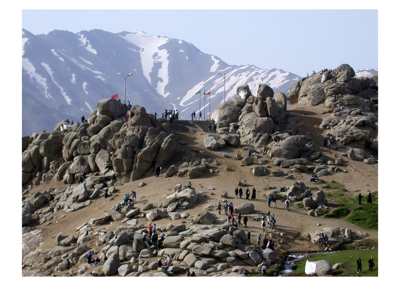
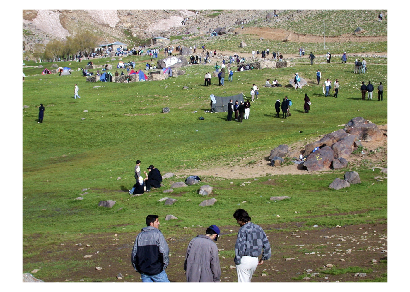
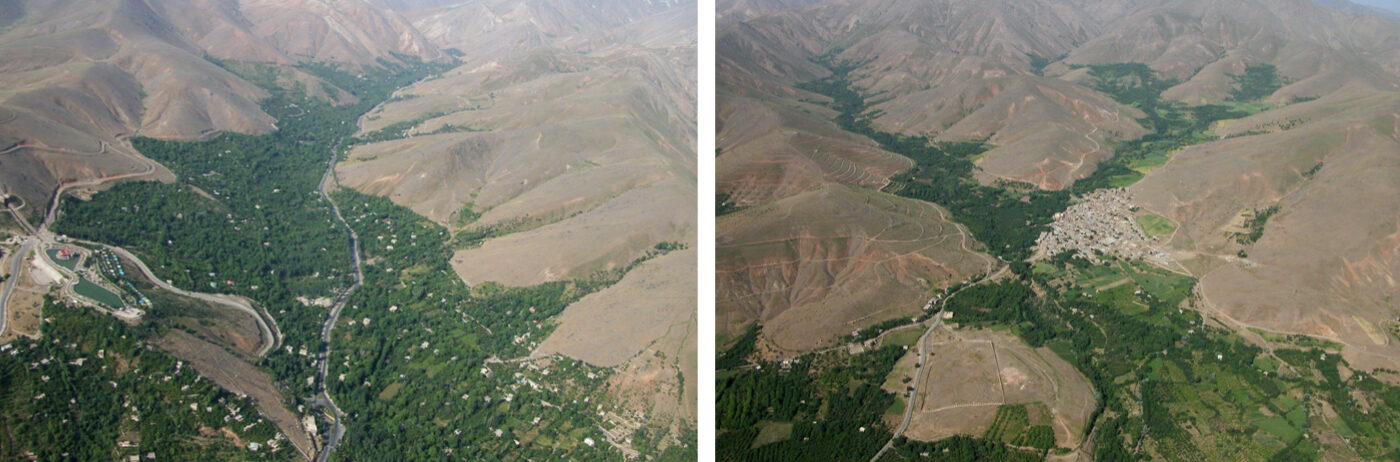
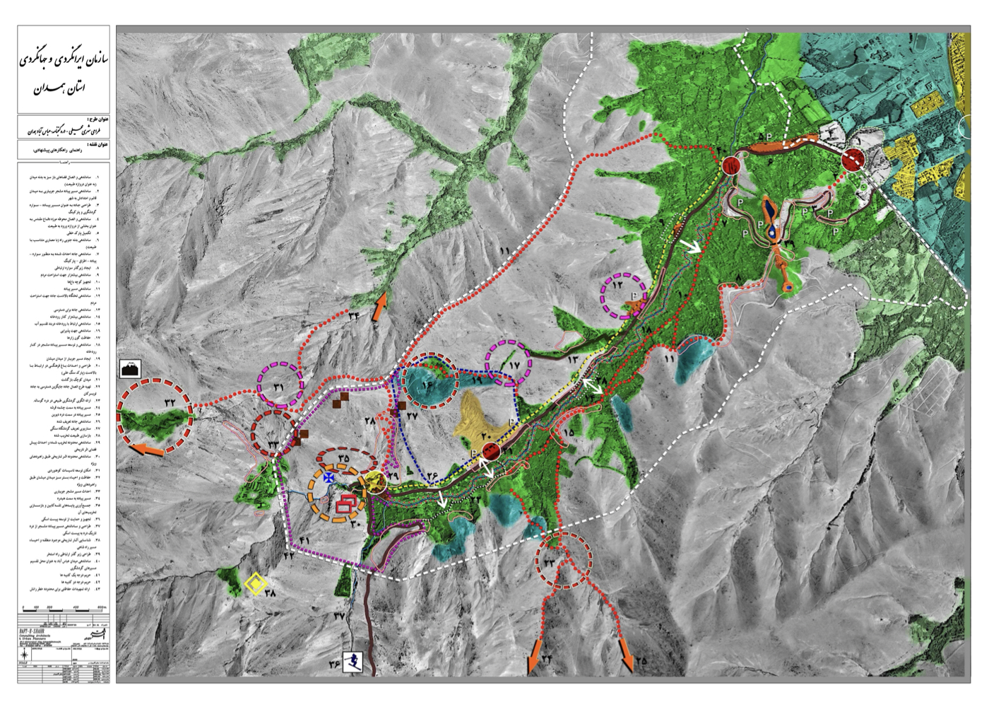
همدان: طراحی شهری- محیطی دره گنجنامه (راهبردی)
فشرده پیشنهادهای طرح:
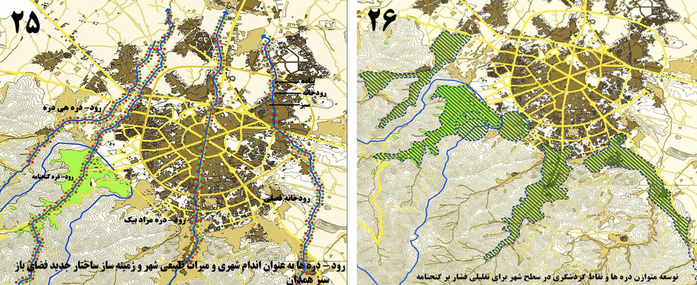
نگهبانی و هم زمان بهره برداری متناسب با توان (حفاظت فعال) از میراث طبیعی–تاریخی شهر همدان در دره گنجنامه، با گسترش گردشگری پایدار در این دره و درههای مجاور که یکی از زیباترین پیوندهای گوهرهای طبیعی و تاریخی در میان شهرهای ایران را شکل میدهند.
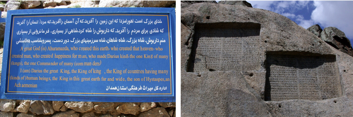
نام درهگنجنامهگنجنامه توسط مردم با این تصور که دو سنگ نوشته موجود آن درباره گنج است انتخاب شده، اما این دو اثر را باید گنجینه فرهنگ و تمدن ایران در ۲۵۰۰ سال پیش دانست. متأسفانه بیاطلاعی یا بیمسئولیتی مسئولان و طمع سرمایه داران، ارزشهای تاریخی و طبیعی این منطقه را به چالش کشیده است.
هدف طرح، بررسی این چالشها و ارائه راهحلهایی برای حفاظت و بهرهبرداری پایدار از دره و ارتفاعات پیرامونی آن بوده است.
پیشینه:
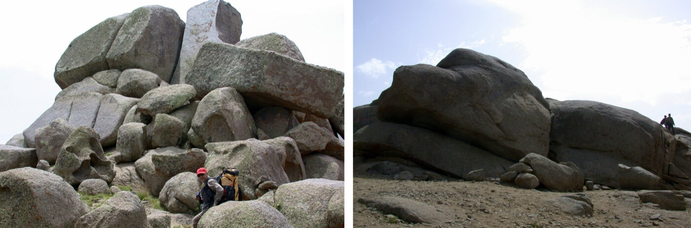
دره گنجنامه یکی از استثناییترین درههای ایران است:
الف – وجود صدها باغ مثمر و سرزنده در دره.
ب – وجود آبشاری زیبا که در زمستان بهطور کامل یخ میزند.
پ – وجود دو سنگنوشته از دو شاه هخامنشی با متنی منحصر به فرد که نشان دهنده نگاه انسانی آنها به حکومت است.
شاهی که بر ۲۸ کشور حکومت میکرد، میگوید: "به نام اهورامزدا که آسمان، زمین، و شادی برای مردم آفرید." در مقایسه با کتیبههای خونبار پادشاهان آشور و بابل، ارزش جهانی این آثار آشکار میشود. اما درهای با این زیبایی بینظیر و ارتفاعاتی پر از تختهسنگهای گرانیتی، با تصمیمات ناآگاهانه مسئولان استان رو به زوال رفته است.با وجود مستندات و مخالفتهای فراوان، پروژه تلهکابین اجرا شد .
و دره با خودرو، حیوانات کرایهای، سرویسهای بهداشتی بدمنظر و بساط غذا اشباع شد. در این طرح، مطالعات جامعی از هوا، زمین، و اسناد موجود صورت گرفت و راهکارها با رویکرد توسعه پایدار ارائه شدند.
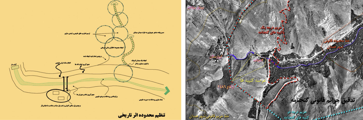
فشرده ایدهها، راهبردها و راهکارها:
۱. حفاظت محیط طبیعی: احیا و محافظت از محیط طبیعی در سراسر دره، بهویژه اطراف آثار تاریخی، آبشار، و دشت میشان
۲. مدریت دسترسی::
الف – طراحی مسیر کم تخریب از همدان تا آثار
ب – جلوگیری از امتداد جاده فعلی به شهر تویسرکان
۳. تلهکابین:
الف – ممانعت از احداث آن در دره گنجنامه
ب – پیشنهاد اجرای آن در دره مجاور (هیدره)
۴. حریم آثار:
الف – رعایت ضوابط حریم میراث
ب – جلوگیری از ساخت و ساز در منظر آثار
۵. ارتفاعات:
الف – جلوگیری از تغییر در ارتفاعات مشرف
ب – تثبیت دامنهها در برابر رانش
پ – ممنوعیت ساخت و ساز در دشت میشان
ت – در صورت ضرورت، ساخت و ساز تنها در تراز پایینتر مجاز باشد
۶. آمد و شد:
الف – ممنوعیت ورود خودرو به محدوده آثار
ب – استفاده از وسایل نقلیه عمومی گردشگری
پ – حفظ بنبست فعلی جاده برای حفظ طبیعت
ت – مسیر ایمن پیاده از گنجنامه تا میشان
ث – تسهیل دسترسی به باغهای درون دره
ج – ساماندهی مسیر شهری–طبیعت
چ – ایجاد ارتباط بین درههای اطراف از فراز کوه
۷. ایدهها و رهنمودهای بیشتر در گزارش اصلی آمده است.
یادآوری:
در جلسه ارائه طرح، استاندار وقت (مهندس زبردست) تأیید کرد که واگذاری اراضی روبه روی آثار اشتباه بوده و وعده بازگشت آن را داد. اما در دوره بعدی (دولت آقای احمدینژاد)، این وعده اجرا نشد و ایستگاه تلهکابین دقیقاً در مقابل آثار ساخته شد. ایستگاه پایانی نیز در دشت میشان ساخته شد و یک سرویس بهداشتی بزرگ در نزدیکی آثار احداث گردید.
آیندگان درباره این تصمیمهای غیرقابل دفاع قضاوت خواهند کرد.
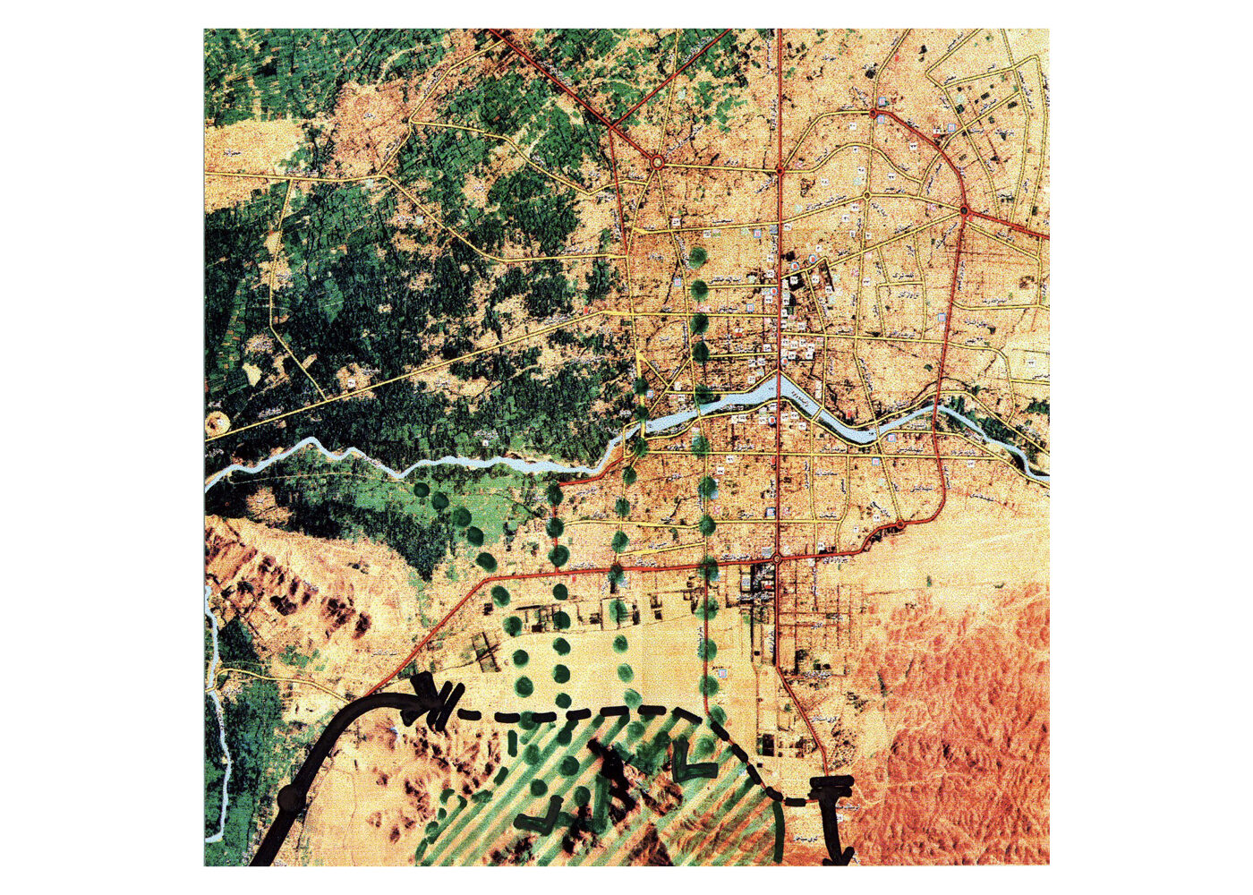
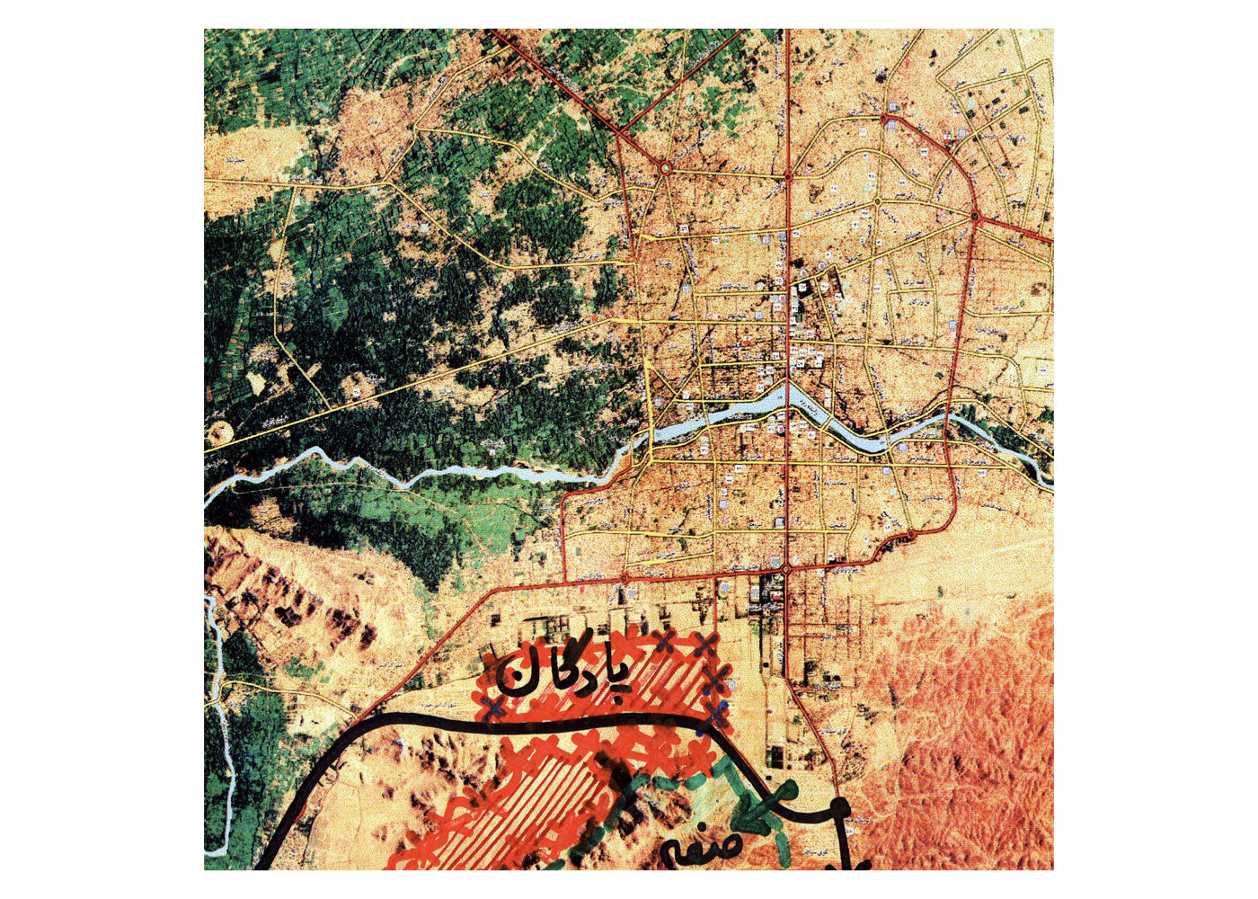
Isfahan
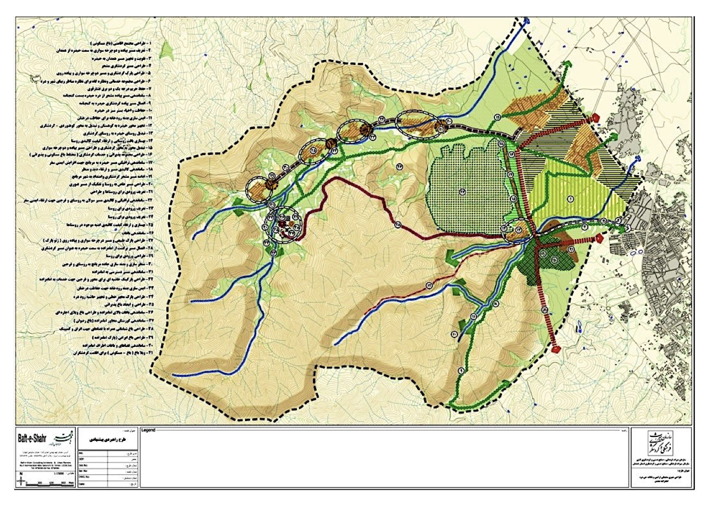
Urban – Environmental Design of Polluted Southeastern Lands (Strategic)
A portion of land in southeastern Isfahan is bounded on one side by surrounding mountains and on the other by agricultural lands to the south of the city. In recent decades, this area has served as a landfill for municipal waste and debris. It is also surrounded by uses such as a compost facility, asphalt factory, Isfahan’s cemetery, and nuclear energy installations. The study area covers approximately 3,000 hectares.
The Municipality of Isfahan commissioned the consultant to conduct a strategic-scale study and propose solutions for pollution reduction, land transformation, and the optimal reuse of these lands. Comprehensive studies were carried out to assess threats, constraints, opportunities, and potentials across relevant fields—urban planning, architecture, environmental science, landscape design, urban economics, and various types of pollution and their spatial impacts on the city and its surroundings. Naturally, the most critical environmental issues in southeastern Isfahan were identified, including the impact of industrial and municipal activities on soil, water, and air quality. The project’s strategic framework was developed by aligning global best practices from other major cities with the region’s specific environmental context, proposing a phased 25-year implementation timeline.
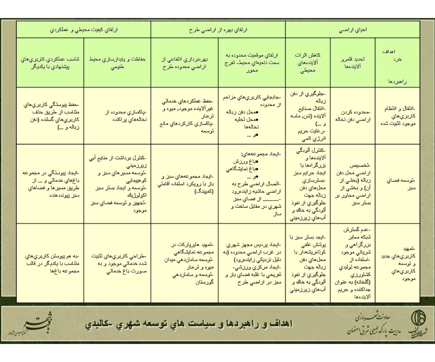
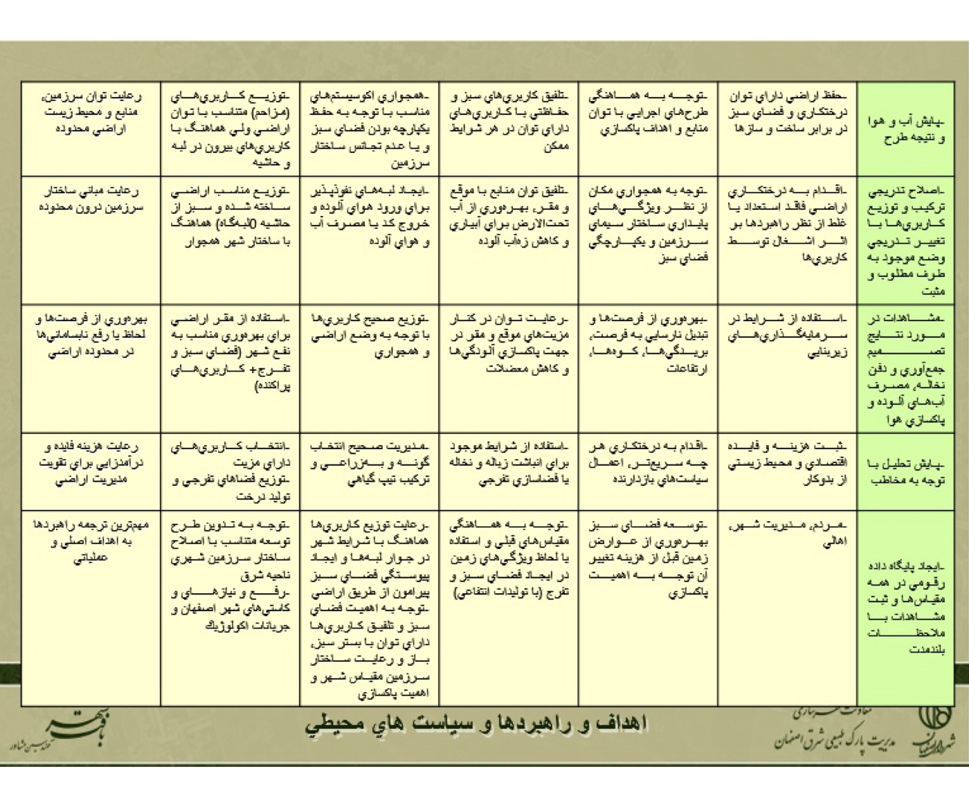
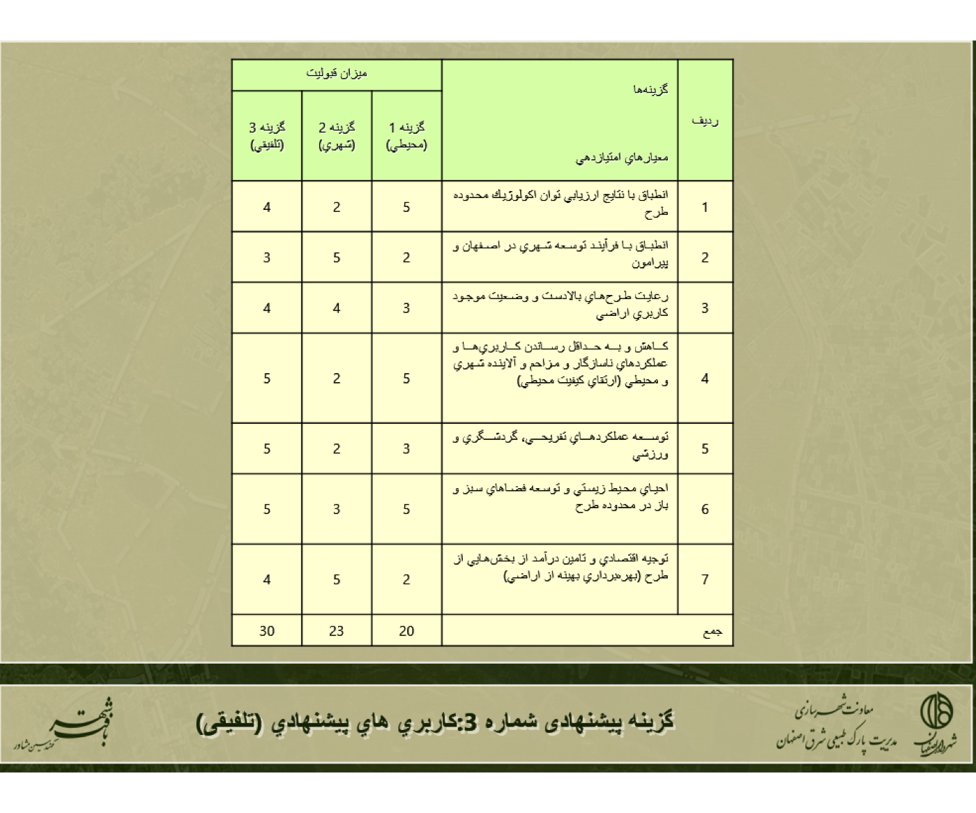
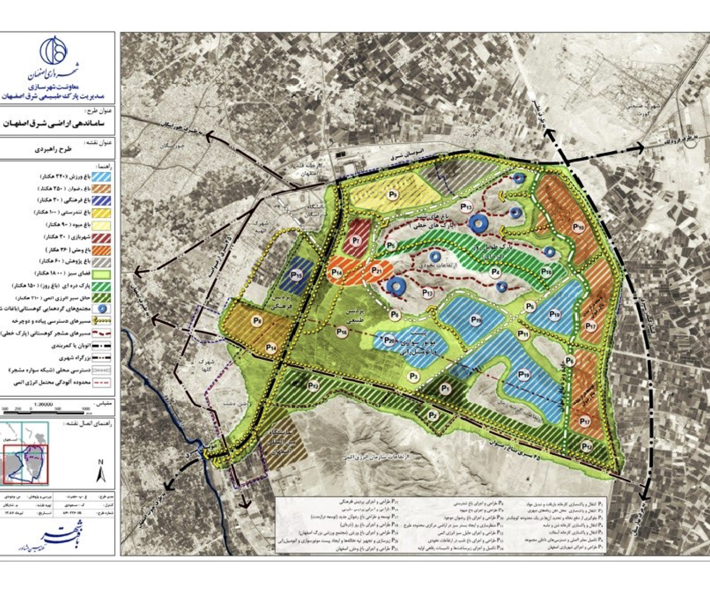
Concepts and Strategic Directions:
These components were summarized across several strategic tables, as follows:
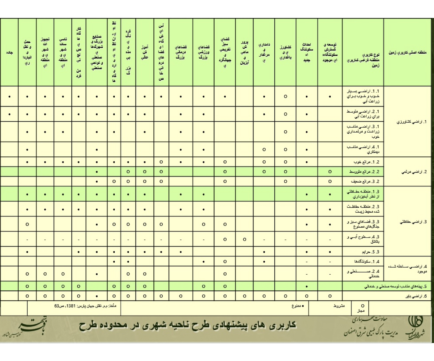
1. Proposed Land Uses for the Urban District within the Project Boundary
2. Environmental Policies
3. Urban–Physical Development Policies
4. Proposal of Three Planning Scenarios
5. Recommended Land Use Plan (Integrated Model)
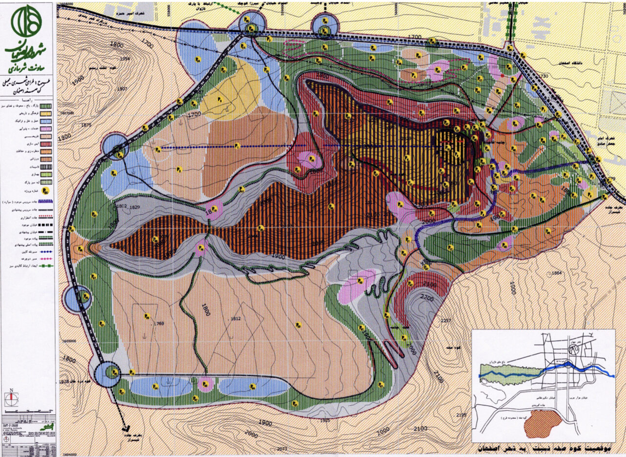
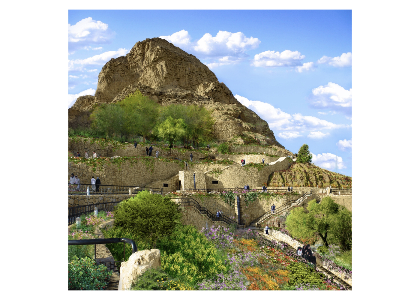
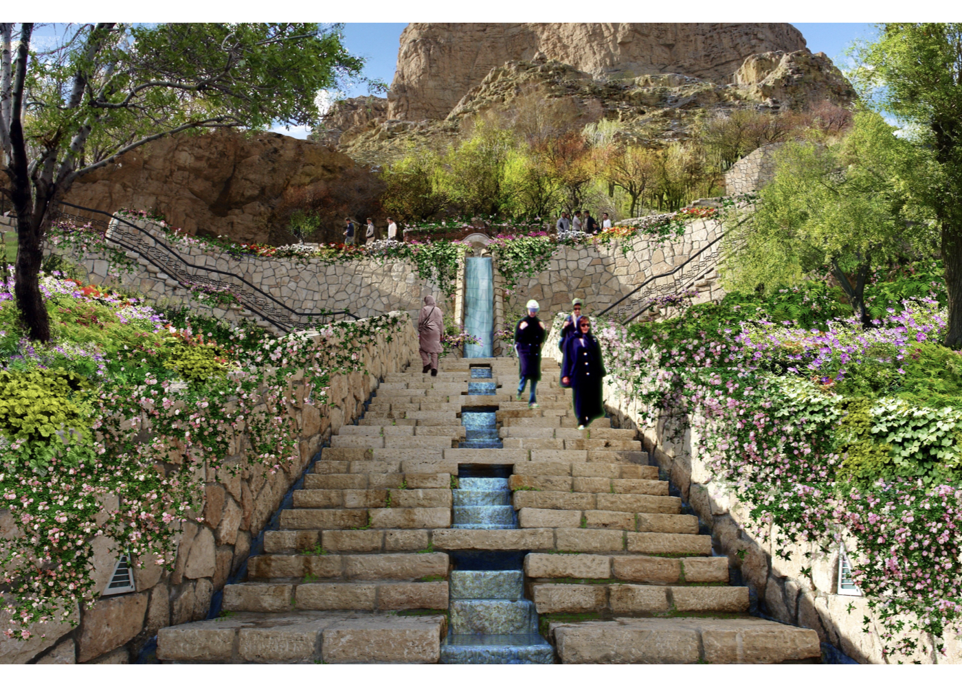
Urban – Environmental Design of Soffeh Mountain
Preventing the Degradation of Soffeh and Transforming It into a Future Natural–Historical Landmark of Isfahan
Soffeh Mountain is located in the southern part of Isfahan and is composed of a series of interlinked elevations arranged in a circular formation.
At the summit lie the remains of a military fortress, likely dating back to the Sassanid era.
This mountain and its fortress have historically played a critical role in securing the central region of the country.
Below the summit lie Zard Spring, a grove of plane trees, and architectural remnants from the Safavid period originally built for royal retreat and hospitality, symbolizing the longstanding cultural connection between the people of Isfahan and this natural recreational area.
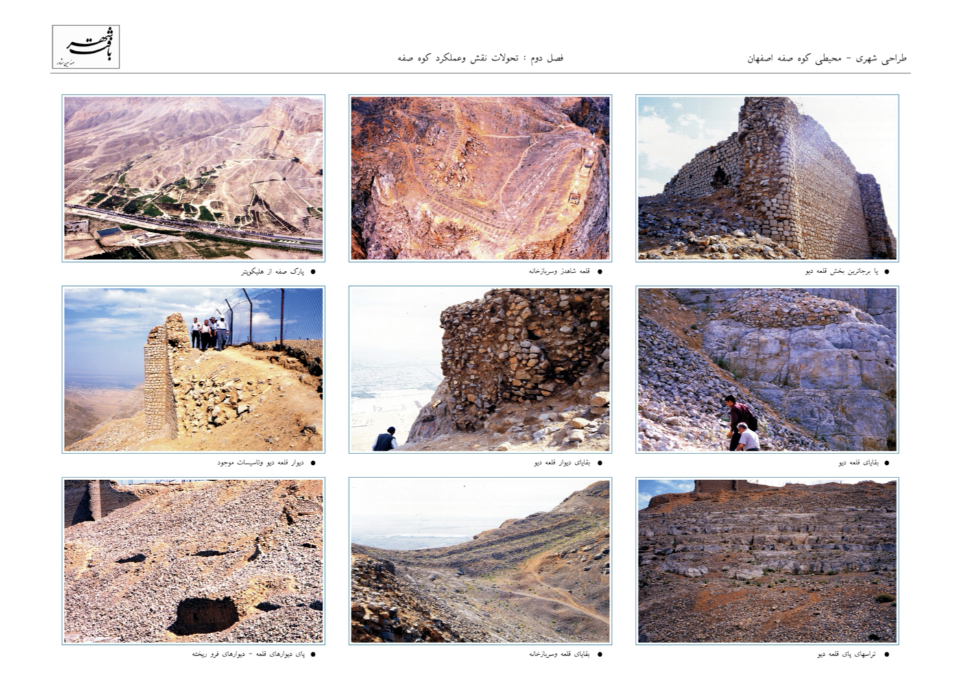
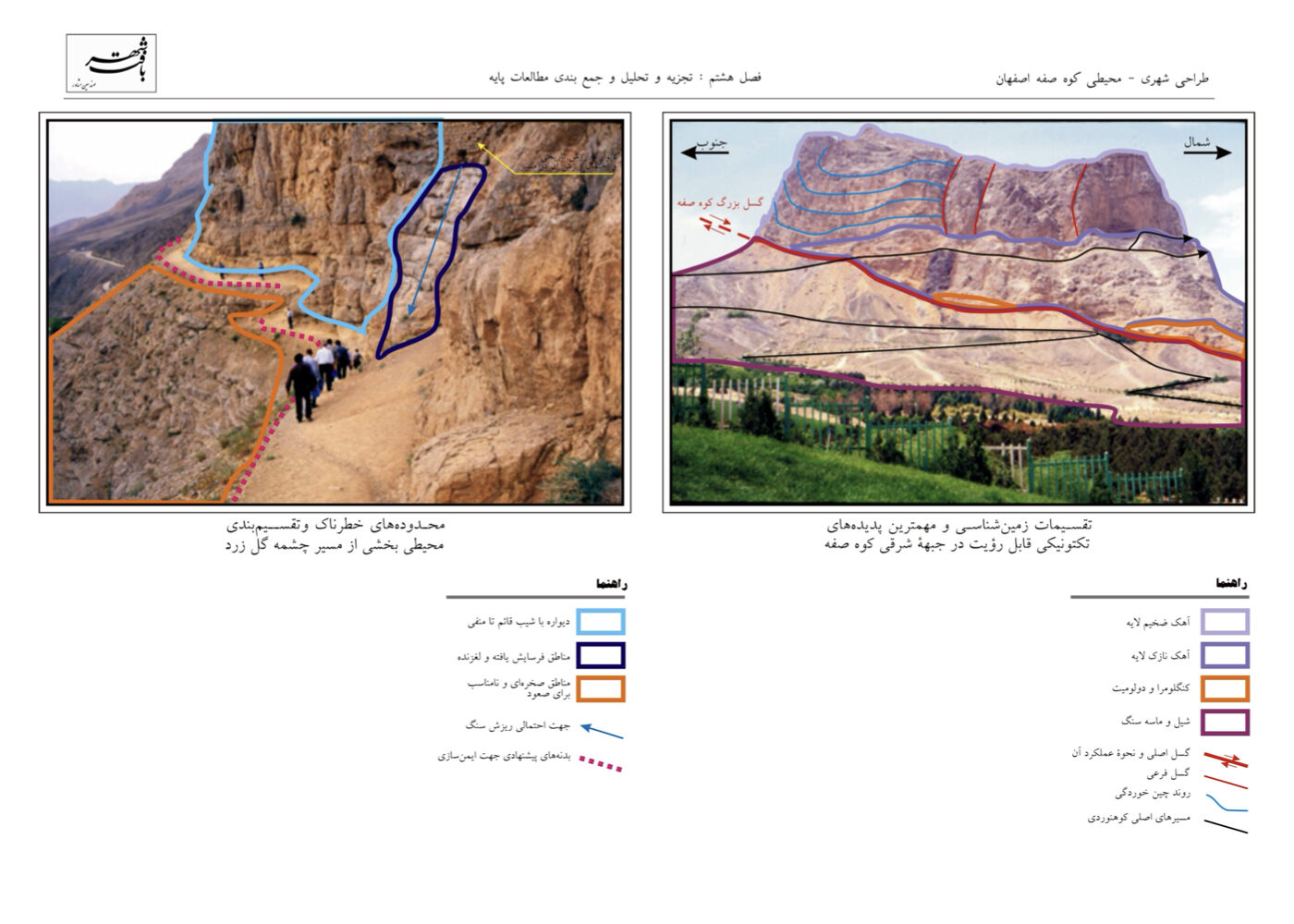
In recent decades, the lands surrounding the mountain have been under military control, and the mountain’s slope was reportedly used as a firing range.
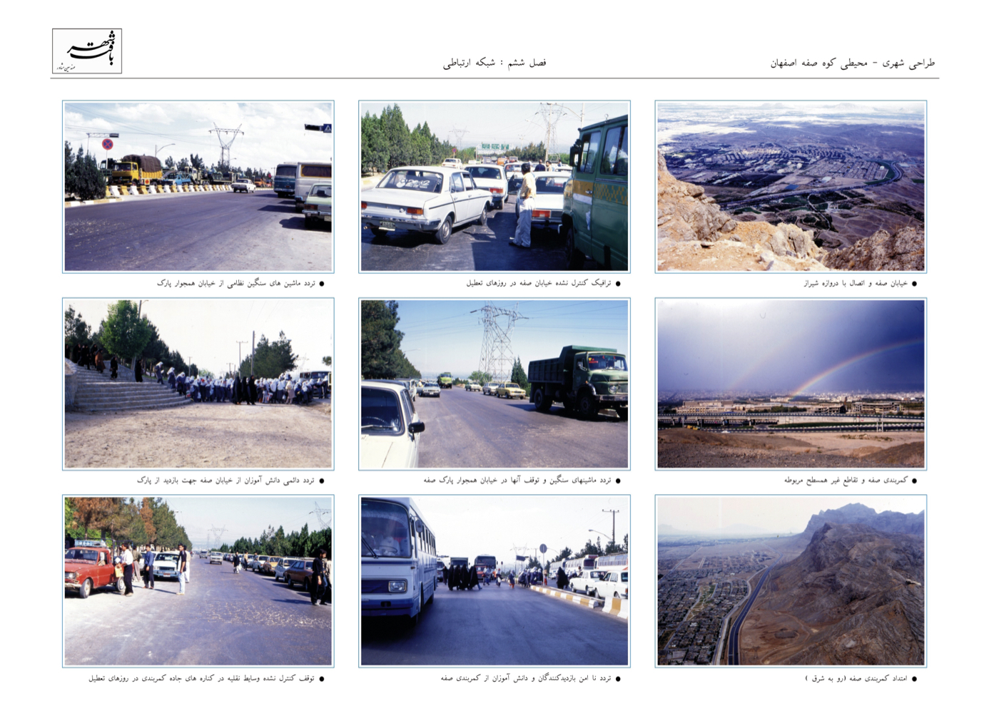
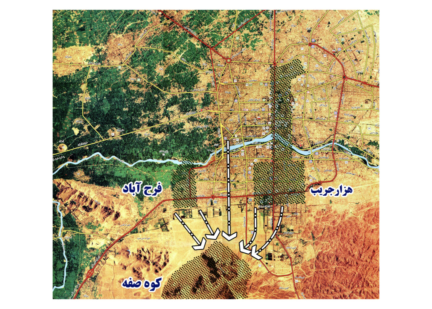
The Southern Ring Highway passes between the city and the mountain, severing the traditional pedestrian access and introducing safety hazards while imposing a full spectrum of pollution—light, noise, air, and social insecurity—onto this valuable natural environment.
Key Strategies and Interventions:
1. Realign the western segment of the Southern Ring Highway, which currently disrupts safe pedestrian access to Soffeh.
2. Designate an alternative highway route south of the mountain.
3. Convert the decommissioned highway segment into a recreational corridor to facilitate safe public access between the city and Soffeh.
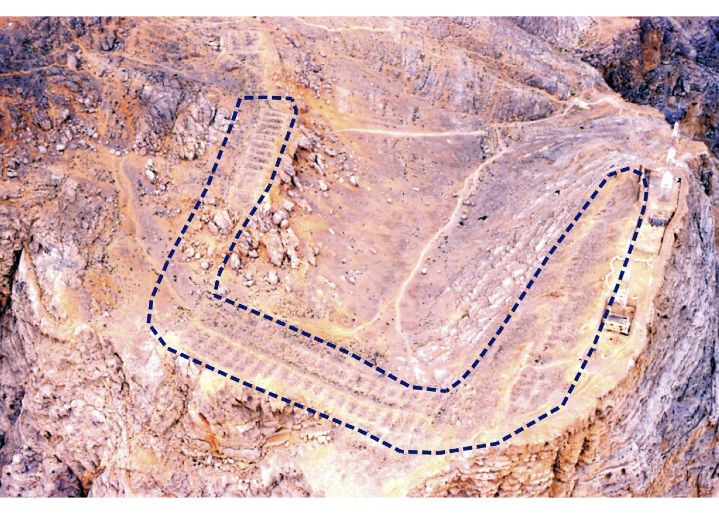
4. Cancel the cable car project at the contractor’s proposed site and relocate it to the former firing range.
5. Reassign the firing range for tourism and recreational development.
6. Construct the cable car terminal outside the protected zone of Shah-Dezh Fortress and at a lower elevation.
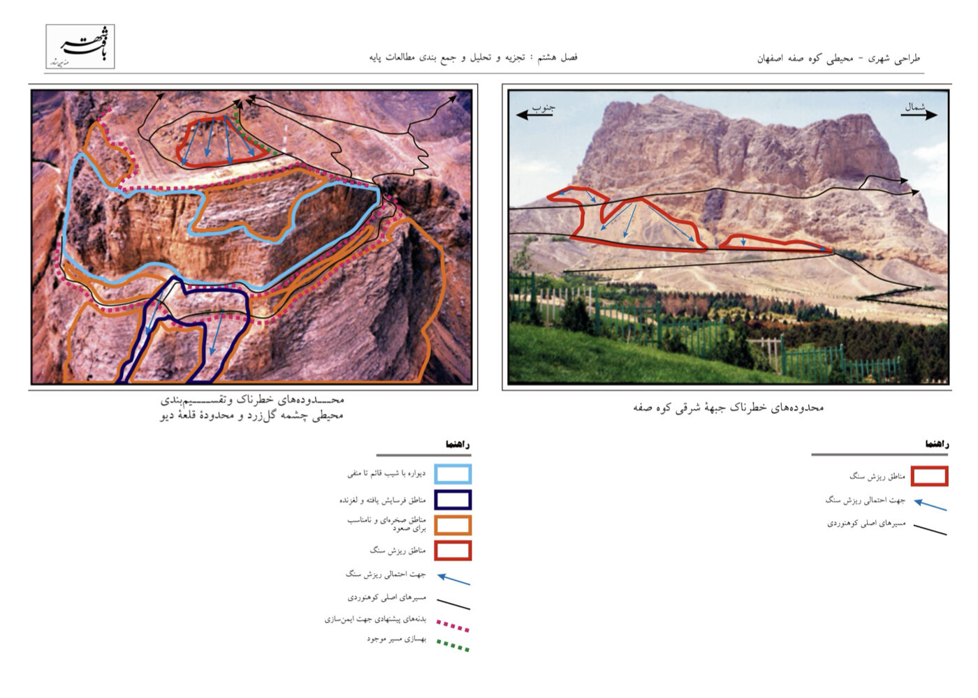
7. Implement rockfall mitigation and safety upgrades on hiking trails prone to landslides.
8. Revitalize Shah-Dezh Fortress into a 24-hour facility for hospitality, lodging, and mountaineering recreation.
9. Develop a nature-based sports complex in the northeastern lands of Soffeh.
10. Establish a protected wildlife reserve in the flatlands between the mountain ridges, covering approximately 200 hectares.
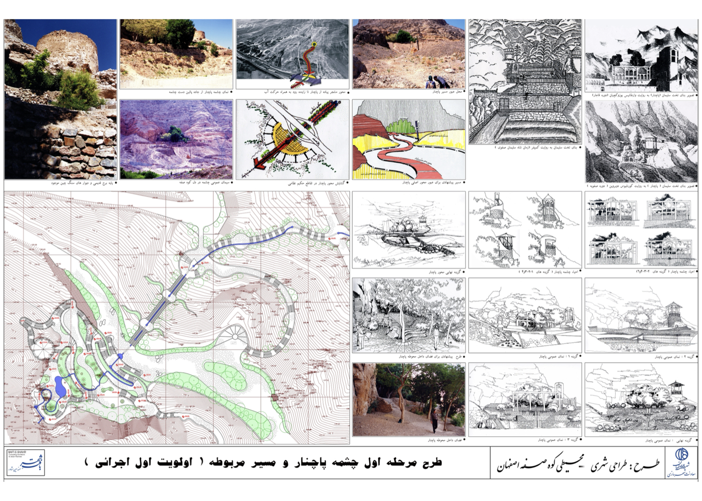
11. Create pedestrian, cycling, and tourist carriage routes connecting Soffeh to Zayandeh-Rood (Najvan) via perpendicular urban streets.
12. Restore road damage near Pachnar Spring (as the first implemented strategic measure).
یادآوری:
The plan was approved, and item 12 was partially executed. Unfortunately, the remaining strategies were not implemented, and the cable car was constructed in an unsuitable location.
Kerman
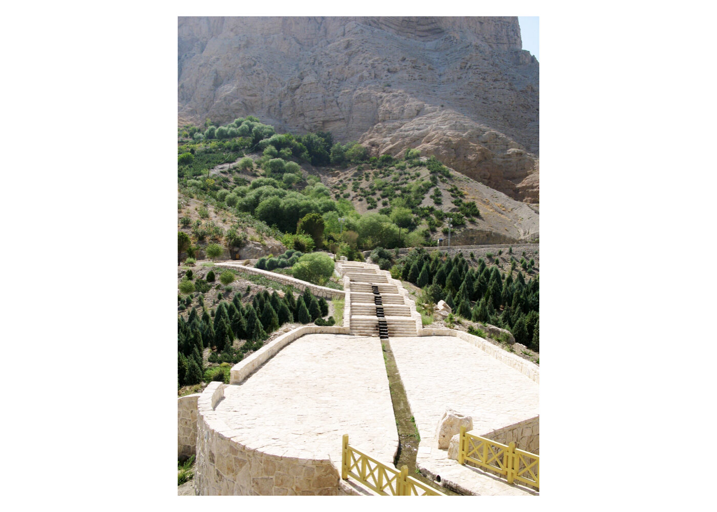
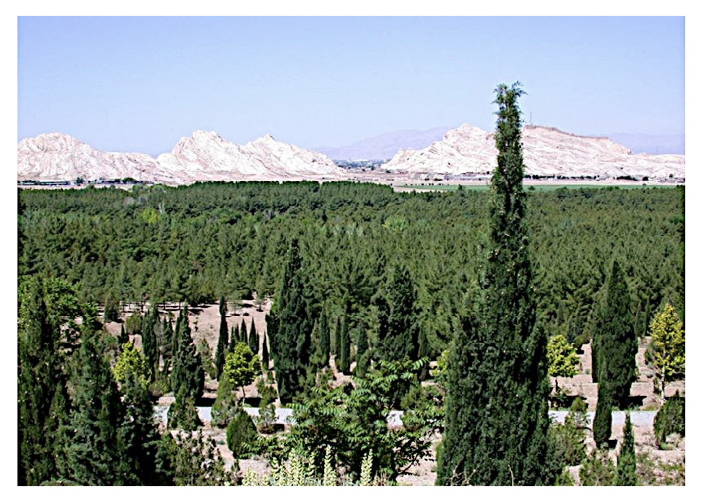
Urban – Environmental Design of Ardashir Castle and Dokhtar Castle – Balash’s Parthian Fortress (Strategic)
فشرده پیشنهادهای طرح:
Organizing the lands surrounding the two historic castles and proposing ecological and spatial connectivity from the eastern highlands and the Tagh Forest through these cultural sites to the adjacent urban market square—linking nature to the city’s commercial heart.
پیشینه:
These two castles currently exist in a semi-ruined state. Dokhtar Castle dates back to the Median era, and Ardashir Castle originates from the Sassanid period. The name “Dokhtar” (literally “Maiden”) signifies its perceived impregnability—emphasizing the strength of its bastions and resistance to conquest.
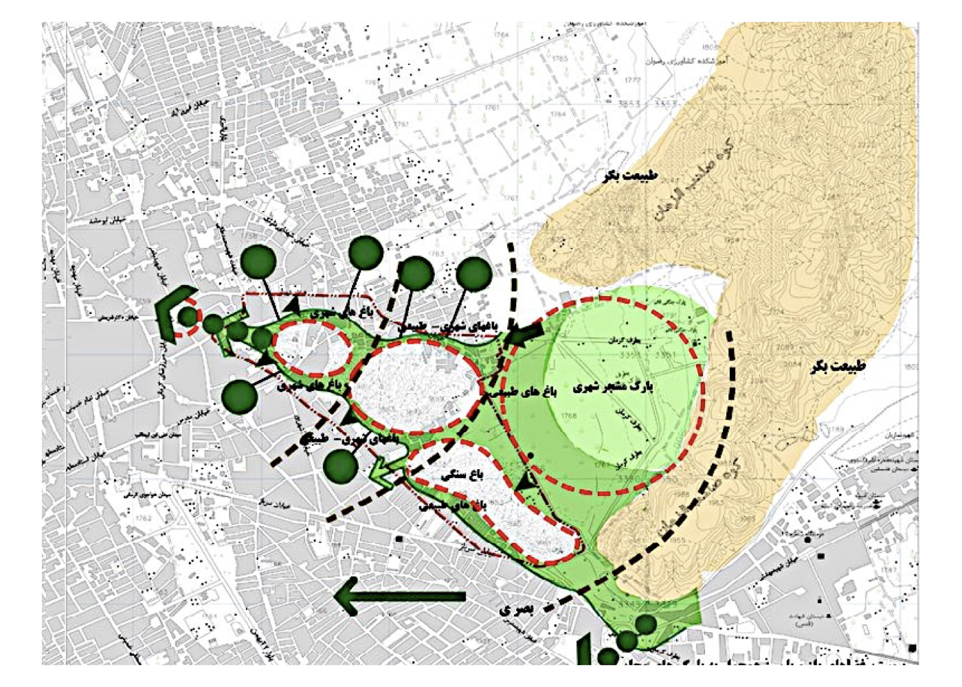
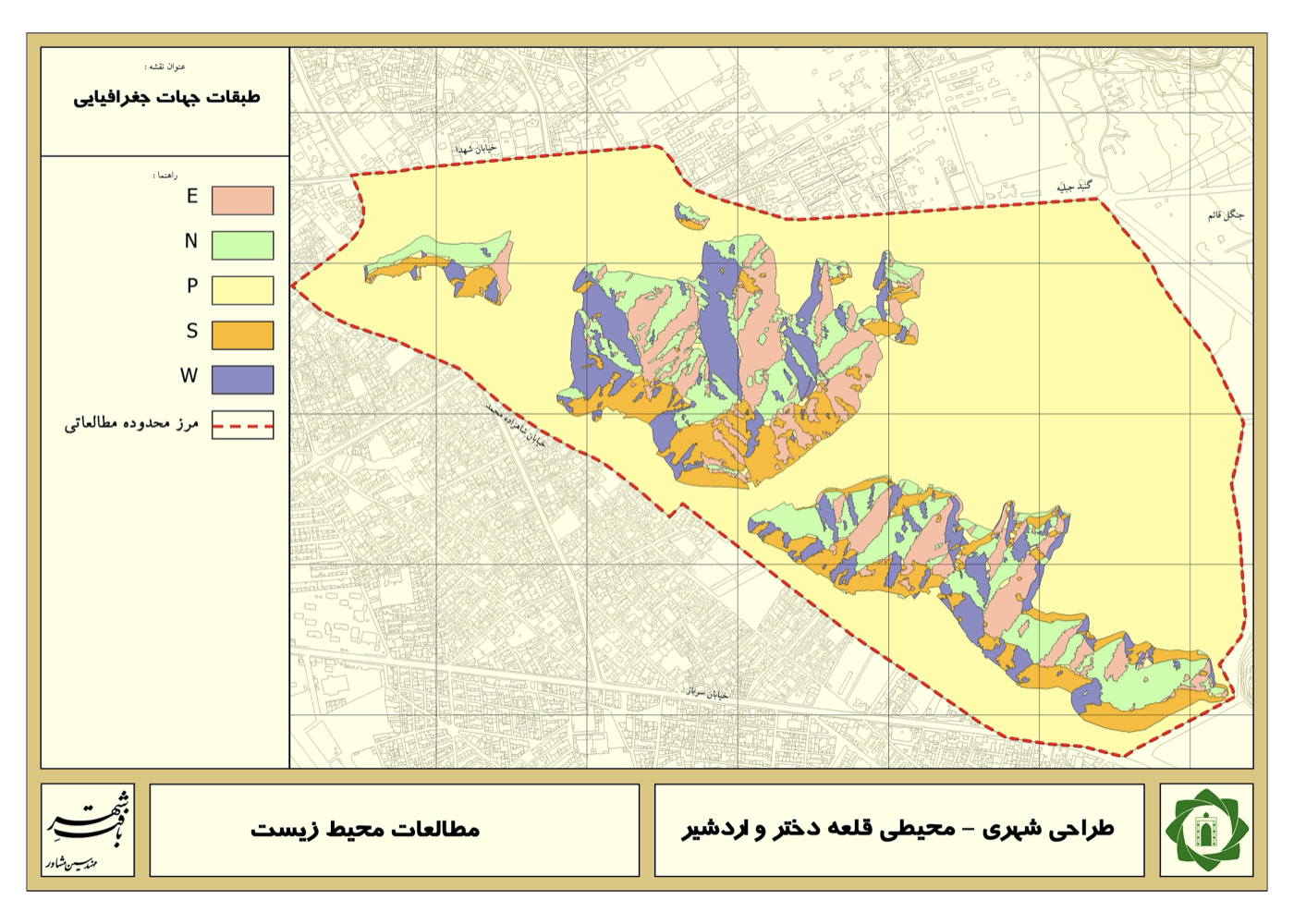
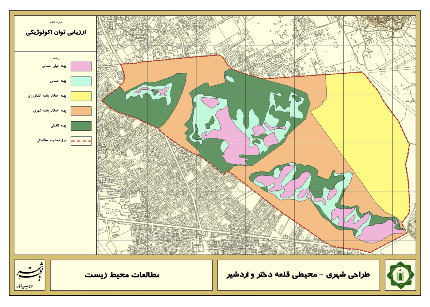
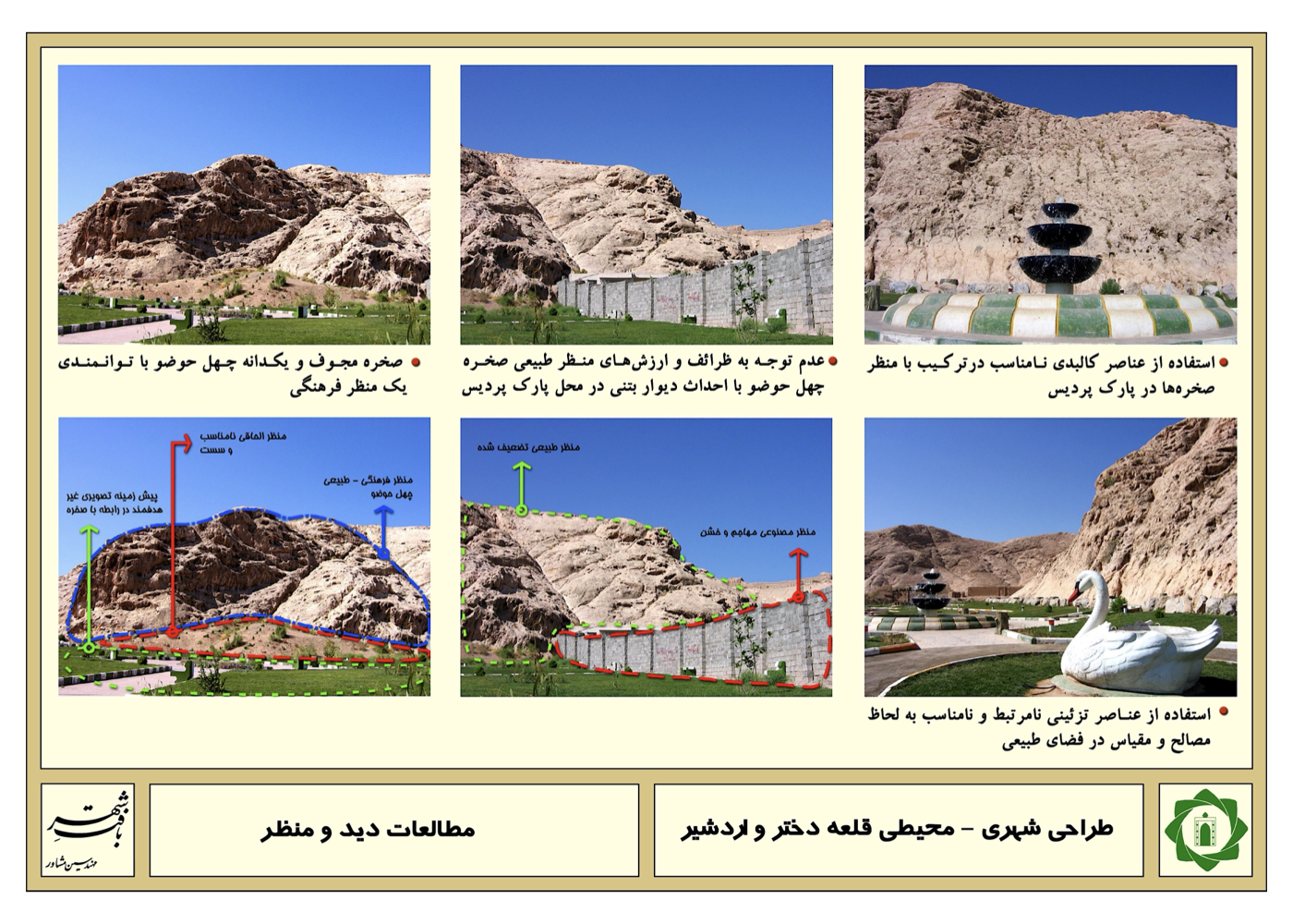
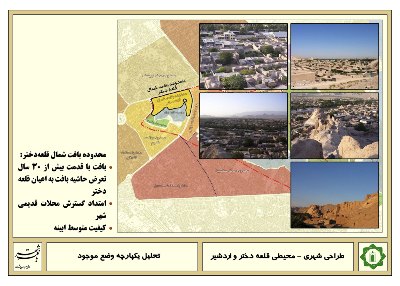
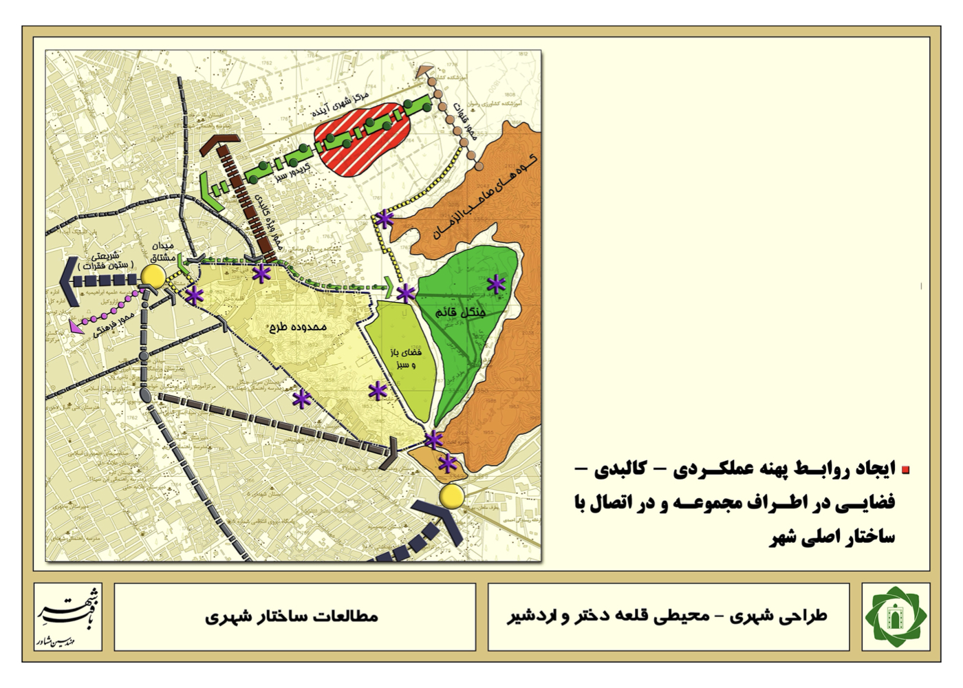
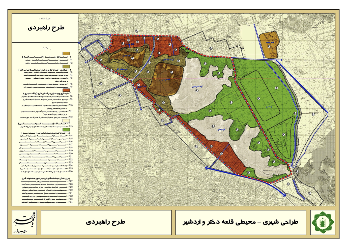
The strategic plan includes:
Identifying the opportunities, constraints, and threats around the castles, resolving existing land-use conflicts, and enhancing environmental quality. Unregulated and expansive construction has occurred around both castles, in some cases encroaching upon their protected heritage buffer zones. A multidisciplinary study was conducted covering environmental, historical, social, and urban planning dimensions. One of the key opportunities identified was to link the Saheb-al-Zaman hills and their afforested green spaces to the castle surroundings and extend this connection all the way to the historic city bazaar square.
Summary of Design Ideas and Strategies:
Within this framework, the castle zones, existing green spaces, nearby historic sites, vehicular streets, and shaded pedestrian walkways were proposed to be integrated into a coherent spatial system. If implemented, Kerman would witness the restoration and revitalization of these castles as cultural tourism assets, linking them on one side to the city’s economic core (the bazaar) and on the other to its natural green belt and elevated terrain. This intervention would significantly enhance the environmental and cultural value of Kerman’s historic urban fabric.
Khorramabad
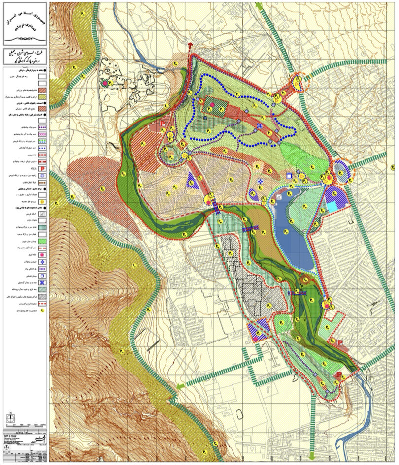
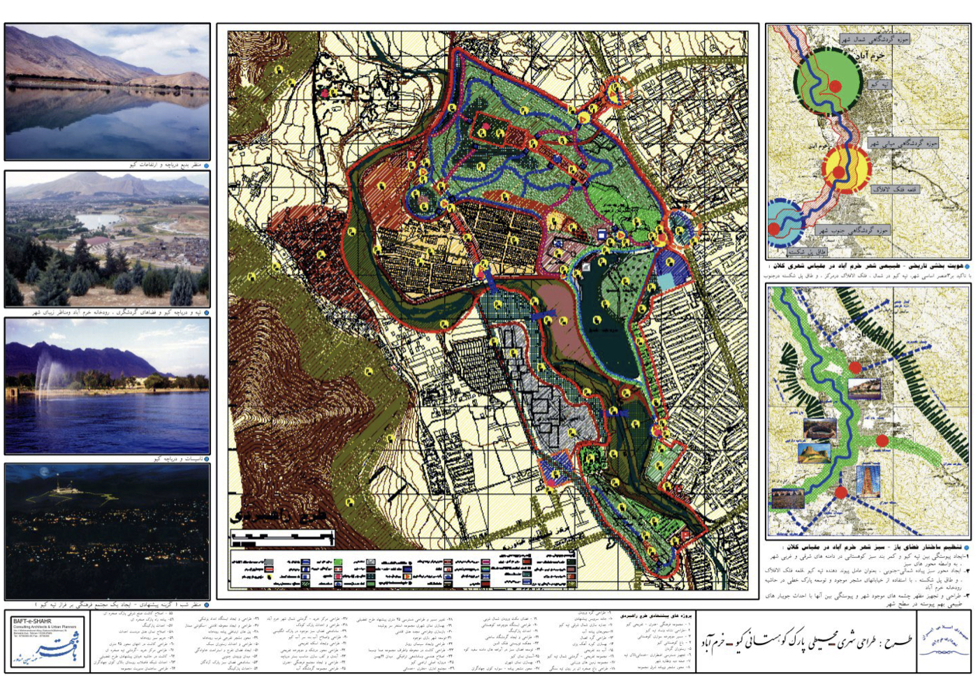
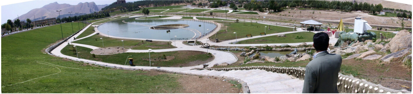
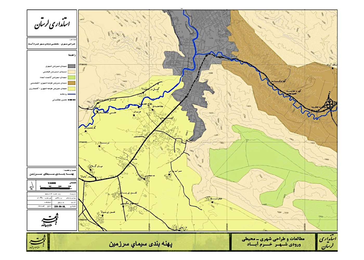
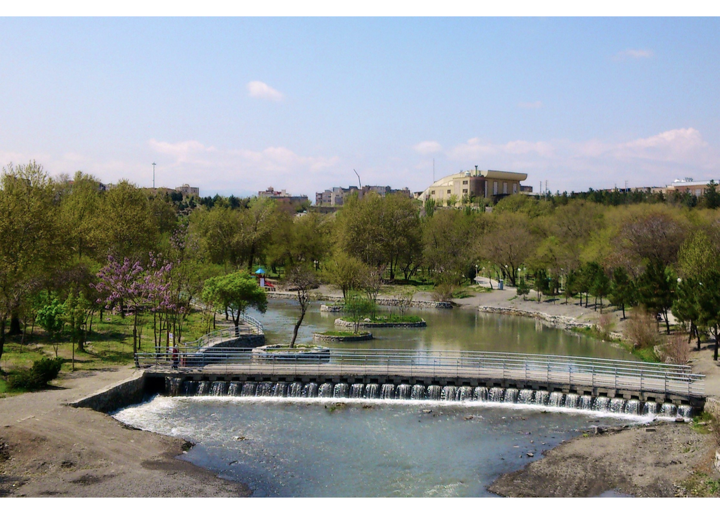
Urban – Environmental Design of the Keeyow Mountainous Zone (Strategic)
فشرده پیشنهادهای طرح:
Reclaiming degraded riverbank lands and adjacent highlands as a green complex for public leisure, creating a tourism attraction for the city, and offering ecological solutions for the city’s natural springs.
پیشینه:
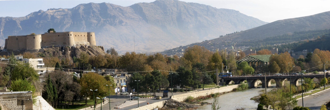
Khorramabad is a historically and ecologically significant Iranian city, notable for its multi-millennial heritage, its unique mountainous terrain, a flowing central river, and numerous springs that have long affirmed the city’s lushness—true to its name.
Following the 1979 revolution and particularly after the eight-year war, Khorramabad saw an influx of settlers from across Lorestan Province. In accommodating this population, the city’s natural assets were increasingly overlooked in planning decisions.
For instance, the city’s inner springs could have formed the basis for master and detailed planning—leveraging flowing water as a structuring element in public spaces—but this potential was ignored.
One of the oldest springs, Gerdab-e Sangi, has tragically been polluted by sewage due to unchecked construction above it. The Keeyow Zone plan addresses these overlooked natural and cultural values and reintroduces them as core urban design elements.
Ideas, Strategies, and Solutions:
1. Restoring the city’s natural–historic identity on a metropolitan scale by emphasizing three symbolic elements: Keeyow Hill (north), Falak-ol-Aflak Citadel (center), and the Broken Bridge Arch (south)
2. Structuring the city’s open and green space system at the metropolitan level:
A. Connecting Kiu Hill with the eastern and western mountain green belts
B. Developing a north–south green corridor through existing tree-lined boulevards and a linear park along the river
C. Designing and enhancing urban springheads with interconnected natural watercourses
3. Proposed strategic projects: A package of 64 initiatives aimed at realizing the macro-scale objectives above
The plan was approved, and portions relating to the river within the Keeyow zone were implemented. However, the implemented green space prioritized lawns and static landscaping, in contrast to the original vision of forestation and garden-making. Nonetheless, even this partial implementation is a commendable step.
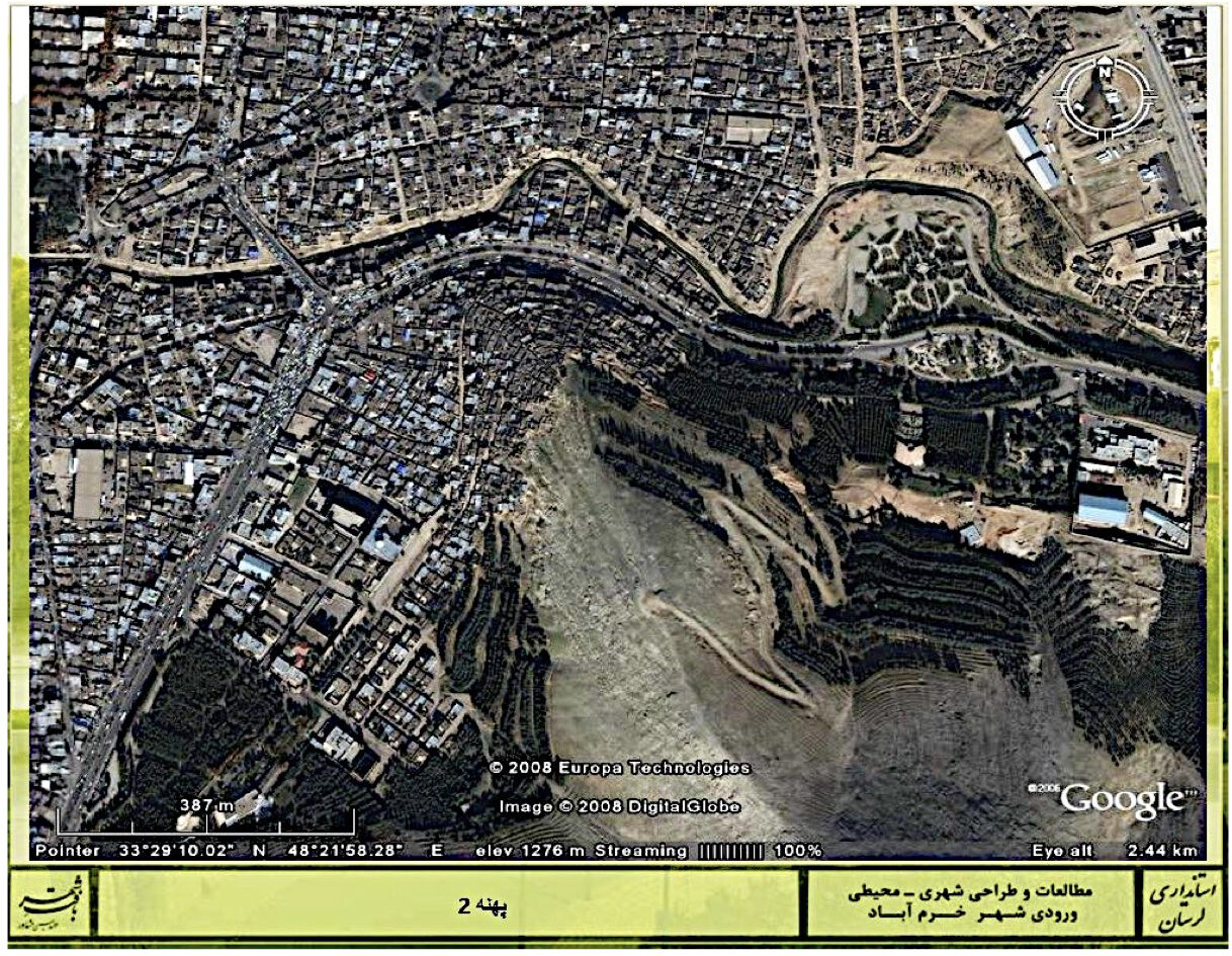
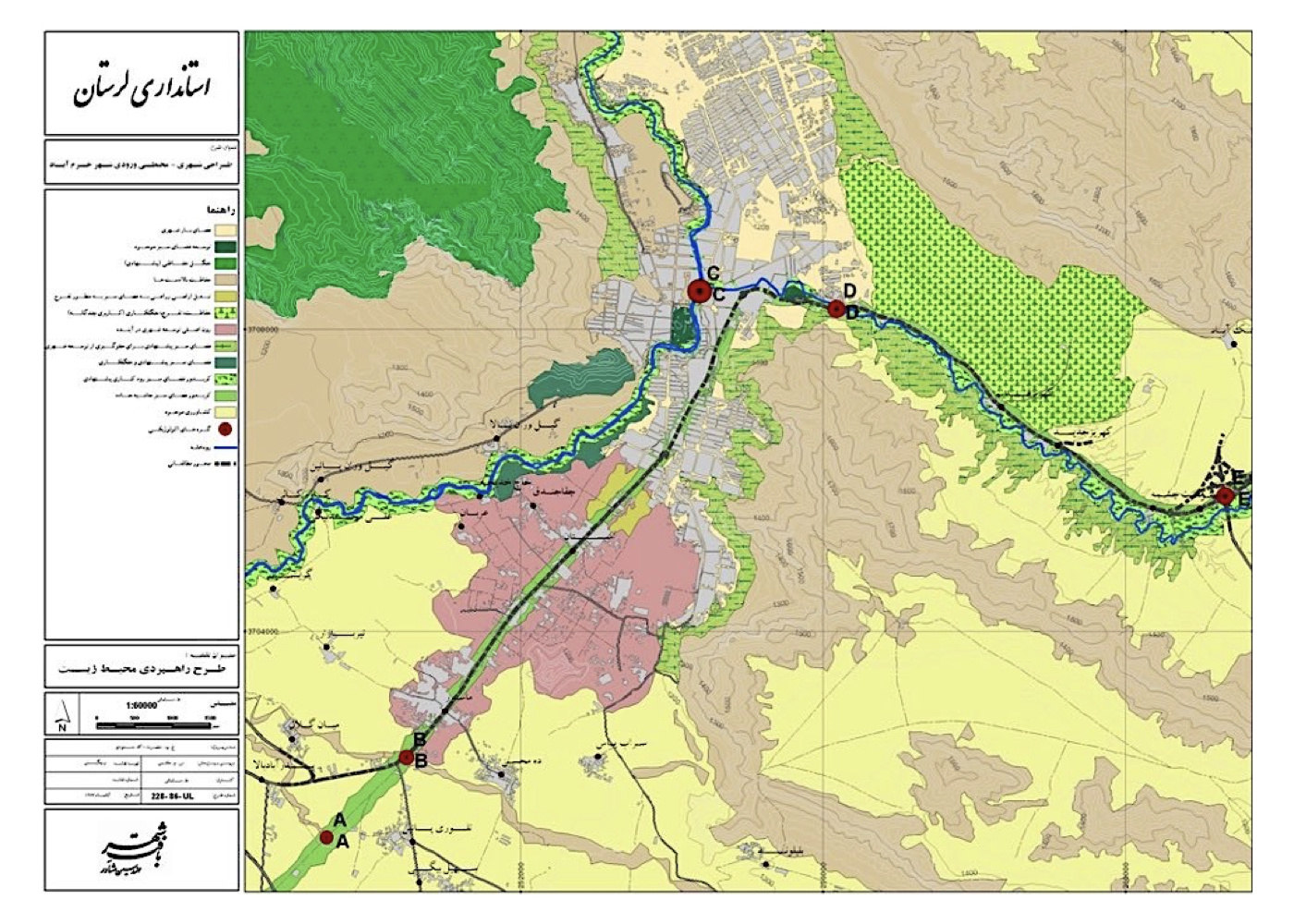
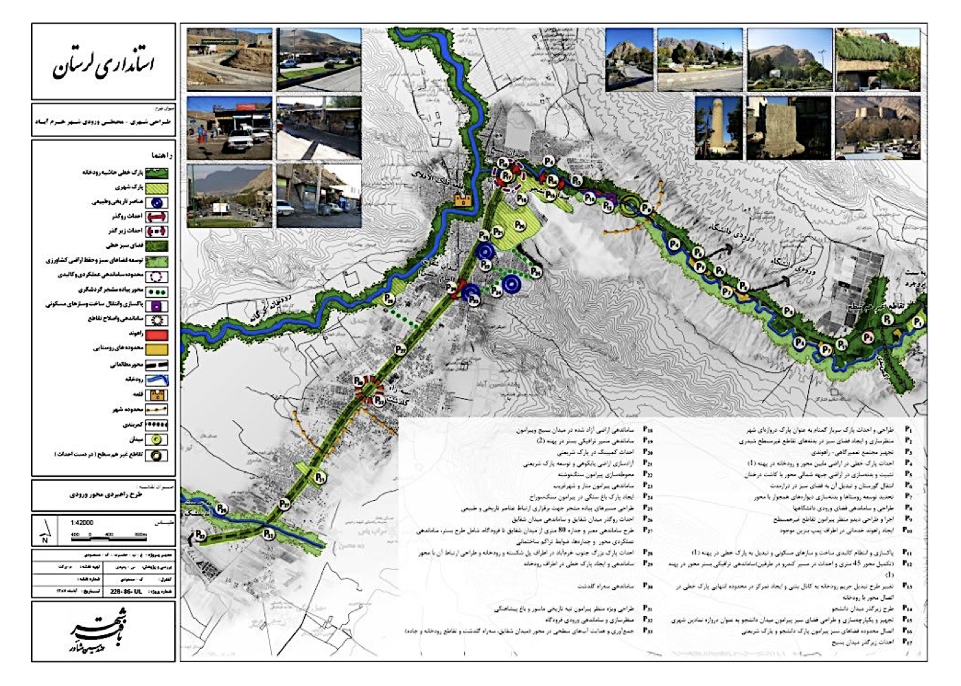
Urban – Environmental Design of the Khorramabad Bypass Corridor (Strategic and Executive Design)
فشرده پیشنهادهای طرح:
Revitalization and reorganization of the corridor, transforming it from a chaotic intercity transport and repair zone into a vibrant urban boulevard—featuring walkable paths, greenery, flowing water, and day–night activity—to enhance Khorramabad’s tourism potential.
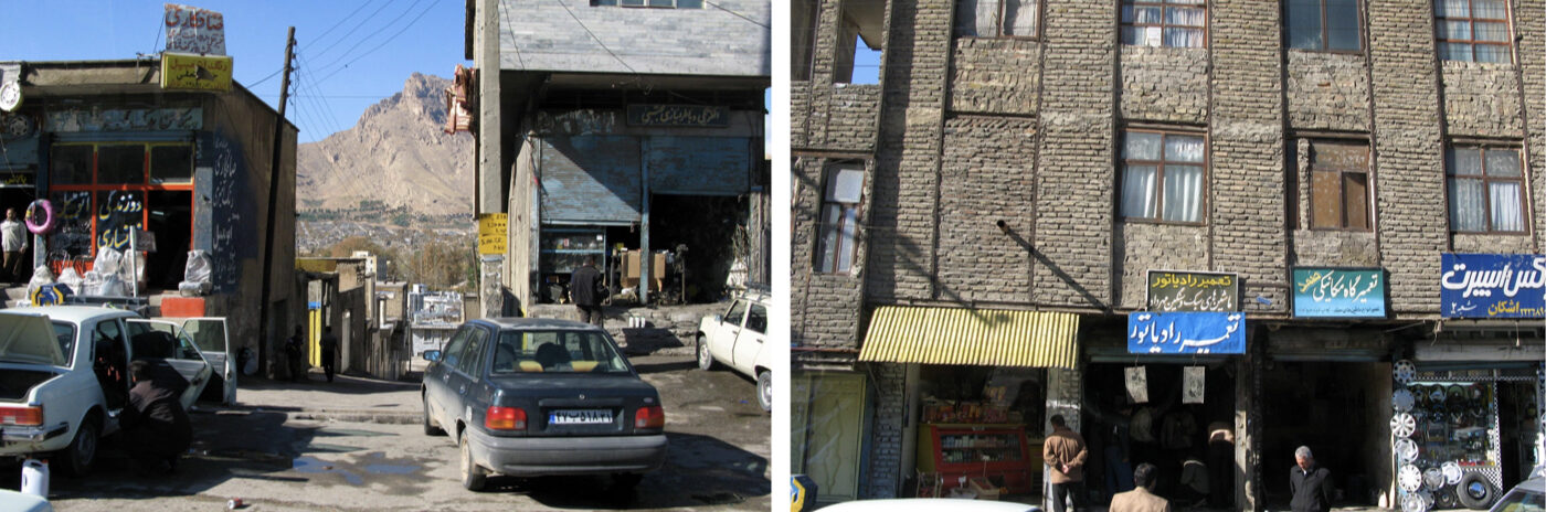
پیشینه:
Khorramabad is an ancient city located in a valley in Lorestan Province, whose name reflects “lushness and prosperity.”
The city forms a remarkable fusion of natural elements—mountains, foothill plains, valleys, a central river, numerous springs, and centuries-old trees. With active conservation (maintenance aligned with ecological use), Khorramabad could become a national model of nature-integrated urban development. Located on the country’s main north–south route, Khorramabad’s arterial corridor has devolved into a disorganized and unattractive roadside transport hub. The design corridor spans 17 kilometers with a nominal width of 100 meters, yet adjacent open terrain and mountainous edges allow for flexible spatial expansion.
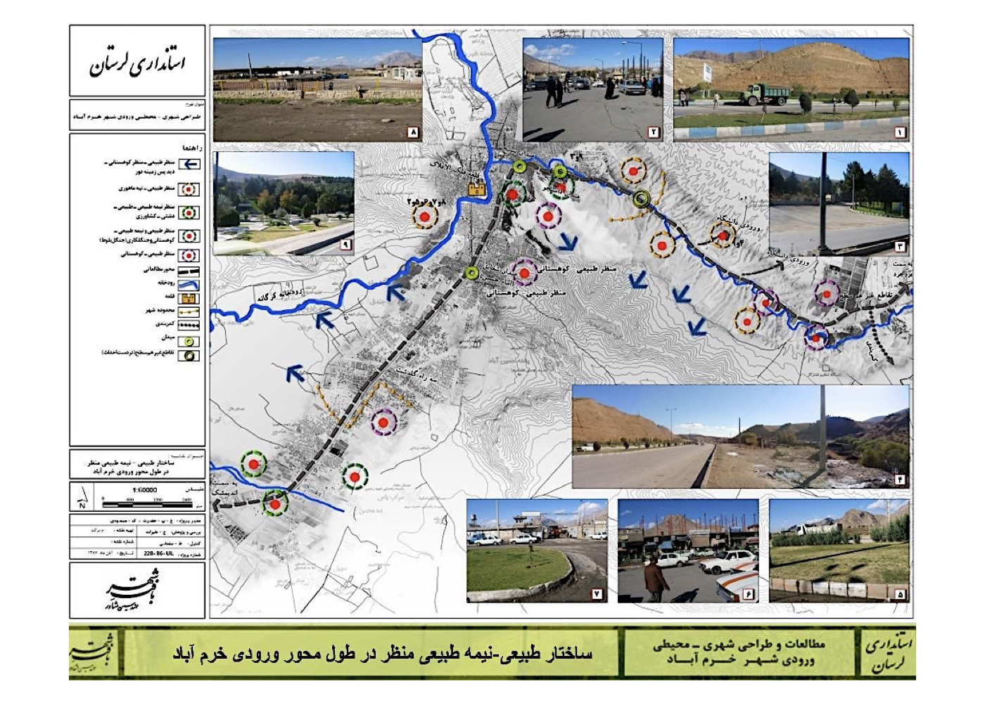
Summary of Key Design Ideas and Strategic Interventions:
1. Revitalization of the corridor base and surrounding edges
2. Functional land-use shift from transport-related services to tourism-oriented development
3. Integration of tourism-compatible functions and activities along the route
4. Reorganizing street and transport networks to improve citywide connectivity
5. Designing safe pedestrian paths with integrated bicycle lanes and accessibility for the visually impaired
6. Creation of linear green spaces and water streams inspired by traditional Iranian boulevards
7. Enhancing urban facades and improving the corridor’s visual and spatial quality
8. Contextual architectural design integrating urban programs with adjacent rock formations
9. Improving visibility and prominence of heritage buildings along the corridor
10. Creating pedestrian routes linking the city to nearby hills and highlands
11. Reclaiming vacant lots and integrating them into the pedestrian network
12. Linking adjacent parks and peripheral green spaces into the main corridor
13. Allocating space for a future urban tram line along the corridor
14. Designating locations for installing historical sculptures and cultural monuments
15. Nighttime lighting design for aesthetic enhancement and public safety
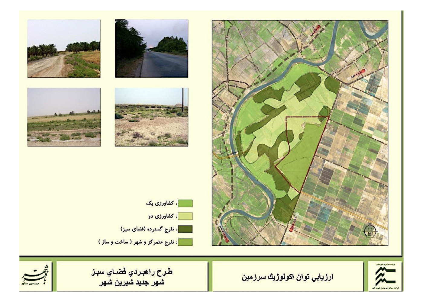
Khuzestan
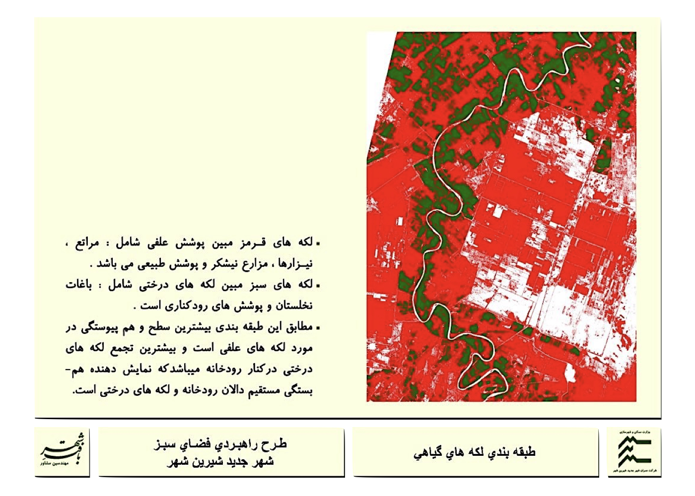
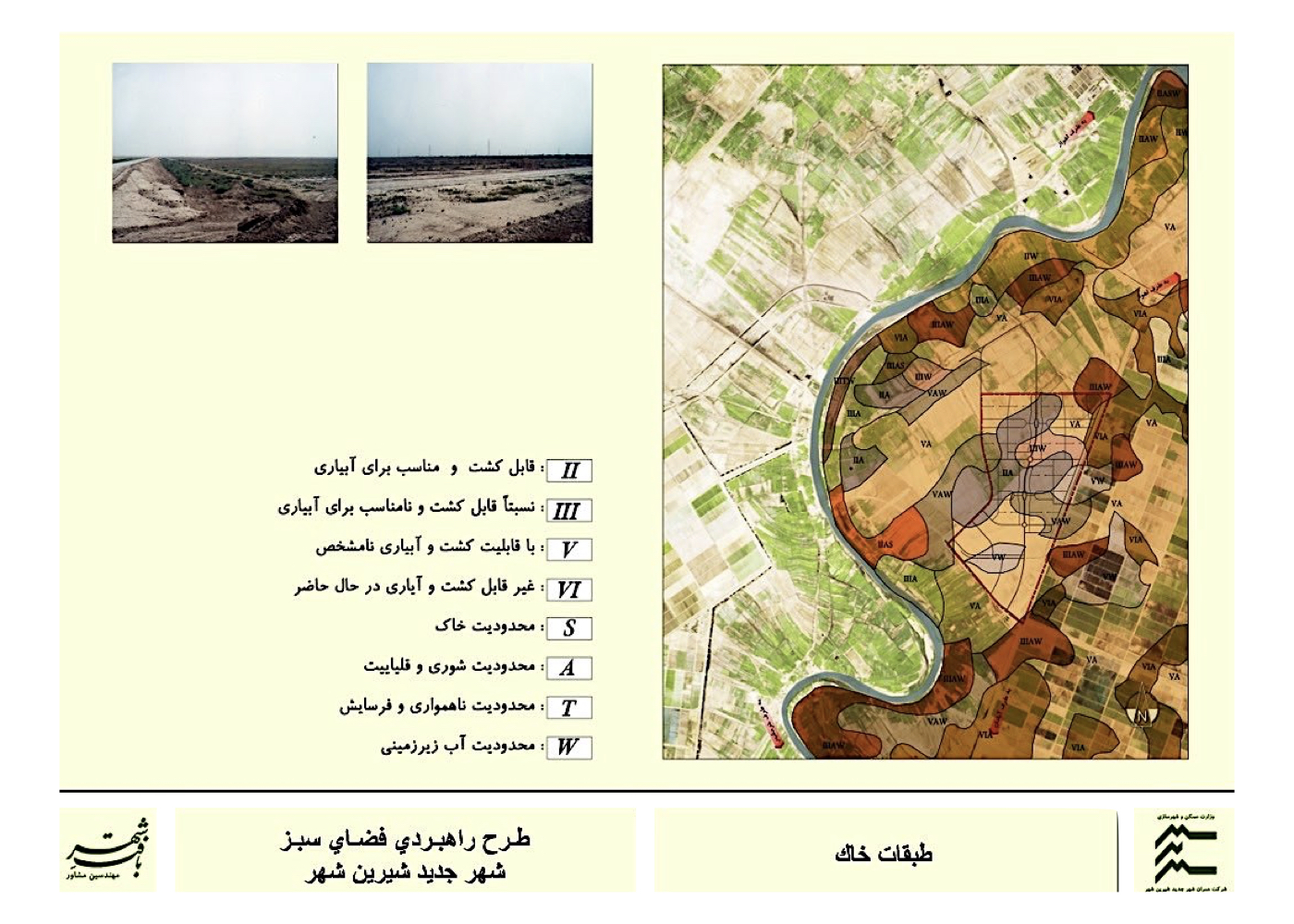
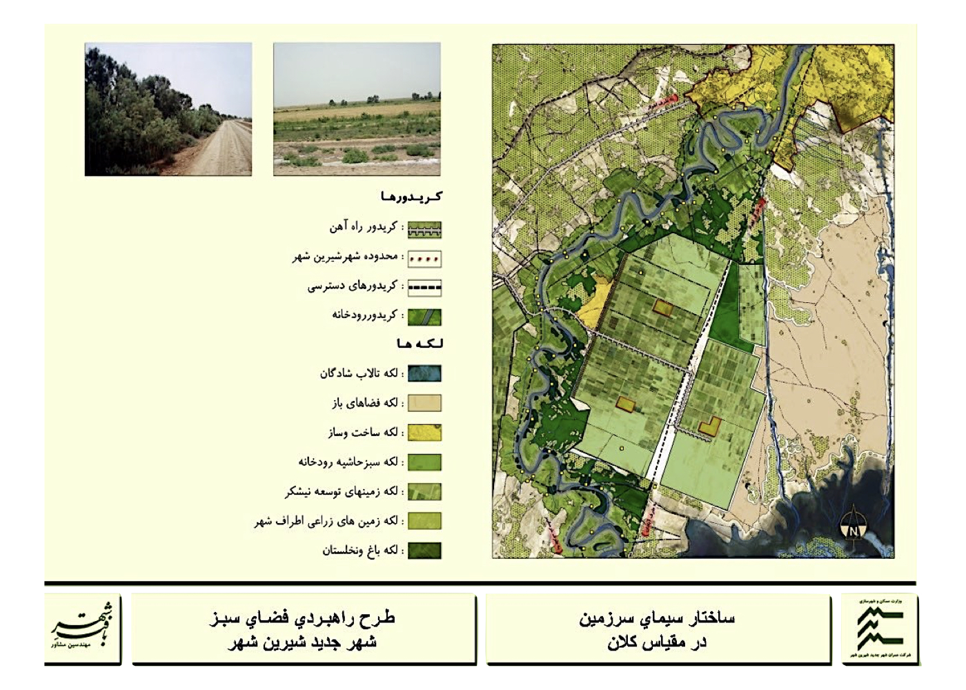
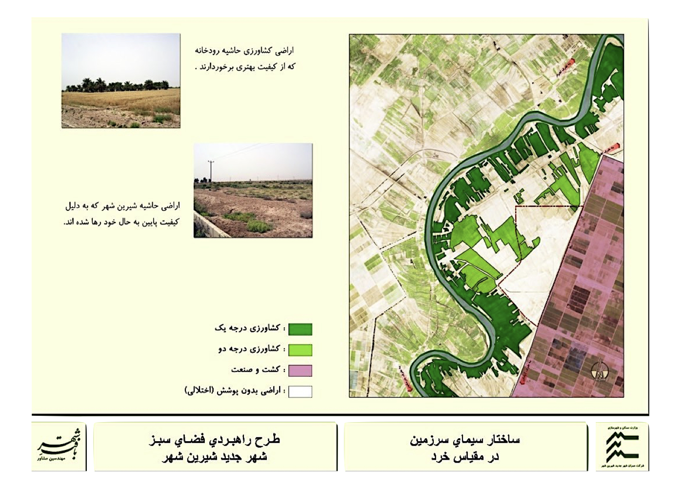
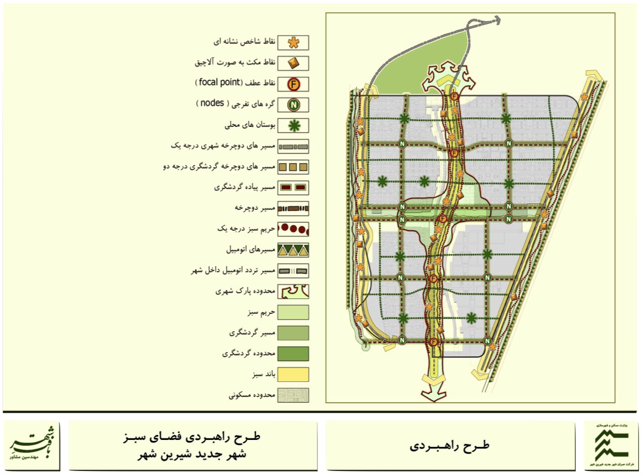
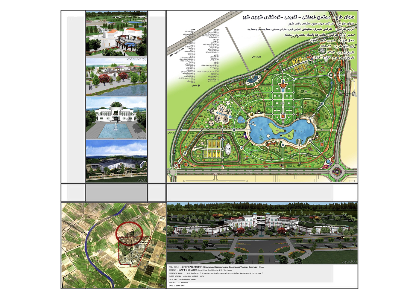
Shirin Shahr New Town – Urban Green Space and Recreational – Tourism Complex (راهبردی)
فشرده پیشنهادهای طرح:
Establishing a sustainable urban green network with ecological connectivity between internal and peripheral green spaces, adapted to the region’s environmental, economic, and recreational conditions.
پیشینه:
Shirin Shahr is located west of the Karun River, adjacent to the sugarcane agro-industrial zone, 46 km from Ahvaz. Planned over 6,500 hectares, the city is intended to absorb population overflow from regional urban centers—especially Ahvaz—and partially serves as a residential zone for sugar industry workers.
Due to the absence of base maps for the site, processable IRS satellite imagery was utilized. These were georeferenced in GIS to generate spatial information layers in fields such as climate, topography, soil, vegetation, wildlife, visual landscape, environment, utilities, and urban structure.
The strategic green space plan and associated recreational-tourism complex were compiled in three volumes:
1. Baseline Studies of the Urban Green Space Masterplan
2. Strategic Plan Report
3. Report on the Recreational–Tourism Complex
Due to the multi-hundred-page length of the full documentation, only a summarized list of contents from the Strategic Urban Green Space Study Report is presented here in a 10-page format for interested readers.
Summary of Core Ideas, Strategies, and Measures:
1. Harmonizing the green space network with groundwater, soil, and other natural resources to ensure ecological sustainability
2. Enhancing urban environmental quality to improve the overall quality of life for residents
3. Utilizing environmental assets to enrich spatial quality and promote tourism
4. Reducing planting and maintenance costs through principles of sustainable green space management
5. Establishing ecological corridors between existing green patches, projected growth areas, and adjacent natural green spaces to form a cohesive and enduring green network
Kish
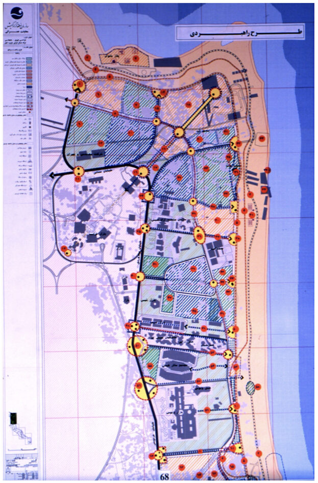
Eastern Coastline Redevelopment – 22 Sea-Perpendicular Axes (Strategic)
فشرده پیشنهادهای طرح:
Reuniting the city and commercial zones with the sea and developing a dynamic coastal tourism experience for both day and night.
پیشینه:
In the 1970s, Kish Island was conceived and built as a luxury recreational and tourism hub for affluent social classes. After the revolution and subsequent war, the area was designated a Free Trade Zone, leading to massive investments in commercial development. In the past three decades, growing popularity among tourists and residents has triggered further waves of development in residential complexes and hotels. Despite the island’s pristine waters and scenic beauty, initial planning failed to engage these natural values—highlighting instead a sunken Greek ship as the area’s top attraction. To address this oversight, the first corrective step was to restructure the island’s eastern shoreline. This plan aimed to improve the quality of the coast and establish seamless physical and visual connectivity between the urban fabric, the public, and the sea.
Summary of Strategies and Interventions:
1. Maximum clearance of coastal land from structures and activities incompatible with tourism
2. Establishing continuity between urban green/open spaces and the shoreline
3. Functional zoning for marine activities and aligning shoreline usage accordingly
4. Identifying key visual landmarks from both urban and coastal perspectives
5. Designing and constructing landmark icons at key nodal points
6. Designing appropriate spaces for events, gatherings, and festivals
7. Opening and enhancing visual corridors from urban thoroughfares toward the sea
8. Redevelopment and aesthetic enhancement of 22 perpendicular axes as urban–coastal connectors
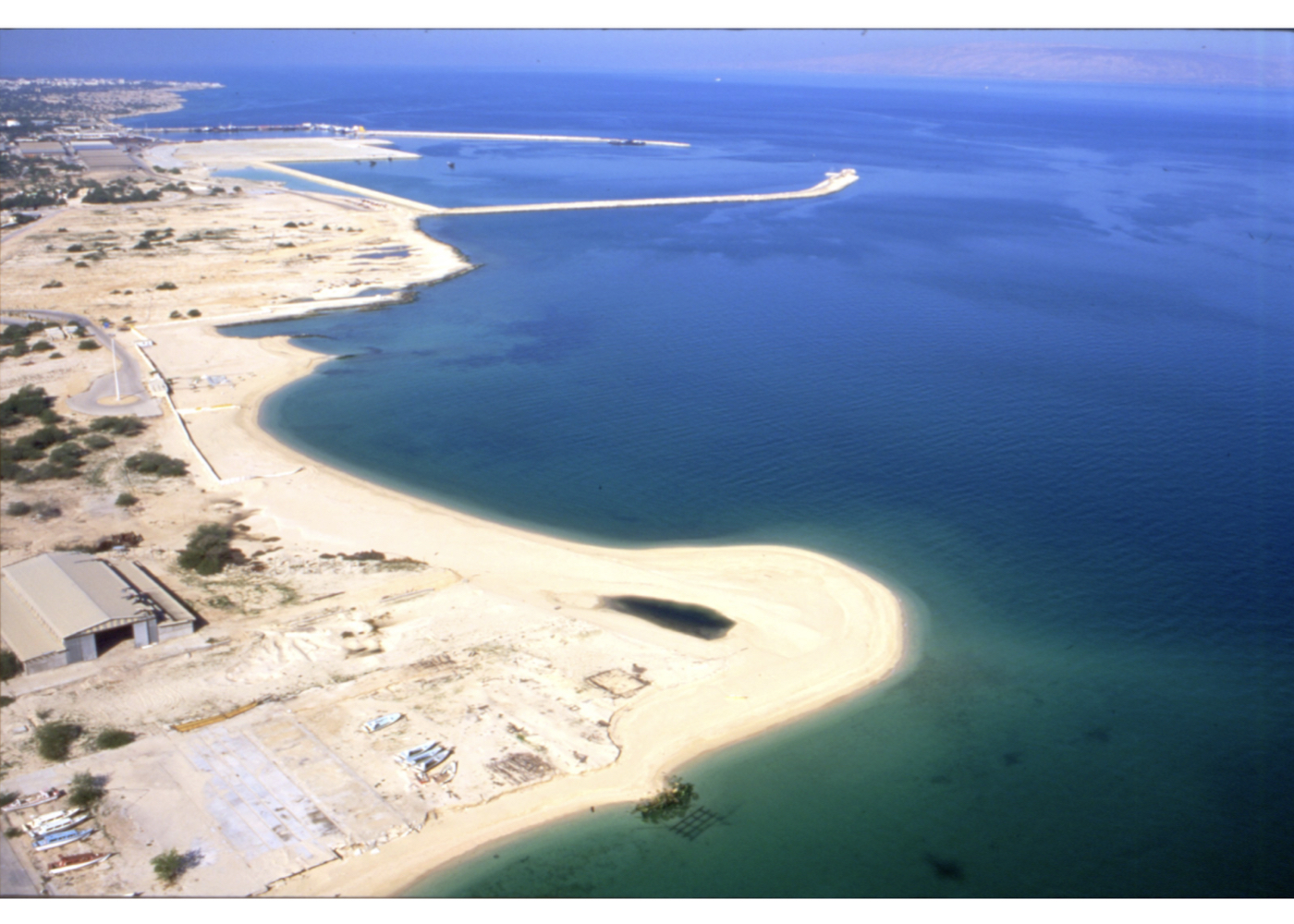
Mashhad
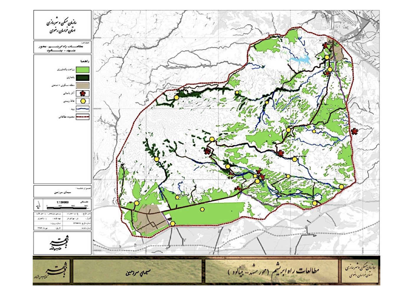
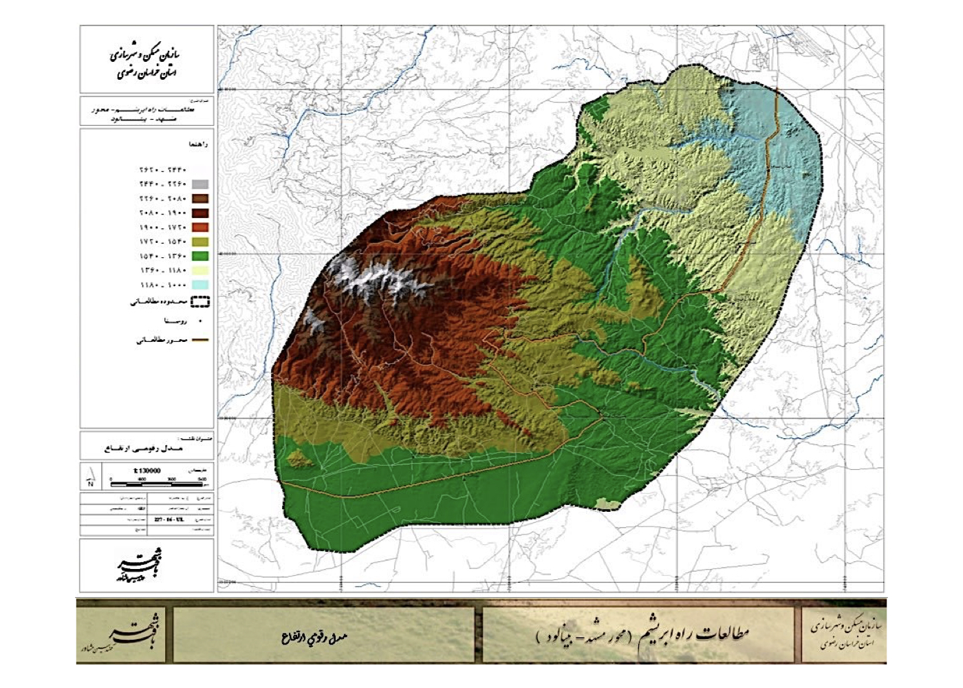
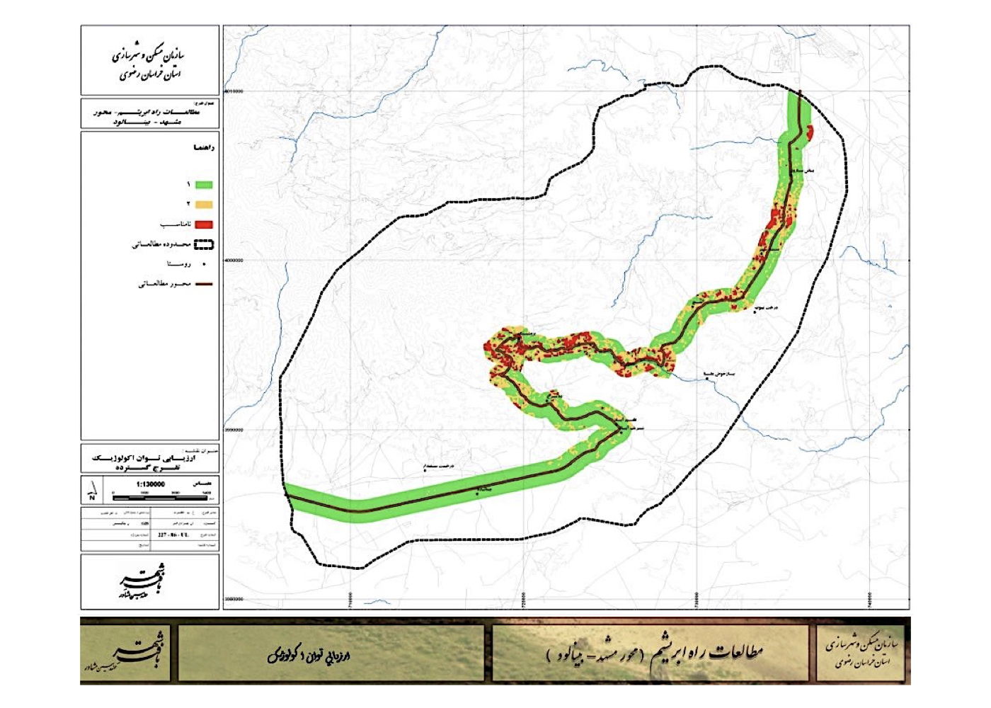
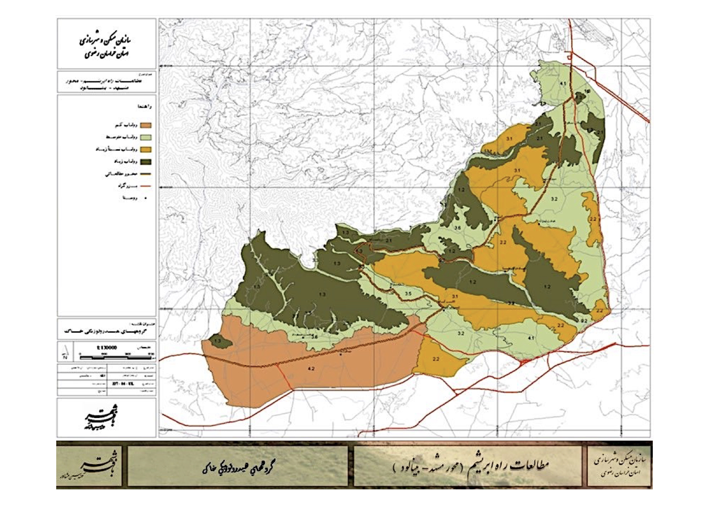
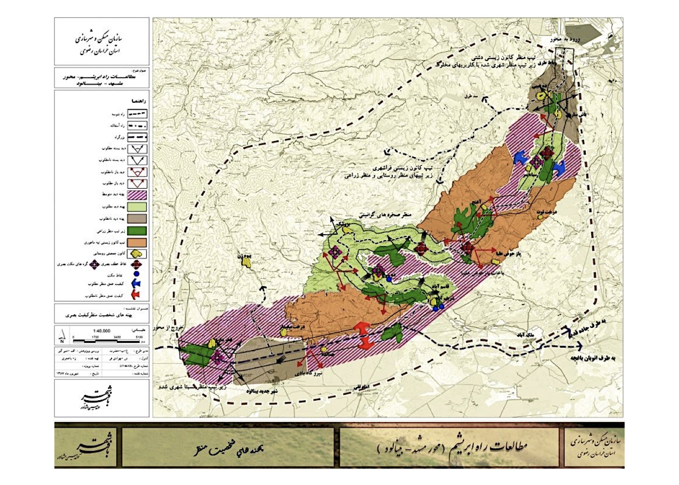
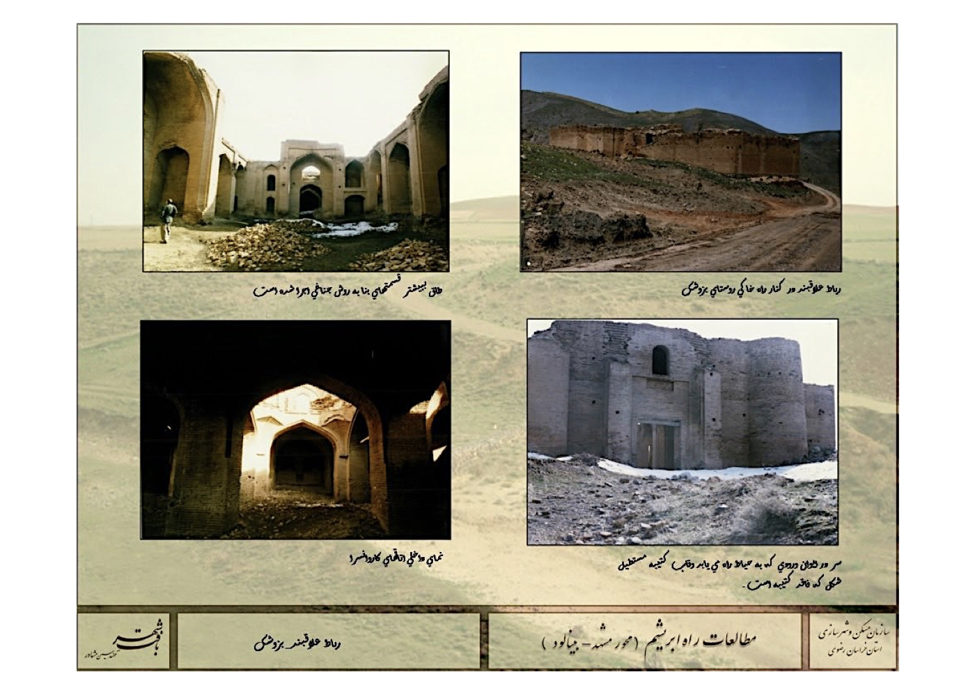
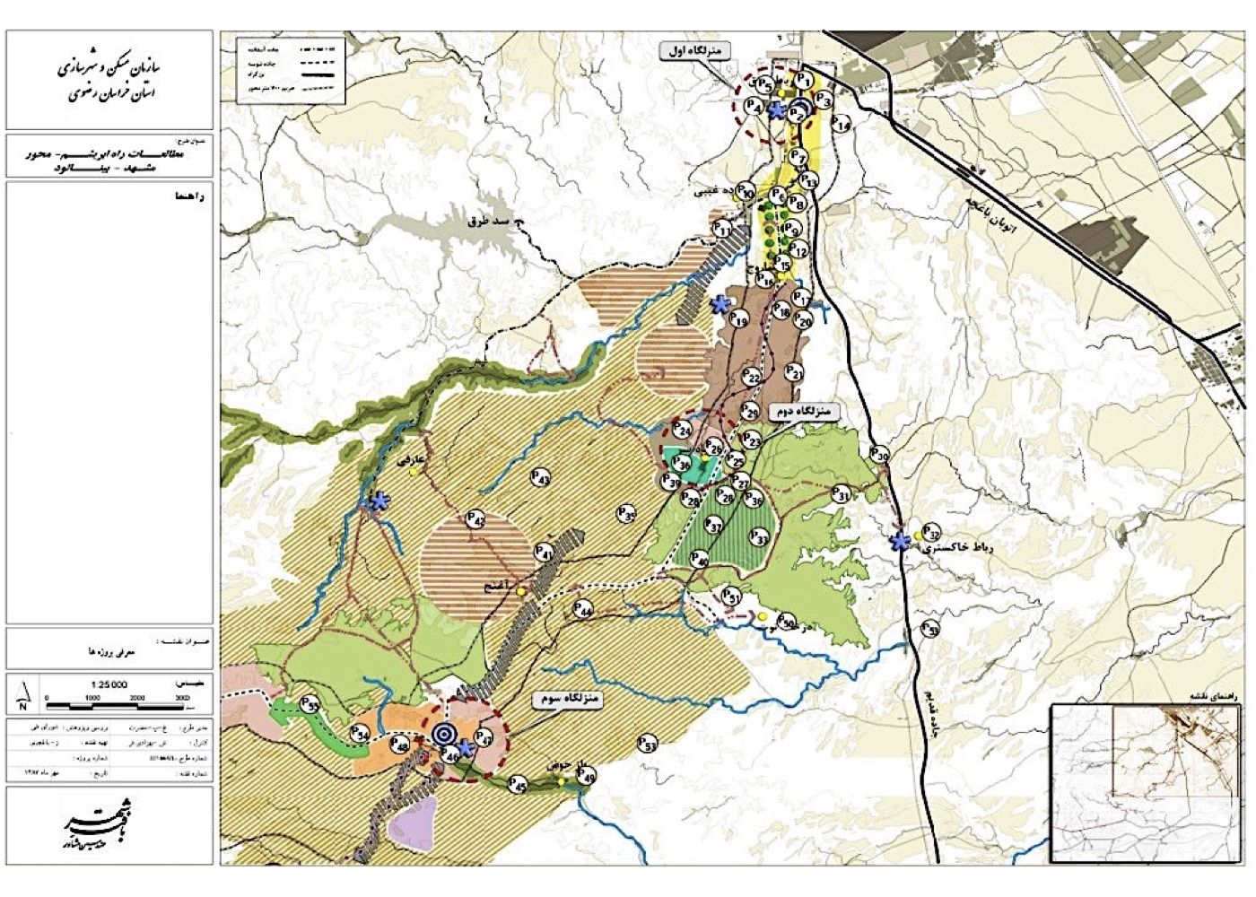
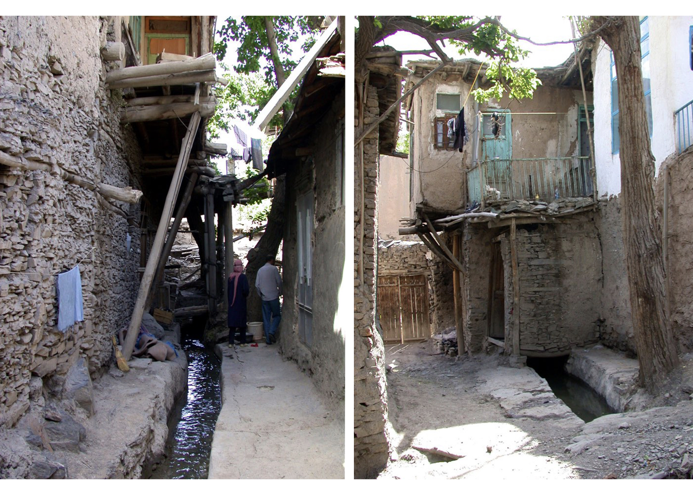
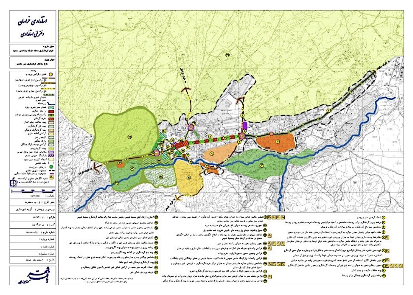
Silk Road Corridor Study: From Mashhad to the New City of Binalood (Strategic)
فشرده پیشنهادهای طرح:
Revitalization and restoration of the Silk Road corridor, enhancing the historic route’s physical quality, as well as preserving existing rural settlements and heritage structures — with the goal of strengthening the tourism potential of Khorasan Province, Mashhad, and Nishapur through the strategic role of the New City of Binalood as a central hub.
پیشینه:
The Silk Road was one of the most ancient and extensive trade and communication routes connecting East Asia to Europe over several centuries, passing through the present-day Iranian route of Tus–Nishapur. In recent years, China’s initiative to revive this corridor for political and economic purposes has prompted significant activity among countries along the route—creating new opportunities to promote tourism and cultural exchange.
The project involved multidisciplinary studies similar to other strategic heritage and tourism plans, including:
Environmental sustainability, visual and landscape analysis, geology, pedology, vegetation cover, green infrastructure, hydrology, mobility and access, urban planning, architecture, historical context, social dynamics, tourism development, economic viability, infrastructure systems, and international case studies.
Summary of Concepts and Strategic Models:
Two distinct tourism development models were proposed:
1. The first model follows a tourism-driven development structure with minimal intervention in the historical and ecological fabric.
2. The second model emphasizes density and clustering of key tourism elements and facilities at strategic nodes along the route.
Urban – Environmental Design of the Torgabeh and Shandiz Valleys and Highlands (Strategic)
فشرده پیشنهادهای طرح:
Tourism development studies in the Torgabeh–Shandiz valleys and surrounding highlands, focusing on the restoration and preservation of natural, historical, and architectural assets as the foundation for sustainable regional development.
پیشینه:
Torgabeh and Shandiz are two well-known destinations for both tourists and pilgrims visiting Mashhad. In addition to these towns, numerous scenic villages exist in the surrounding valleys—such as Mayan, Zoshk, Gong, Abardeh, and Moghan. All are situated along the northern slopes of the Binalood mountain range. In recent decades, aggressive real estate investment and unregulated construction in these valleys and hillsides have caused environmental degradation. The Khorasan Provincial Government commissioned a strategic tourism plan titled Torgabeh–Shandiz Tourism Development Plan to address these issues. The study area covers approximately 600 square kilometers (60,000 hectares).
Following baseline studies across multiple disciplines, the key outputs included:
Geological analysis, water resource and climate assessments, soil studies, vegetation and landscape evaluation, environmental impact, ecological carrying capacity, natural and cultural attractions, local architecture, economy, historical heritage, tourism trends, institutional structure, and infrastructure mapping. The current conditions—including development trends, opportunities, constraints, and risks—were evaluated for each sub-region. Regional and supra-regional development goals and corresponding strategies were then formulated. Specific objectives, policies, and policy recommendations were established.
Summary of Macro Strategic Plan:
1. Primary regional mobility and access network
2. Functional and environmental land-use zoning
3. Designation of dispersed and concentrated recreational zones
4. Protected and conservation priority areas
5. Strategic planning domains
6. 34 large-scale design and development topics prioritized for implementation
7. Regulations and zoning codes were defined for each sub-region
8. Comprehensive Environmental Impact Assessments (EIA) were conducted
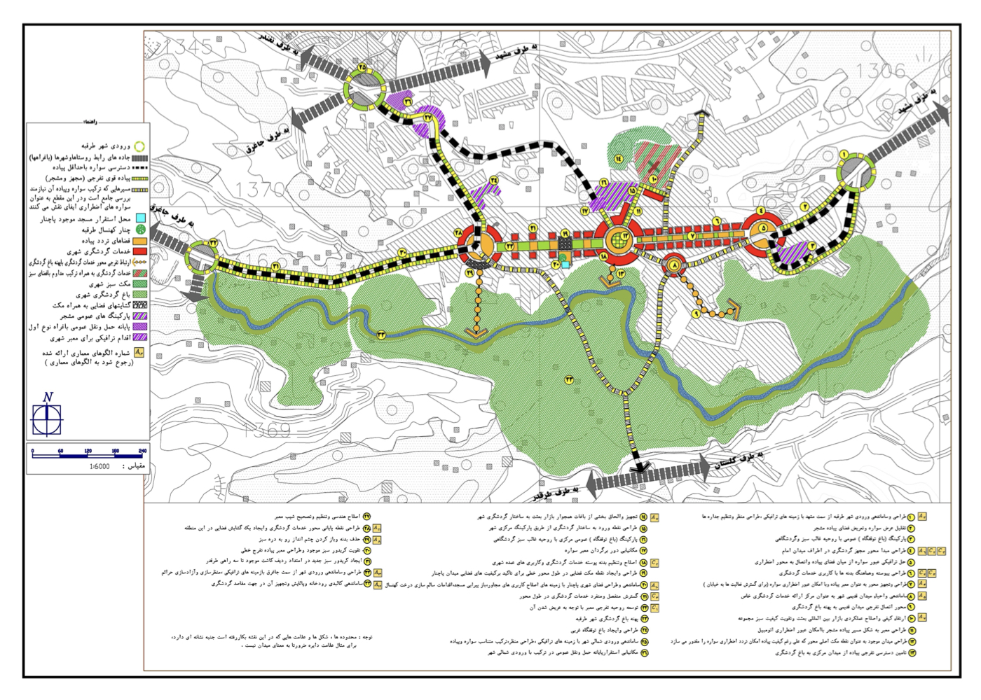
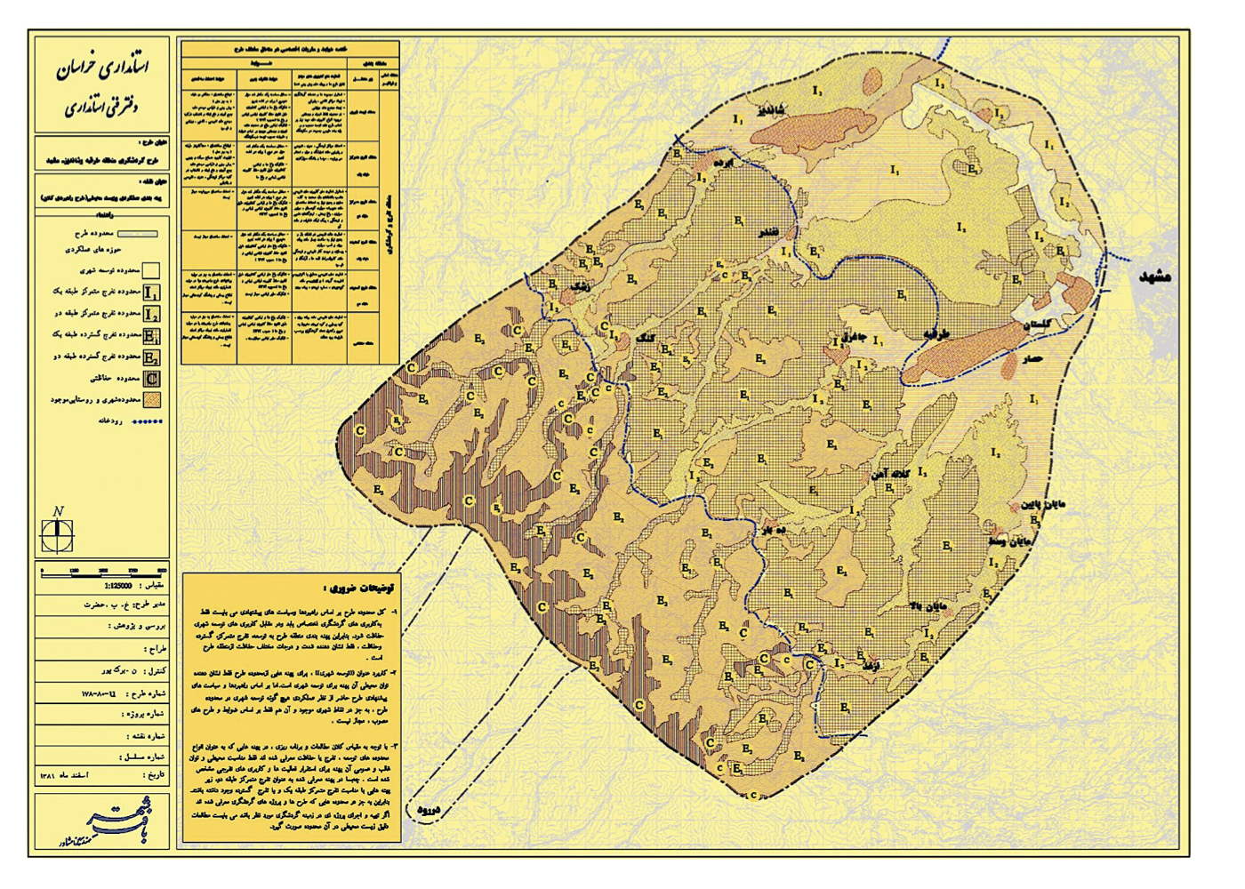
Summary of Intermediate-Scale Strategic Plan:
A tourism development framework was designed for the towns of Targabeh and Shandiz, including architectural, urban design, landscape, and civil infrastructure models tailored to the environmental context. Proposals were also made to achieve balanced tourism distribution among Mashhad’s various valleys.
یادآوری:
Plans of this nature must begin with a rigorous ecological capacity and carrying capacity assessment. Subsequently, proposed projects should undergo environmental impact analysis to avoid major planning failures—such as the Padideh Shandiz project, which was launched without proper evaluation and undermined long-term sustainability.
Strategic Evaluation of the Redevelopment Plan Surrounding the Imam Reza Shrine
فشرده پیشنهادهای طرح:
This study critically examines the challenges caused by the implemented redevelopment plan and proposes strategic solutions for resolving the resulting urban crisis.
پیشینه:
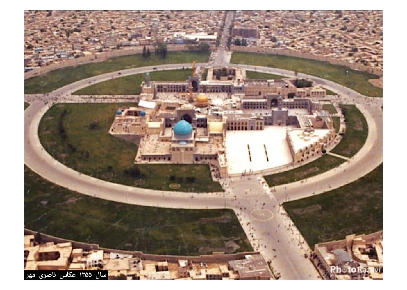
The consulting engineer behind the plan ordered widespread demolition and reconstruction in the heart of a historic city. Mashhad has undergone many transformations over centuries, the most recent prior to the 1979 Revolution under Governor Valiyan, who oversaw the demolition of about 50 hectares of urban fabric around the shrine. A tall boundary wall was erected around the shrine, severing its connection to the surrounding city. Locals often likened it to the “Berlin Wall” of Mashhad. Historically, the people’s relationship with the shrine was organically embedded within the integrated urban fabric.
After the revolution, initial steps were taken to resolve traffic issues around the shrine. In the 1990s, a redevelopment contract was signed with the architectural consultancy Tash. The plan covered approximately 300 hectares and was approved in 1996. Despite being the primary stakeholder, Mashhad Municipality struggled to assess the plan and commissioned a separate consultant for review.
As the lead urban fabric consultant, I took responsibility for this strategic review, forming a multidisciplinary team of experts in urbanism, economics, transportation, and sociology. We conducted site visits, stakeholder meetings, and a full report was submitted to the municipality and governorate. A 12-page executive summary of the report was prepared and is also available for reference here. All strategic recommendations are documented in Section 11 of the report.
Section 10 of the report outlines the following consequences of the redevelopment plan:
A. Over 15 years of redevelopment, the city center would effectively become a massive construction zone.
B. Municipal authority would be weakened, creating administrative suspension and intensifying chaos in central governance.
C. Land consolidation and accompanying social and bureaucratic complexities would present major implementation challenges.
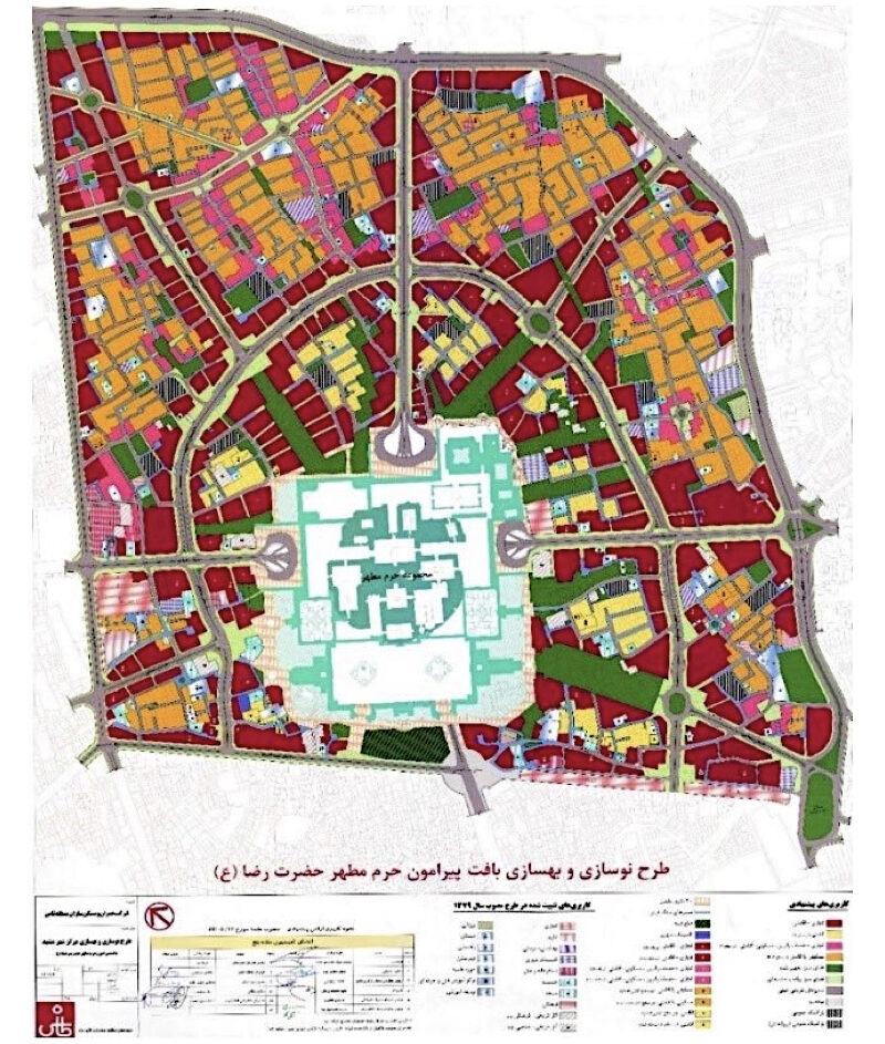
Key Recommendations:
1. Shift from demolition-led redevelopment to improvement-based revitalization.
2. Establish a system of continuous monitoring and evaluation
3. Protect the jurisdiction and authority of responsible public institutions
4. Establish a high council or national commission given the scale and sensitivity of the project
Reminder:
Nearly 30 years later, despite several revisions, the cycle of demolition and reconstruction continues, and the identity of Mashhad’s historic center has been severely compromised.
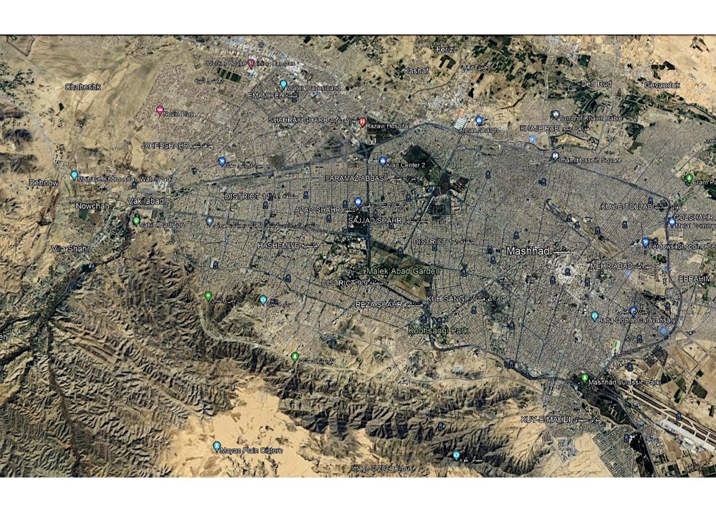
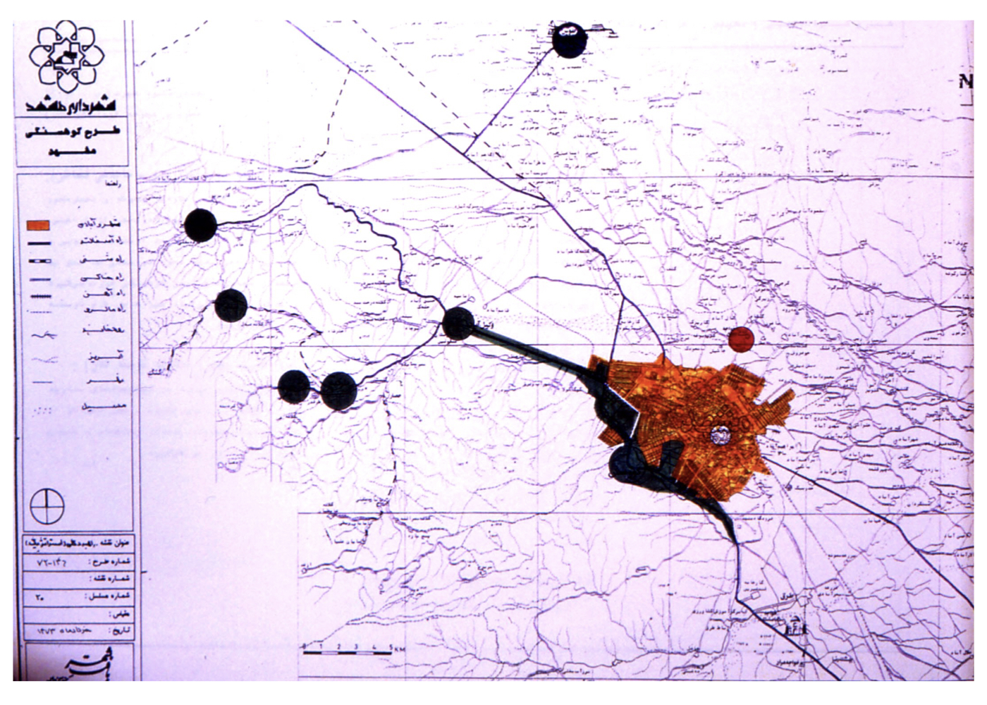
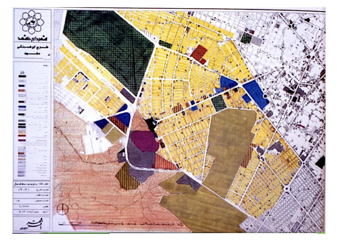
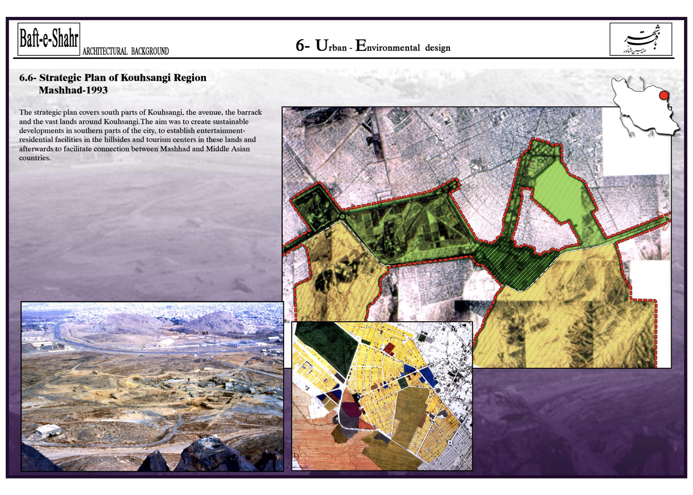
Koohsangi District (Strategic)
فشرده پیشنهادهای طرح:
Evaluating the conditions, assets, and constraints of the Koohsangi area as one of Mashhad’s key natural values and strategic levers for sustainable urban development.
پیشینه:
ساحل شهر كوهسنگي area, located in southern Mashhad, was considered outside the urban boundary for many years. The development of the كوهسنگي Club, its large pool, and the beautifully tree-lined كوهسنگي Boulevard—built during the Reza Shah era by the late Asadi—gradually steered urban expansion southward toward كوهسنگي. With the later construction of Mashhad University and its placement behind the rocky hills, military facilities and infrastructure projects were introduced, and land was allocated to military compounds.
Summary of Macro-Scale Strategic Ideas:
It was determined that Koohsangi lands could form the connective tissue linking several of Mashhad’s large urban green spaces, shaping a comprehensive green infrastructure for the city’s south.
These green spaces, arranged from west to east, include:
1. Vakilabad
2. Kase Partovi
3. Vakilabad Road, with its ancient mulberry trees and flowing qanat water
4. Mellat Park
5. Mashhad University Campus
6. The 200-hectare Malek Garden
7. Television Garden
8. Koohsangi
9. Lashkar 88 Military Base (planned for future decommission)
10 – Greenbelt south of Mashhad Airport
Project Proposal:
To link these major parks and gardens through Vakilabad Road, Television Garden, and Koohsangi —once the military base is cleared—creating a 200-hectare green corridor. This green corridor would dramatically boost the ecological capacity of southern Mashhad and establish the longest continuous green tourism axis in Iran, connecting the airport to Vakilabad.
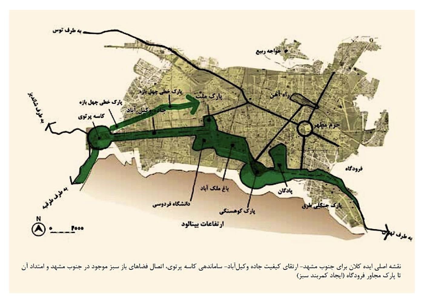
یادآوری:
Vakilabad Road could have retained its historic role as a recreational axis—with dedicated lanes for pedestrians, cyclists, carriages, and fitness. However, the addition of metro and surface trains transformed it into a high-speed traffic corridor with multiple overpasses—diminishing its functionality as a tourist-friendly greenway.
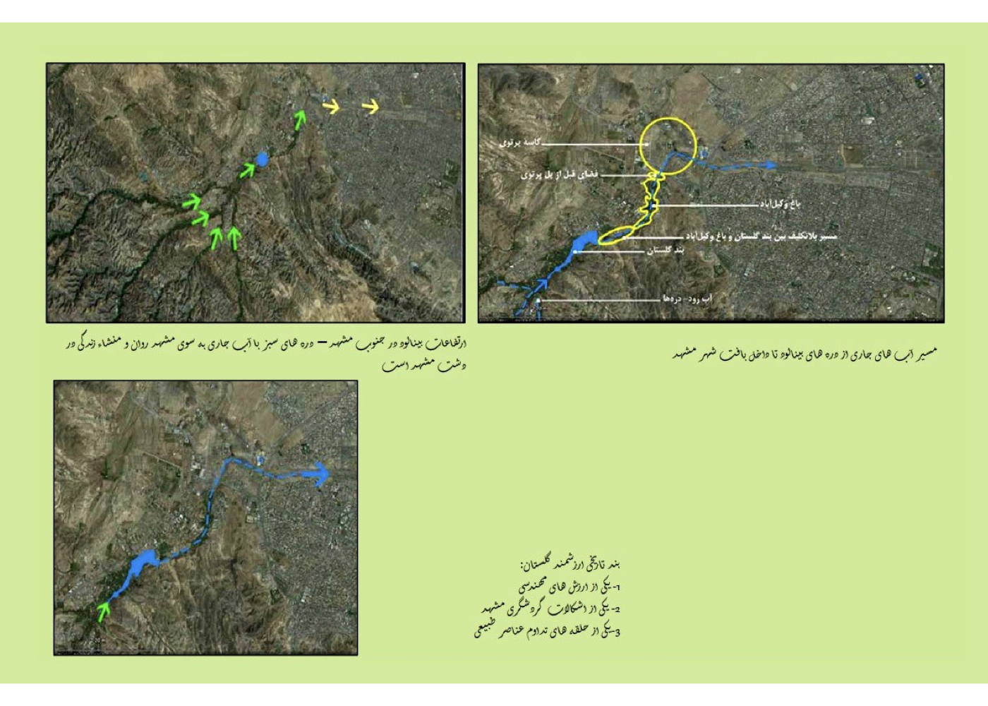
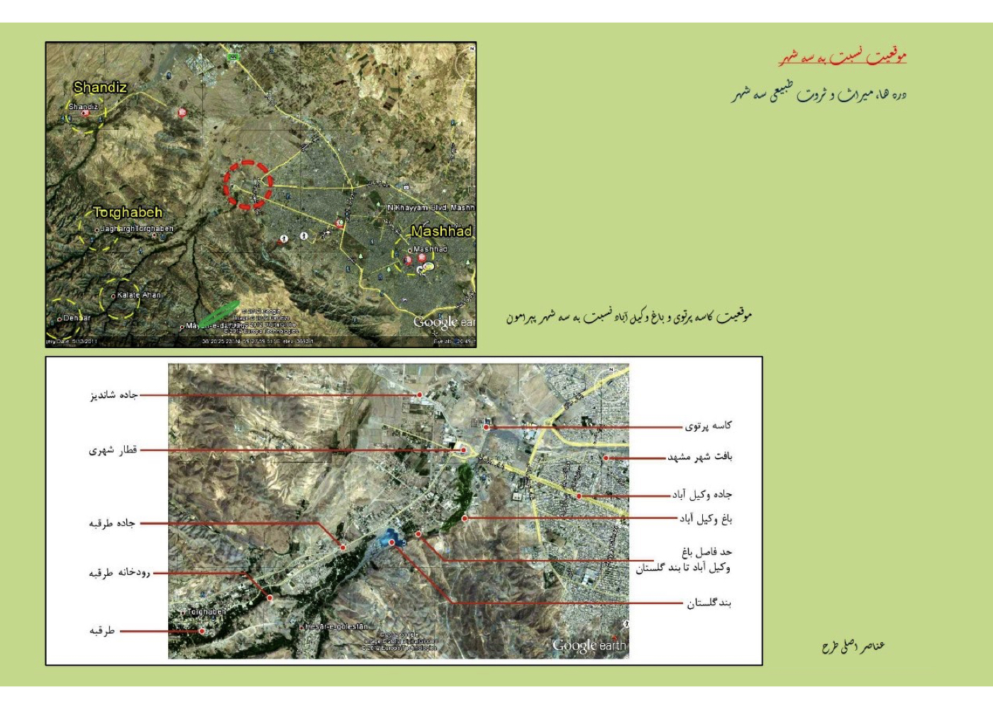
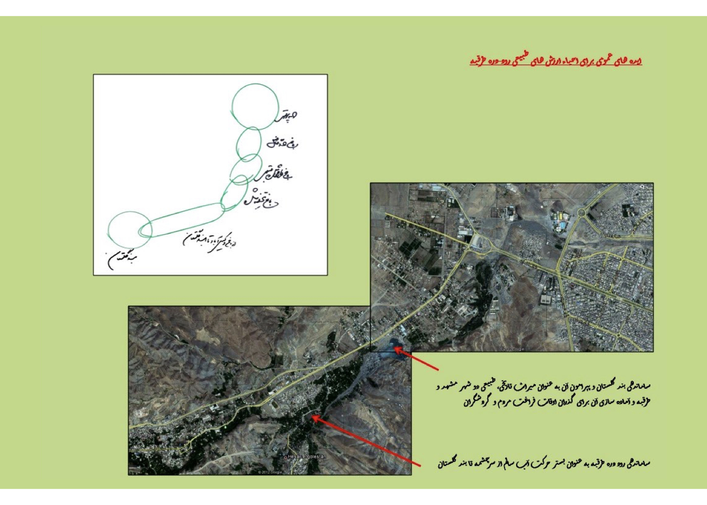
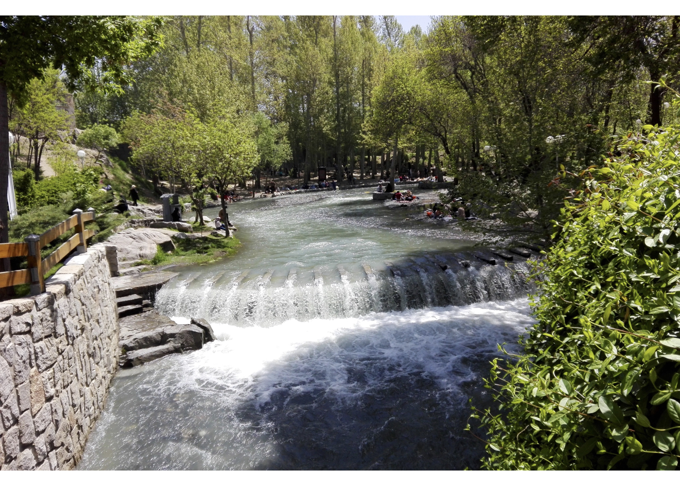
Vakilabad District (Strategic)
فشرده پیشنهادهای طرح:
Assessing the potential to interconnect dispersed natural features along the Targabeh River–Valley corridor into a continuous green and stream-based ecological system, extending from the Binalood Mountains into the urban fabric of Mashhad—linking Band-e Golestan, Vakilabad Garden-Valley, Kase-ye Partavi, and Kal-e Chehel-Bazeh.
پیشینه:
Vakilabad Garden, approximately 70 hectares in size, was endowed by the late Hossein Malek to the people and placed under the stewardship of the Mashhad Municipality.
1. It is located at the base of the Targabeh Valley, at the threshold of Mashhad, and benefits from the Targabeh River’s water flow.
2. An aqueduct was built to supply water to the garden across two levels, but portions of it are illegally tapped by residents along its course.
7. Reviving the qanat system and efficiently using both aqueduct and surface water for tree irrigation
8. Designing Kase-ye Partavi as a rock garden and transition point from the city toward Mashhad’s summer pastures (Targabeh, Shandiz)
9. Creating a linear park along the Kal-e Chehel-Bazeh streambed to link neighborhoods to natural areas like the Binalood foothills
Implementation Notes:
1. Some components were implemented under subsequent mayors.
2. Vakilabad Garden’s main plan was approved and implemented.
3. Portions of the qanat were cleaned and secured, though not fully rehabilitated.
4. Kase-ye Partavi’s design was altered and implemented without consultant supervision.
5. The continuation of the green corridor was later designed by two firms, but property disputes have hindered implementation.
POLADSHAHR
Urban – Environmental Design of the City’s Central Axis
فشرده پیشنهادهای طرح:
Enhancing the environmental quality of the city’s central service corridor by strengthening its connection to the adjacent natural landscape (mountain).
پیشینه:
Poladshahr is a newly planned city located 20 kilometers from Isfahan, originally designed to house employees of the Isfahan Steel Plant, and is gradually expanding. The project area is the city’s main urban axis, which extends toward the nearby hills. This project was part of an urban design competition, where the consultant secured second place by a narrow margin. The client proposed a joint effort with the first-place winner, but the consultant declined.
Summary of Core Concepts Based on Isfahan’s Climatic and Cultural Characteristics:
1. Guiding surface water flow along pedestrian walkways by transforming hazardous water channels into tranquil, stream-like features
2. Establishing strong, shaded green corridors along pedestrian paths (inspired by the historic Chaharbagh axis)
3. Extending the green corridor to the mountain summit to connect urban and natural environments via a continuous green belt
4. Reinforcing physical and functional connectivity between the city and mountain through a tree-lined pedestrian spine
5. Creating a large public terrace with cultural and recreational facilities atop the mountain as a gathering and interaction node
6. Constructing a hospitality structure next to the terrace for day-and-night use by residents and tourists
7. Designing a public linear “urban paradise” (interlinked gardens) at the junction of urban fabric and foothills
Final Vision of the Plan:
Poladshahr would feature a linear green-commercial center with a stream, an urban paradise at the base of the mountain, a green, ecologically restored mountain, and a vibrant natural space for public interaction and recreation—day and night.
Qazvin
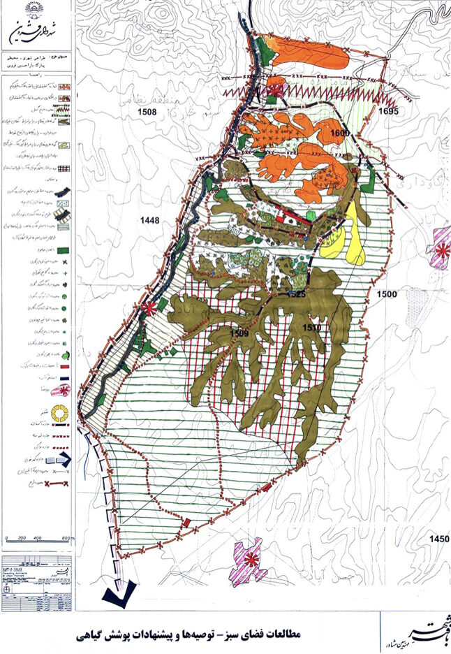
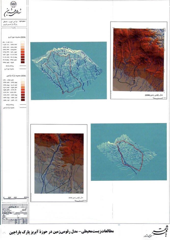
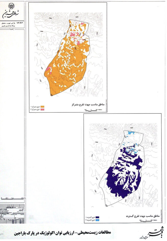
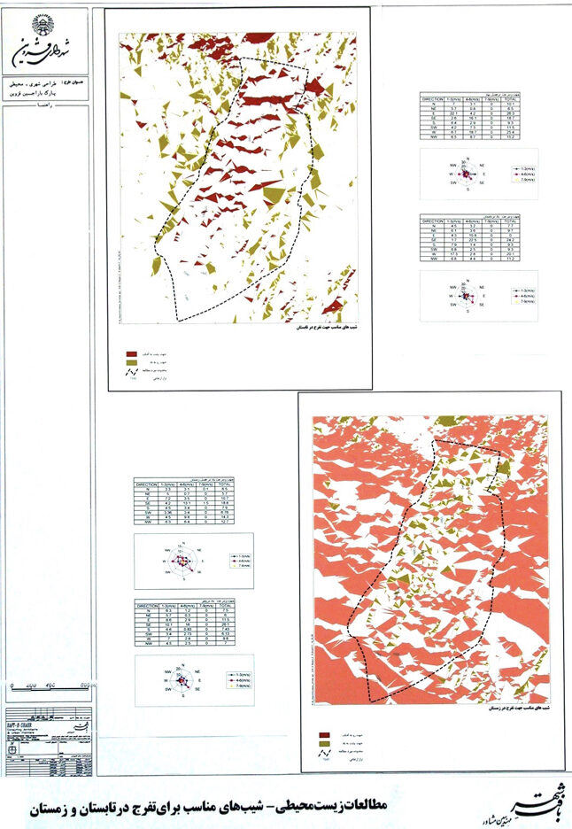
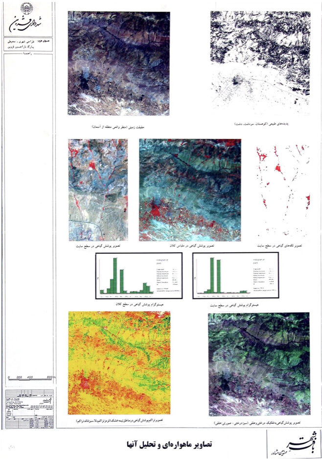
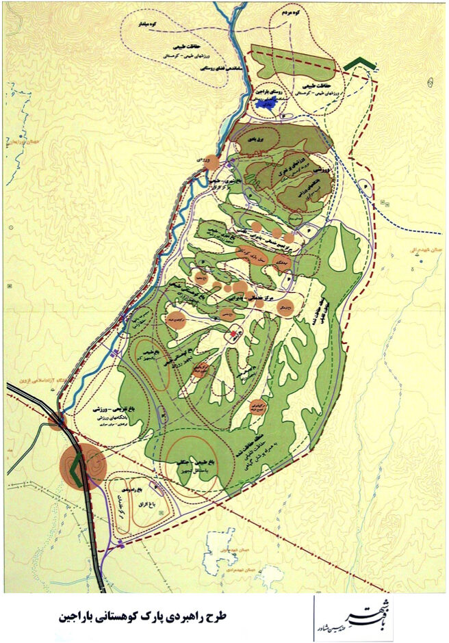
Urban – Environmental Design of the Barajin Highlands (Strategic (Strategic)
فشرده پیشنهادهای طرح:
Evaluating the proposed “City of Knowledge” in this area—which was ultimately rejected—and replacing it with a nature-based tourism complex utilizing the unique natural assets of the Barajin lands.
پیشینه:
The Barajin foothills and steep terrains are located northeast of Qazvin, across from the Tehran highway, with a commanding view over the city. These lands are ecologically linked to the adjacent mountain range, and their surface and groundwater resources historically supplied water to Qazvin’s historic gardens. Unfortunately, the highway has now severed this vital connection.
During stakeholder meetings, it was revealed that the government had planned to build a “scientific city” in this zone. It is worth noting that the Barajin lands are separated from the Islamic Azad University campus (located next to the highway) by a shallow ridgeline.
Study Findings:
Comprehensive urban, environmental, and geological analyses concluded that, due to visual dominance over the city, ecological significance in supporting urban orchards, and the presence of active faults, this site was unsuitable for establishing a scientific city. Before the results were presented, local authorities had anticipated approval and had already initiated preparatory activities. The day of the presentation, in the presence of the provincial governor, marked a historic moment in Qazvin’s urban planning discourse. The scientific and evidence-based presentation unsettled some officials, but the governor acknowledged the validity of the findings and ordered a full reassessment of the proposal. Instead of the scientific city, the consultant proposed converting Barajin into an urban natural paradise, aligned with the ecological potential and site constraints. In subsequent meetings, the consultant’s strategic vision was endorsed.
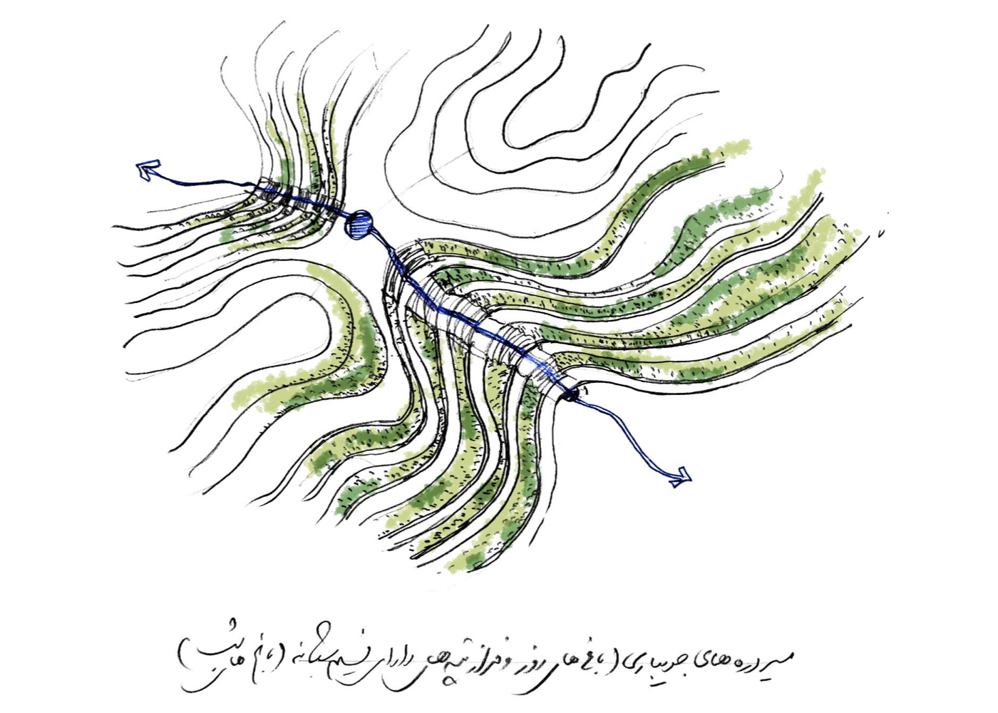
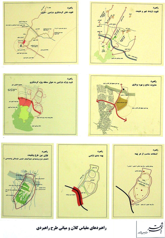
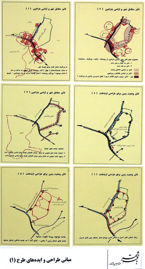
Summary of Design Concepts and Strategies:
“Day Gardens” and “Night Gardens”
Strategic Master Plan Summary:
The urban natural paradise was master-planned based on land capacity assessments, functional zoning, green space design according to soil and water potential, and phased implementation components. For the first time in Iran, the concept of “Day Gardens” and “Night Gardens” was introduced for such mountainous terrain. The design considered wind orientation, low-visibility zones at night, and the functional use of ridges and valleys—organizing movement and garden placement accordingly.
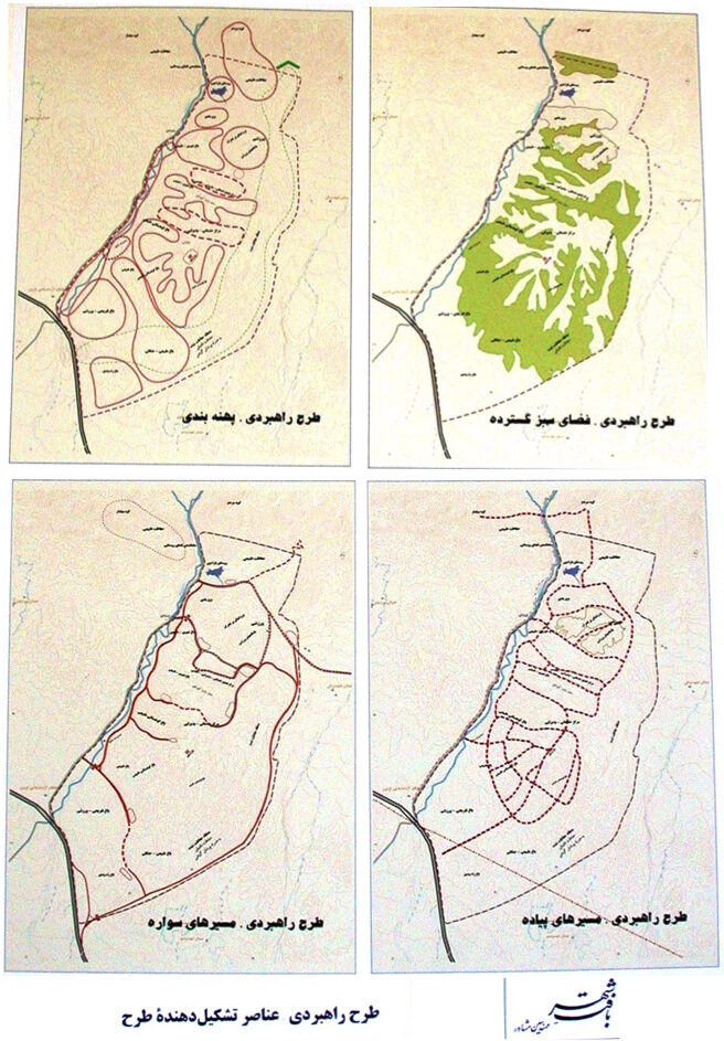
Ramin New Town
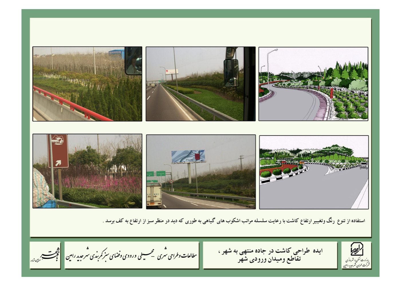
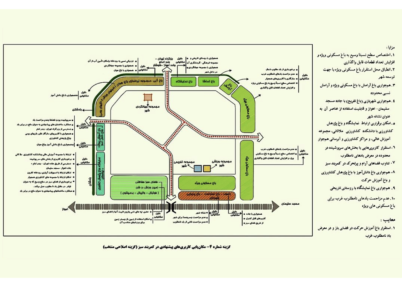
Urban – Environmental Design of Gateway and Greenbelt
فشرده پیشنهادهای طرح:
Securing the greenbelt zone, improving environmental quality, and—where feasible—introducing compatible land uses.
پیشینه:
The New Town of Ramin is located in Khuzestan Province. Within its master plan, a greenbelt of appropriate width was designated to buffer and protect the city from external environmental factors. Green spaces on the urban fringe often suffer from safety issues due to insufficient surveillance, blind spots caused by dense vegetation or uneven terrain, and low visibility—especially at night. Tragic incidents in Tehran’s Lavizan Park illustrate the potential dangers of neglected peripheral green spaces. An effective strategy to enhance safety is the placement of environmentally compatible and green-aligned land uses within these areas. The plan proposes such land uses, ensuring not only ecological compatibility but also functional synergy with adjacent urban uses. This integration enhances the economic viability of the area, strengthens surrounding urban functions, and contributes meaningfully to public safety. It facilitates safe public access to nature and supports the sustainable development of the new town.
Maps and detailed descriptions are provided in Section 5.
Shiraz
Urban – Environmental Design of the Northern Highlands (Baba-Kouhi)
فشرده پیشنهادهای طرح:
The mountainous landscape is one of Shiraz’s natural treasures and should be comprehensively studied as an integrated whole. With its inherent ecological value preserved, it must be organized and activated for public use—especially for youth engagement.
پیشینه:
The Baba-Kouhi Highlands are located in the northern zone of Shiraz. The study area encompassed approximately 3,700 hectares, while the design intervention zone covered around 1,180 hectares. After studies commenced, a significant portion of the central land was allocated to a government ministry.
Due to the topographical and ecological integrity of the upper mountain terrain, a unified study was conducted across the entire highland zone, with findings submitted to the municipality. With administrative changes in municipal leadership and policy, the plan was not pursued further, despite the completion of all study phases.
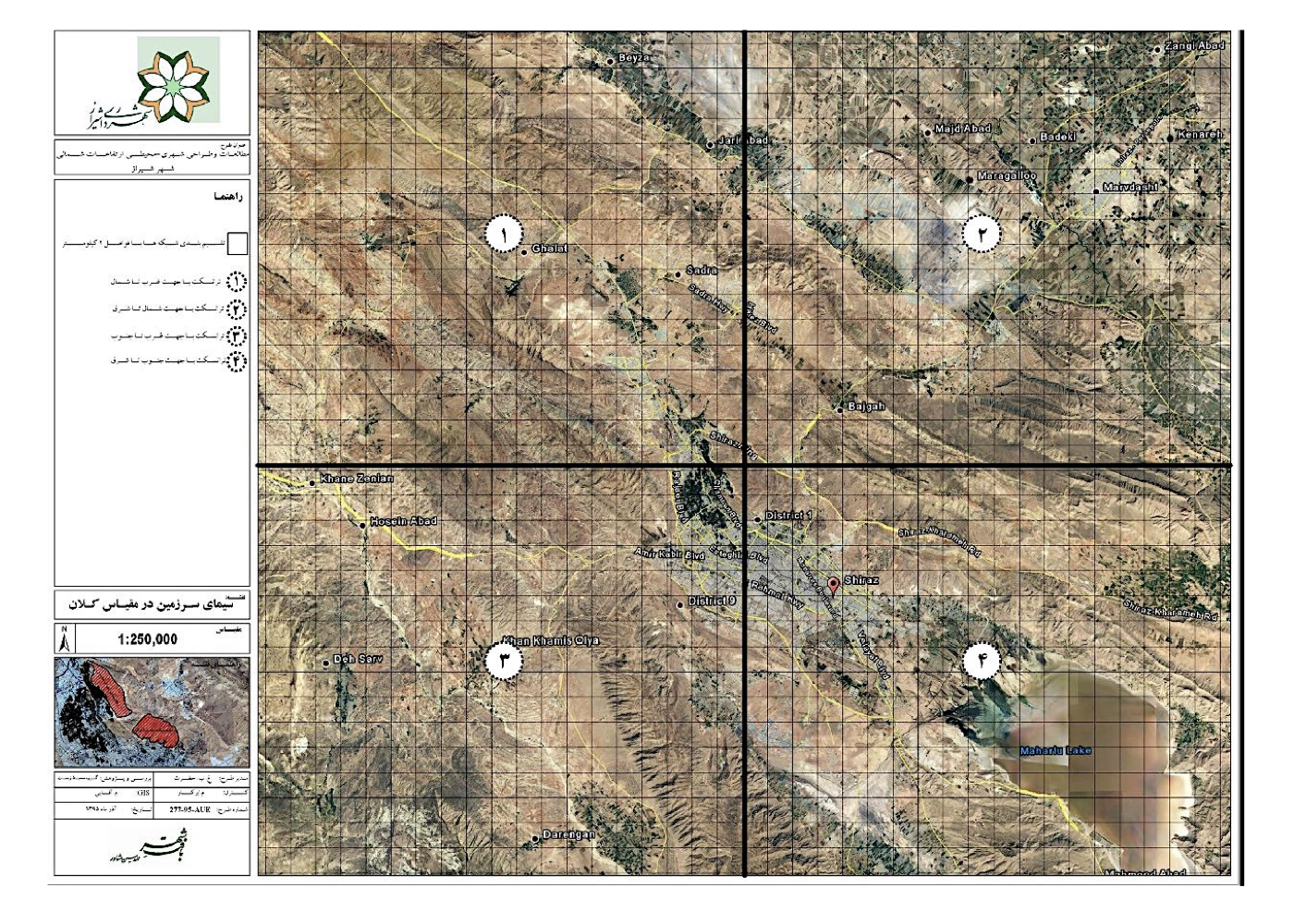
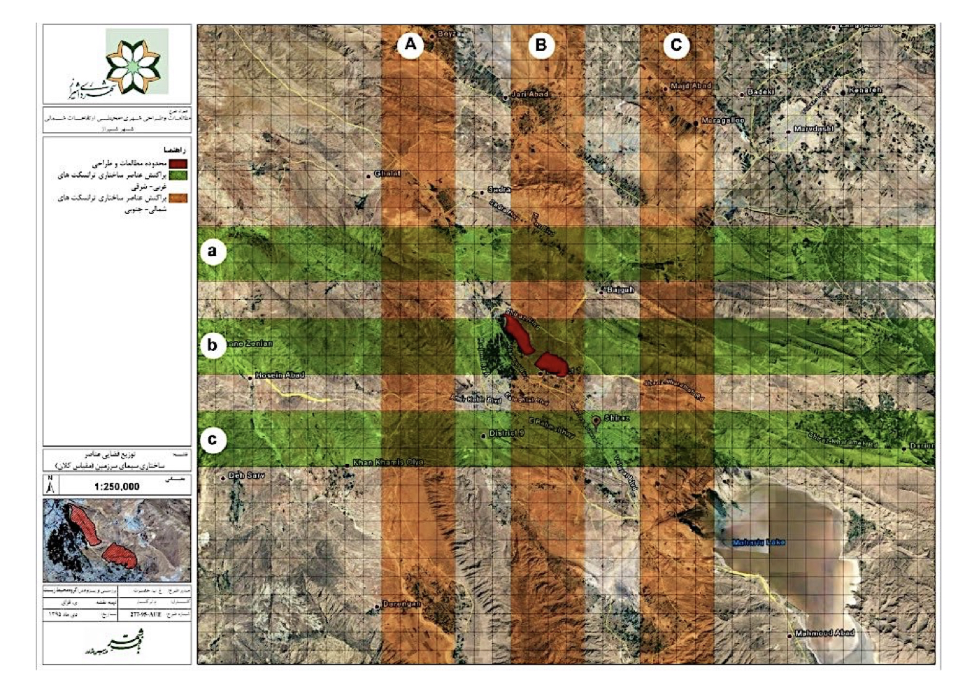
The multidisciplinary urban–environmental studies were conducted with a focus on active conservation, enhancing natural landscape quality, and aligning land use with ecological capacity. The goal was to define a sustainable tourism framework that maintains a balanced relationship between people, city, and nature.
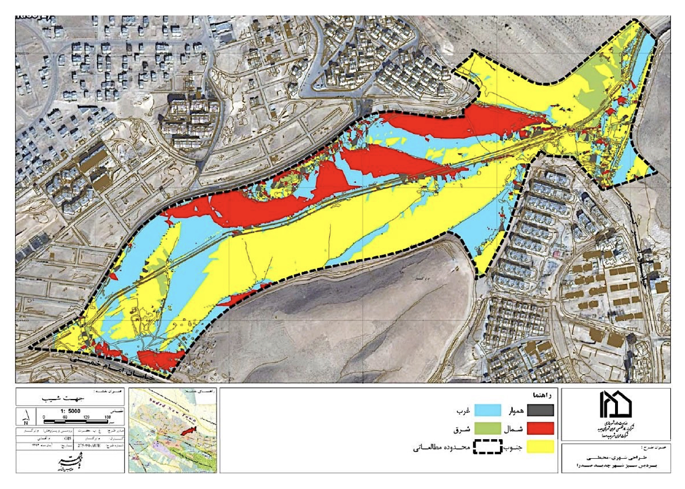
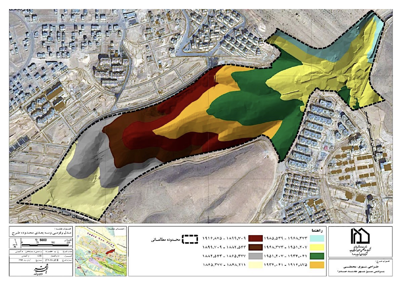
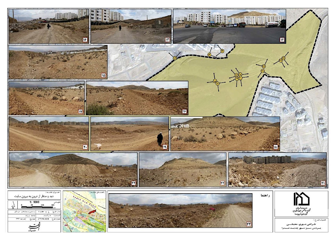
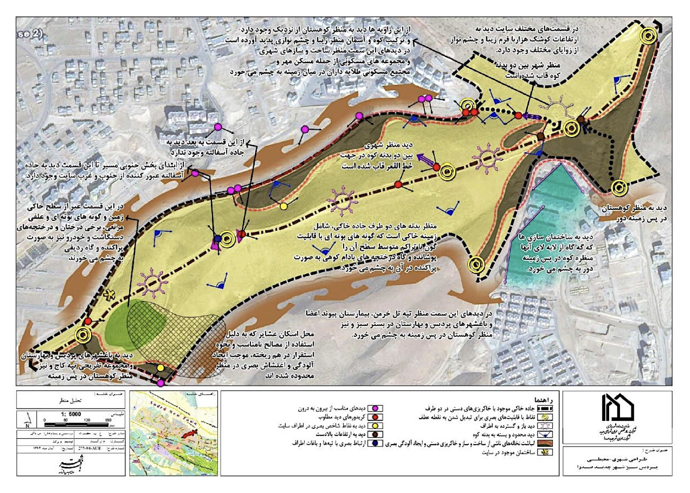
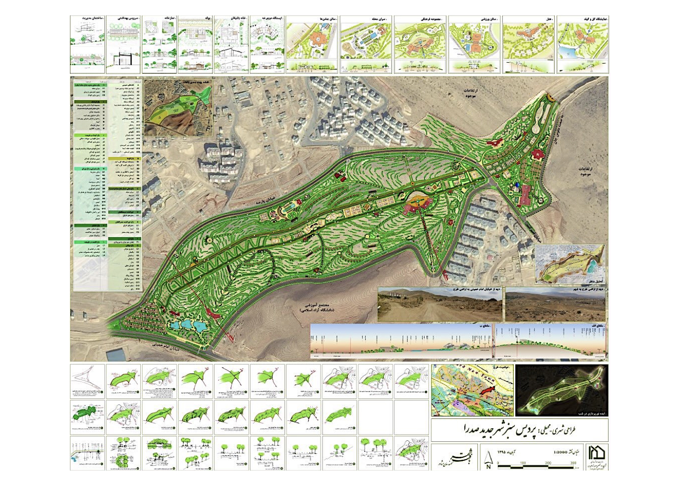
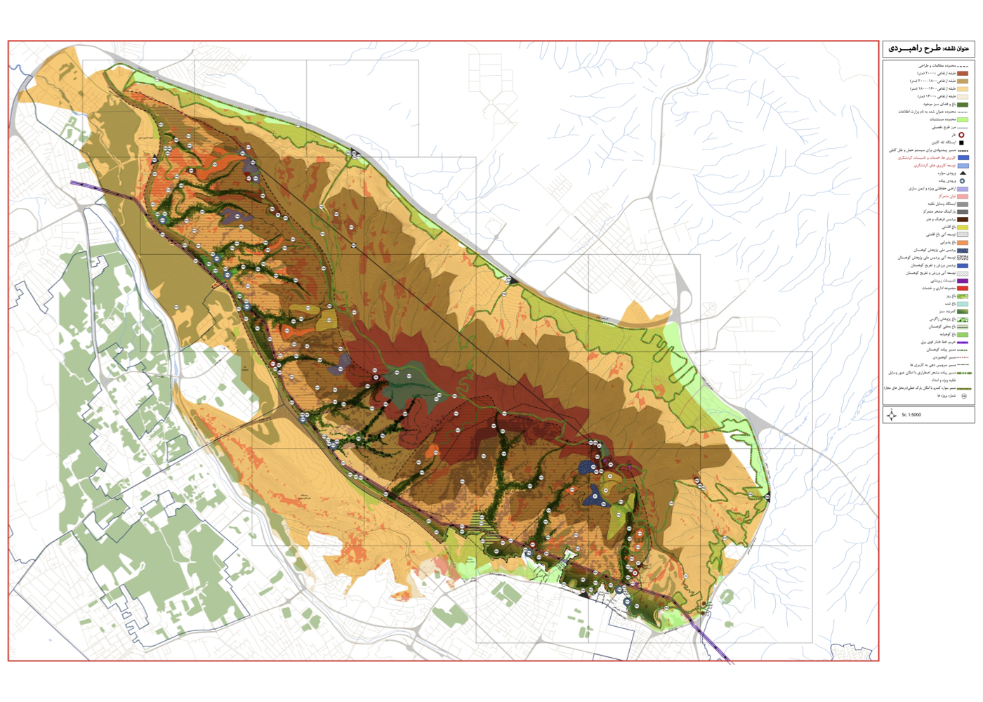
New Town of Sadra – The Green Paradise of Sadra
فشرده پیشنهادهای طرح:
Land zoning and the definition of optimal land uses for areas intersected by a national oil pipeline running through the city.
پیشینه:
A national oil pipeline traverses the New Town of Sadra. This not only disrupts urban continuity, but also imposes restrictions on construction and tree planting, while spatial organization along the pipeline corridor remains a challenge. A sloped area of approximately 60 hectares along the pipeline was designated by city management for public green space development. The consultant assessed all relevant factors, including soil quality, slope conditions and sun exposure, prevailing winds, planting restrictions along the pipeline, adjacent residential structures and their needs, bordering streets, water scarcity, etc. It was proposed that the land be developed as an urban paradise—a system of interconnected gardens.
The conceptual framework consists of thematic gardens, titled as follows:
1. Flowers. 2. Unity Neighborhood (North). 3. Morning Promenade. 4. Evening Promenade. 5. Night Garden. 6. Youth (sports complexes along the pipeline). 7. Sacrifice Neighborhood (South). 8. Culture. 9. Children and Nature. 10. Hospitality and Recreation. 11. Notables Garden. 12. Nature Residency
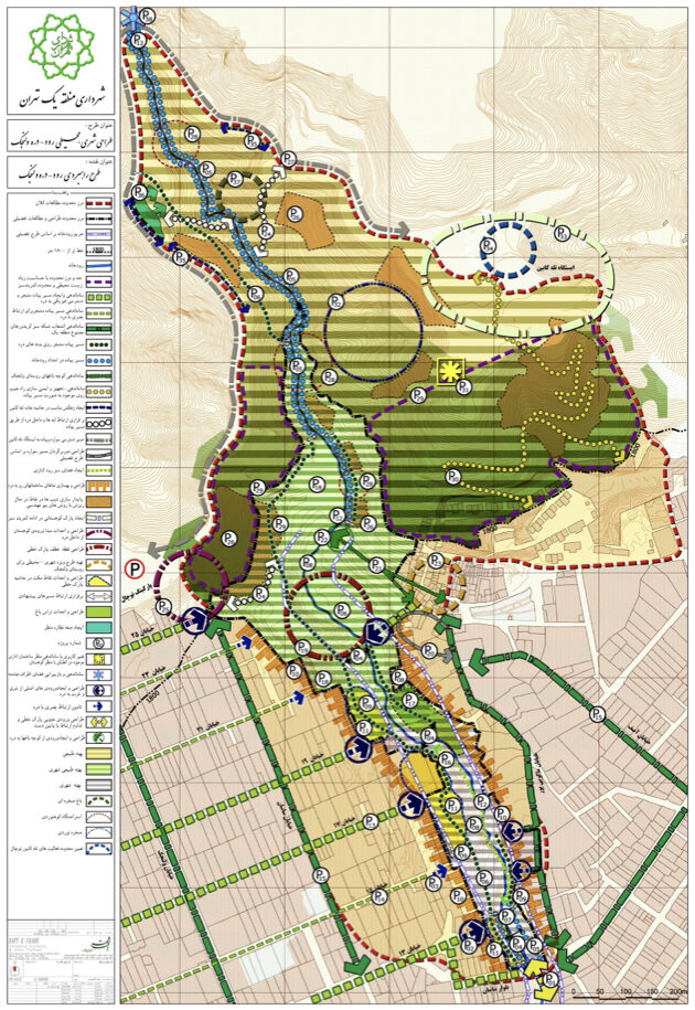
Tehran
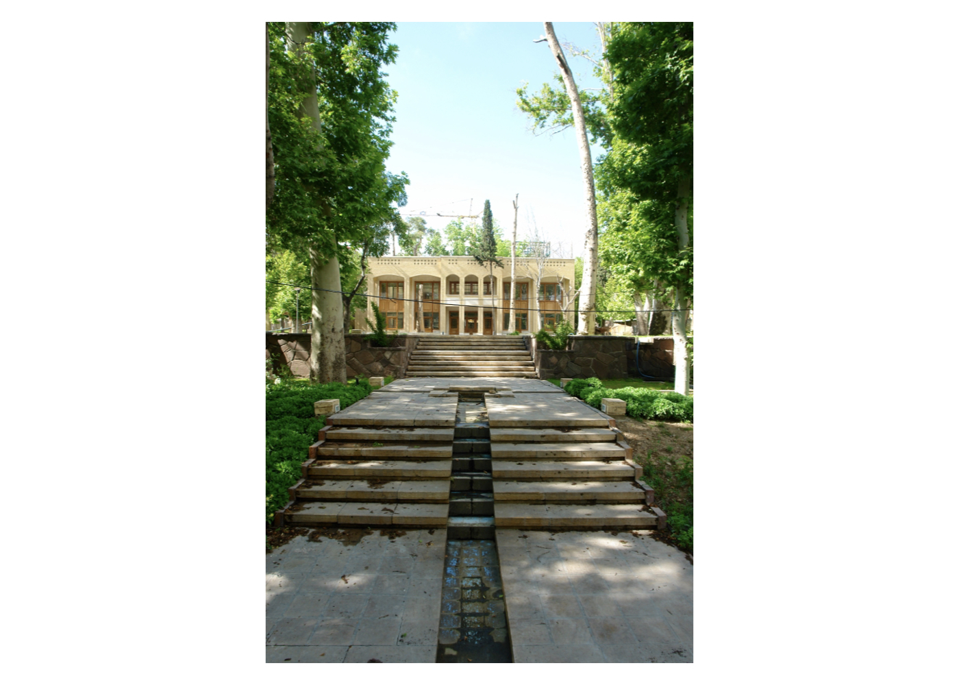
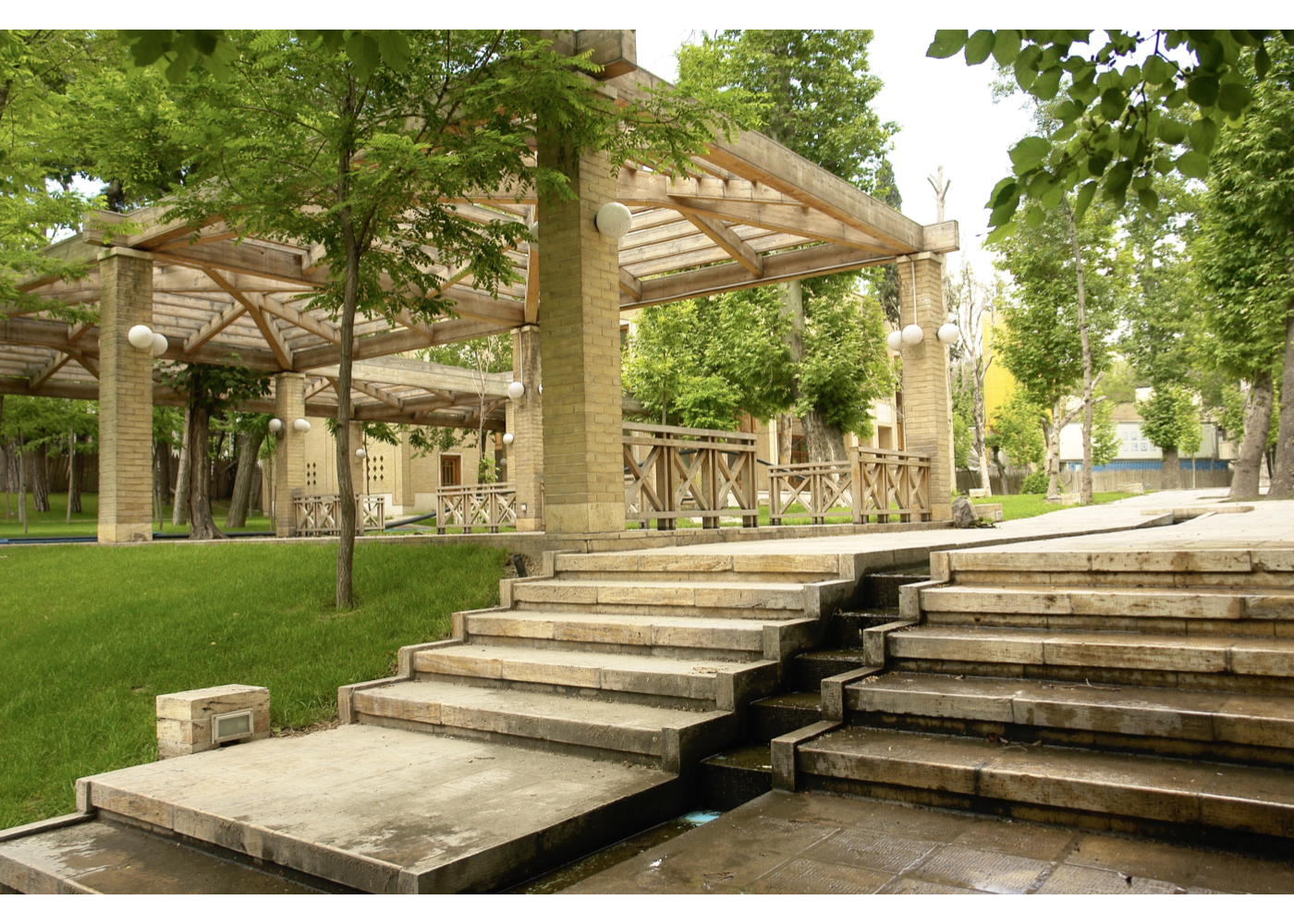
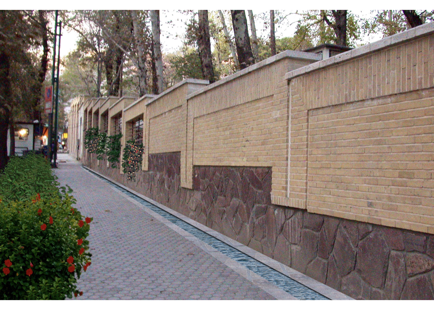
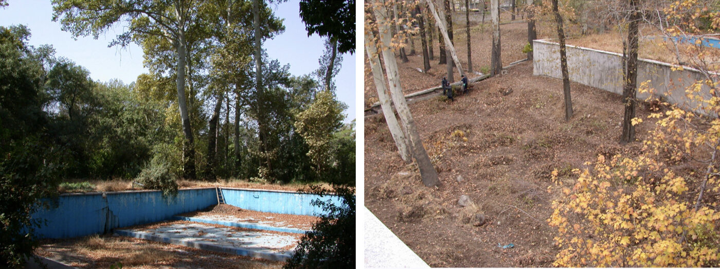
Urban – Environmental Design of the National Oil Company Garden
فشرده پیشنهادهای طرح:
Preventing the gradual destruction of a historic garden and its qanat by designing an educational–hospitality complex for the National Oil Company
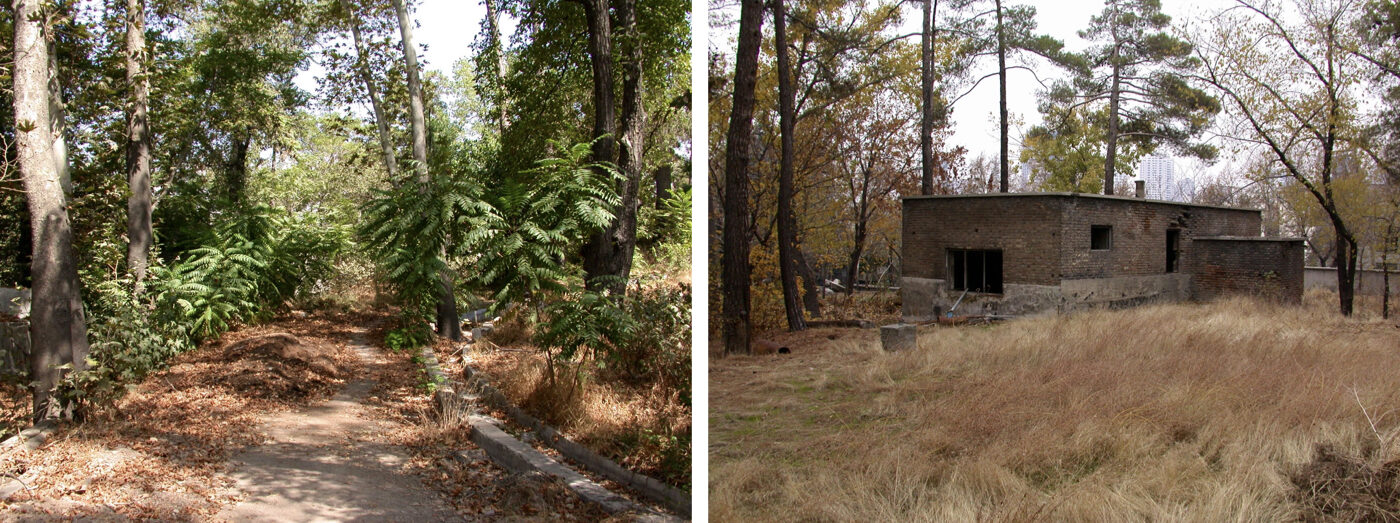
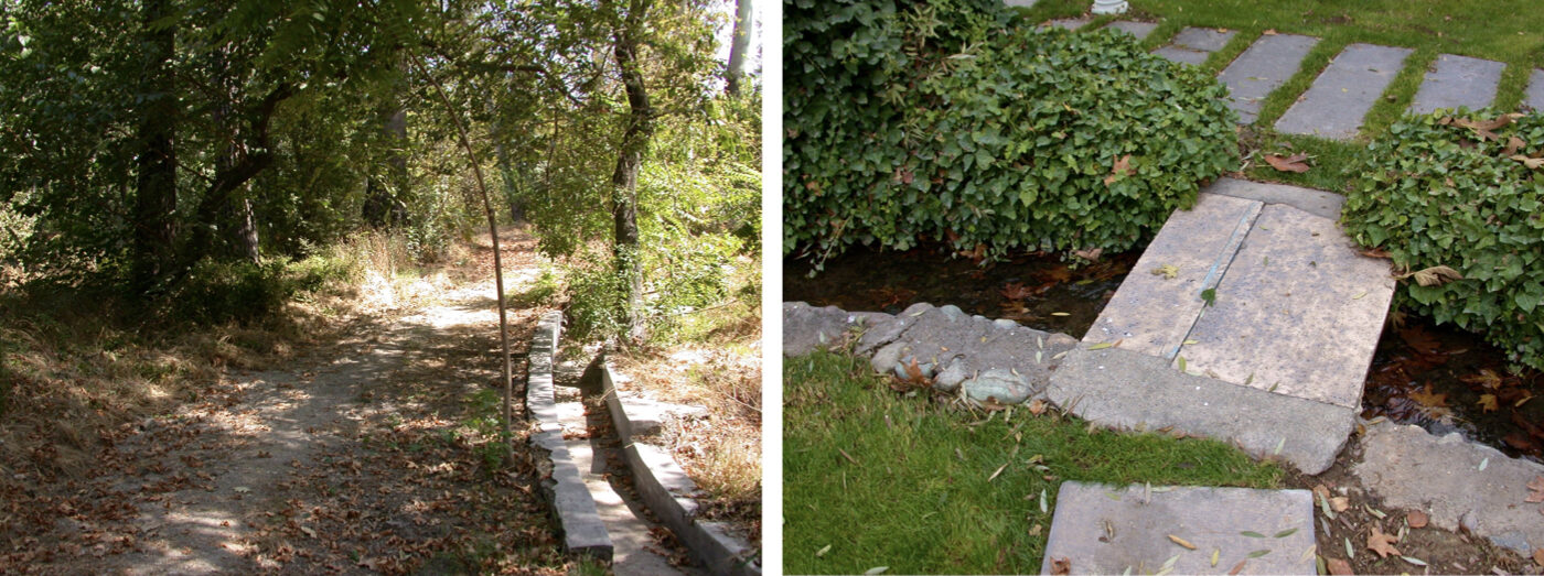
پیشینه:
This small garden, which contained a qanat (traditional underground aqueduct), mature trees, and an unstable structure, belonged to the National Iranian Oil Company.
In initial negotiations, it was agreed that the garden’s function would be redirected to activities aligned with the company’s needs. Following preliminary studies and in a meeting with the then Minister of Oil, the educational–hospitality use was selected as the most viable option to ensure the garden’s preservation.

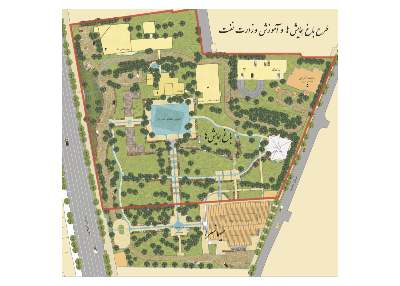
Designated Functional Objectives:
1. Hosting guests of the National Oil Company
2. Providing training for company managers
3. Holding contract signings and official meetings
The proposal included:
1. Landscape restoration of the garden
2. Revitalization of the qanat and its emergence point
3. Structural reinforcement and architectural enhancement of the existing building
4. Construction of a new hospitality facility
5. Building a training center and conference hall
6. Provision of appropriate parking facilities
Important Note:
This project exemplifies how a compatible new use can align with the ecological and spatial capacity of a historic garden, where ownership by a stable and reputable institution enables both protection and maintenance funding.
Unfortunately:
After the plan’s completion, Tehran Metro Company constructed a station along the qanat route without coordination, disrupting the qanat’s flow and compromising its function.
Plan for the Protection and Regeneration of Gardens and Farmlands (راهبردی)
فشرده پیشنهادهای طرح:
Formulating environmental policies and planning strategies for conserving and organizing gardens and farmlands, based on ecological zoning and environmental baseline studies.
پیشینه:
Since the 1960s, protecting urban gardens has been an ongoing challenge for municipalities in cities like Tehran, Mashhad, Tabriz, and Shiraz. Master and detailed plans, as well as thematic studies, have largely failed to address the issue effectively.
Root Cause of Failure:
The primary failure was due to offering solutions rooted solely in urban planning without adequately integrating environmental considerations.
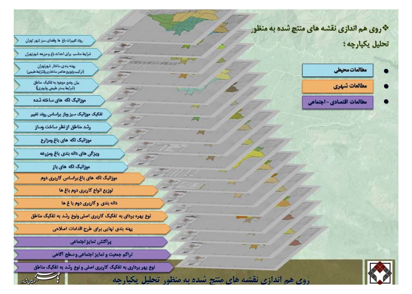
Tehran Municipality signed a contract with the Baft-E-Shahr consultant for this project and the study was structured around baseline research in:
1. Environment and landscape
2. Urban planning and legal frameworks
3. Urban economy
4. Acquired property rights and ownership
Innovative Feature of the Plan:
Due to the vast number and dispersion of gardens and farmlands, and the difficulty of site visits, this became the first urban planning project in Iran to employ satellite image analysis as a primary environmental and landscape study method. Satellite imagery was acquired and analyzed by experts, and the outcomes informed decisions across sectors including landscape, ecology, urban planning, and more.
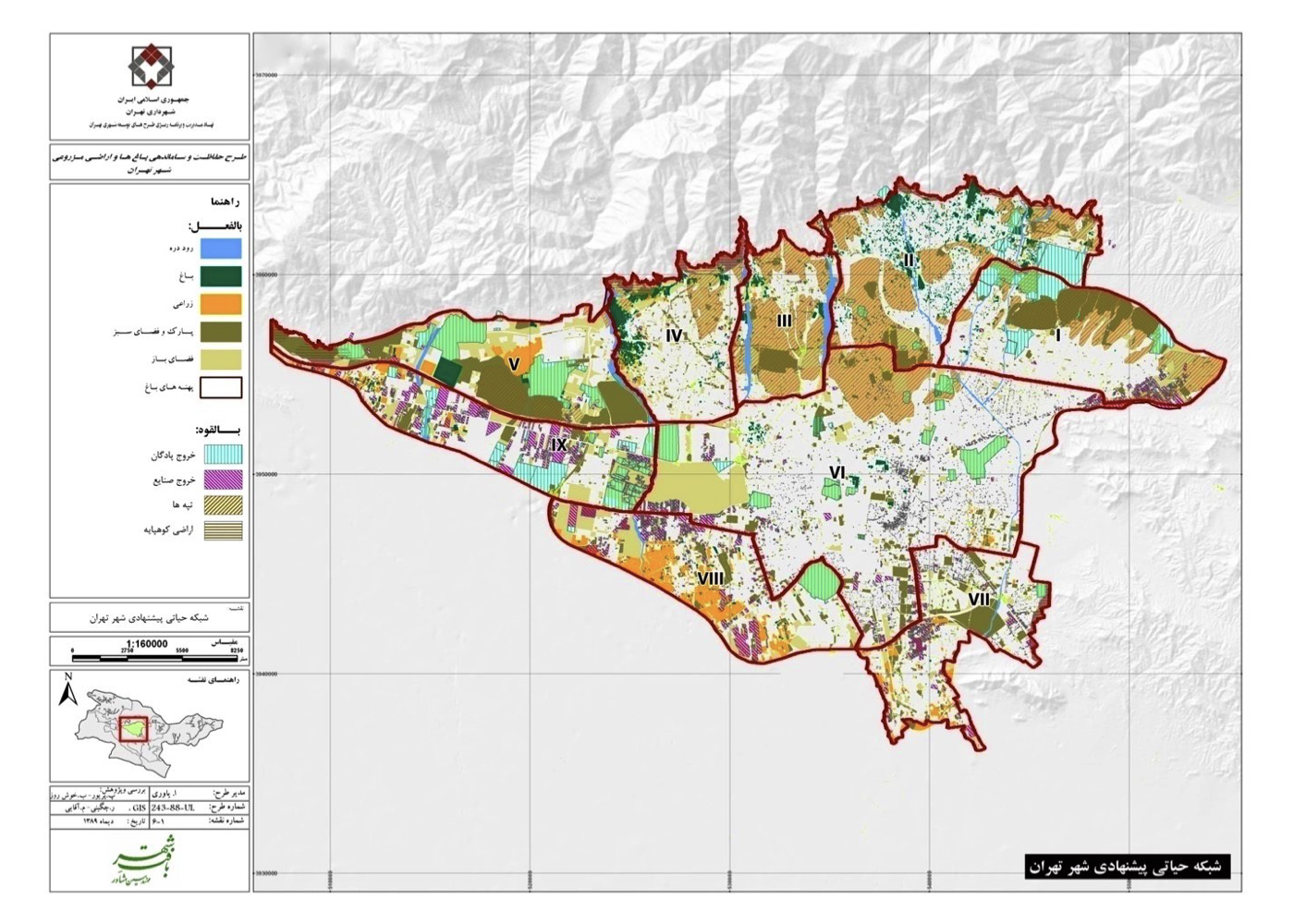
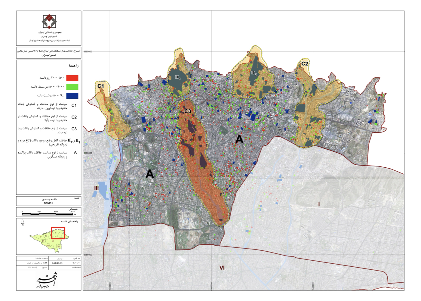
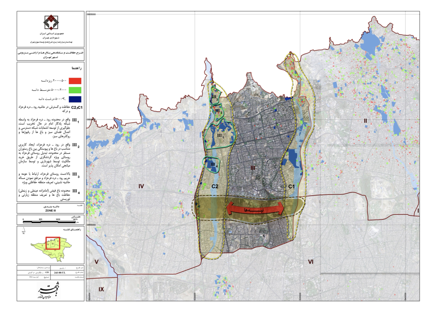
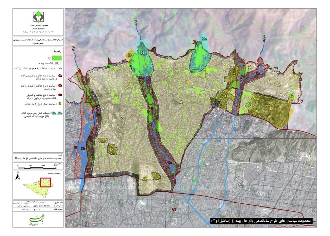
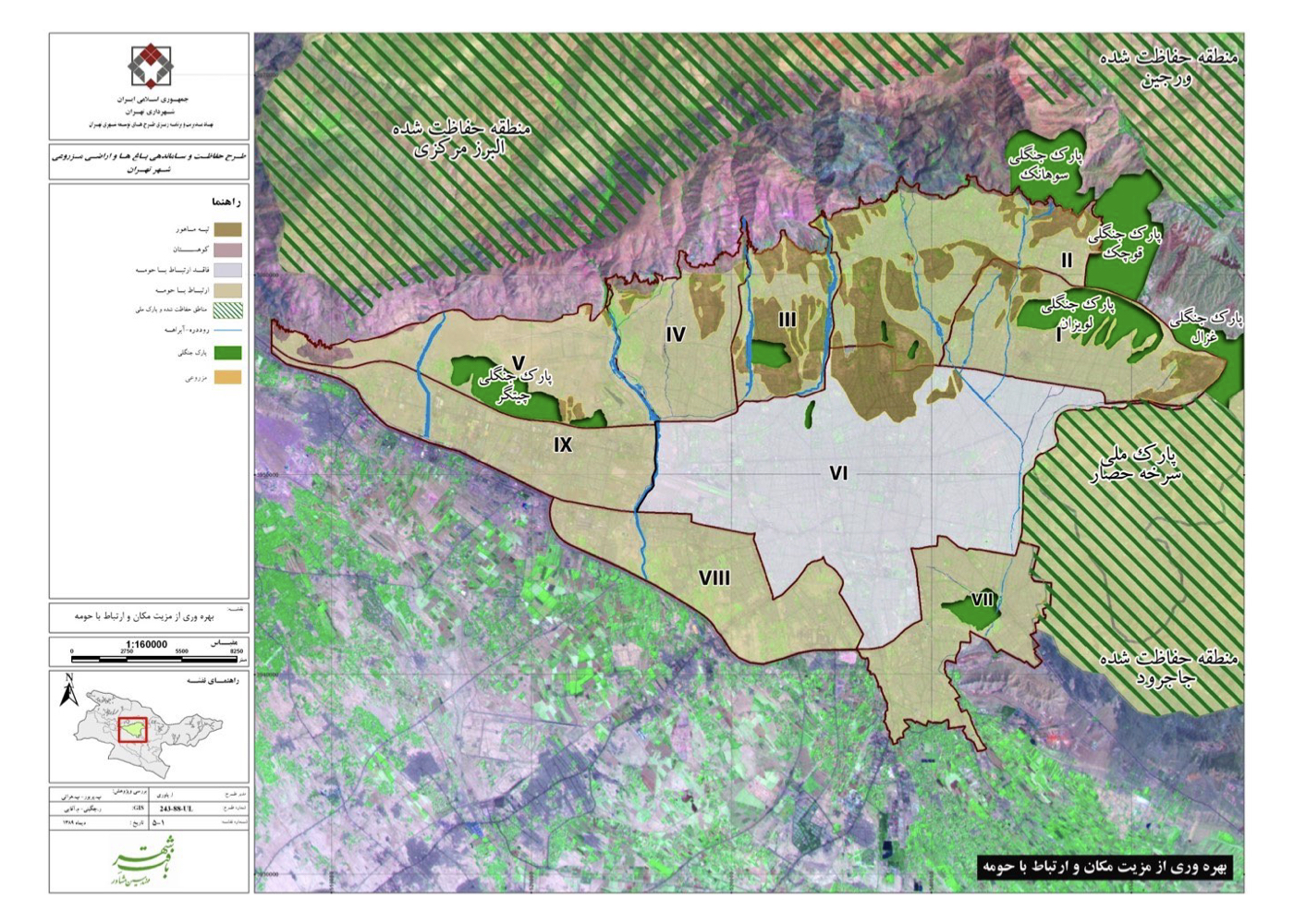
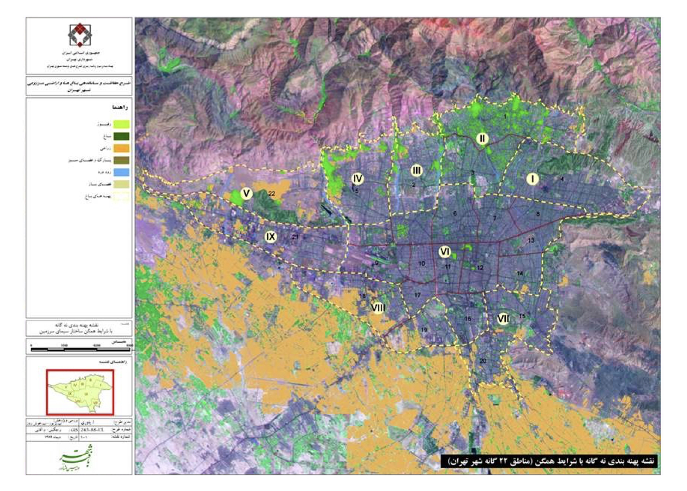
Summary of Ideas and Strategic Measures:
1. Dividing the 700 km² area of Tehran into 9 ecological zones
2. Defining sub-zones and special areas within each ecological zone
3. Providing zone-specific strategies for protection, improvement, and adaptive planning
Project Continuation Status:
The strategic phase of the plan was completed and approved, but its progression was halted due to a change in municipal leadership.
Additional Note:
One of the project’s lead experts, a faculty member at Tarbiat Modares University, later continued the project independently through a university contract — with the hope that it will yield beneficial results.
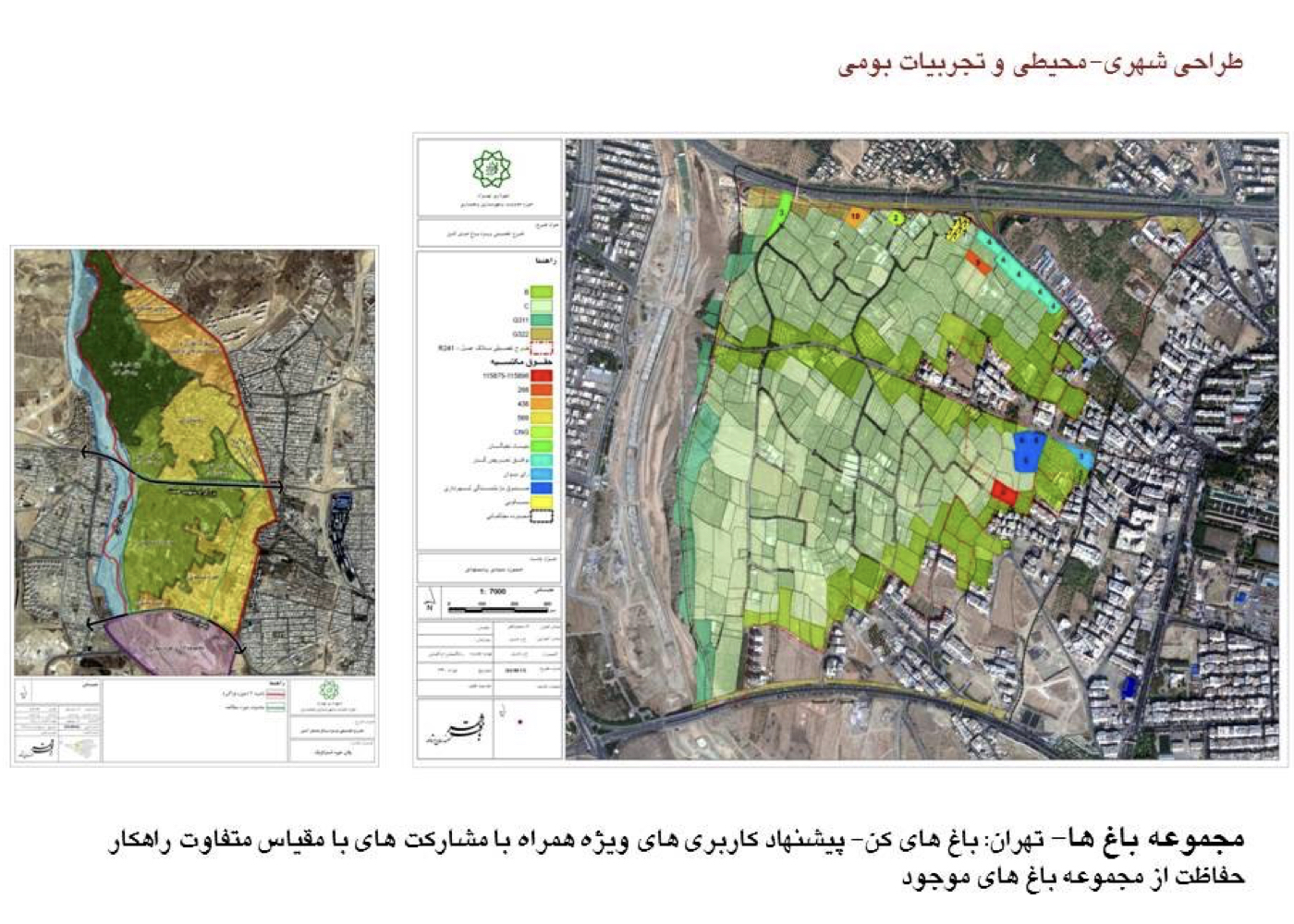
Special Plan for the Kan Gardens (Strategic)
فشرده پیشنهادهای طرح:
Strategic protection and revitalization of the Kan Gardens, guided by environmental analysis and ecological landscape planning.
The total area of the northern, central, and southern segments exceeds 600 hectares. Hemmat Expressway was routed through the middle of the gardens, resulting in severe damage, disruption of irrigation systems, and accelerating land use changes. Further pressures from new urban roads and municipal land acquisition deals have worsened the destruction.
Study Area:
The study focused on the southern section, approximately 200 hectares in size.
Study Areas Covered:
Threats, limitations, opportunities, and capacities — with a special emphasis on green space preservation
Summary of Strategies and Interventions:
1. Creating a landscape matrix to reconnect the northern and southern garden zones
2. Reorganizing the Hemmat Highway edge to minimize ecological fragmentation
3. Enhancing the interface with the Kan River to restore water dynamics and landscape continuity
4. Redirecting construction patterns in favor of riparian green space restoration
5. Establishing water collection basins to support upstream infiltration and replenish aquifers
6. Redesigning streets like Andisheh and Ta’avon to better align with ecological and urban structure
Key Priorities for Pre-Design Phase:
1. Secure and sustainable water supply
2. Access and connectivity
3. Parcel patterning and land ownership regulation
4. Ecological quality and vegetation density
5. Spatial coherence of garden areas
A priority matrix was prepared at the end of the pre-design phase to guide future implementation.
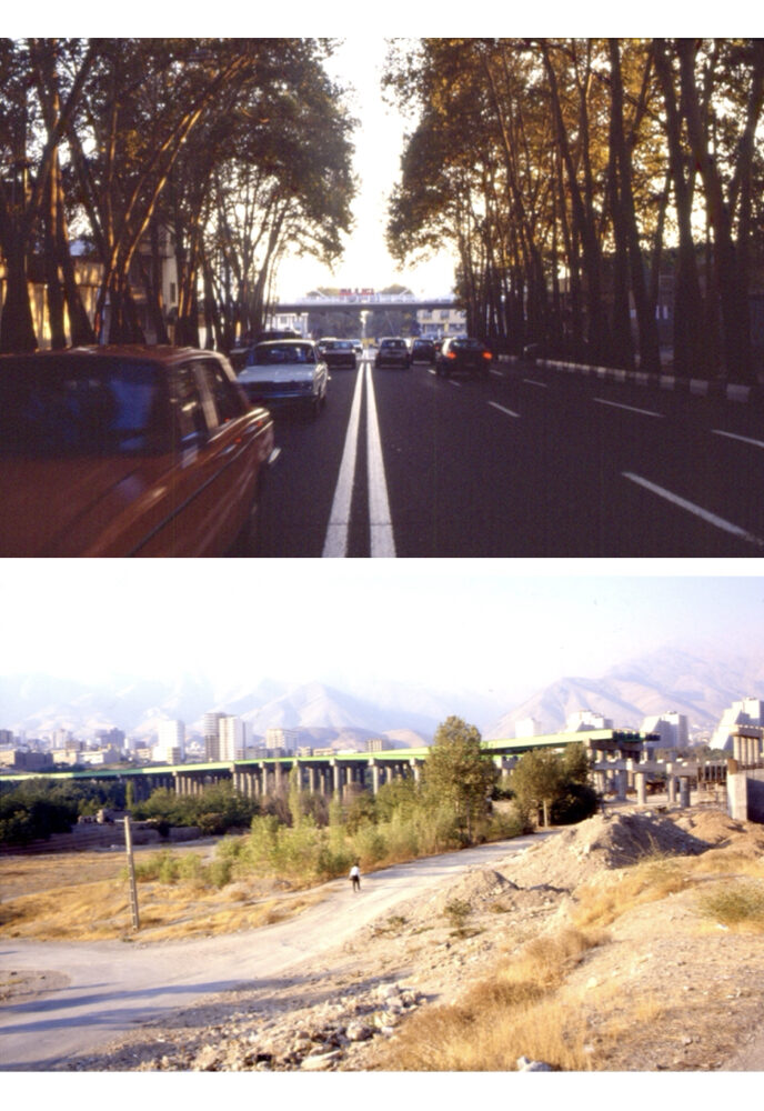
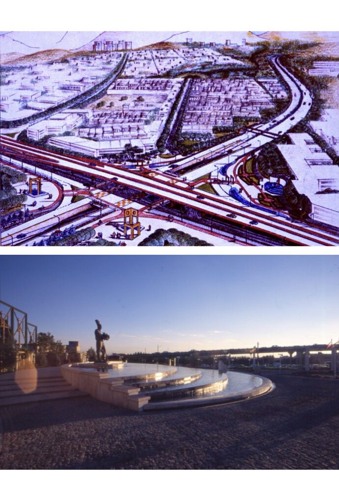
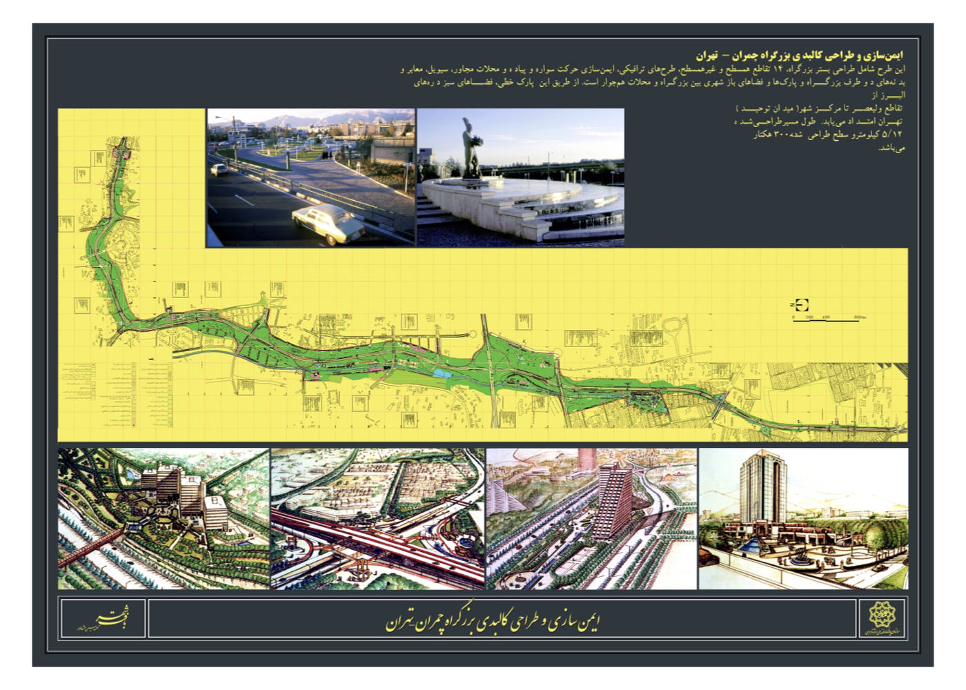
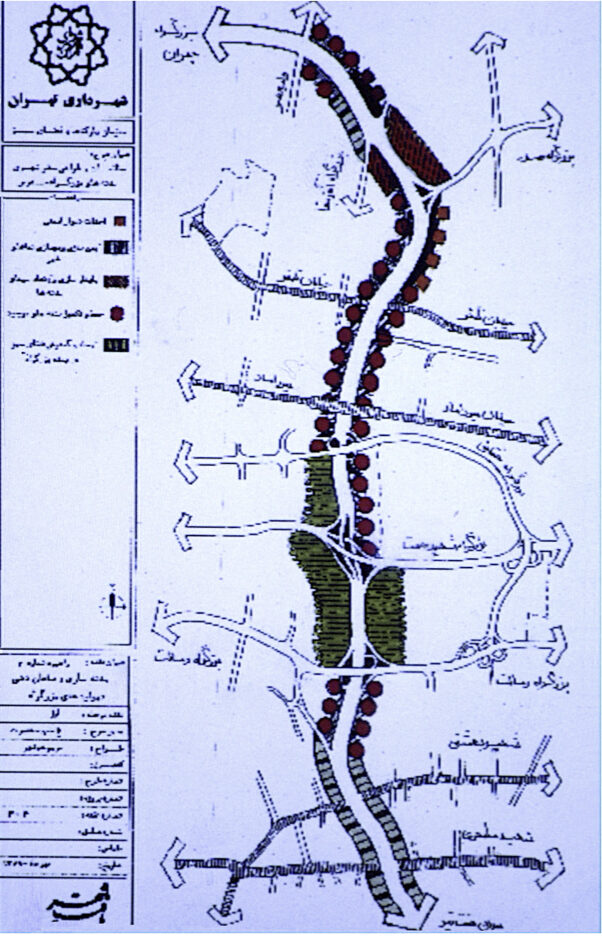
Physical and Environmental Design of the Chamran Highway Corridor (Strategic – Phases I & II)
فشرده پیشنهادهای طرح:
Reviving the greenway spirit and extending the lush landscape of northern Tehran into the urban fabric of southern districts
پیشینه:
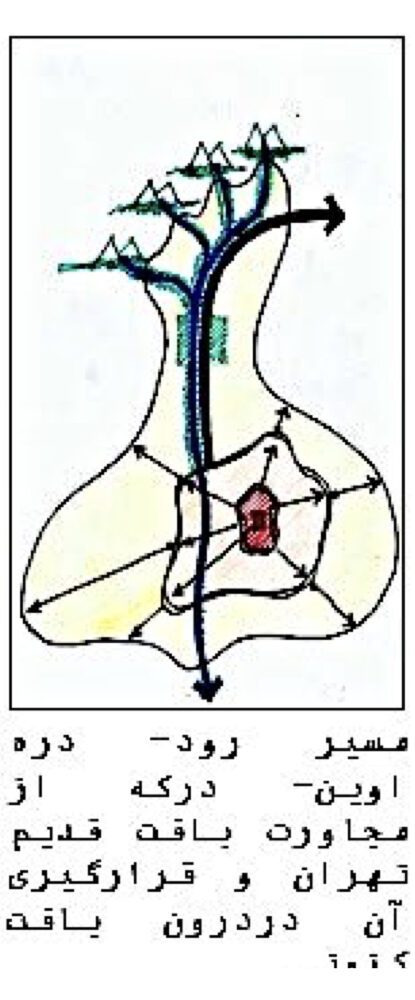
Chamran Highway was constructed in the 1960s as a major north–south axis in Tehran. It was originally called “Parkway” due to its path through Vanak Gardens and the Ovin–Darakeh orchards to the north. A regulation was established requiring a 35-meter buffer zone on both sides of the highway, yet implementation faced challenges, especially from nearby garden owners and residents. Aerial surveys were conducted via helicopter alongside detailed field assessments. Chamran Highway spans 12.5 km across several municipal districts. Due to differing perspectives among city officials, the corridor was divided into five zones, each overseen by an executive manager.
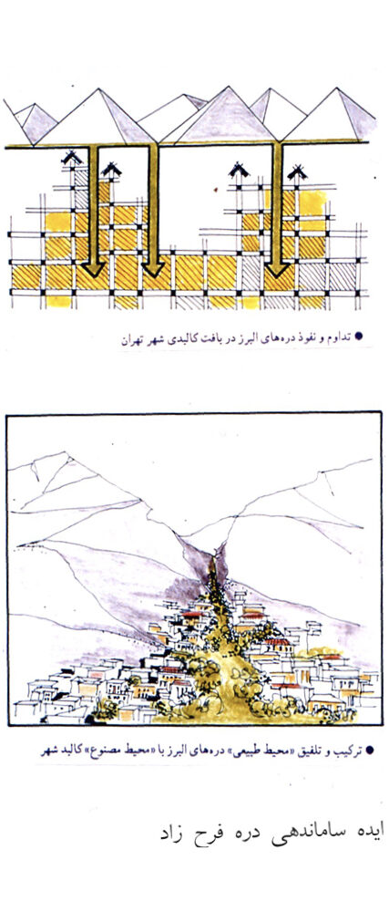
The “Green Palm of Tehran” Concept:
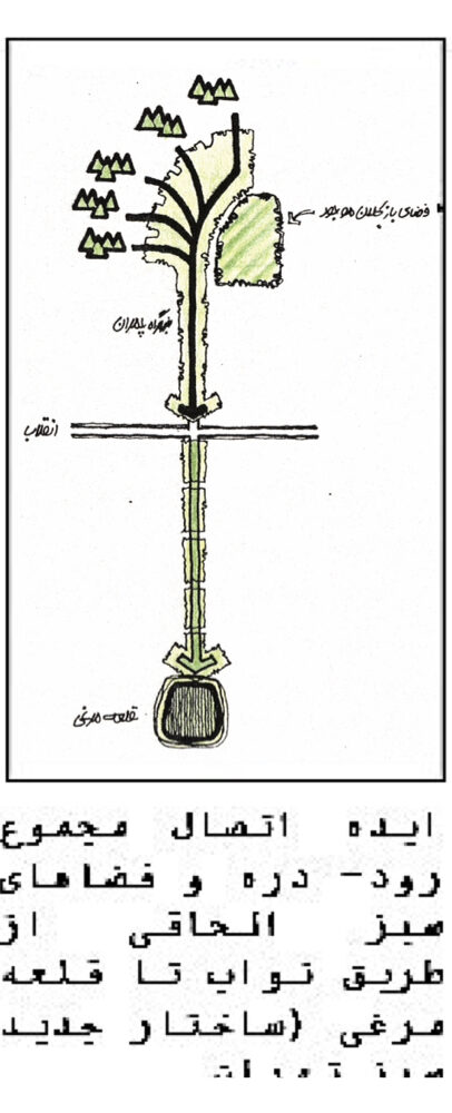
In the attached sketch, mountain ridges are depicted as fingers, and river–valleys as the spaces between — forming the metaphorical “green palm” of Tehran.
Summary of Key Ideas and Strategies:
1. The highway was once at the city’s edge but now lies at its center.
2. It runs parallel to the Ovin–Darakeh river-valley, both influencing and being influenced by this natural corridor.
3. Proximity to historic gardens and the river grants it ecological and cultural significance.
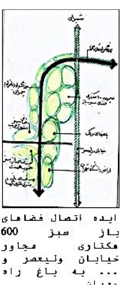
4. At its junction with Valiasr Street (formerly Pahlavi), it interfaces with institutional gardens, hospitals, and exhibition grounds totaling around 600 hectares.
5. Linking these sites can create a continuous green corridor from Vanak Gardens to Towhid Square.
6. Continuing to Ghal’e Morghi (200 hectares), the area could host an urban green campus.
7. This green axis, from the Alborz foothills to Tehran’s southern edge, would form an ecological backbone for the city.
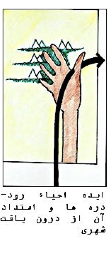
Another Core Idea of the Plan:
A paradigm shift in naming and managing Tehran’s seasonal waterways — from “canal” (masil) to “river–valley” (rud–darreh)
Benefits of This Conceptual Shift:
1. Recognizing river–valleys as critical ecological assets
2. Reviving them as green ecological corridors from the mountains into urban neighborhoods
3. Purging pollutants and physically integrating valleys into city life
River–Valleys Considered for Ecological Integration:
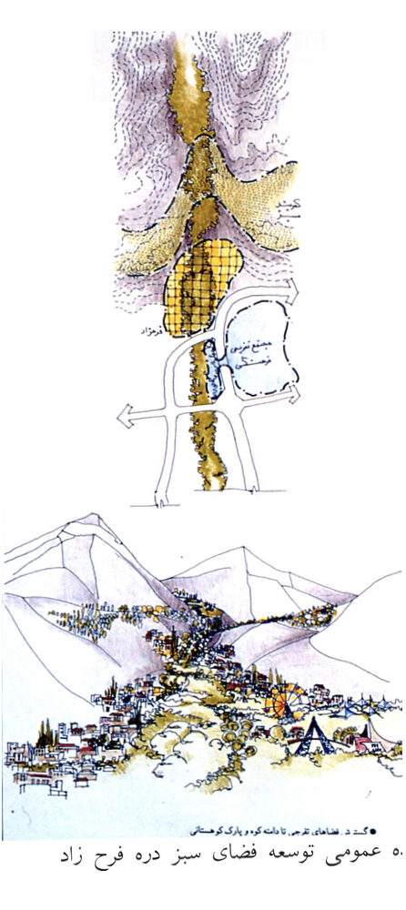
Darabad, Golabdarreh, Ovin, Darakeh, Farahzad and Kan
وضعیت اجرا:
1. Strategic and Phase I & II plans were approved.
2. Implementation deviated due to leadership change and new highway intersections and expo facilities.
3. Ghal’e Morghi was later turned into Velayat Park, but the Chamran–Navab green corridor concept was abandoned.
4. Hemmat and Hakim highways damaged the natural state of several valleys by crossing directly over them.
Urban – Environmental Design for the Kolakchal Valleys (راهبردی)
فشرده پیشنهادهای طرح:
Zoning the northern elevations of Tehran and providing protective strategies against rapid urban encroachment into the valleys.
پیشینه:
In recent decades, explosive urban growth in Tehran and its neighboring cities has aggressively expanded into foothill areas, leading to the occupation of ridges, valleys, and lowland slopes, threatening these natural assets. During the design contract for Ferdowsi Garden, it was proposed to conduct a comprehensive environmental study of four valleys linked to Kalakchal.
The four valleys studied were:
Shahabad (Darabad), Jamshidieh, Tang-e-Hesarak and Golabdarreh – Together covering an area of approximately 12 km².
Main Objectives:
1. Establish a mountain design framework
2. Provide strategies to improve safety and environmental quality in Tehran’s northern highlands
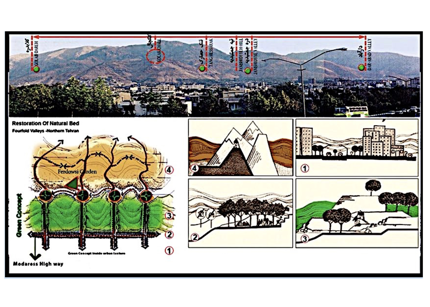
Summary of Kalakchal Valley Environmental Design Strategies:
1. Zoning the mountainous and foothill areas into four zones:
A. Urban fabric
B. Mountain greenbelt
C. Active conservation
D. Pristine nature
2. Preventing urban expansion toward the mountains via designated buffer trails
3. Establishing a protective greenbelt in Zone 2
4. Valley Protection Strategies:
A. Repeal the law permitting construction up to 1800m elevation
B. Draft new legislation to stabilize the city’s northern boundary based on ecological criteria
C. Establish public gardens at valley entrances to prevent urban encroachment (e.g., Ferdowsi Garden as a prototype)
وضعیت اجرا:
باغ فردوسي تهران was studied and opened in 1996 as the first implemented phase of this strategic environmental initiative.
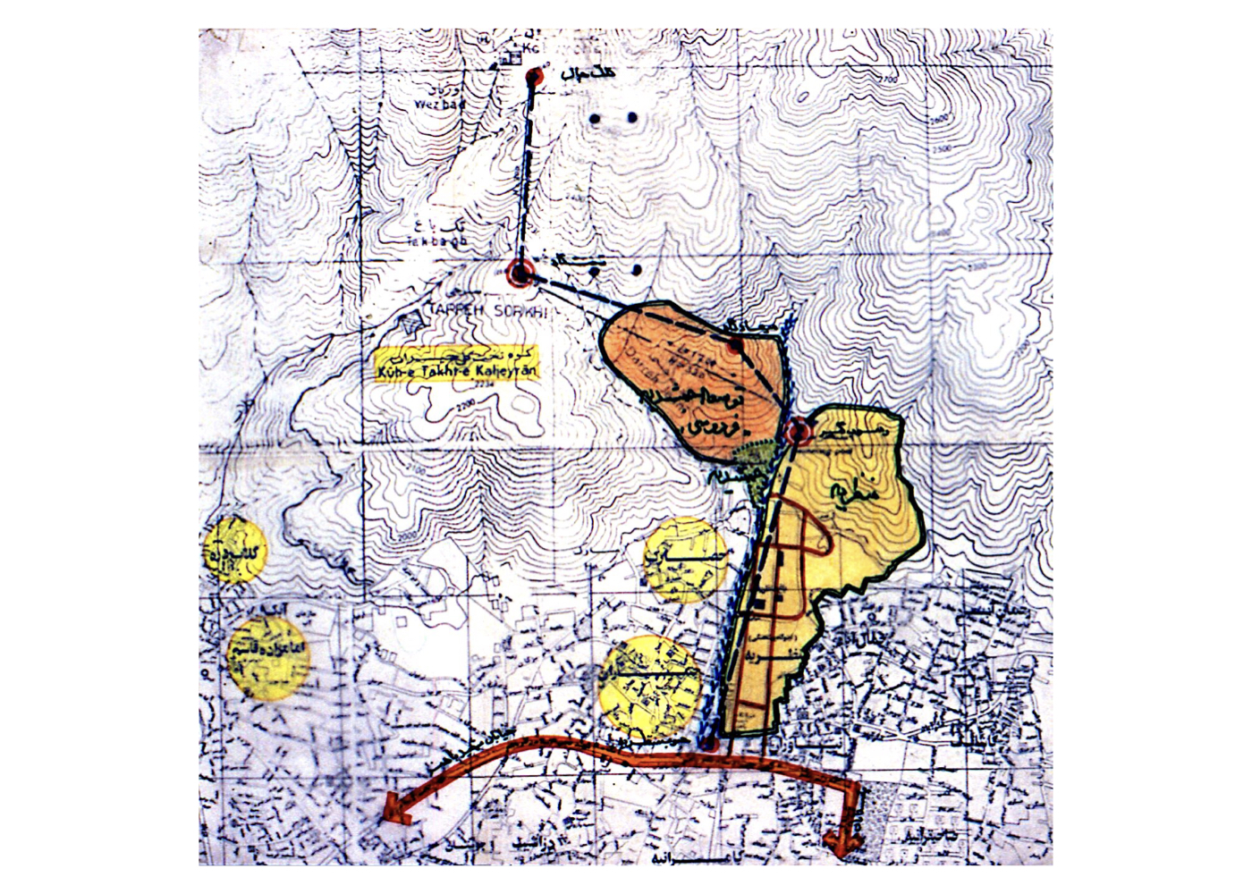
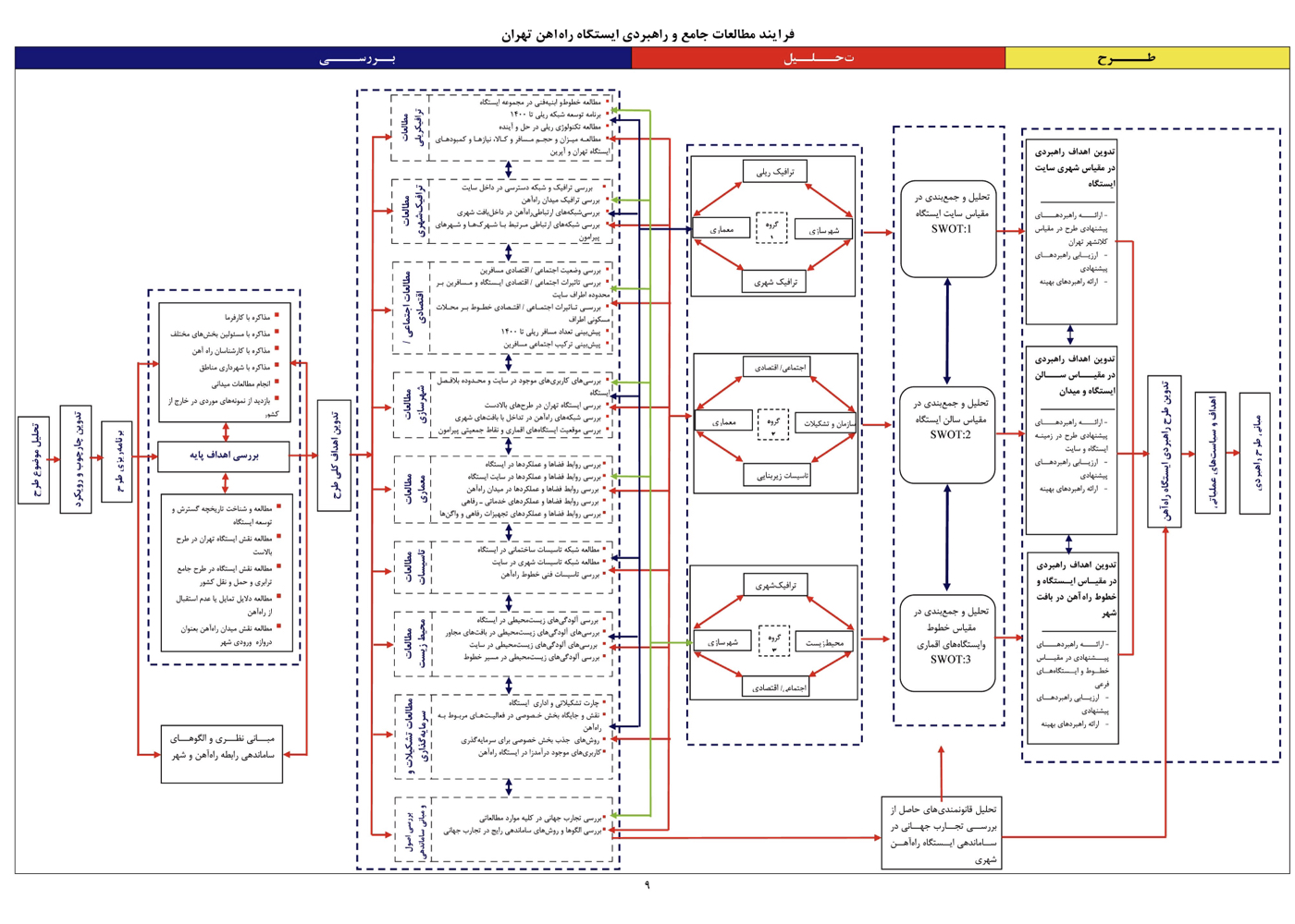
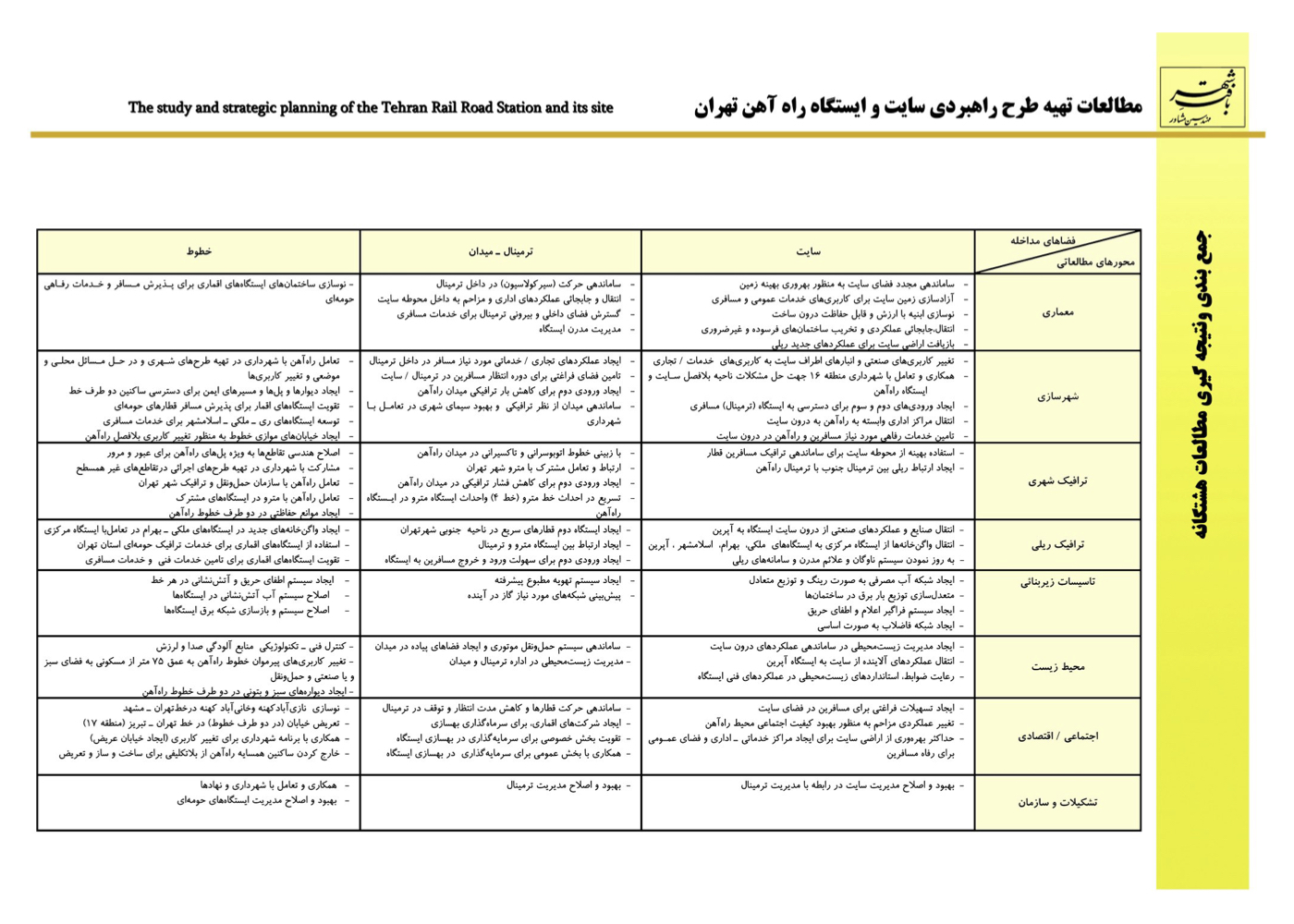
Urban – Environmental Design of the Tehran Railway Station and Its Satellite Stations (راهبردی)
فشرده پیشنهادهای طرح:
A strategic plan for Tehran’s central railway station, its surrounding lands, and future satellite stations to meet long-term mobility demands
پیشینه:
The Tehran railway station was inaugurated in 1938 and had aged over 70 years at the time of this project. While rail infrastructure in developed countries has evolved significantly, Tehran’s central station and lines had seen minimal modernization. The Iranian Railway Company selected the Urban Fabric Consultant to lead this modernization initiative.
Regeneration of the Soleymaniyeh Lands – Southern Tehran (Strategic)
فشرده پیشنهادهای طرح:
Regenerating abandoned brick pit lands into a cultural, athletic, and artistic hub for southern Tehran
پیشینه:
Southwest of Khorasan Square in Tehran lies over 500 hectares of land known as the Soleymaniyeh Lands, which were handed over to the municipality.
These lands faced numerous issues:
1. Numerous excavation pits caused by historical brickmaking operations
2. Water accumulation from rising surface water levels
3. Proximity to current highways and potential future highway corridors
4. Proximity to the polluted water canal of Sorkheh Hesar
5. Presence of high-voltage power pylons and cables
6. Ownership claims by a governmental institution

Summary of Project Strategies and Concepts:
1. Defining and securing the future highway alignment using the location of power lines and pylons
2. Subdividing the land after respecting all environmental and infrastructural buffer zones (highways, electricity, qanats, surrounding plans)
Proposed Land Uses and Spatial Interventions:
1. Four small green spaces functioning as local and neighborhood parks near highway edges
2. One large park (urban paradise/campus) covering 250 hectares
3. Customizing each park’s function based on neighboring communities’ needs and access patterns
4. Activity zoning of the “Azadegan Urban Campus” to serve both city-scale and southern Tehran districts
Vision:
With this project, one of southern Tehran’s largest abandoned post-industrial sites would be reborn as a vibrant cultural, natural, and civic destination, supporting both environmental regeneration and social sustainability.
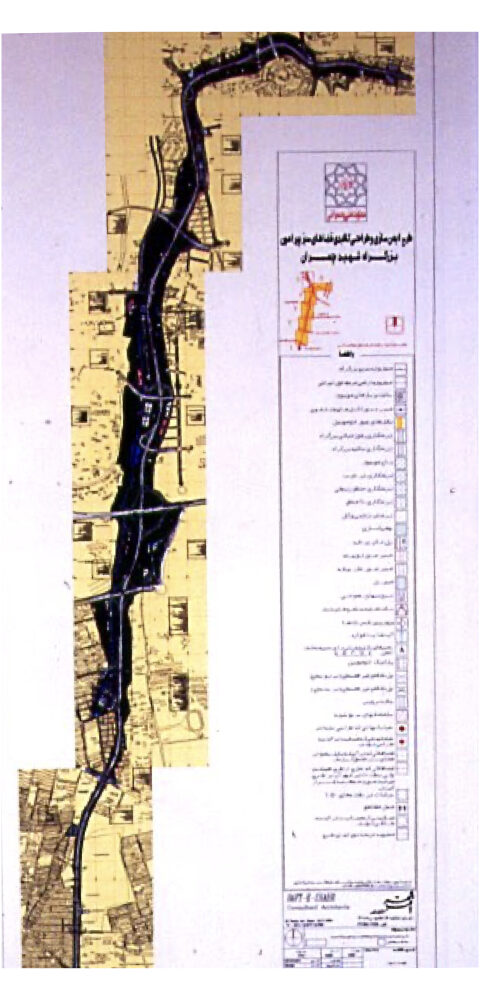
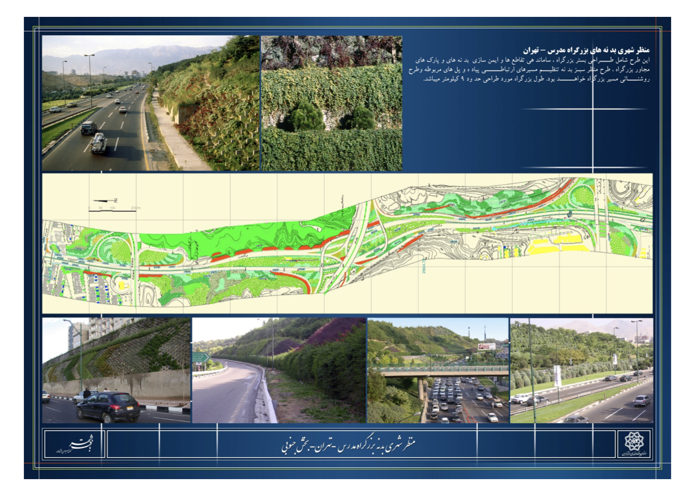
Urban – Environmental Design of Modarres Highway (Strategic – Phase I – Implementation)
فشرده پیشنهادهای طرح:
Reviving the spirit of a greenway and extending the northern Tehran landscape into the central urban fabric
پیشینه:
Modarres Highway is one of Tehran’s major north-to-central transportation corridors. It is flanked by a mix of residential, administrative, religious, and service-based land uses, and because it traverses steep terrain, its edges have significant elevation differences from the roadbed.
Before this project, the standard method for treating urban highway slopes was to install stone or concrete retaining walls, resulting in cold, monotonous, and lifeless scenery along both sides of the highway. Modarres became the first urban highway in Iran designed under the “green corridor” concept.
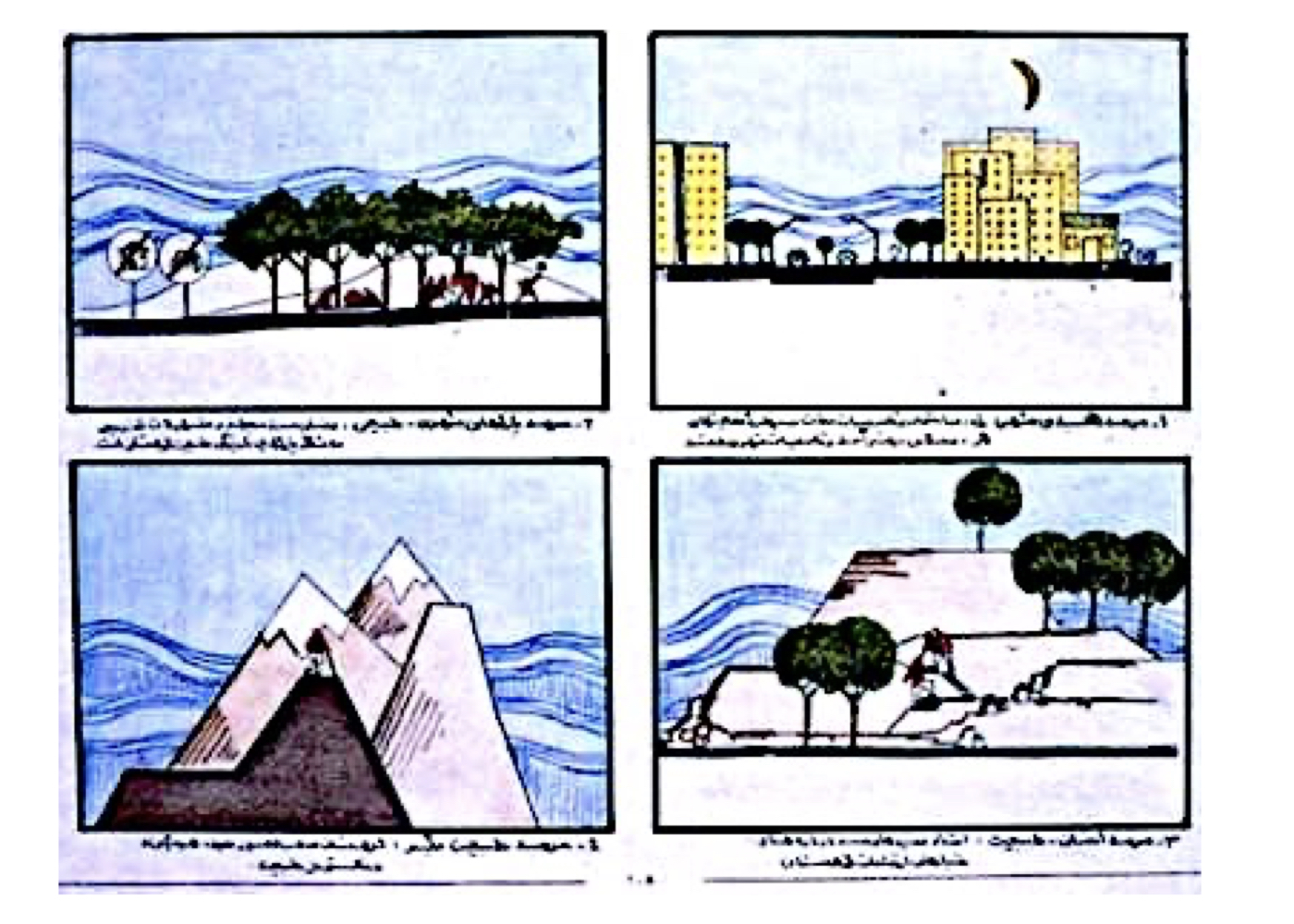
Summary of Design Ideas and Executed Measures:
1. The highway should not function merely as a vehicular passage but as an integral, livable urban element.
2. Its slopes offer opportunities for expanding urban greenery and tree cover.
3. Due to water scarcity, drought-tolerant plants and drip irrigation were recommended.
4. The corridor should maintain scenic and spatial variety.
5. Tree placement must avoid obstructing drivers’ visibility.
6. Plant species should be low-maintenance due to slope safety risks for gardeners.
7. Avoid tall concrete or stone walls; instead, follow the natural contours of the land.
8. Integrate leftover triangular or fragmented plots into the highway’s green slopes where feasible.
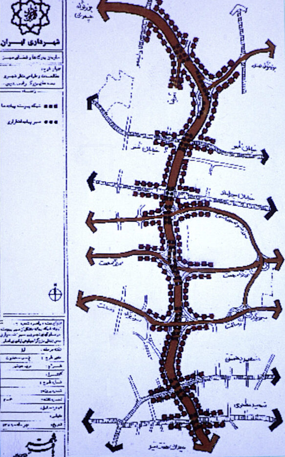
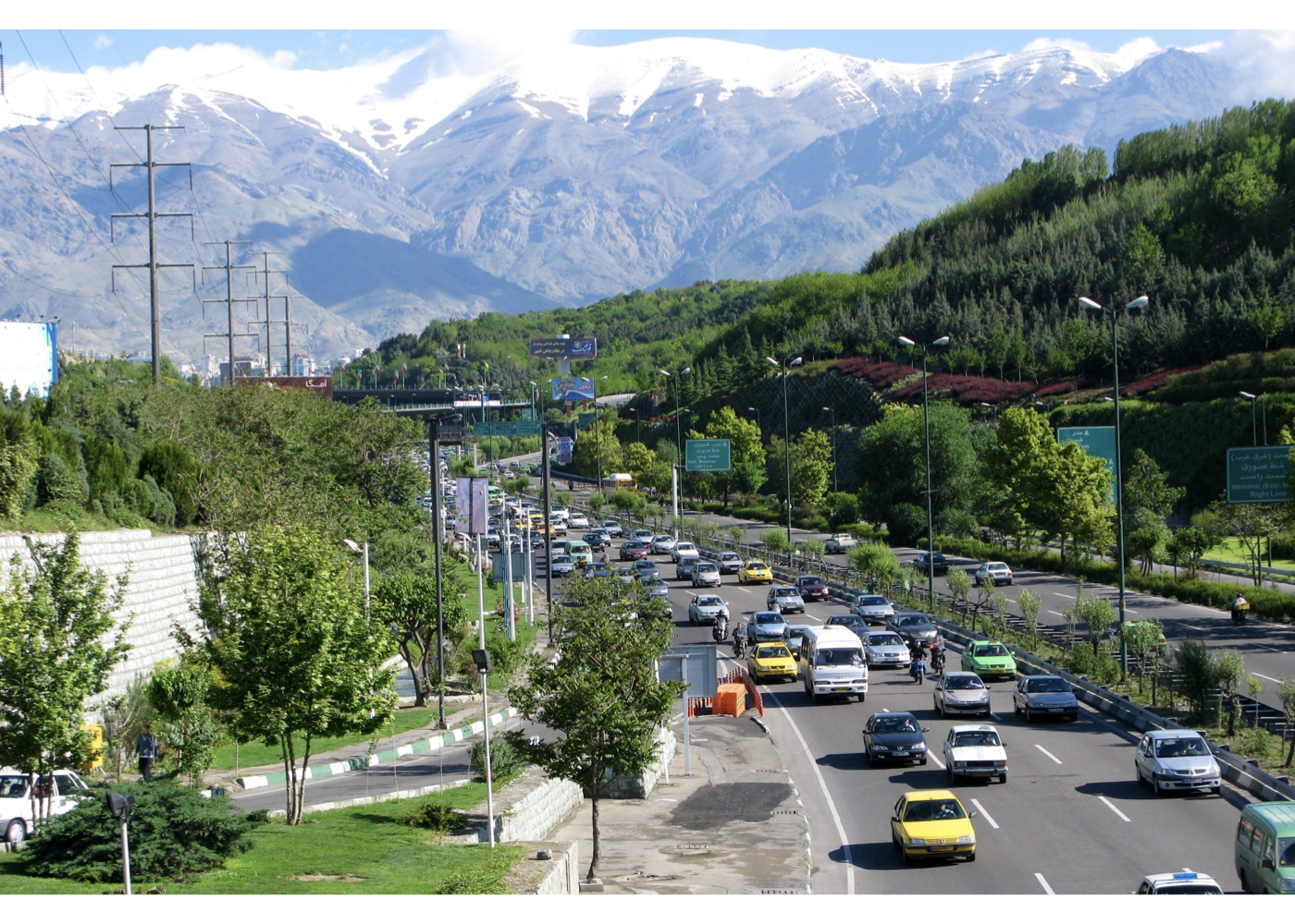
Initial Implementation Outcomes:
Although the project was not fully implemented, the executed portions significantly cooled the highway corridor compared to adjacent neighborhoods in summer and created a more pleasant visual and environmental experience.
Other Implementation Notes:
9. Billboard installations followed safety and aesthetic guidelines suited to traffic speed.
10. Median trees were selected to be leafless in fall/winter, reducing snow and ice hazards.
Important Note:
Despite the proposal’s thoughtful ideas, the Parks Department used grass instead of drought-resistant plants and installed sprinkler systems instead of drip irrigation, leading to freezing and associated hazards during winter months. In some zones, instead of trees, superficial flower beds were planted.
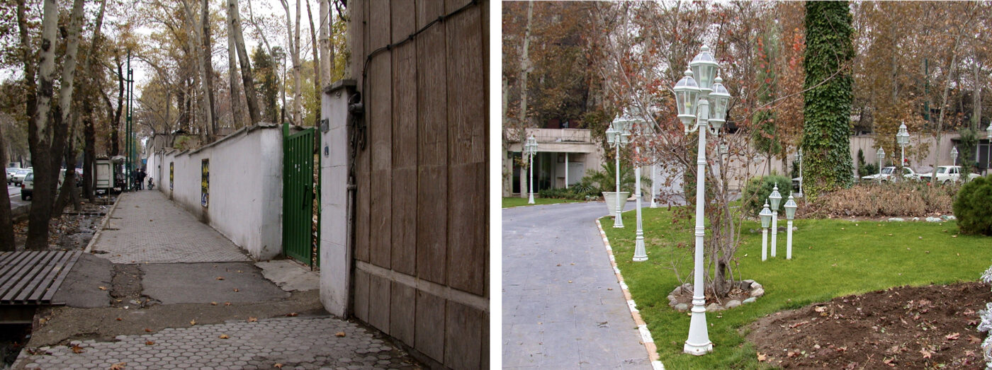
Urban – Environmental Design of Streets in District 12 (Central Tehran)
(Strategic – Phase I – Implementation)
فشرده پیشنهادهای طرح:
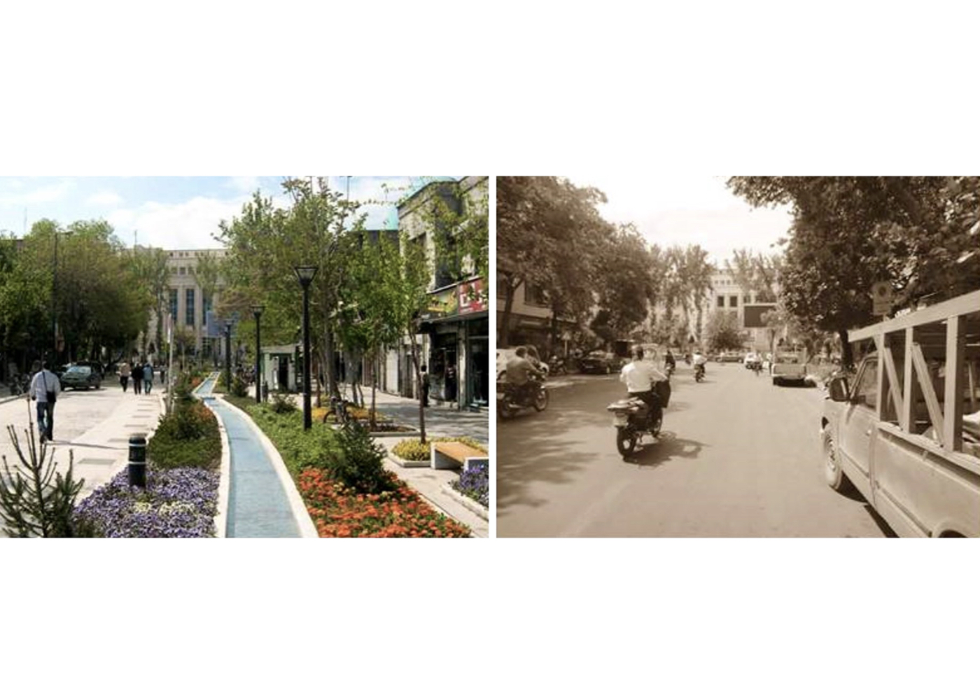
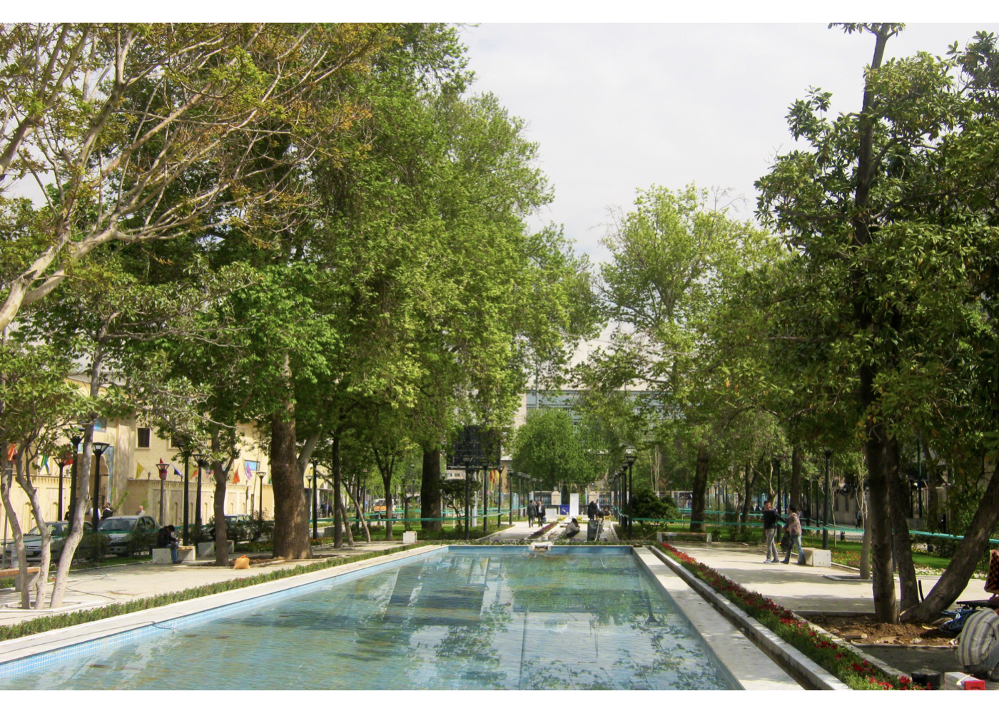
Reviving the Iranian concept of garden–bazaar and enhancing the environmental–urban quality of central Tehran’s streets
پیشینه:
Unlike many world capitals, the old streets of central Tehran had long been neglected. Heavy traffic, thousands of motorbikes, overcrowding, and growing insecurity had discouraged people from visiting, shopping, or strolling in the area.
The district municipality initially aimed to renovate street paving, but the plan encountered major challenges, sparking complaints from residents, institutions, and local businesses. The consultant was asked to quickly deliver a corrective and improvement plan.
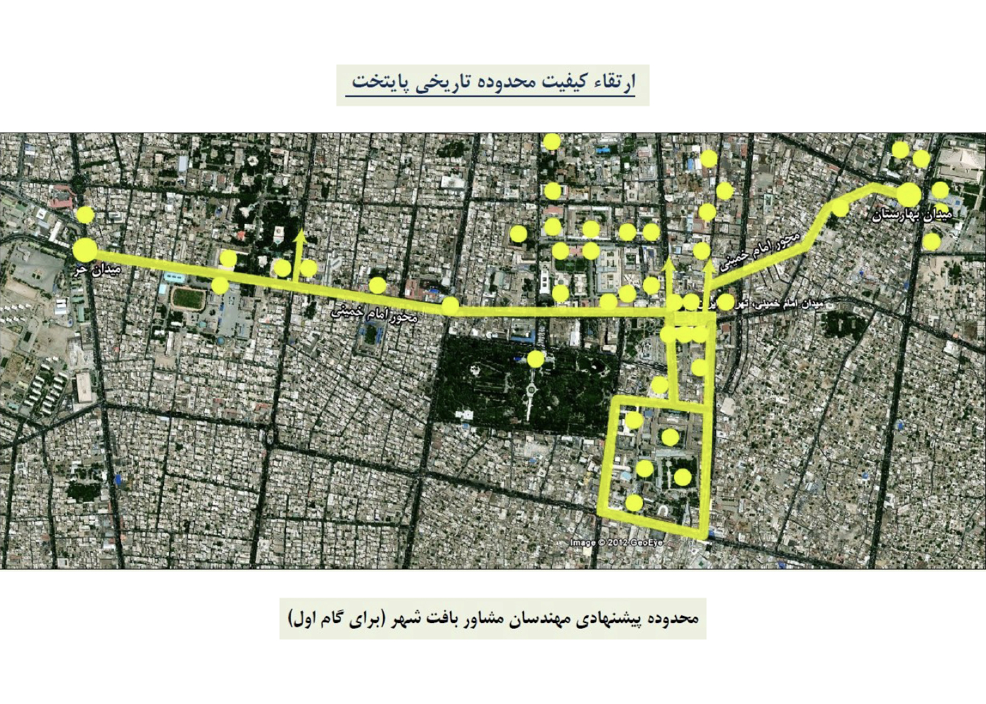
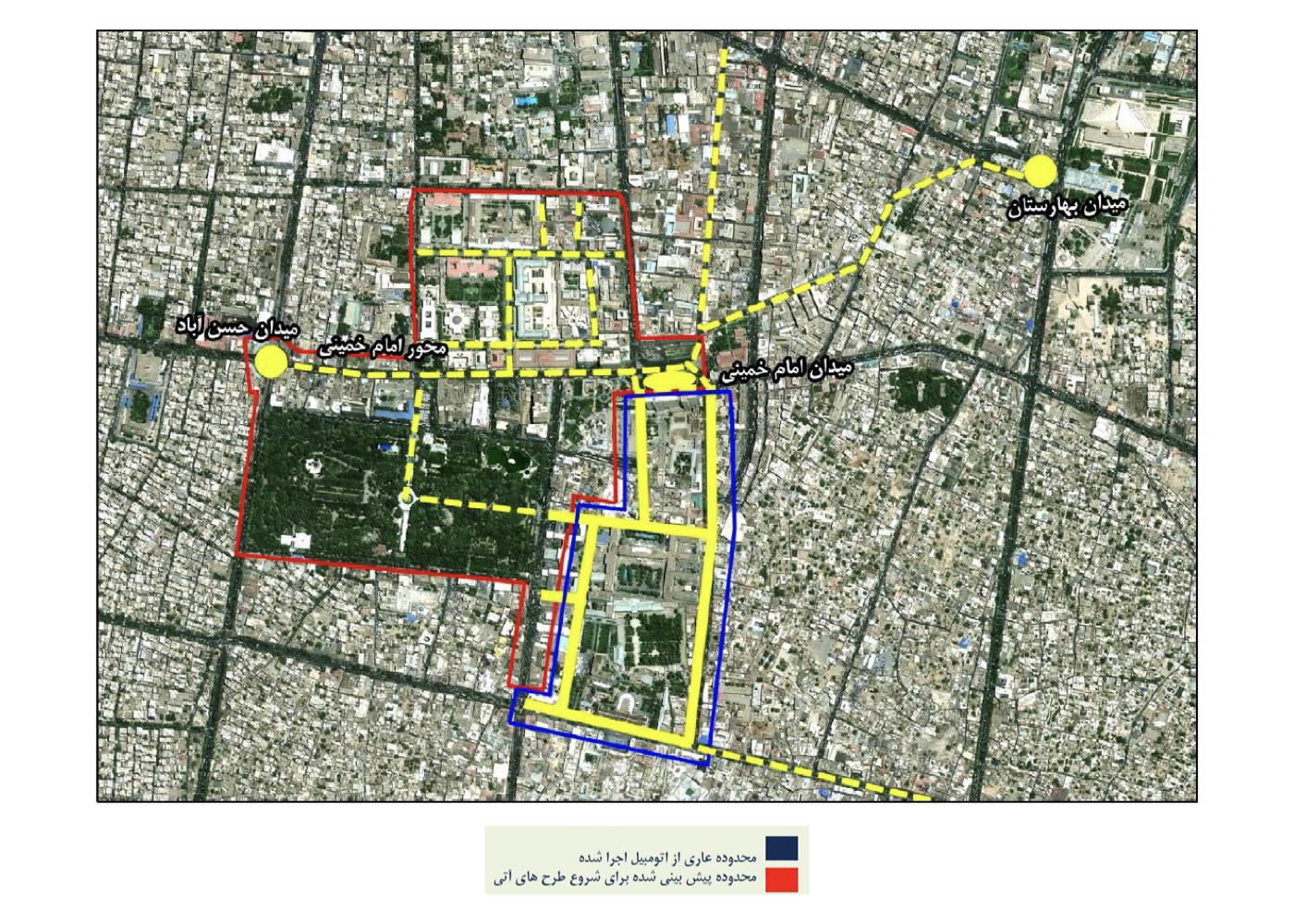
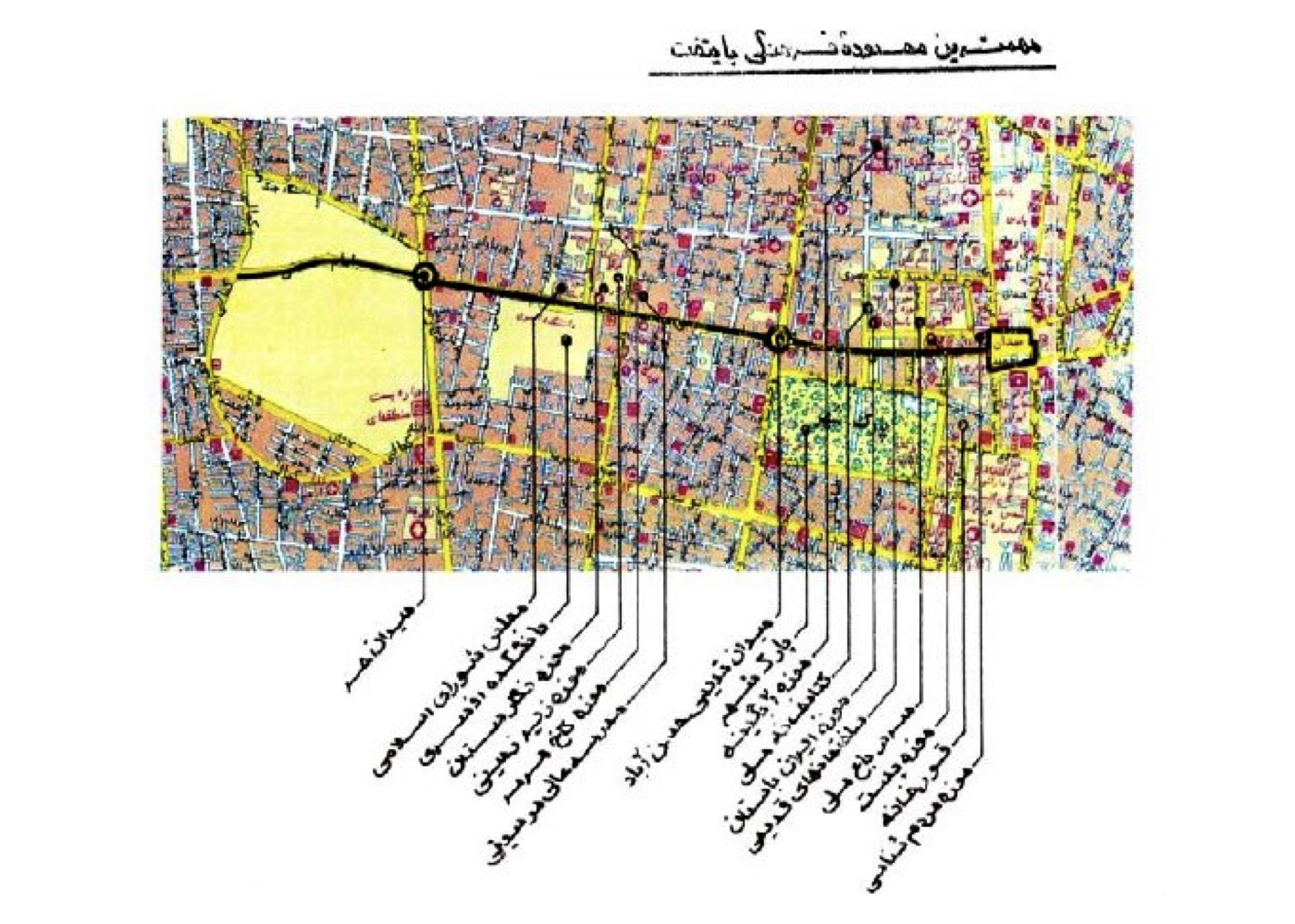
Field studies and construction works began simultaneously:
In the streets of Bab Homayoun, Naser Khosrow, Davar, and Sura-Esrafil, 24/7 interventions were carried out in alignment with the proposed design theory. Additional streets like Little Davar, 15 Khordad Square, Mehran Alley, and Berlin Alley were also incorporated.
One of the major challenges was coordinating 36 different entities — including public offices, ministries, and trade associations — which was successfully accomplished.
A public survey confirmed this project had the highest citizen satisfaction rate among all Tehran urban initiatives.
Summary of Design Concepts and Approaches:
1. Acknowledging each street’s historical character and the socio-economic conditions of its residents
2. The design was not just about paving but a full environmental transformation
3. Creating conditions for qualitative transformation in the urban fabric
4. Enhancing visual identity and social dynamics in the city core
5. Reviving the intrinsic values of traditional passageways
6. Drawing upon global best practices for revitalizing historic centers
7. Tailoring street upgrades to the function of surrounding institutions
8. Restoring natural elements lost from the city center
9. Reconnecting pathways severed by dense motor traffic
10. Increasing green space per capita
11. Reclaiming leftover lots around movement corridors
12. Prioritizing pedestrian presence over vehicle traffic
13. Coordinated traffic reduction and time-based regulation
14. Ensuring safe and accessible nighttime mobility in downtown Tehran
وضعیت اجرا:
After a change in district leadership, the plan was halted, but the portion that was implemented led to tangible positive change.

Urban – Environmental Design for Velenjak Valley (Strategic)
فشرده پیشنهادهای طرح:
Protecting and securing the river-valley corridor, enhancing environmental quality, and extending the mountain landscape into the lower urban fabric
پیشینه:
Velenjak Valley is one of Tehran’s northern central valleys, originating from the Alborz Mountains. The valley remained largely untouched for decades, but in the past 40 years, unchecked urban development and embankment on the valley’s slopes have caused significant ecological degradation.
Project Objective:
To assess risks and reorganize the valley floor and slopes to ensure both safety and landscape quality and enable human access to the upper natural zones via walking and cycling infrastructure.
Summary of Ideas and Interventions:
1. Designing the riverbed and valley slopes to safely channel mountain runoff
2. Extending the mountain’s natural landscape down into the urban edge (up to Chamran Expressway)
3. Slope stabilization designs based on:
A. Soil type (natural or filled)
B. Slope gradient and shape
C. Street and building elevations nearby
4. Creating pedestrian connections across the valley
5. Designing green cover on both slopes, considering:
D. Soil quality
E. Water flow dynamics
F. Elevation difference between upper and lower sections
G. Visual coherence with the surrounding landscape
6. Providing site-specific sketches and photographic documentation to guide staged implementation
Ultimate Goal:
If fully implemented, this project would transform Velenjak Valley into a safe, natural green corridor, linking urban life to the mountain ecosystem.