8. Sustainable Development Approach
Urban-Environmental Design for Sustainable Urban Development
(Safeguarding, Revitalization and Responsibly Utilizing the Natural Assets of the City)
Preface:
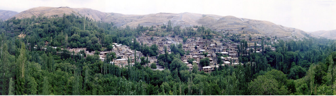
Our country lies in an arid, low-rainfall region with a vast desert at its center. The survival of many of our cities depends on one or more natural treasures, in mutual interaction with them.
Our wise ancestors, with deep knowledge of effective systems, structured the relationship between humans, cities, and the surrounding nature in an intelligent and forward-thinking manner—safeguarding natural assets while allowing for their use in line with ecological capacity, thus avoiding gradual degradation.
Until the past century, this balanced and sustainable relationship between city, people, and nature endured across our land. However, in recent decades, urban development plans have prioritized physical expansion, neglecting foresighted strategies to protect cities’ natural treasures. Especially in the last four decades, due to shortsighted and profit-driven management, the destruction of these valuable resources has accelerated. Examples include:
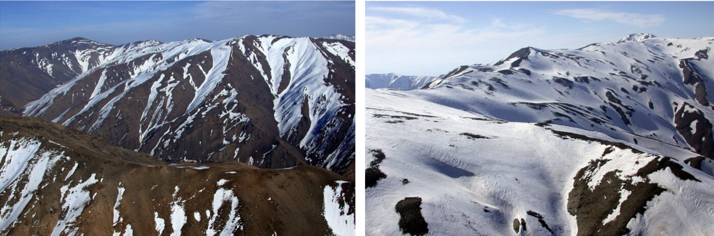
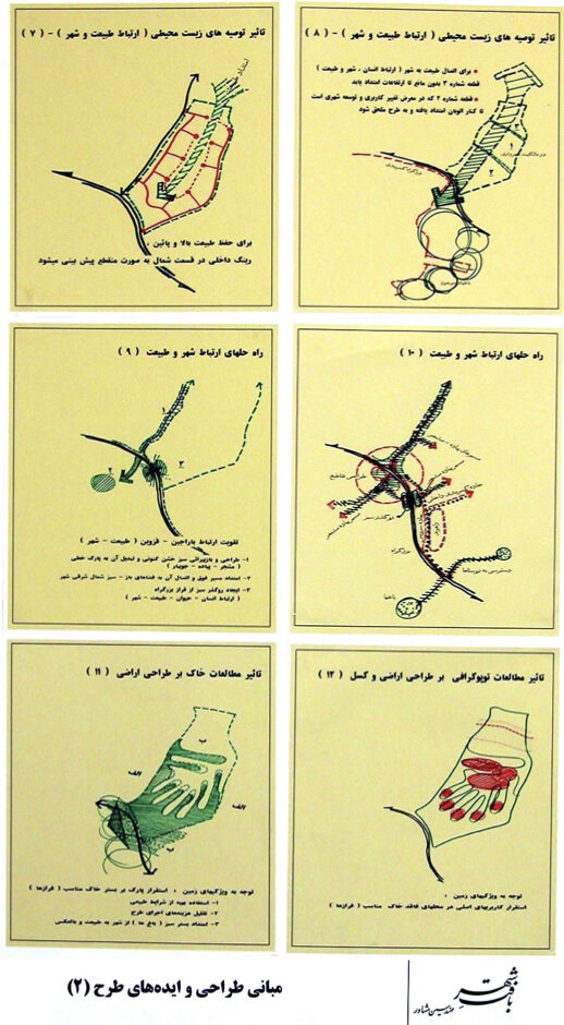
Mountains and hills: For urban expansion, these were designated for military, recreational, educational, and residential uses. Their slopes were carved for ease of construction, with excavated soil dumped into valleys and lowlands.
Foothill lands: Absorbed into the expanding urban fabric.
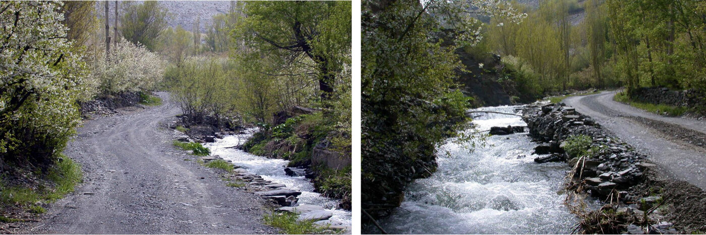
Valleys and their surroundings:Due to fertile soil and water access, initially transformed into private gardens, then into garden-villas, and ultimately apartment complexes.
Waterways: Filled with debris from hill excavation or eroded into instability.
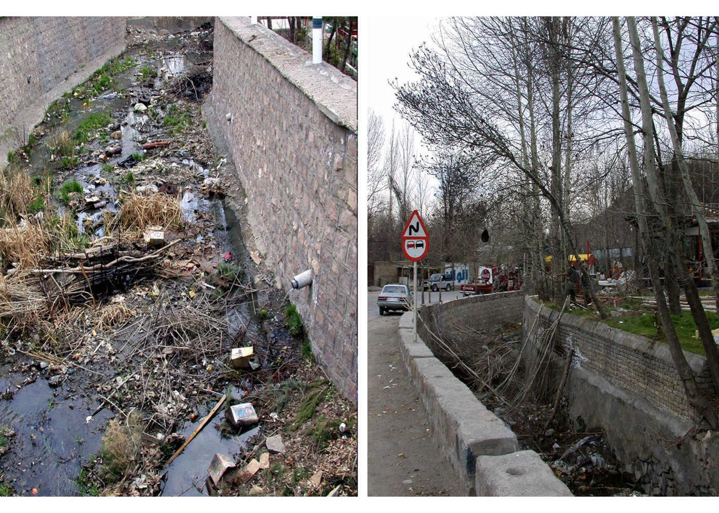
River-valleys: By enforcing regulations without environmental considerations (lacking a forward-looking perspective on the environment), their natural beds were replaced with concrete channels. These paths turned into waste disposal sites and conduits for polluted water. The remaining land on both sides of the channels was converted into roadways and subsequently sold off.
Rivers:Without complete urban wastewater systems, sewage was discharged directly into rivers, turning them into polluted conduits to lakes and seas.
Springs: Legal and illegal upstream construction has degraded water quality and polluted spring sources.
Seas and shorelines: Shores lost their natural purity and value, and the sea was turned into an urban wastewater basin.
Lakes: Unprincipled dam construction has led to the drying of lakes.
Qanats (underground aqueducts): Construction within their protected zones, unauthorized water extraction, sewage discharge, and damage during the development of subways or urban highways led to the destruction of this invaluable engineering heritage passed down from our ancestors.
Groundwater: Highways and tunnels built without accounting for natural underground water paths have blocked or destroyed them.
Gardens: As key cultural assets of our cities, gardens are losing their resilience due to disrupted water supply routes, destroyed qanats, pollution, and over-construction—and are now rapidly vanishing.
and…
Conclusion:
The above examples demonstrate how, after centuries of resilience, natural resources and environmental heritage are now facing destruction by our generation. In response, experts and nature advocates have worked to propose solutions to halt this destructive trajectory and restore balance. In this spirit, I have—alongside fellow committed colleagues and drawing on experience with nature-based projects—proposed the theory of Urban–Environmental Design. A theory that, by interrupting the current course of degradation, enables responsible use of natural treasures and supports sustainable development of our cities and country. It is hoped that this effort will play a positive role in achieving its intended goals.
Definition of Urban–Environmental Design:
Wherever a city influences—or is influenced by—a natural element within or around its boundaries, all planning must prioritize rules, regulations, and guidelines rooted in environmental studies, landscape design, and related sciences—these must form the foundation for urban development plans in the domains of urbanism, urban design, and allied disciplines.
Achievements of the Urban–Environmental Design Theory in Iran:
Over the past four decades, I have had the honor of directing the planning and design studies of several valuable natural assets in cities across the country. These projects were prepared and proposed based on the theory of “Urban–Environmental Design” and could have simultaneously protected and enhanced the environmental quality of these natural assets—resources that are the wealth, heritage, and foundation for continued healthy urban life—while enabling equitable, capacity-aligned, and sustainable use by citizens, improve people’s attitudes and relationships with nature, and contribute meaningfully to sustainable urban development.
However, fundamental changes to the plans, their incomplete implementation, or execution without the involvement of the original designers and under non-expert directives, often lead to deviation from the original vision, potentially causing harm, and distancing the project from its core objectives of natural resource protection and sustainable use.
The reports for these projects have been compiled over the years across various cities, amounting to several hundred volumes, and were developed through national funding and the dedicated efforts of experienced, committed professionals.
While it is not feasible to present all these reports here, summarizing the strategies, approaches, and recommendations of these projects for each city’s residents especially students and younger generations can raise awareness about the unique natural and historical values of our cities and nation, and foster their engagement in preserving these natural treasures and priceless generational heritage.
A Few Important Notes Regarding These Projects:
Some proposed strategies—such as enhancing human-nature-city interaction—are generalizable and applicable to similar urban contexts. In many of these cities, other relevant plans exist that are not covered here. Some plans were not executed—or only partially realized—due to funding gaps or changes in administration.
In Section 8 of this website, information is provided on Fourty urban–environmental design projects across 16 cities in Iran.
ARAK [ 9 Projects ]
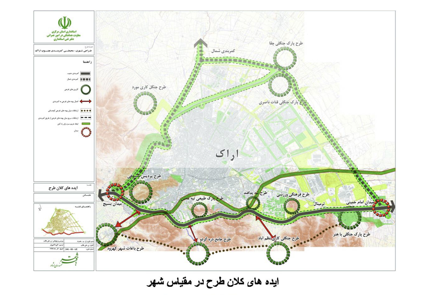
Arak: Urban – Environmental Design of Arak Ring Highways
Summary of the Proposal:
The project aims to expand green spaces along Arak’s ring highways to reduce air pollution, improve safety and visual quality, and enhance the city’s environmental character. It also seeks to create accessible linear and nodal recreational spaces where residents can enjoy leisure time — strengthening the connection between people, the city, and its natural assets.
Background:
Arak is one of Iran’s major industrial centers, home to numerous factories that have significantly contributed to air pollution. As a result, respiratory diseases have increased among residents.
In response, city authorities and the provincial government launched a joint effort to expand urban green areas wherever possible, and commissioned the consultant to develop comprehensive proposals considering existing opportunities and constraints. The following projects were prepared and approved:
Urban–environmental design of the southern ring highway corridor
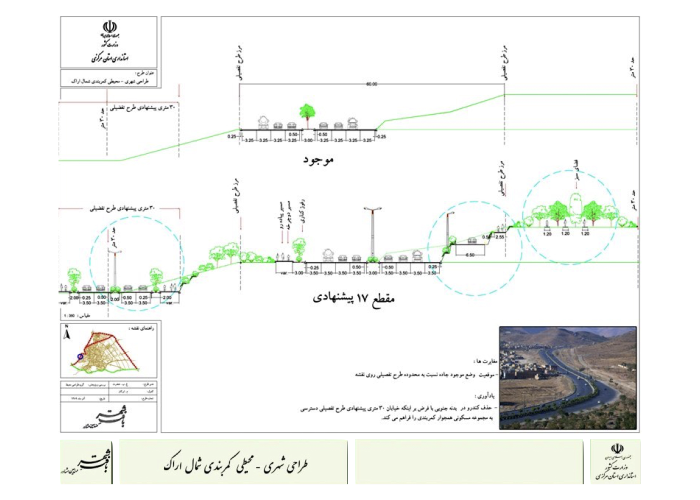
Urban–environmental design of the northern ring highway corridor
Urban–environmental design of the four main city entrances
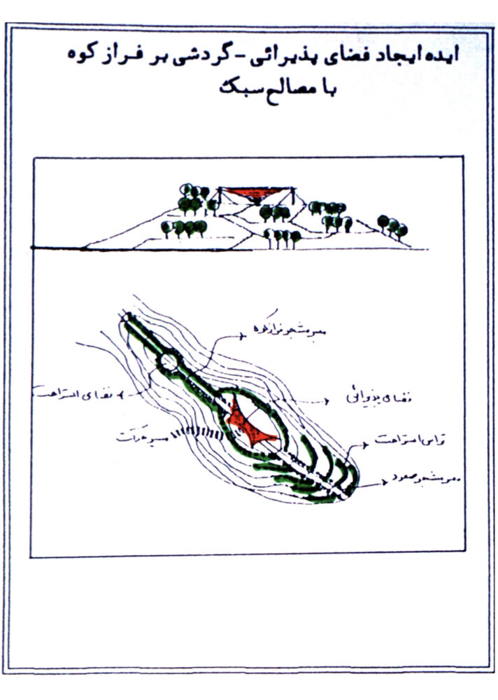
Urban–environmental design of Mount Mostofi
Urban–environmental design of Mount Gerdoo (former stone quarry)
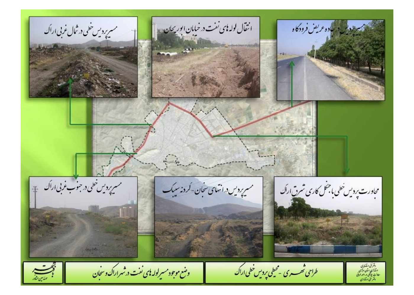
Urban–environmental design of the oil pipeline corridor crossing the city
Implementation Status:
Out of these six projects, approximately 10 kilometers of the southern ring highway and the Mount Mostofi green development have been implemented. However, due to administrative changes and possible funding limitations, the preparation of detailed executive plans for other areas was not pursued.
Significance and Outlook:
The proposed green highway corridors were envisioned as interconnected ecological belts capable of substantially reducing urban air pollution. Likewise, the greening of Mount Mostofi, Mount Gerdoo, and the oil pipeline corridor would have further enhanced air purification and urban livability.
Details of projects No. 4, 5, and 6 are presented separately in their respective sections, while plans for projects No. 1, 2, and 3 are shown on this page.
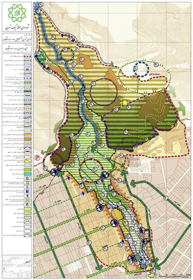
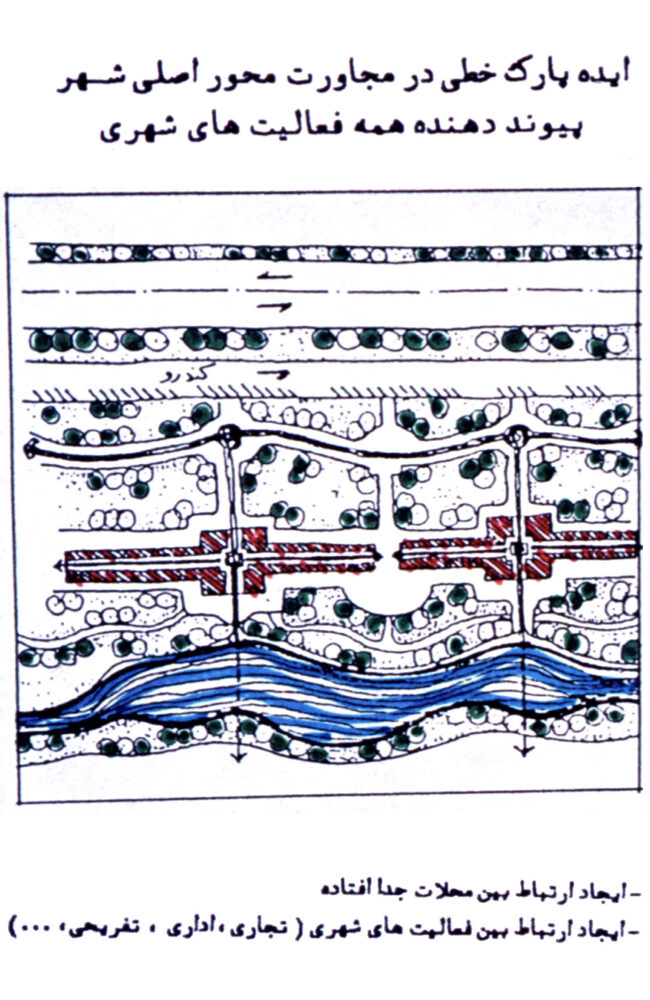
Arak: Urban–Environmental Design of the Linear Paradise (Strategic)
Summary of Proposal:
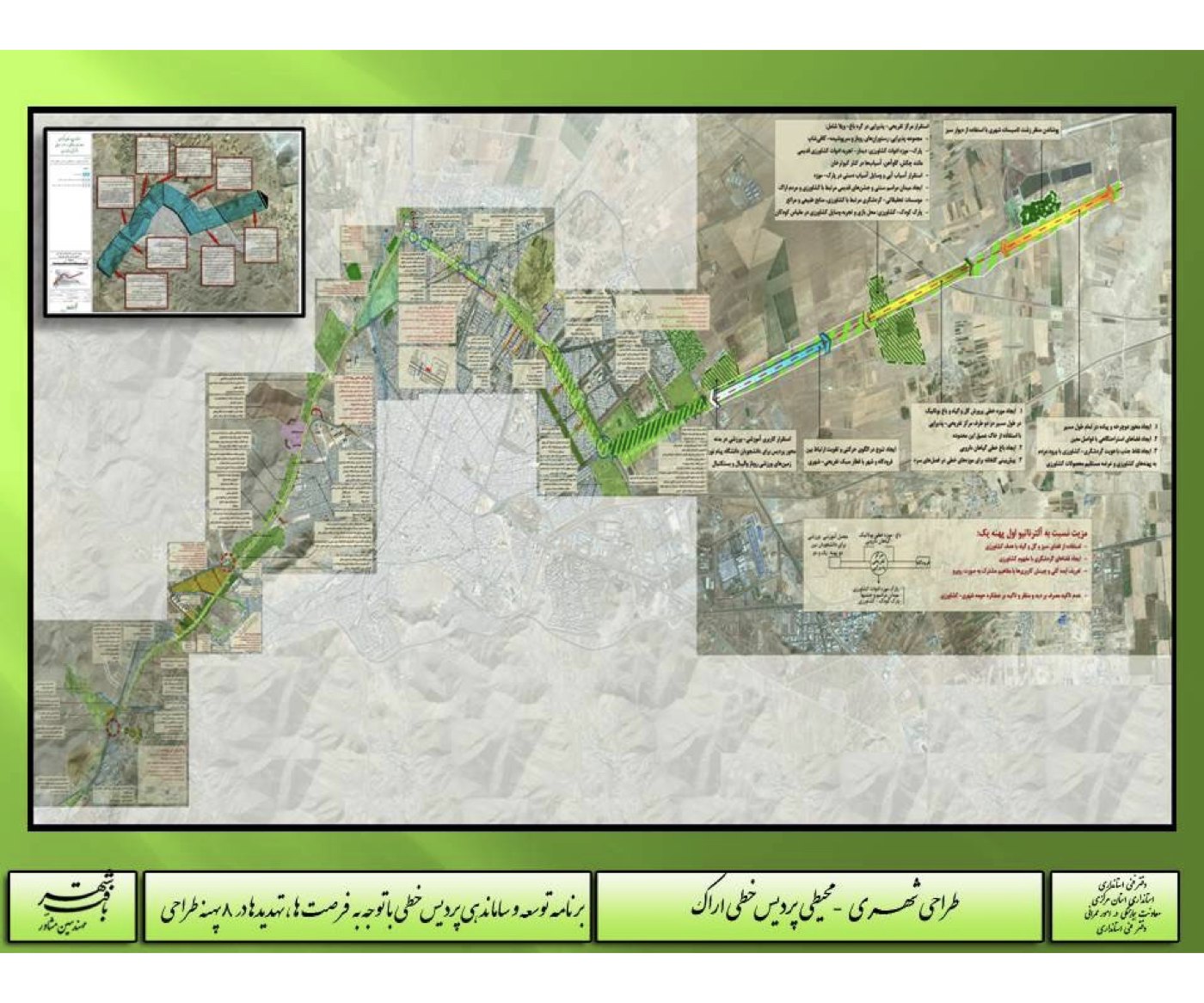
Transforming a polluted, industrial corridor into one of the city’s natural assets, increasing urban green space and areas for leisure, creating walking, exercise, and recreational routes, and establishing a continuous pedestrian connection between neighborhoods through a green corridor that reconnects the city with its natural features.
Background:
In the city of Arak, a petroleum pipeline corridor had passed through the urban area for decades. As the city expanded, the pipeline came into direct contact with residential neighborhoods and caused surface and subsurface contamination in several locations.
The Provincial Government and Municipality decided to dismantle the pipeline and assign a new land use to its route. Comprehensive urban–environmental studies were conducted, and it was proposed that—given the severe air pollution in Arak—the corridor should be transformed into a linear green campus. This green spine would allow all adjacent neighborhoods to walk, cycle, and spend leisure time along it, while its vegetation would help moderate the city’s air quality.
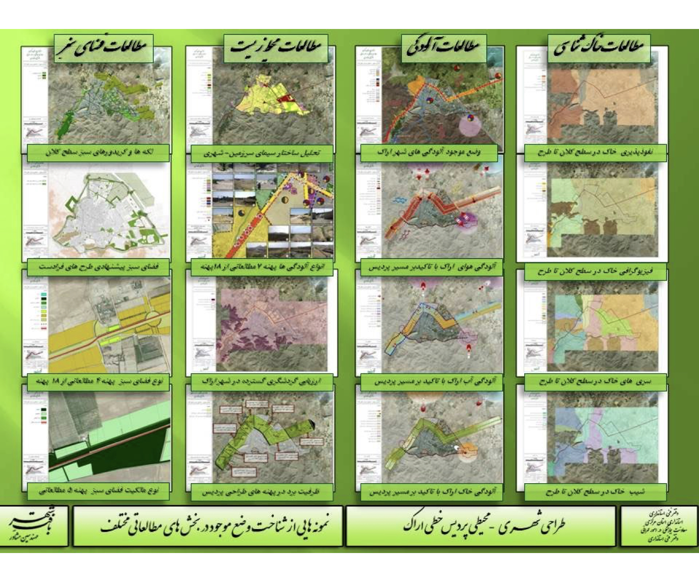
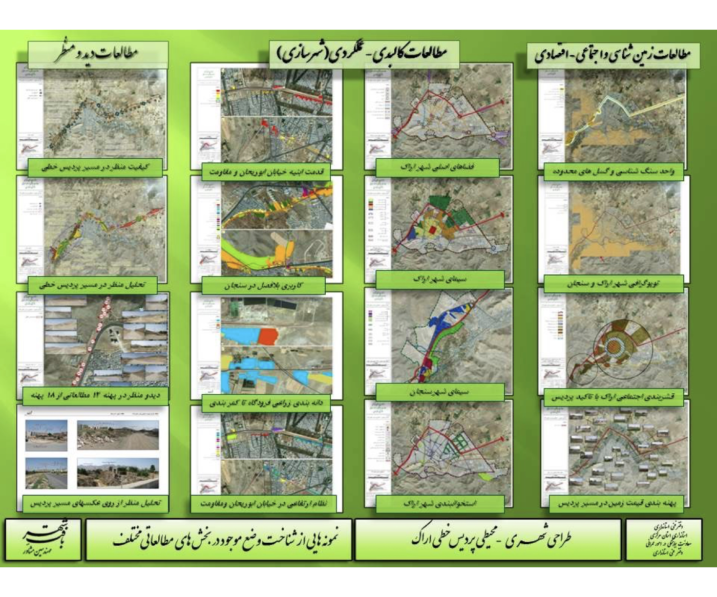
Extensive studies were carried out in geology, soil science, environmental pollution assessment, landscape and urban design, visual analysis, and connectivity. Based on the existing conditions, the corridor was divided into eight zones for evaluation. The design proposal was developed—and approved—according to the following concepts, strategies, and guidelines.
After approval, it appears that local authorities later modified certain land-use elements of the project to increase economic return and attract investment.
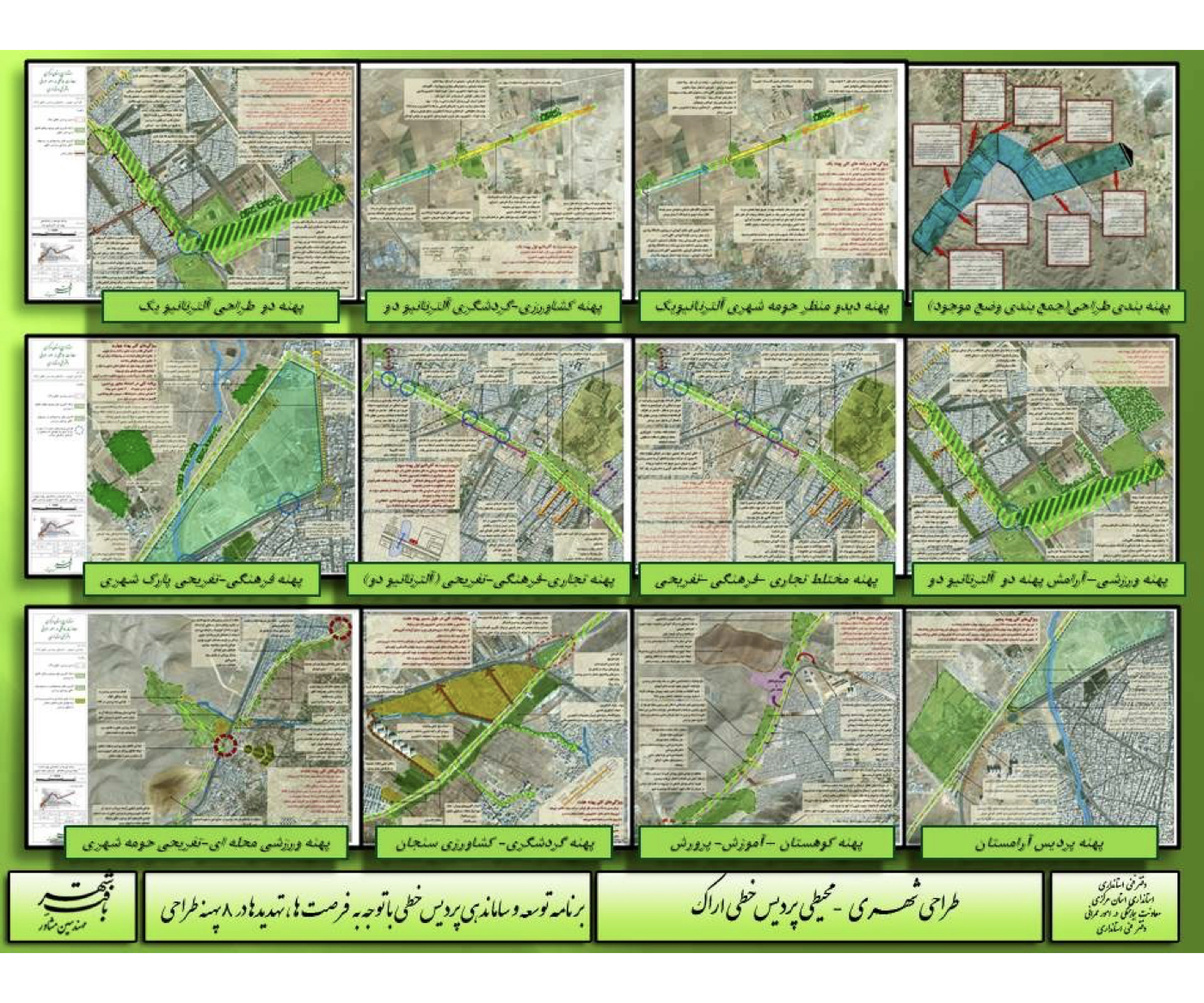
Summary of the Proposal’s Key Concepts and Strategies:
1. Soil remediation and environmental cleanup along the corridor
2. Integrating leftover open fragments and marginal lots (triangular or unused lands) into the linear campus
3. Connecting the city’s scattered green spaces to the corridor to create a continuous, resilient urban green network
4. Increasing green density in adjacent urban parks and green areas
5. Constructing multiple football pitches and sports fields to reinforce the corridor’s sports-oriented identity
6. Linking Senjan Boulevard to the Senjan Valley gardens by strengthening the role of the linear campus
7. Creating a physical and functional connection between the linear campus and Arak’s city center
8. Providing design guidelines for variable widths along the campus according to land-use changes, access nodes, and key turning points
9. Designing expandable spaces along the corridor based on land owned by the Housing and Urban Development Organization
10. Developing planting patterns and landscape typologies, including stone retaining walls, slopes, rest areas, emergency routes, pedestrian and bicycle paths, parking zones, children’s play areas, foothill zones, hospital-edge landscapes, urban utility concealment treatments, “Garden of Tranquility” areas, and hospitality/refreshment nodes
Project Impact – Outcome:
The full implementation of this project could have strengthened the connection between people, the city, and the area’s natural assets, linking the neighborhoods and the city’s multiple green initiatives into a continuous, vibrant green network. It also had the potential to significantly reduce pollution and contribute to the sustainable development of Arak.
However, it appears that after the initial approval, modifications were made to the plan and its land uses to create more opportunities for investment and possibly new construction.
Bandar Abbas [ 1 Project ]
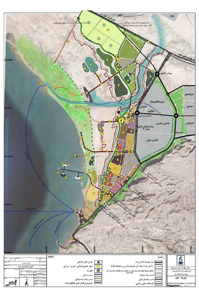
Bandar Abbas: Coastal Boulevard Project (Phase One)
Summary of Proposal:
The project aims to halt the ongoing destruction of the shoreline and adjacent urban facilities, while improving the environmental quality and tourism services along the city’s waterfront. It focuses on reorganizing and redesigning the visual and functional character of the coastal boulevard, strengthening the connection between people, the city and nature.
Preface:
In the 1960s, a coastal boulevard was constructed in front of the historic part of Bandar Abbas. A stone revetment wall was also built to reinforce a portion of the shoreline. Throughout the 1980s this wall was repeatedly damaged by waves and continuously repaired. Beyond this structural issue, the boulevard suffered from additional problems: deteriorated green spaces, informal fish markets, the presence of customs installations, unregulated street vendors, gatherings of addicts, dilapidated urban fabric, a poor coastal landscape, and the absence of suitable facilities and services required for tourism.

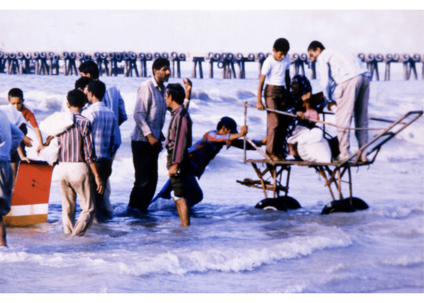
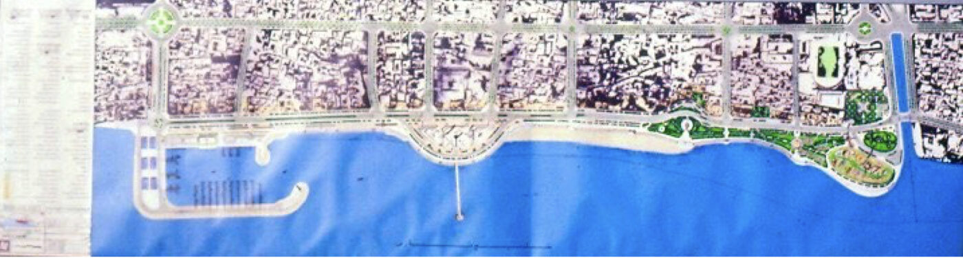
Although the client’s initial request was limited to designing coastal green space, it became evident that numerous more critical issues had to be addressed beforehand. Due to the lack of reliable data on tides, currents, and marine activity, extensive studies were conducted. These resulted in a comprehensive design for 2,500 meters of coastline—from the fish market to Khor Gorsuzan. Key findings regarding the existing conditions are summarized as follows:
1. The existing coastal wall provides protection for the boulevard and its green areas.
2. The wall is continuously damaged by wave action.
3. Persistent degradation of green areas; disorder in the fish market zone; chaotic boat and launch movements; widespread social and visual disorder due to the presence of addicts and the homeless; lack of tidal and hydrographic data; and the absence of public tourism facilities.
4. Rising groundwater levels in buildings near Khor Gorsuzan due to insufficient drainage.
Summary of the Proposal’s Key Concepts and Strategies:
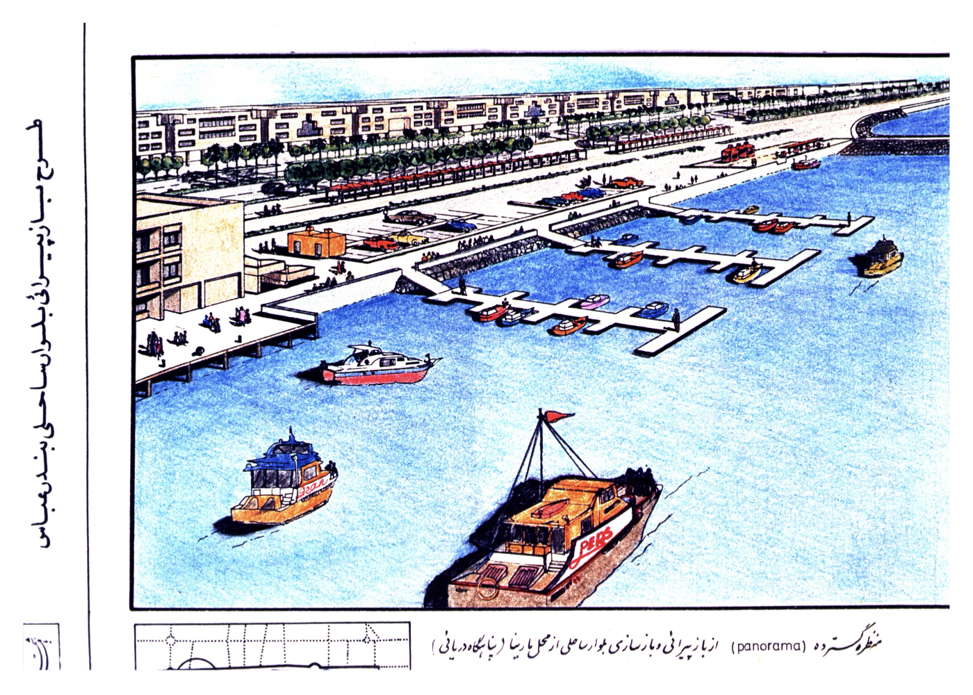
1. Construction of a marina (safe harbor) for boats and launches at the former Gamberoon port, integrated with the urban circulation network.
2. Using the marina as a buffer to reduce wave pressure on adjacent shoreline sections.
3. Building a new reinforced concrete seawall and installing wave-breaking elements where necessary.
4. Removal of the old customs building and damaged pier, followed by limited land reclamation in the same area.
5. Development of a mixed-use commercial–administrative complex using the newly reclaimed areas.
6. Correcting structural deficiencies of the retaining walls along Khor Gorsuzan to prevent groundwater rise.
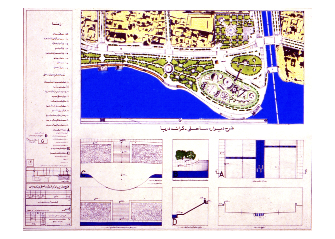
7. Creation of climate-appropriate green spaces along the waterfront.
8. Transforming the entire boulevard corridor into a coastal linear garden.
9. Preparing a coastal landscape design aligned with local architectural heritage and compatible with proposed uses.
10. Maximum alignment with master plans (comprehensive and detailed plans) and environmental conditions.
Administrative Outcome:
The project was approved despite changes in municipal leadership. However, it was not implemented due to the subsequent deputy governor’s insistence on excessive land reclamation (similar to Dubai’s shoreline expansions). Years later, SADRA Company (specialized in port and offshore construction) reportedly signed a contract with the municipality to build the marina. They obtained the design documents from the consultant but, unfortunately, implemented a different marina in an unintended location—within the area designated for the commercial–administrative complex—using rock fill, leaving it incomplete. This created a long-standing urban problem and tensions with city officials.
Significance and Outlook:
If executed correctly in the planned locations:
1. Marine and urban circulation would be properly organized.
2. The deteriorated boulevard would transform into a vibrant, green coastal promenade.
3. The coastal skyline would adopt a harmonious design inspired by local architecture.
4. The city—especially its historic core—would be beautifully reconnected to the sea. (A genuine integration of people, city and nature.)
5. The implementation of these projects contributes to the sustainable development of the city of Bandar Abbas.
Chabahar [ 2 Projects ]
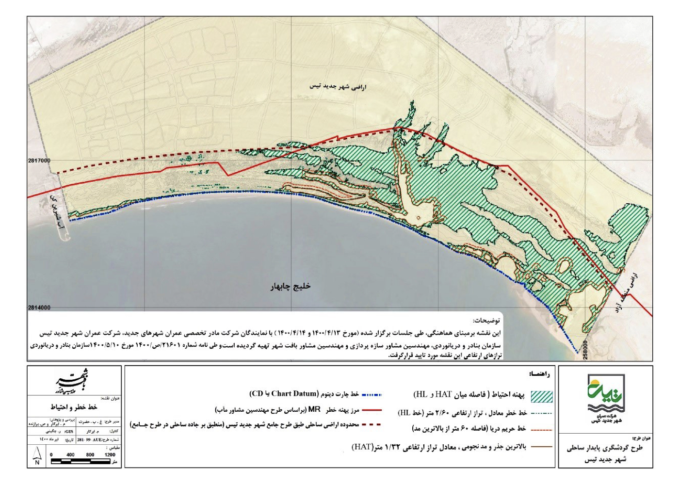
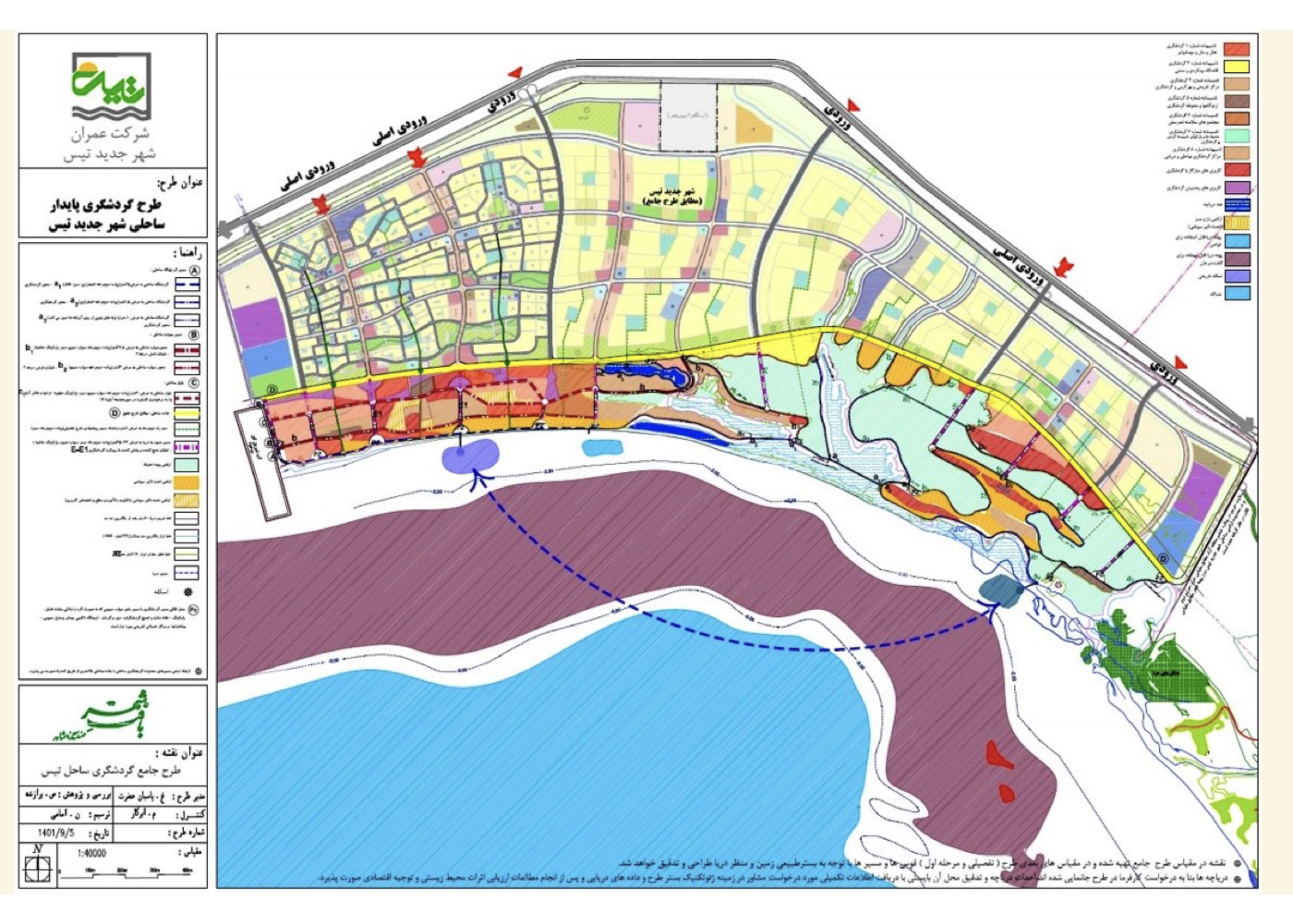
Chabahar: Urban – Environmental Design for the New Town of Tis Coastal Area (Strategic)
Summary of Proposal:
Formulating sustainable tourism strategies for the coastal zone of the New Town of Tis, grounded in environmental assessment, scientific analysis, and coordination with Chabahar Free Zone planning
Background:
The coastal zone of the new town of Tis, spanning several hundred hectares, lies south of the town and is positioned north of Chabahar Bay, adjacent to the previously planned Free Zone coastal area. The same consultant had previously completed studies for the adjacent Free Zone shoreline.
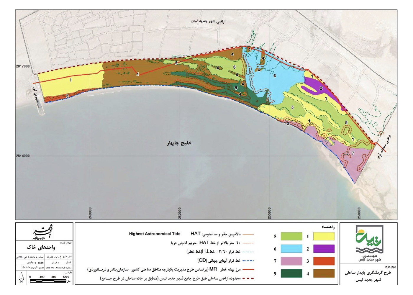
Scope of Studies Included:
1. Geology and soil analysis
2. Hydrology and climate studies
3. Flora and fauna inventory
4. Pollution analysis and industrial impact evaluation
5. Landscape, urban design and architecture
6. Comparative studies of domestic and international tourism
7. Social, economic and traffic studies
8. Transformation trends, GIS layer integration, opportunities and constraints
Key Feature of the Plan:
Three environmental policy scenarios were developed:
Aggressive, Economic and Adaptive. Each scenario outlined distinct degrees of land use intensity, ecological resilience, and development feasibility.
Final Strategy:
Following integrated analysis, the adaptive scenario was prioritized and detailed strategies, policies, regulations, and recommendations were developed and approved under a sustainable tourism development framework.
Project Impact – Final Outcome:
If fully implemented, the new city of Tis will benefit from a safe and protected coastline, a well-structured hierarchy of connections between the urban fabric and the seashore, a controlled circulation network, and an organized urban landscape and visual character that preserves the natural qualities of the coast. The result will be an attractive, human-centered coastal promenade that enhances both the city’s identity and the public experience.
Chabahar: Urban–Environmental Design of the Free Zone Coast (Strategic)
Summary of Proposal:
A Preparation of a strategic framework for developing tourism in Chabahar, based on:
1. Preserving the natural and environmental values of the coastline
2. Ensuring coastal safety against severe storms and tsunamis
3. Strengthening the relationship between people, the city and nature
Background:
Chabahar is one of Iran’s most important gateways to the Indian Ocean. Over the past century, numerous plans have been prepared to develop and activate this coastline, but most have remained unimplemented or incomplete. These have ranged from:
1. Plans for establishing an air fleet base
2. Creation of a Free Trade–Industrial Zone
3. Joint initiatives with other stakeholder countries for maritime transport and logistics
4. And most recently, large-scale tourism development
However, large-scale tourism development requires a very different spatial, environmental and operational foundation compared to the previous sectoral plans. All potentials, constraints, opportunities and threats specific to tourism must be addressed, including:
1. Coastal water conditions
2. Safety and risk from marine hazards
3. Landscape quality and visual appeal
And many other factors considered in this project’s studies and recommendations.
Gaps in Previous Development Plans:
This project revisits and complements earlier development plans by addressing critical studies and issues that were previously neglected or only treated in a very general way, including:
1. Conducting oceanographic studies specific to the Chabahar coast
2. Reviewing past tsunamis and assessing the risk of future tsunamis
3. Accurate definition and refinement of the ICZM line (Integrated Coastal Zone Management) for the study area and its formal stabilization (previously, only a very general line had been defined along the southern coast of Iran)
4. Identifying conflicts between approved master and detailed plans and the requirements of a tourism-friendly coast and proposing solutions
5. Assessing the impact of marine storms on the coastline
6. Identifying existing incompatible or conflicting activities along the coast (with tourism goals) and proposing mitigation or relocation strategies
7. Studying the quality, movement and circulation of water in the bay and its effect on pollution in Chabahar Bay
8. Estimating future tourism flows over the coming decades between Asia and Europe and the likely routes they will use
9. Evaluating the influence of China’s Silk Belt and Road Initiative on future tourism routes
10. Analysing the mutual impacts of international investments in comparable ports in neighbouring and regional countries
11. Identifying the reasons behind other countries’ success in attracting international tourists—especially in coastal areas similar to Chabahar, such as Greece, Spain, Turkey and others.
12. Studying the coastal seabed and visual character of the coastline, as well as construction regulations in tourist-oriented coastal cities
13. Providing guidelines and recommendations for coastal construction patterns that are attractive and suitable for tourism
Summary of Key Strategies and Ideas:
1. Aligning tourism development with coastal safety against natural hazards (storms, sea-level events, tsunamis)
2. Preventing incompatible or unstable land uses that conflict with tourism objectives
3. Designing coastal building lines and envelopes that respect the landscape, environmental constraints and international best practices in tourist coasts
4. Increasing Chabahar’s share of international tourism as a safe and sustainable node along regional and intercontinental routes
Project Impact – Outcome:
The full implementation of this plan can reduce pollution and land-use inconsistencies along the coastal strip, establish a stable relationship between the Free Zone and the sea, enhance the potential for sustainable coastal tourism, add to the tourism capacity of the Chabahar Gulf, fulfill the authorities’ ultimate goal of developing sustainable tourism along the Free Zone’s coastline, and ultimately contribute to the sustainable development of the entire region.
Hamedan [ 1 Project ]
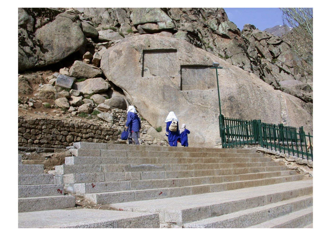
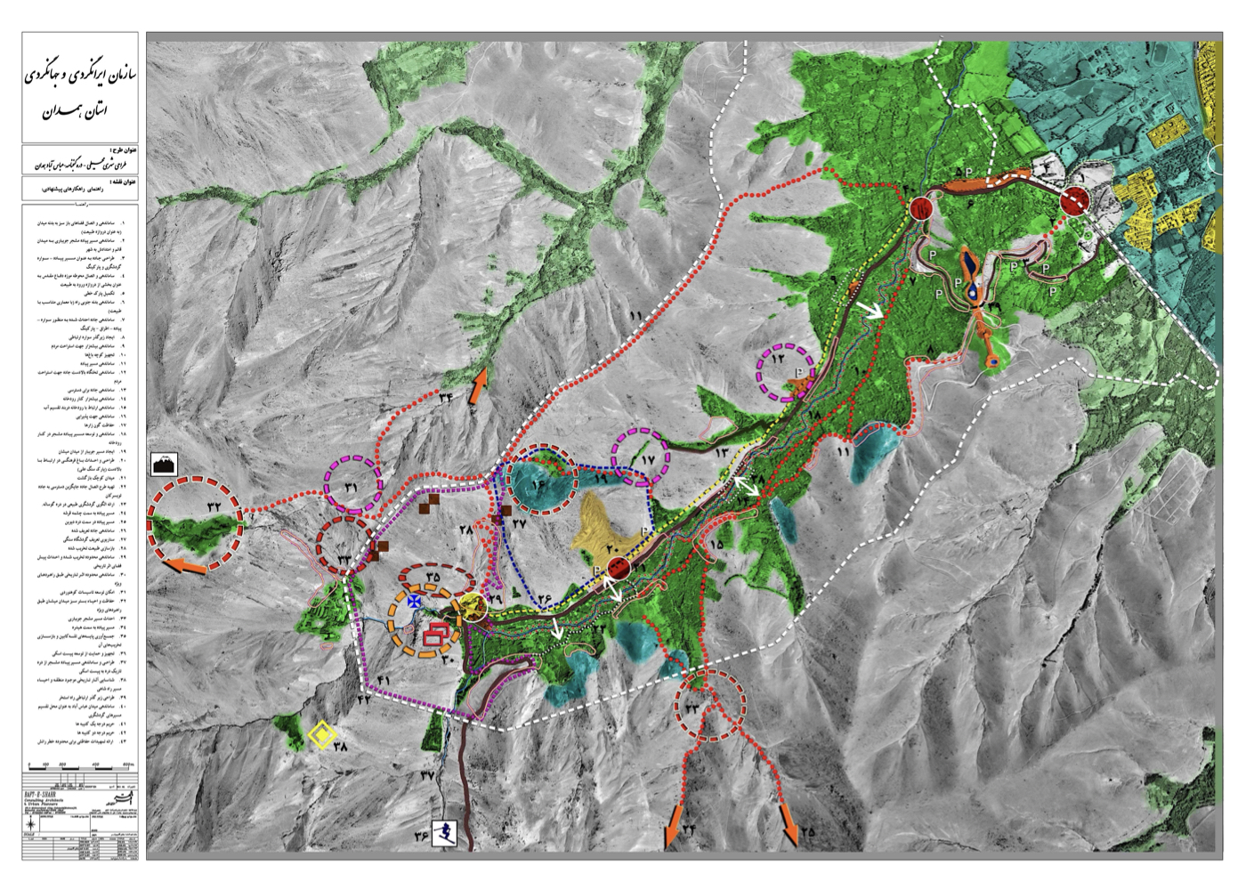
Hamedan: Urban–Environmental Design of the Ganjnameh Valley (Strategic)
Summary of Proposed Strategies:
A strategic plan for the active protection and capacity-based utilization of Hamedan’s natural and historical heritage in Ganjnameh Valley, through the development of sustainable tourism in this valley and the adjacent valleys.
The goal is to create an environment worthy of two extraordinary, world-class inscriptions, and to strengthen the relationship between people, the city, nature, and history.
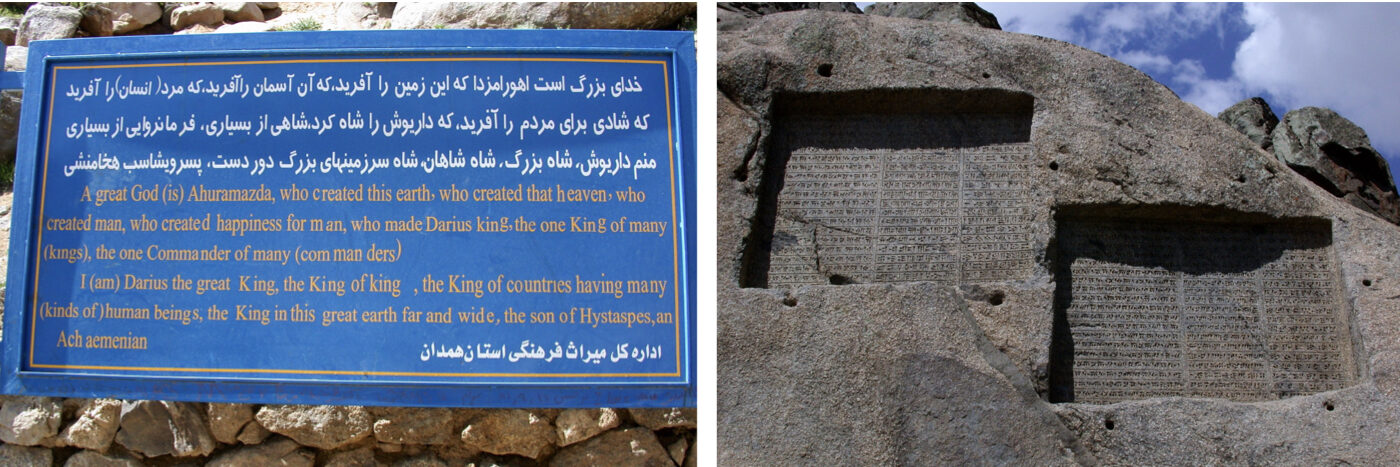
The name Ganjnameh (Book of Treasure) emerged from a popular belief that the inscriptions describe hidden treasure; however, these two 2,500-year-old rock inscriptions are themselves treasures of Iranian civilization. Mismanagement, lack of awareness, and commercial greed have put their natural and cultural values at risk.
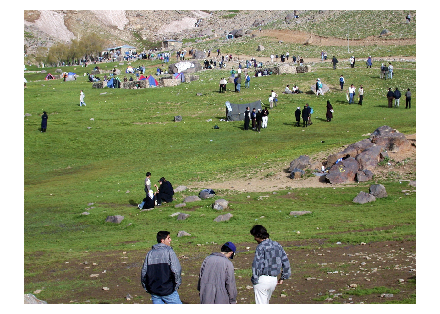
This plan identifies the threats and proposes strategies for sustainable protection and responsible development of the valley and surrounding highlands.
Background:
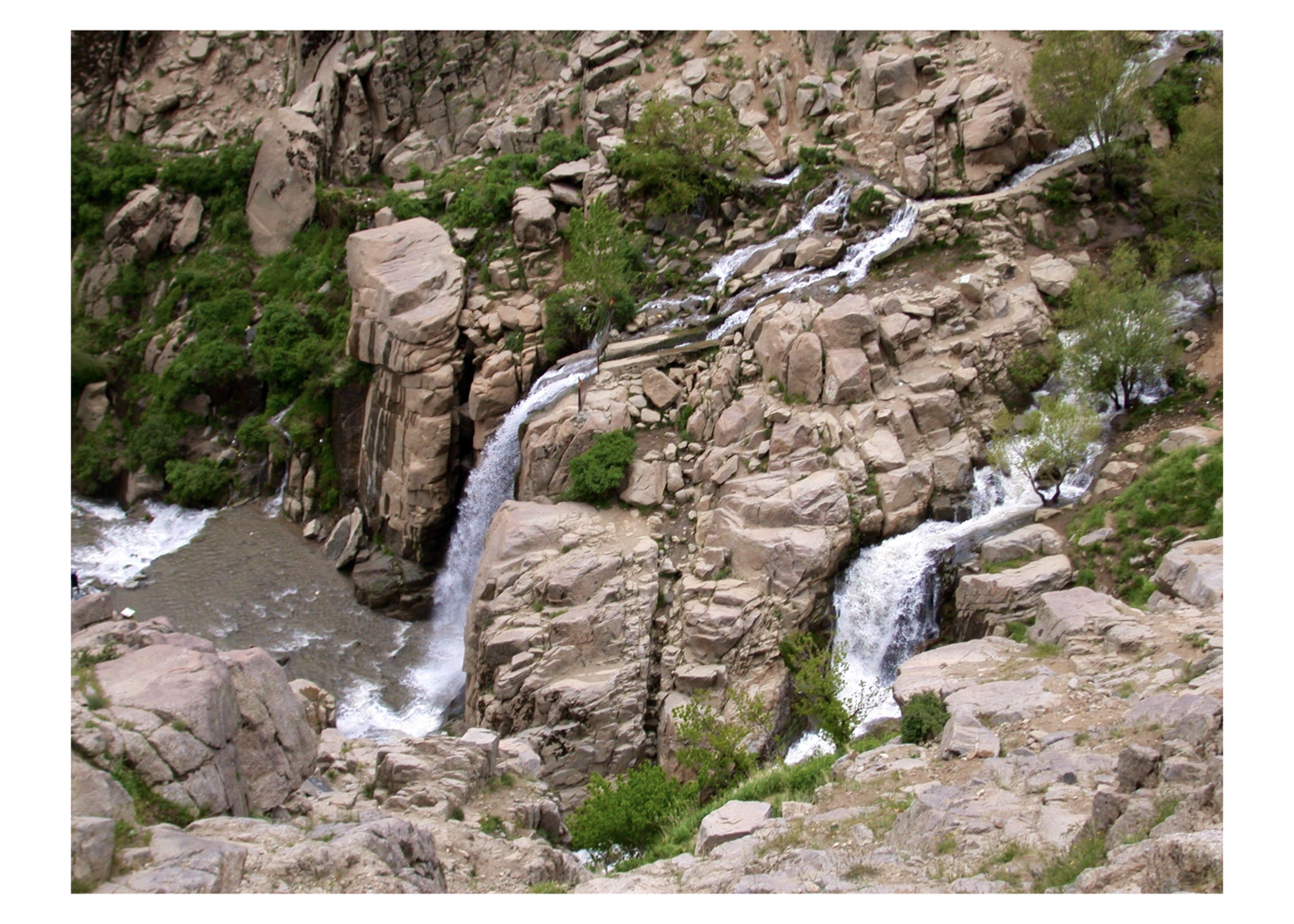
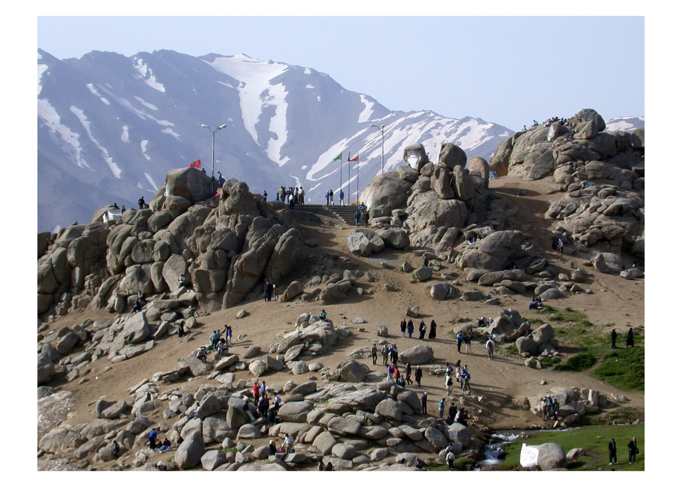
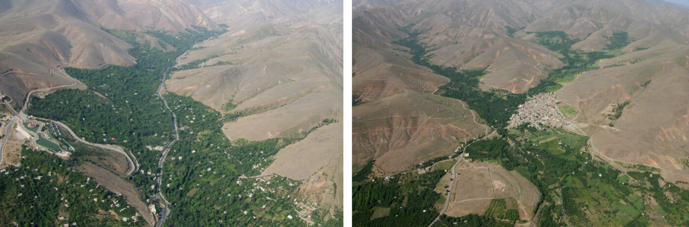
Ganjnameh Valley is one of the most exceptional valleys in Iran, owing to:
A. Hundreds of vibrant orchards within the valley
B. A striking waterfall that freezes completely in winter, descending from the beautiful Mishan plain
C. Two 2,500-year-old Achaemenid inscriptions with unique historical and cultural value
One inscription reads:
“By the will of Ahura Mazda who created the sky, created the earth, and created joy for the people.”
This perspective—prioritizing the creation of joy for the people—stands in stark contrast to the violent narratives of Assyrian and Babylonian inscriptions preserved in the British Museum.
This project includes comprehensive aerial and ground studies, analysis of all available documents, and a sustainable-development–oriented framework for future action.
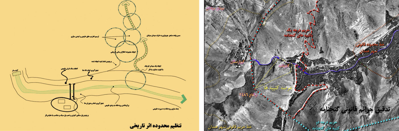
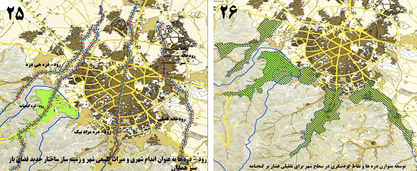
Key Ideas, Strategies, and Recommendations:
1. Environmental Protection: Restoration and integrated protection of the natural environment, especially around the inscriptions, waterfall, and Mishan plain.
2. Access Management: Designing a low-impact access route from Hamedan to the inscriptions. Preventing the extension of the existing road toward Tuyserkan.
3. Cable Car: Prohibition of any cable-car installation in Ganjnameh Valley. Recommendation to relocate it to the adjacent Hey-Darreh Valley.
4. Heritage Buffer Zones: Full compliance with cultural-heritage protection regulations. Preventing construction within the visual corridor of the inscriptions.
5. Highlands: Preventing destructive interventions on overlooking heights. Stabilizing slopes to prevent landslides. Prohibiting construction in the Mishan plain. Allowing limited construction only at lower elevations, under strict regulations.
6. Circulation & Mobility: Prohibiting private vehicles from entering the heritage zone. Using dedicated tourism transport. Maintaining the current dead-end road to protect nature. Designing a safe pedestrian trail from Ganjnameh to Mishan. Facilitating access to orchards. Organizing the city–nature interface. Creating connections between adjacent valleys across the mountains
Project Impact – Outcome:
Had the project been implemented as approved, the Ganjnameh Valley would have been organized in a respectful and exemplary manner in every aspect:
1. Circulation routes would have become safe, and the surrounding landscape would have been properly arranged.
2. The gardens would have been actively protected according to the prescribed guidelines.
3. A safe connection between the valleys and adjacent highlands would have been established.
4. Mountaineering and nature-based recreation would have developed sustainably.
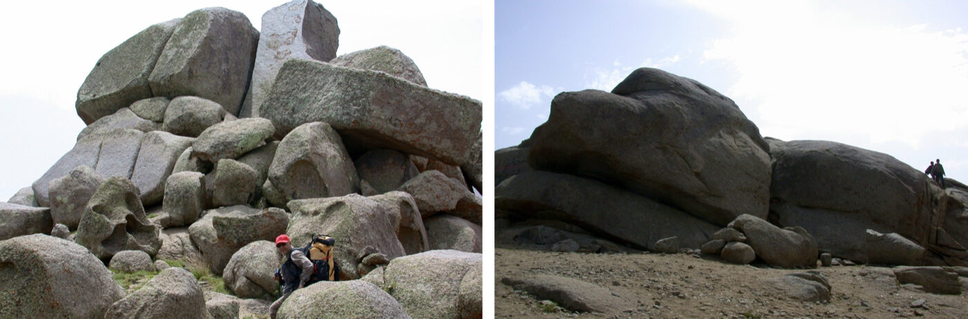
5. The natural assets of the area — including Mishan Plain, the waterfall, the river path, and the rocky mountains with their colossal boulders — would have been preserved.
6. By locating the cable car in the neighboring valley, an aerial connection to Mishan Plain would have been provided without causing damage to Ganjnameh Valley.
7. Creating a parking area for the cable car in the adjacent valley would have been easier, more environmentally sound, and free from the risk of destroying existing gardens.
8. By equipping the neighboring valleys, nature tourism would have been more evenly distributed, reducing excessive pressure on Ganjnameh Valley.
9. Overall, this approach would have prevented the degradation of Ganjnameh Valley and similar valleys in other cities — such as Torghabeh and Shandiz, as well as the valleys near the Tehran cable cars.
10.The surroundings of the two historical monuments would have been organized in a dignified and appropriate manner, demonstrating our generation’s respect for ancestral heritage.
11. Public engagement and tourism at this valley — where nature and history form a unique combination — would have increased and been sustained.
12. The project would have contributed to sustainable tourism and strengthened the economy of Hamadan.
13. The connection between people, city, and the intertwined tapestry of nature and history would have been fully realized.
14. The overall set of strategies, approaches, and recommendations presented in this plan could have contributed to achieving sustainable development in the city of Hamedan.
Governance Note:
Despite its unrivaled landscape, granite cliffs, and world-class historical assets, misguided administrative decisions have pushed the valley toward degradation.
At the time the design proposal was submitted, the cable car project had not yet begun, and the consulting engineer firmly expressed his opposition to locating the cable car in front of the existing historical monuments, providing numerous documents from similar cases around the world. The governor at the time (Mr. Engineer Zebardast) promised to reclaim the land that had been allocated near the historical sites; however, unfortunately, this promise was not fulfilled during the following administration (the Ahmadinejad government) and as a result:
A. The cable-car base station was built directly in front of the inscriptions
B. The destination station was placed at an unsuitable location in the Mishan highlands
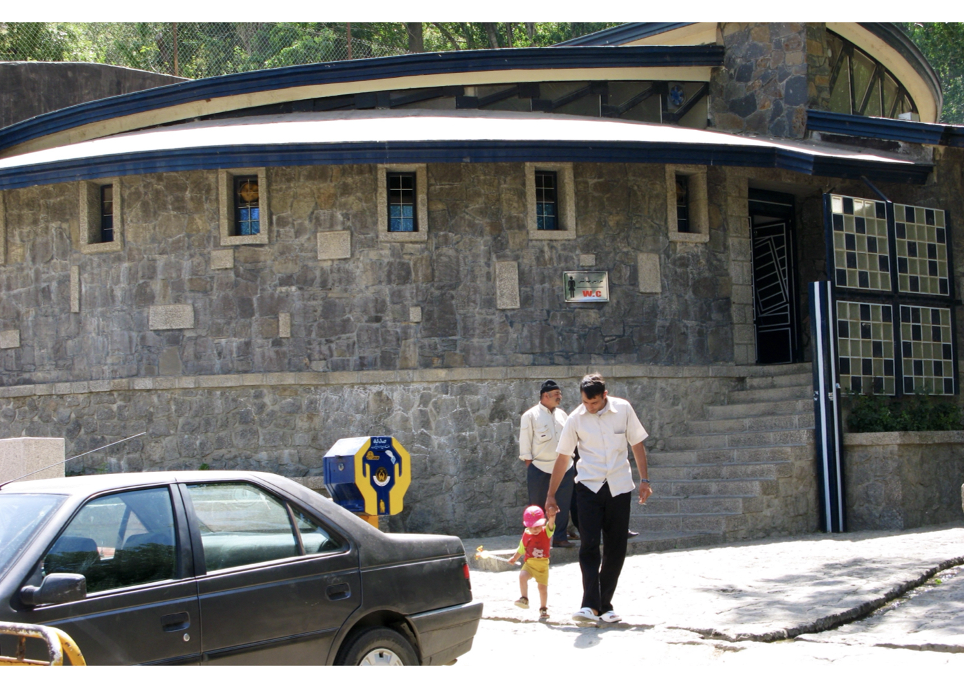
C. A large public restroom was constructed near the heritage monuments
And the Ganjnameh Valley, facing the historic monuments and the natural waterfall, became congested with cars, rental animals, mismatched structures of the cable car station, and shops selling low-quality Chinese goods.
Future generations will pass judgment on these indefensible decisions.
Isfahan [ 2 Projects ]
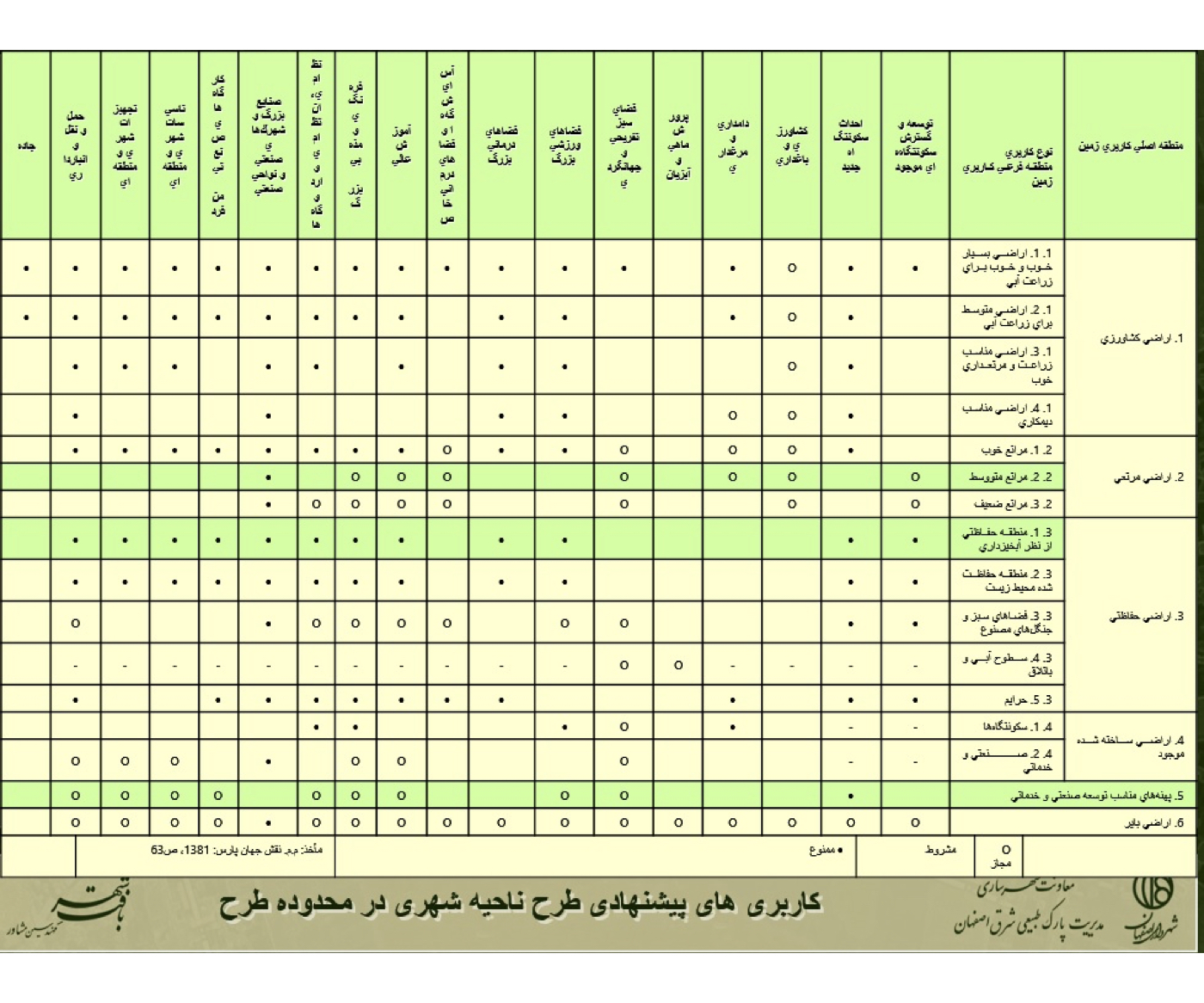
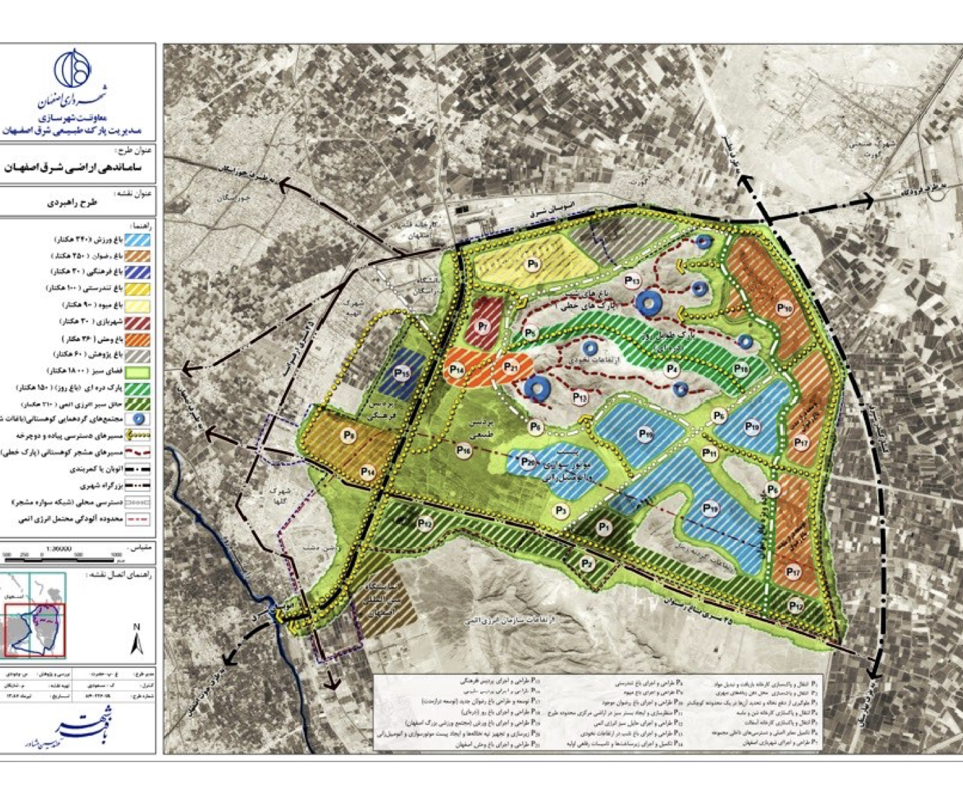
Isfahan: Organization of Eastern Lands of Isfahan (Strategic)
Summary of Proposed Strategies:
Transforming the extensive contaminated lands in southeast Isfahan into a functional zone for urban services, and ultimately returning the remediated lands to the city and its residents.
Background:
The southeastern lands of Isfahan connect to the surrounding mountains on one side and overlook agricultural areas to the south. Over recent decades, this area has been used as the city’s landfill and debris disposal site, with adjacent facilities such as a compost plant, asphalt plant, Isfahan cemetery, and nuclear energy installations.
The study area covers approximately 3,000 hectares.

The Municipality of Isfahan commissioned the consultant to develop strategic solutions for pollution reduction, land rehabilitation, and enabling optimal future use of these lands.
Comprehensive studies were conducted across multiple fields—urban planning, architecture, environmental sciences, landscape design, urban economics and detailed analyses of soil, water and air pollution. The major environmental challenges and pollution sources affecting the southeastern region were identified.
Based on comparable international experiences and adapted to the local environmental context, a set of strategic guidelines was formulated for a 25-year implementation horizon.
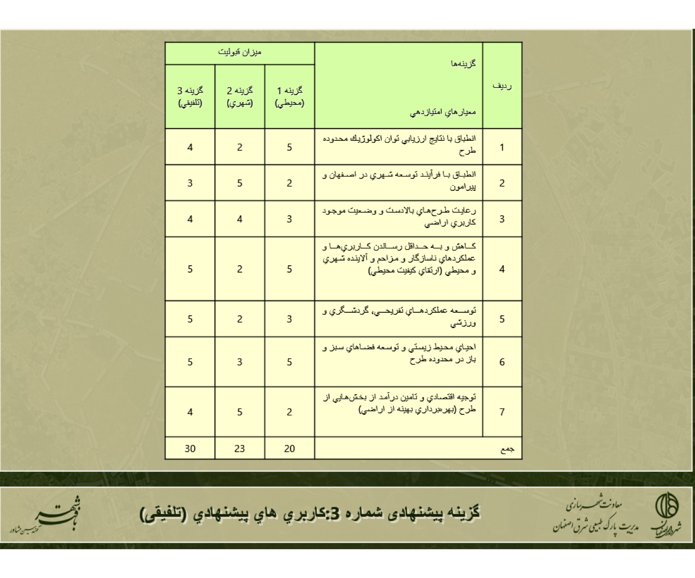
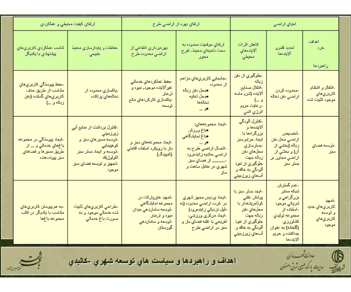
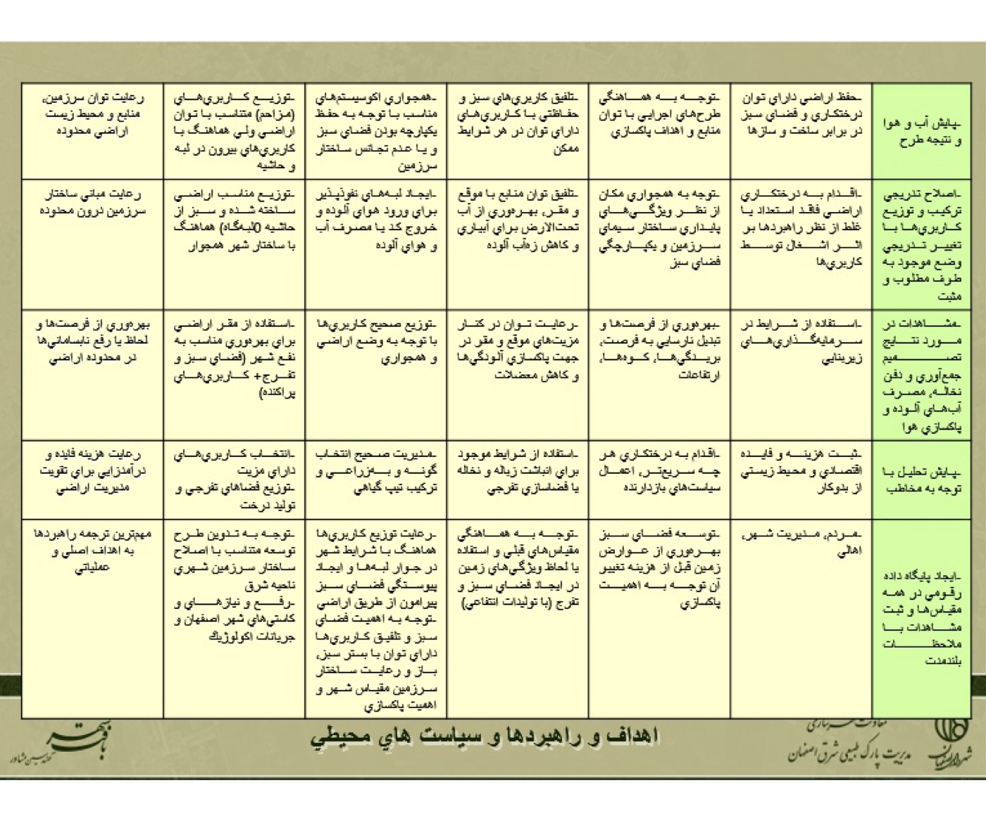
Summary of Key Concepts, Ideas and Strategies:
These items are organized into several tables:
1. Proposed Urban Land-Use Framework for the Study Area
2. Environmental Policies
3. Urban Development & Spatial Policies
4. Three Alternative Development Scenarios
5. Integrated (Combined) Land-Use Proposal
Project Impact – Outcome:
The full implementation of this project can transform these vast lands—currently an environmental challenge for Isfahan—into productive areas free from existing pollution, thereby contributing to the sustainable development of the city.
After the project was approved, the Municipality of Isfahan will proceed with the next stages.
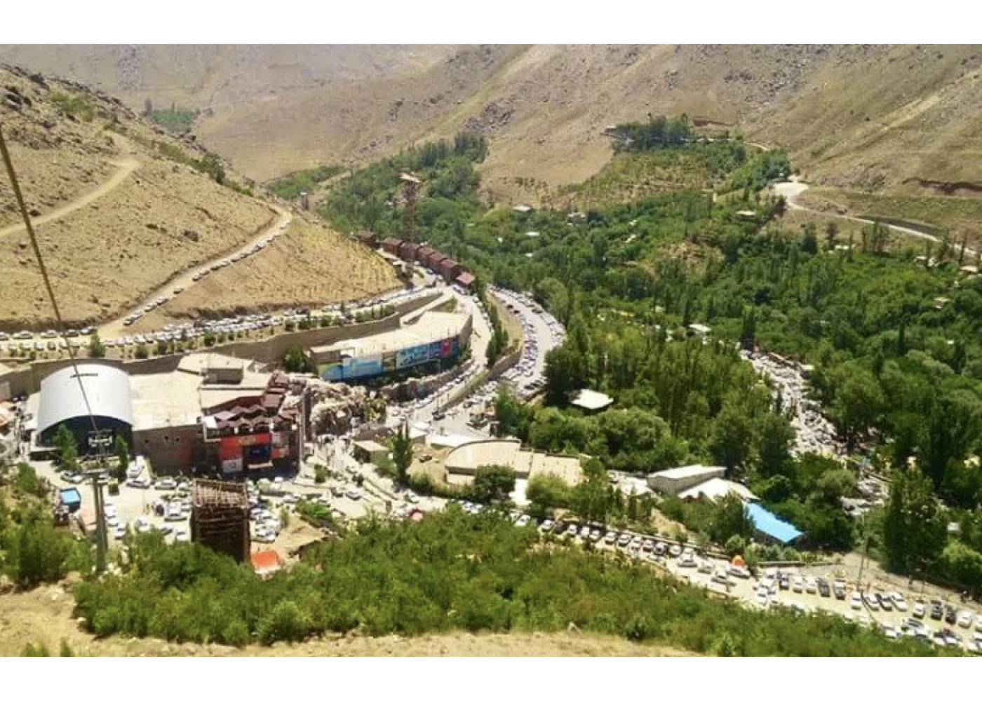
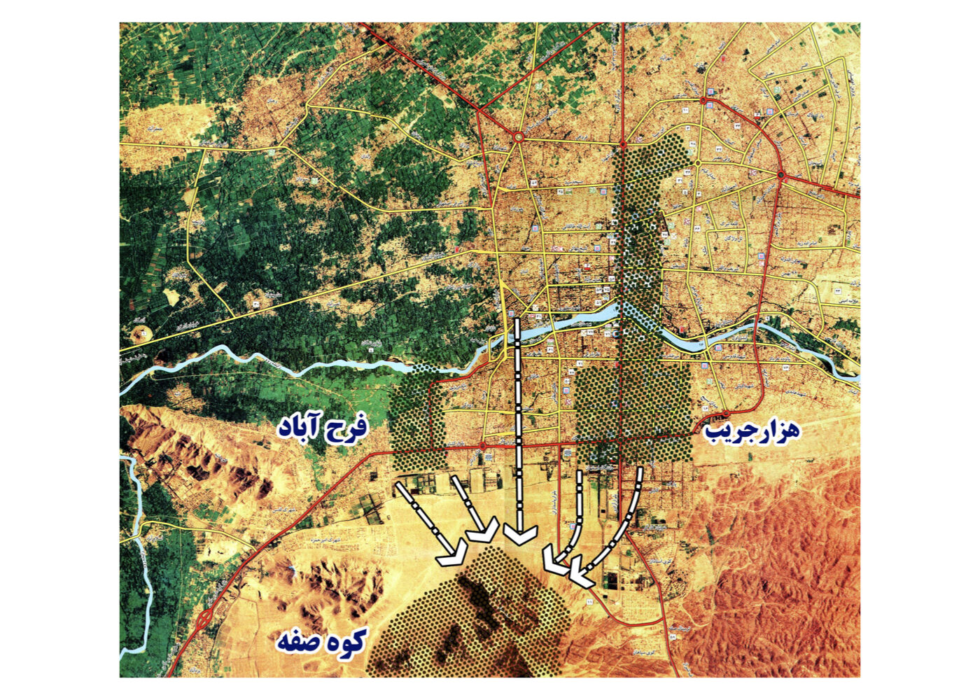
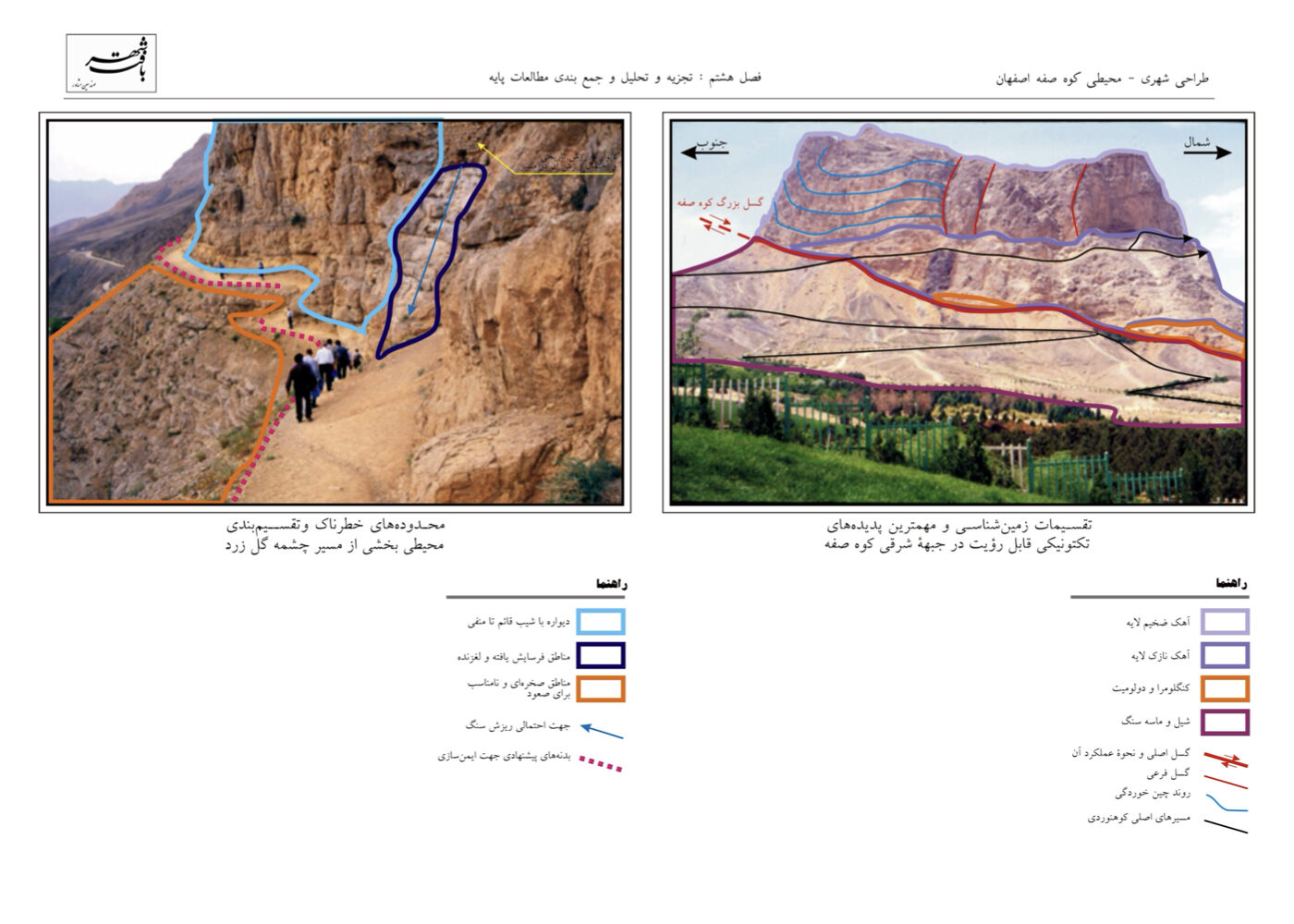
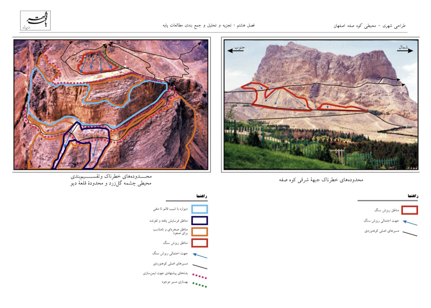
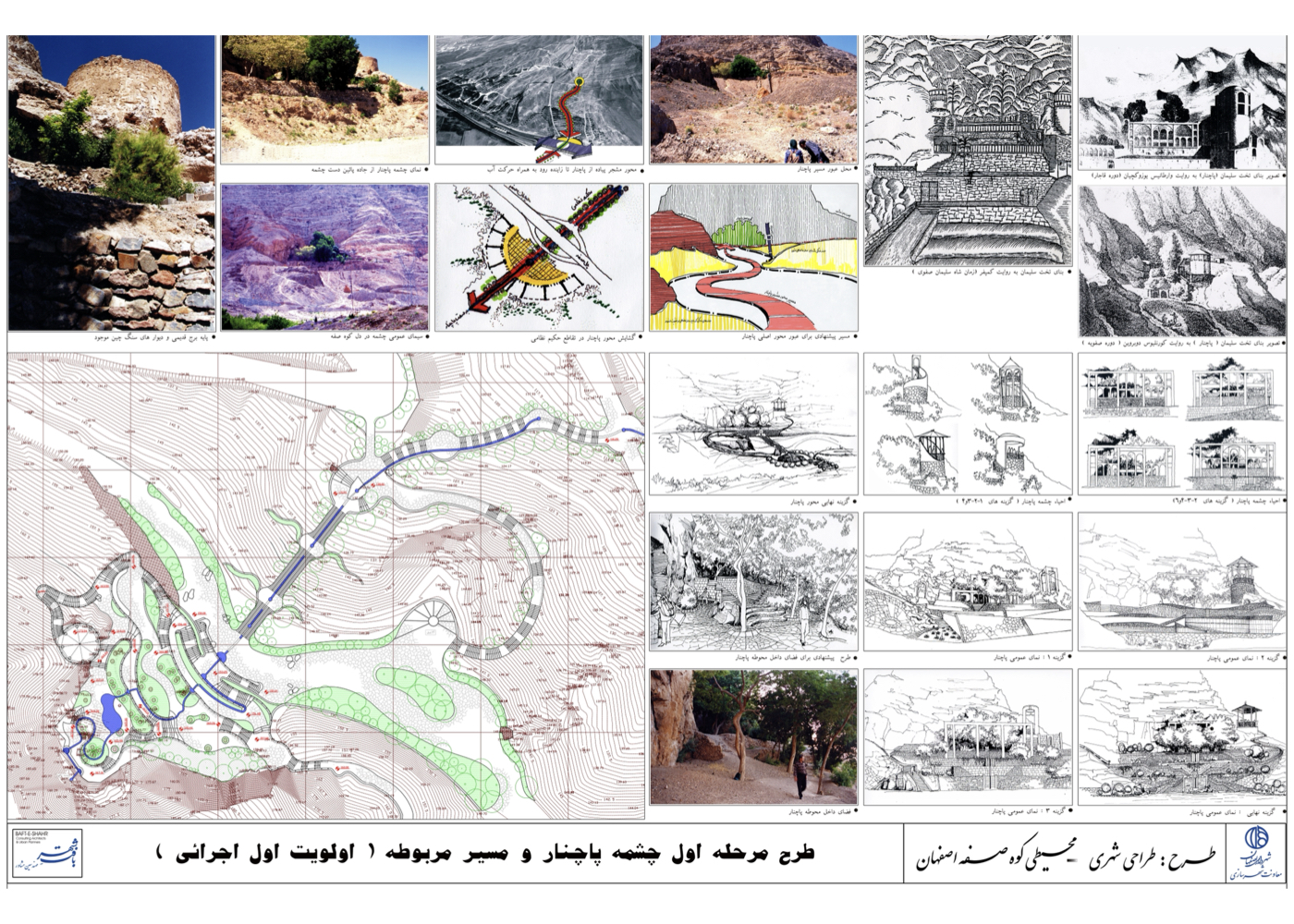
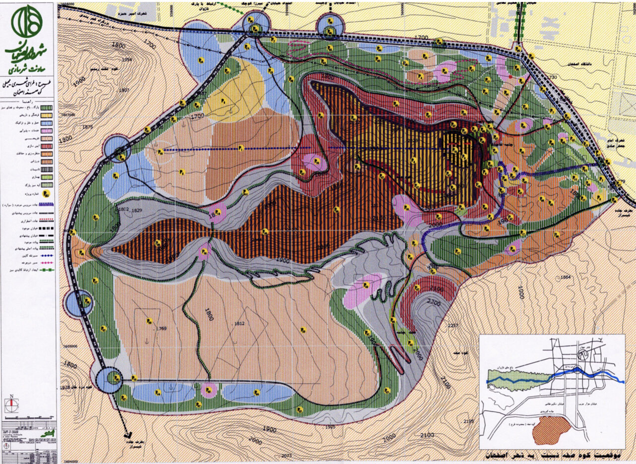
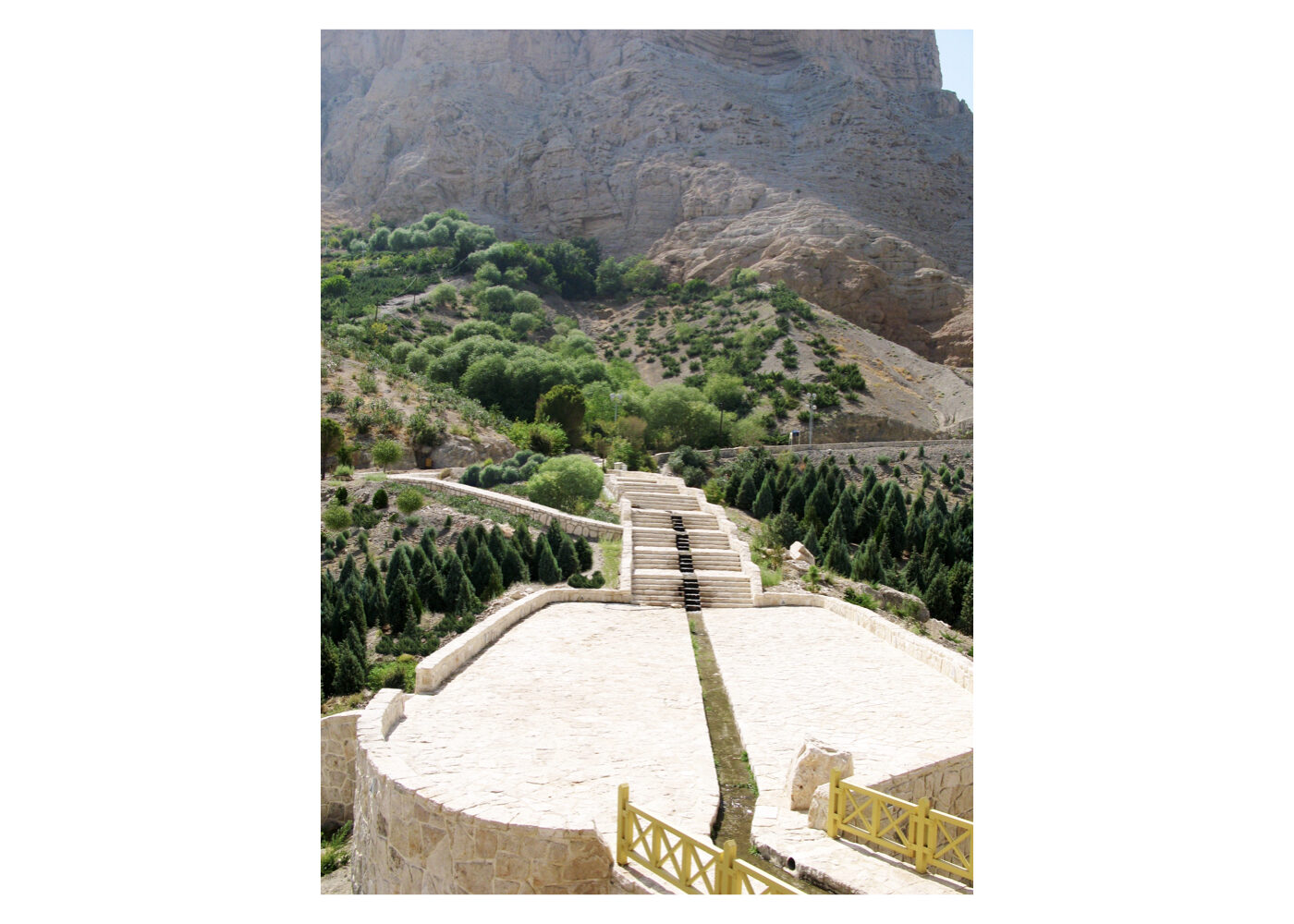
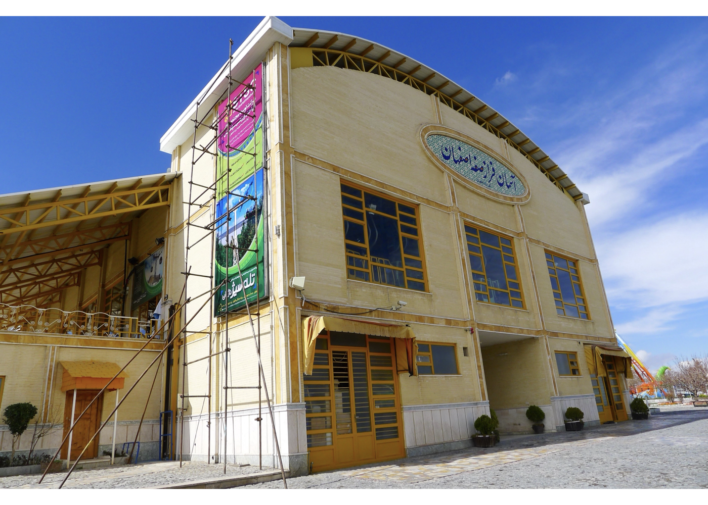
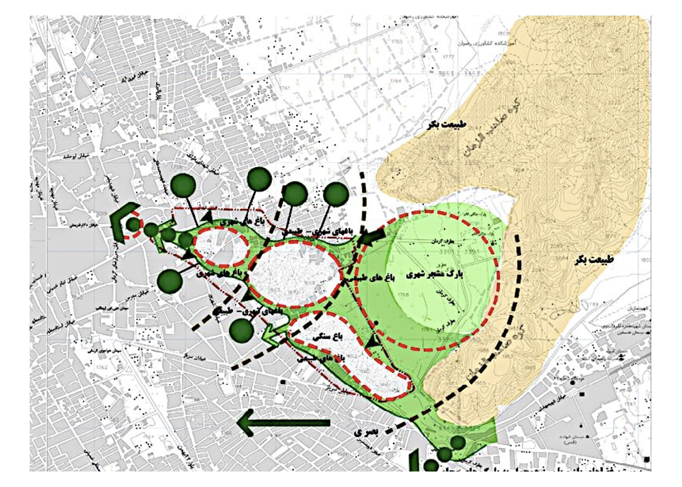
Isfahan: Urban–Environmental Design for Mount Soffeh
Summary of the Proposal:
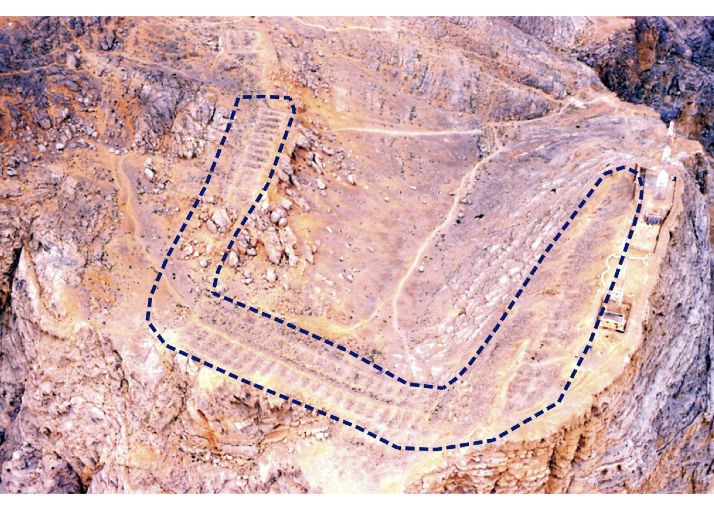
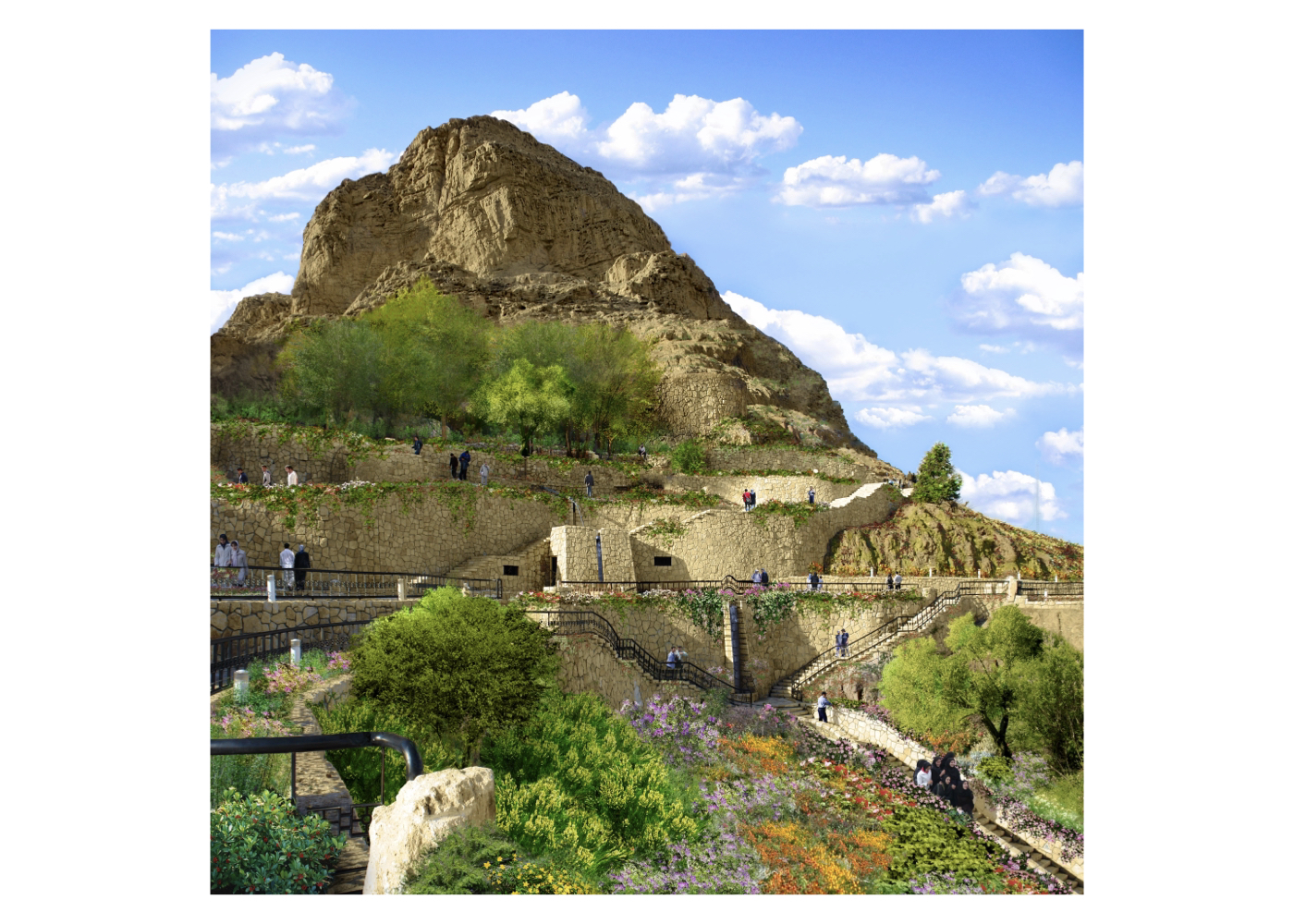
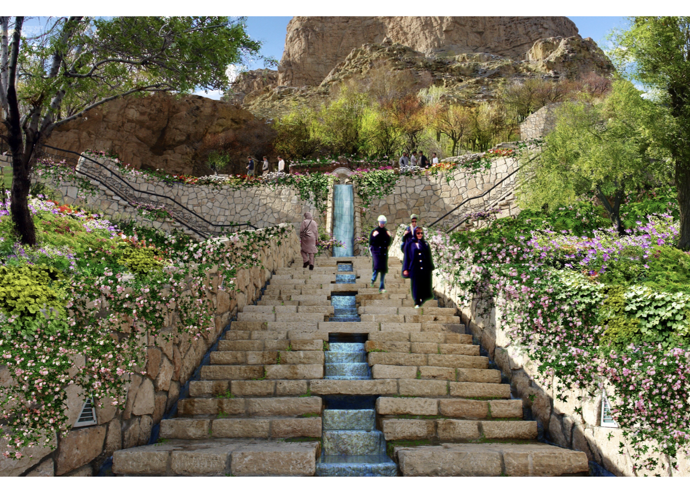
Preventing the ongoing degradation of Mount Soffeh; rehabilitating damaged areas and roads; improving safety along mountain access routes; enhancing environmental quality; restoring the historic Shah-Dezh fortress; establishing a safe connection between two major natural assets—the mountain and the Zayandeh-Rud River; and transforming Soffeh into one of Isfahan’s significant natural–historical landmarks for the future (strengthening the bond between people, the city, nature and history).
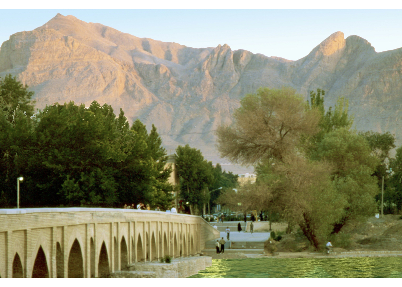
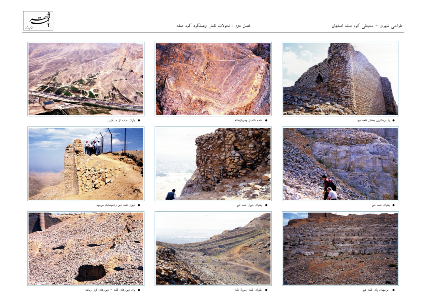
Below the peak lies the Zard Spring, accompanied by a cluster of plane trees and remnants of Safavid-era structures that once served as royal resting and reception spaces. Historically, people accessed the mountain through the gardens of Hezar-Jarib, symbolizing the deep cultural relationship between the people of Isfahan and this natural recreational landscape.
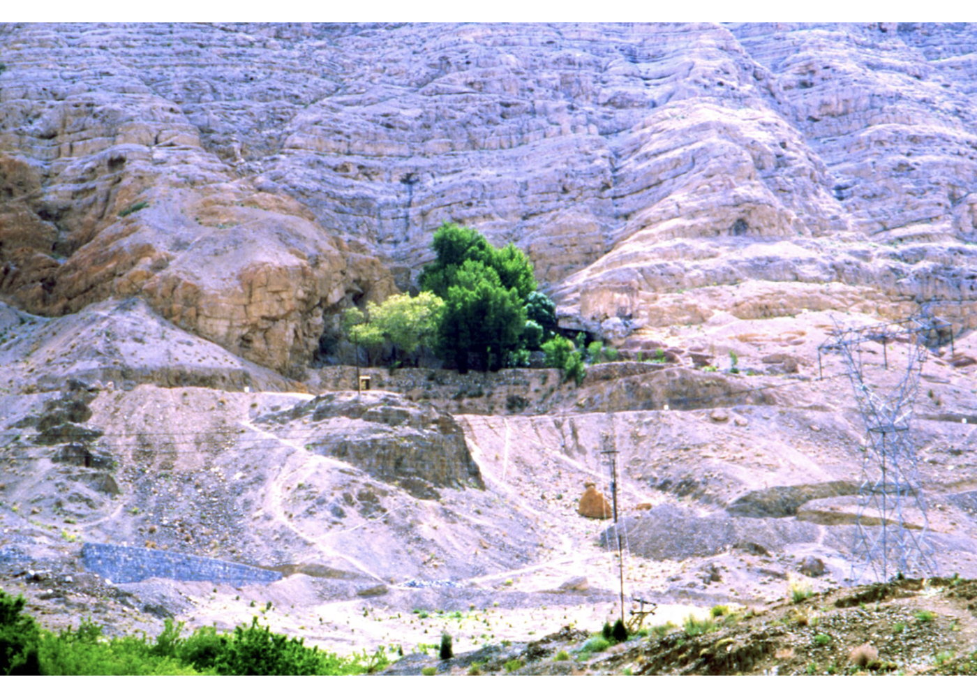
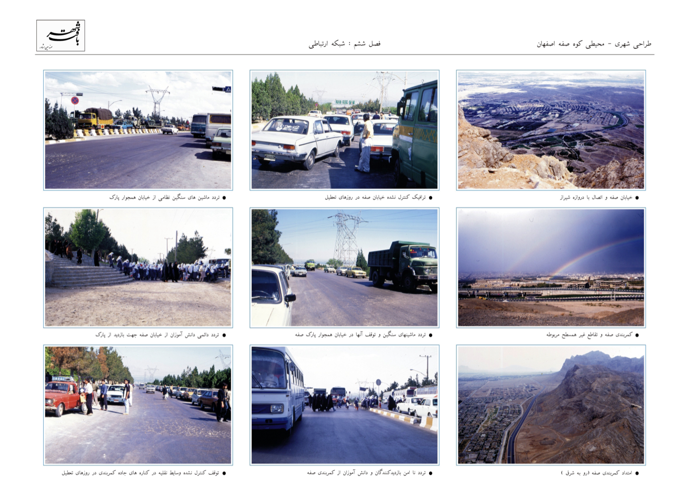
In past decades, lands adjacent to the mountain came under military control, and the slopes were reportedly used for shooting practice. The southern ring highway now passes between the city and the mountain, severing this long-standing public connection and imposing multiple forms of pollution—light, noise, air, and social insecurity—on Soffeh’s valuable natural environment.
Comprehensive studies were carried out across all required environmental, cultural, safety, and infrastructural fields.
Summary of Proposed Ideas and Solutions:
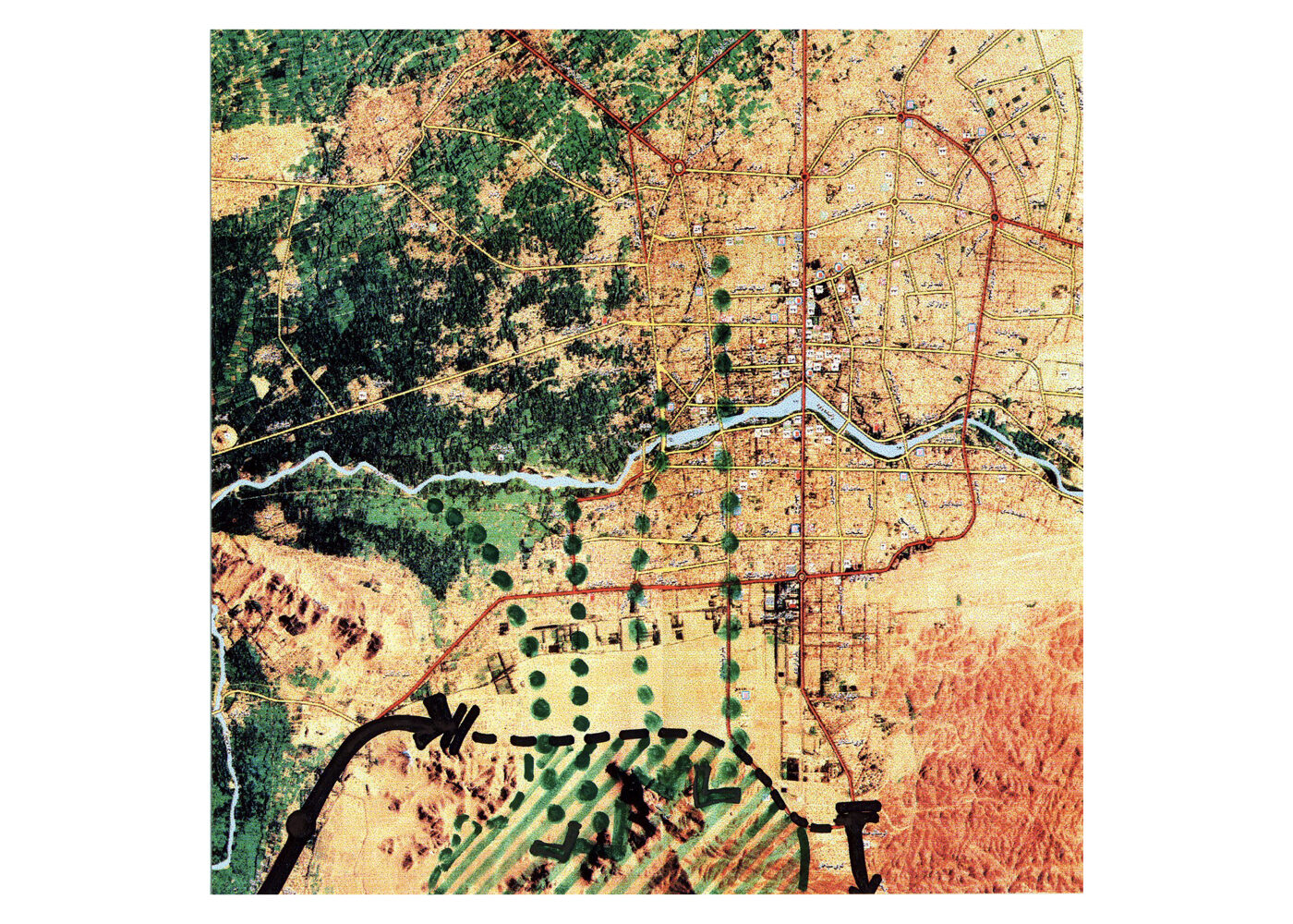
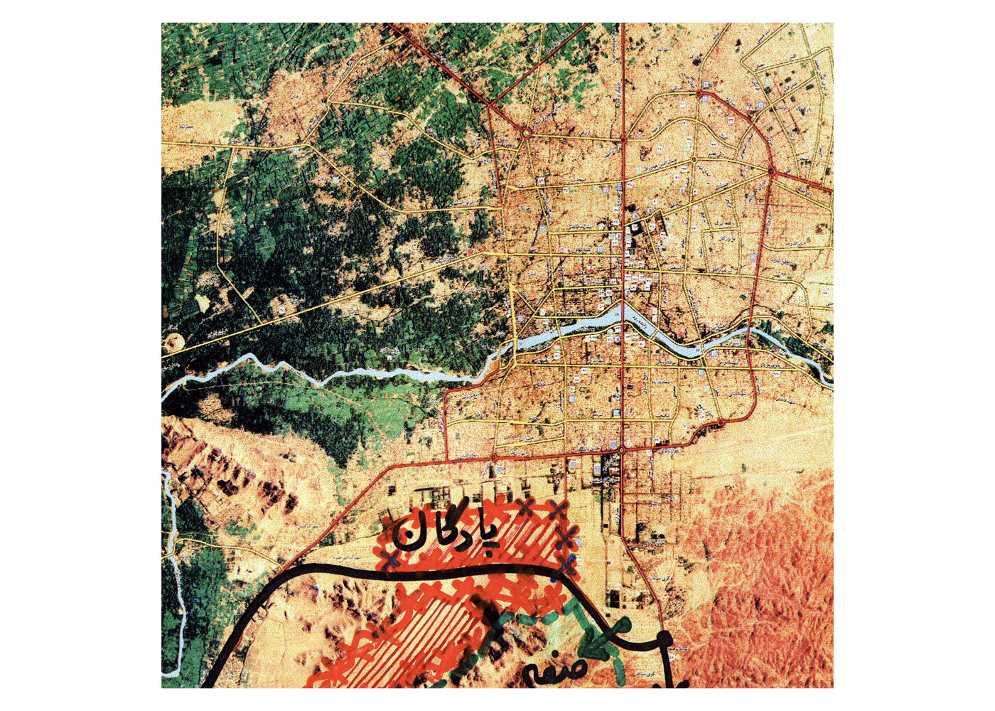
1. Rerouting the western segment of the southern ring highway, which has disrupted safe public access to Mount Soffeh.
2. Designating an alternative route south of the mountain.
3. Transforming the current highway segment into a pedestrian-friendly recreational axis, restoring safe and direct access between the city and the mountain.
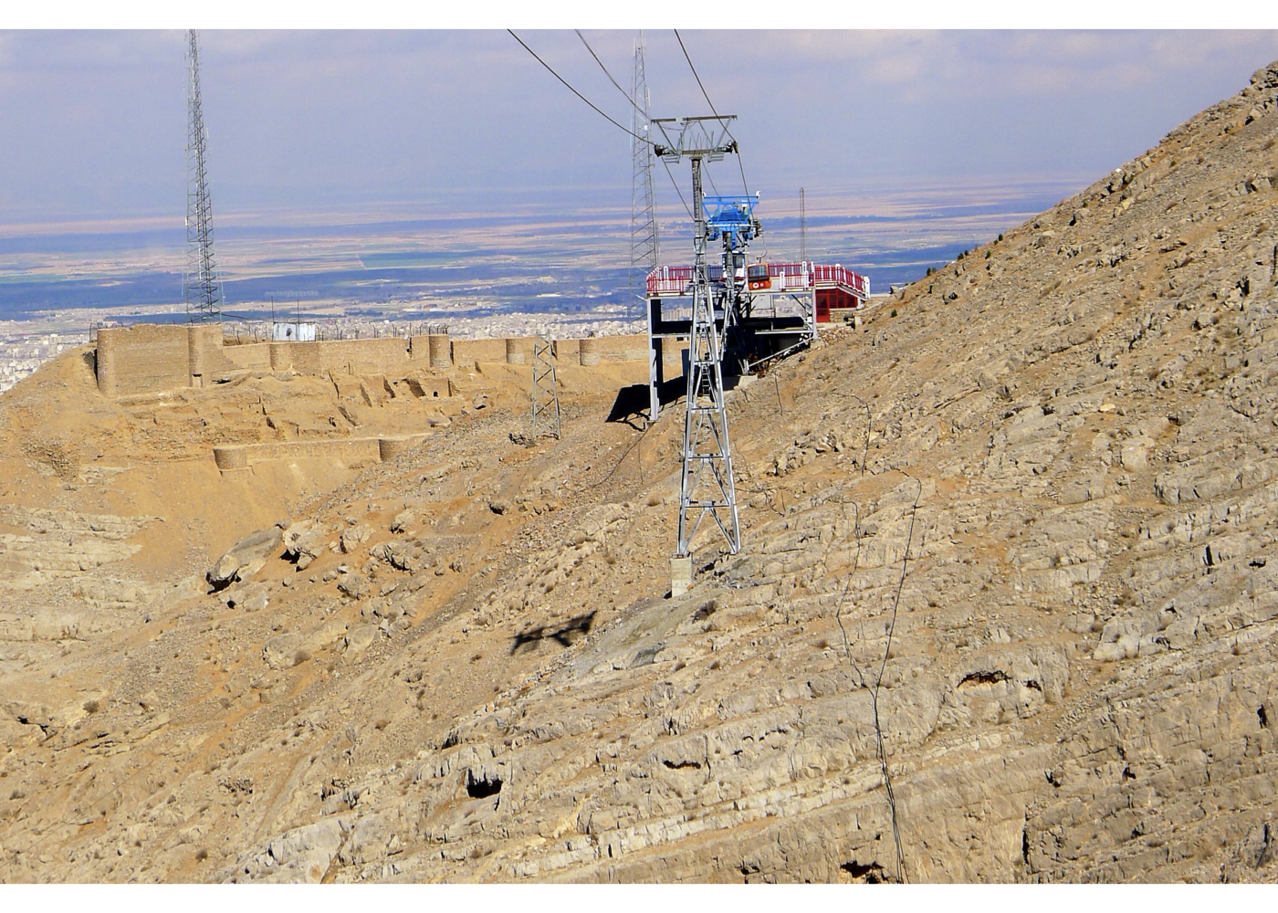
4. Preventing construction of the cable car at the contractor’s proposed location, and relocating it to the former shooting-range area.
5. Redeveloping the shooting-range lands into a tourism and recreation complex.
6. Locating the cable-car station outside the protected zone of Shah-Dezh, at a lower elevation.
7. Enhancing safety along pedestrian trails vulnerable to rockfall.
8. Restoring Shah-Dezh fortress and transforming it into a 24-hour reception, lodging, and sports center for hikers and tourists.
9. Establishing an outdoor sports complex in the northeastern lands of Soffeh.
10. Creating a protected wildlife sanctuary within the flat terrain between the elevations (approx. 200 hectares).
11. Developing pedestrian, bicycle, and tourist-carriage routes connecting Soffeh to the Zayandeh-Rud/Naqsh-e-Jahan Green Corridor through the perpendicular streets.
12. Rehabilitating road-related damages around the Pachenar Spring (the first implemented phase of strategic proposals).
13. Revitalizing all natural springs within the site.
14. Designing multiple entrances from all four cardinal directions, each serving appropriate activities.
15. Creating an open-air music and performance venue overlooking the city of Isfahan.
Project Impact – Outcome:
If fully implemented, the project will reunite Mount Soffeh with the city of Isfahan after many years of separation, restoring a safe and accessible relationship between people, the city, and nature. The three natural jewels of Isfahan — the Zayandeh Rud River, the Najvan Green Complex, and Mount Soffeh — will be linked through continuous green corridors. The Army shooting range will be transformed into a recreational complex, and the various forms of pollution caused by the ring highway will be resolved. Mount Soffeh, similar to the Koohsangi Complex in Mashhad, will evolve into a beautiful parkland composed of gardens serving diverse recreational, athletic, and ecological functions. The area will serve citizens of Isfahan and visitors from across the country day and night, becoming one of the city’s future assets. In doing so, the idea of reconnecting people, the city, and nature in Isfahan will be fully realized and will contribute to the city’s sustainable development.
After the plan was approved, a portion of it — including the Pachenar and Khachik springs and the Zagros House — was designed and carried out under the supervision of the designer, reaching near completion. However, with subsequent changes in management, the later stages were not pursued.
Unfortunately, as happened in the Ganjnameh Valley project in Hamedan, the starting and ending stations of the cable car were constructed by the developers in unsuitable locations.
Kerman [ 1 Project ]
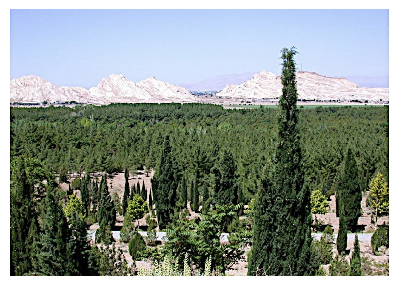
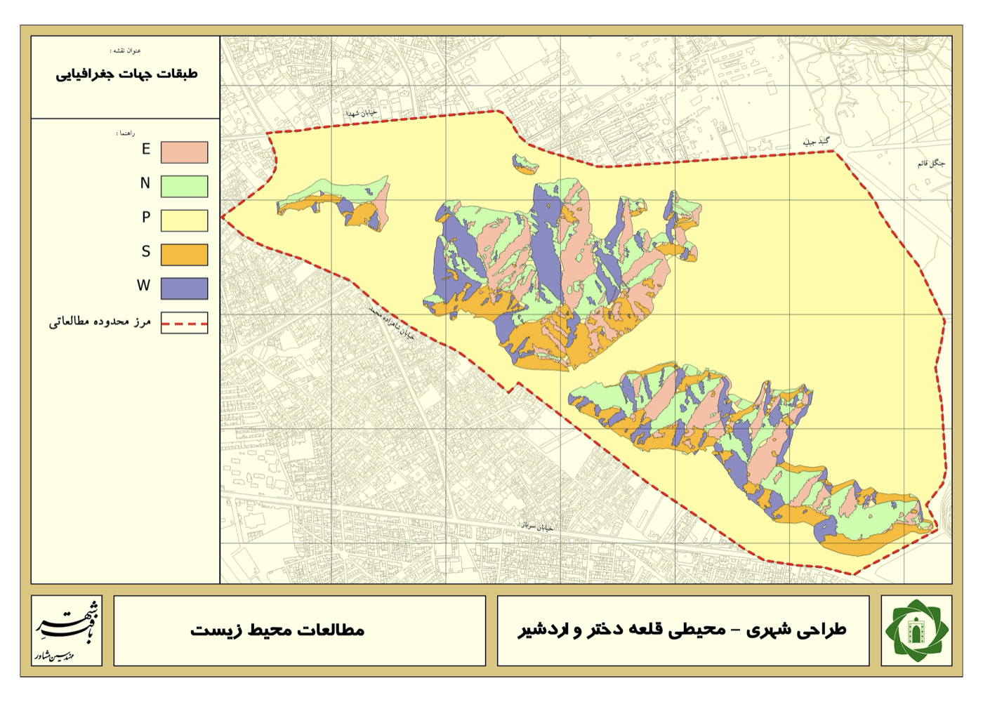
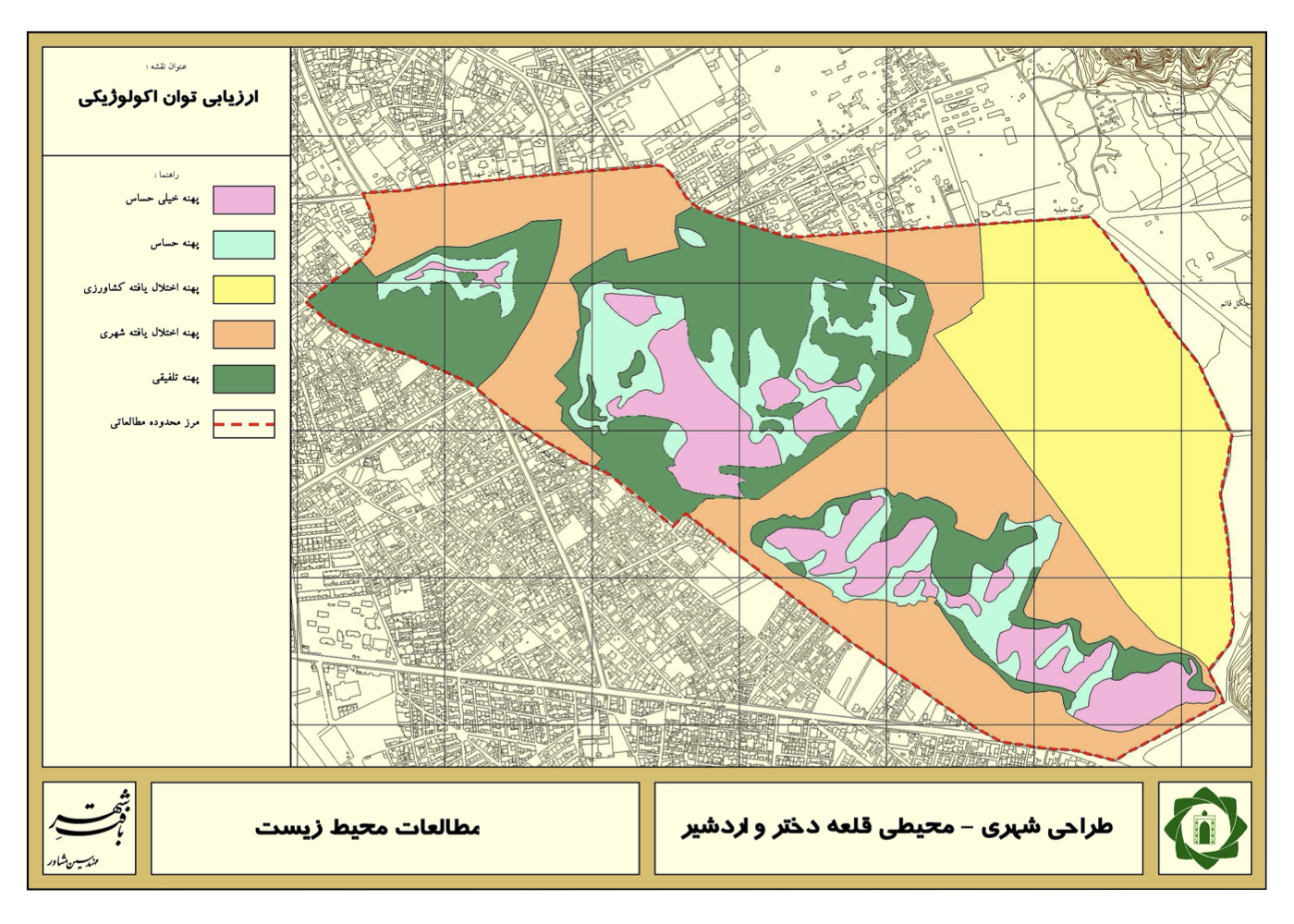
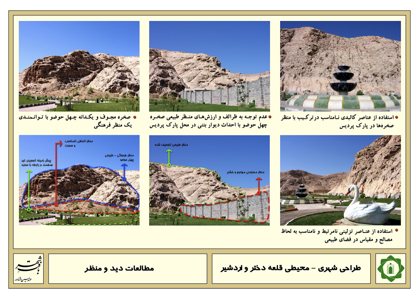
Kerman: Urban–Environmental Design for Ardeshir Castle (Strategic)
Summary of Proposed Strategies:
Organizing the lands surrounding the two castles and proposing a connection between the eastern highlands of the city and the Tāgh forest through the surrounding lands and the castles, extending all the way to the square adjacent to the city’s bazaar.
This creates a continuous link between nature and the bazaar—a connection between people, the city and the natural environment.
Background:
These two castles are currently in a semi-ruined state. Dokhtar Castle dates back to the Median era, and Ardeshir Castle belongs to the Sassanian period. The naming of the castle as “Dokhtar” (“unreachable” or “invulnerable”) reflects the strength of its fortifications and its resistance to conquest by invaders.
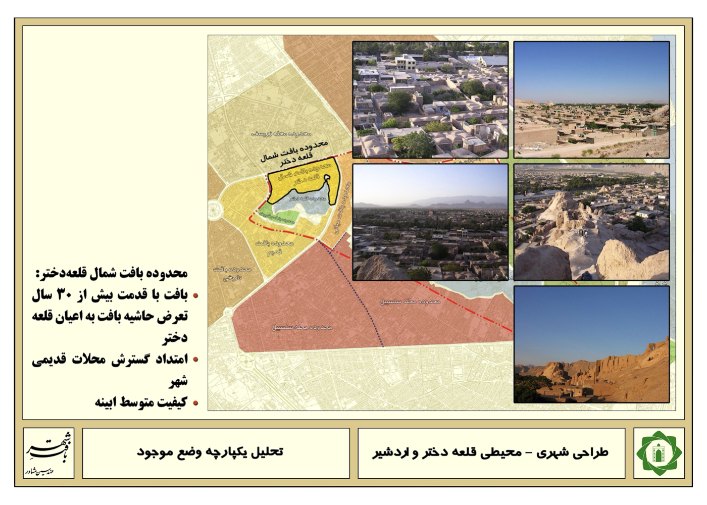
Scope of the Strategic Plan:
The plan involves identifying the capacities, limitations, opportunities, and threats related to these two castles and their surroundings, resolving existing conflicts, and improving the environmental quality of the area.
Extensive unregulated construction has taken place around the castles, in some cases encroaching upon their protective boundaries. A comprehensive study—natural, historical, social, urban, and more—was conducted. One of the major potentials identified was creating a connection between the adjacent highlands (Saheb-al-Zaman) and the large man-made green space in the foothill lands, linking them with the surroundings of the two castles with the possibility of extending this connection up to the square next to the old city bazaar.
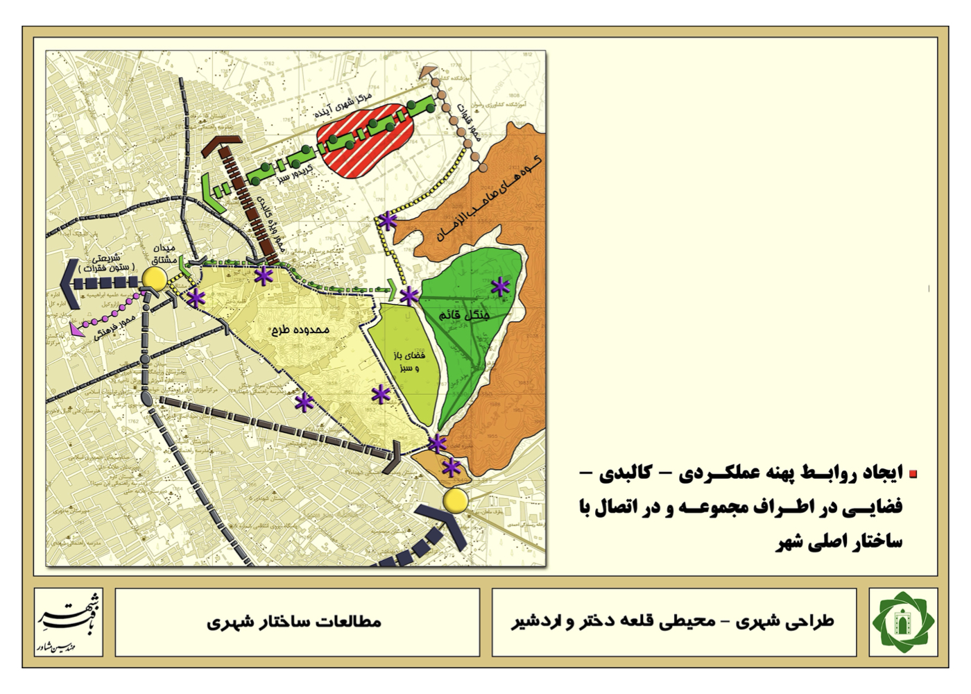
Summary of the Main Ideas, Strategies and Solutions:
Within this framework of existing opportunities, the areas around the two castles, the existing green spaces, and one or two neighboring historical sites were connected to a unified green network through suitable vehicular routes and tree-lined pedestrian pathways. If implemented, this plan would revitalize and rehabilitate the two castles for tourism use. It would link them on one side to the city’s economic center (the old bazaar) and on the other side to the extensive man-made green areas and the Saheb-al-Zaman highlands. Such a connection—bringing together the urban fabric, elevations, green space, historical heritage, and nature—would create a major transformation in enhancing the environmental quality and value of this historic part of Kerman.
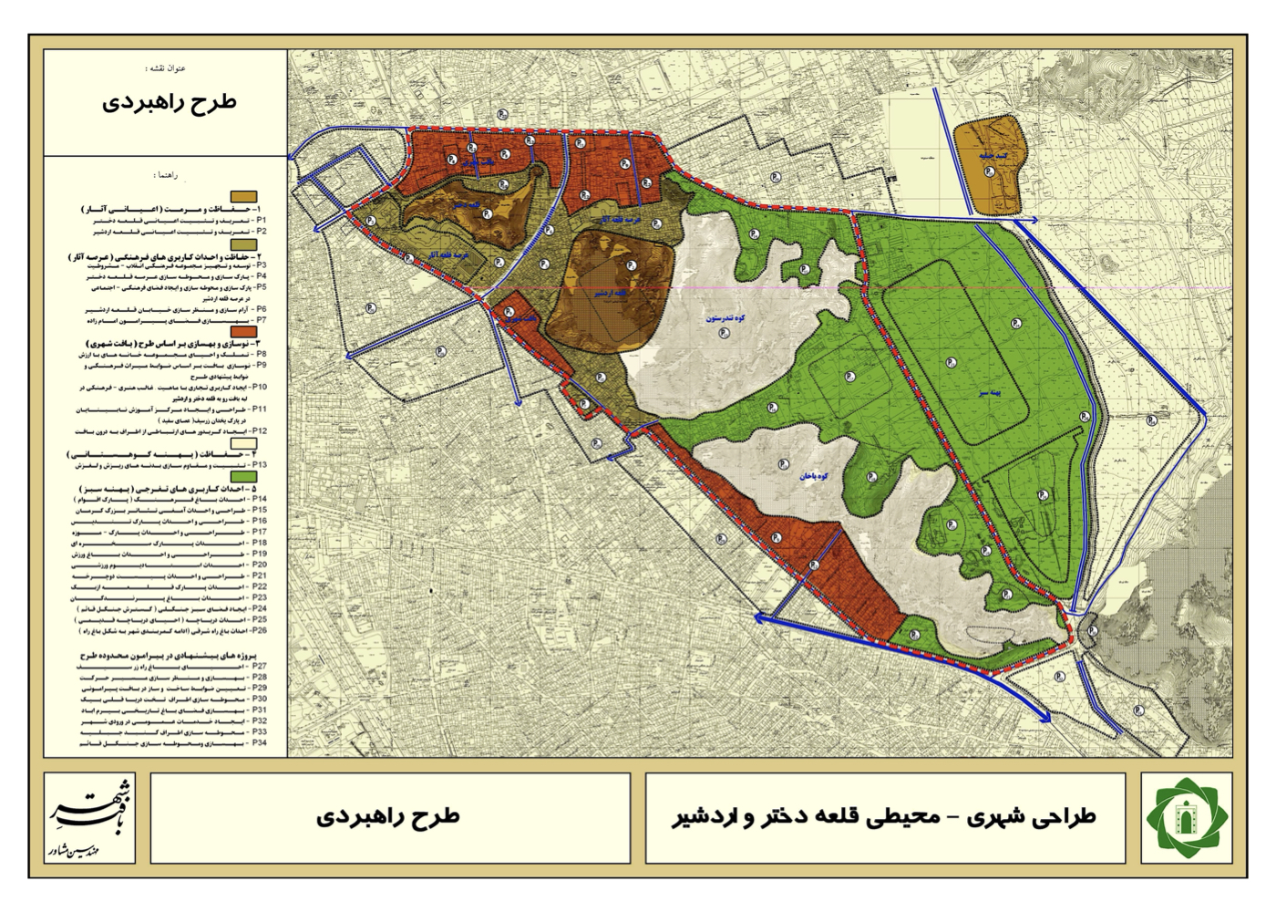
Project Impact – Outcome:
Upon full implementation of the project, a new urban structure will emerge in the city of Kerman. Within a green landscape enriched with sports and recreational activities, the project reconnects citizens and the city with nature and its natural and historical assets — including the northern mountain range, the man-made forest, and the two historic fortresses. This integrated complex will significantly contribute to the city’s sustainable development.
Following the project’s approval, the continuation of subsequent implementation stages was entrusted to the Municipality of Kerman.
Khorramabad [ 2 Projects ]
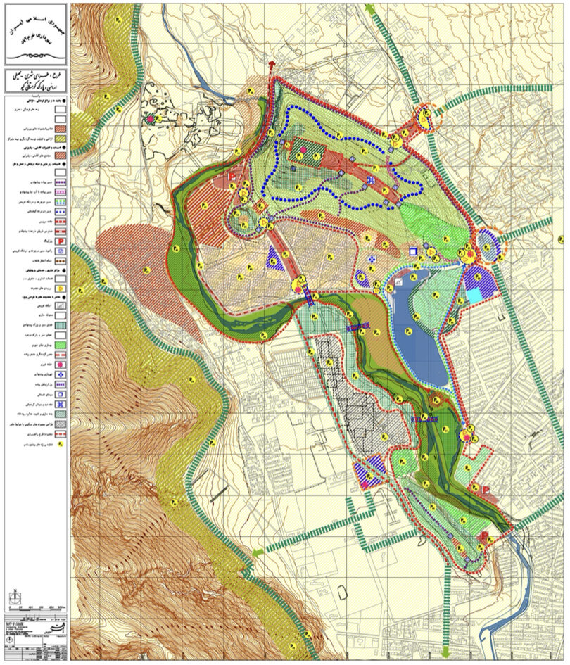
Khorramabad: Urban–Environmental Design of the Kiu Mountainous Area (Strategic)
Summary of Proposal Recommendations:
Transforming the degraded lands along the riverbank and adjacent highlands into a green recreational complex for the public, creating a new tourism attraction for the city, and developing solutions for the city’s springs — reconnecting people, the city and its natural treasures.
Background:
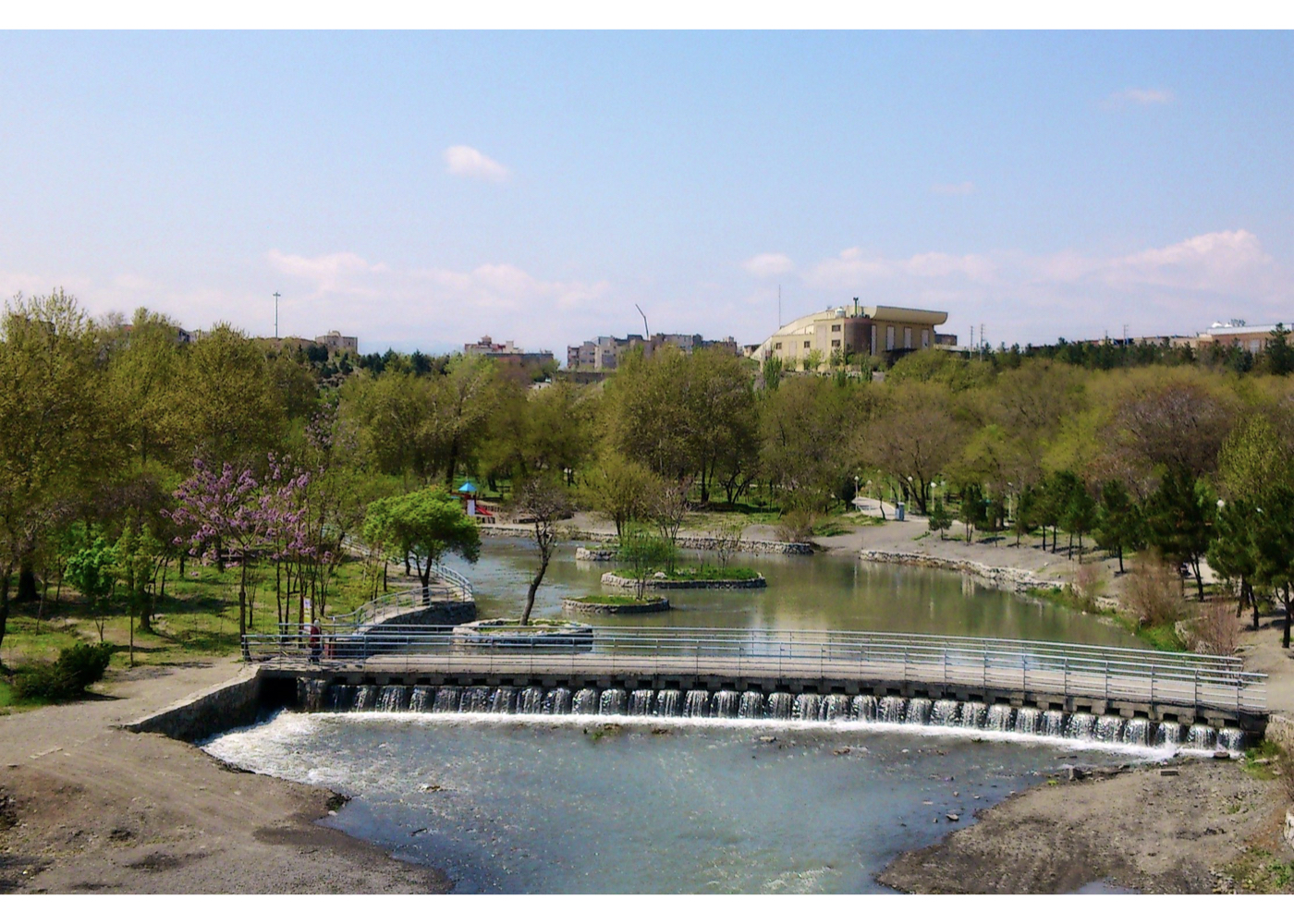
Khorramabad is, in many respects, a unique city in Iran: its several-thousand-year-old history, the unparalleled natural landscape of the surrounding mountains, the abundant river running through its center and the numerous springs scattered across the city — all testify to the “khorrami” (freshness and prosperity) reflected in its name.
After the 1979 Revolution, and especially following the eight-year war, large populations from various parts of the province settled in the city. Naturally, amid the challenges of accommodating this population, planning and attention to natural assets were somewhat neglected. One example is the city’s springs: the comprehensive and detailed plans prepared for Khorramabad could have been structured around these springs and the flow of water through streets and promenades, making Khorramabad one of the few Iranian cities where the freshness of running water and clean springs would be visible everywhere.
One of the oldest springs is the Stone Whirlpool (Gerdab-e Sangi). Unfortunately, unregulated housing has been built around it, the spring has become contaminated by wastewater, and other springs have suffered similar fates. Moreover, the municipality, disregarding the value of running water, has redirected springs into concrete pipes and discharged them as waste into the river. This strategic plan for the Kiu area addresses and highlights these natural values and the city’s environmental heritage.
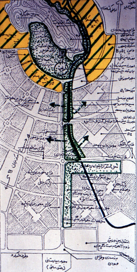
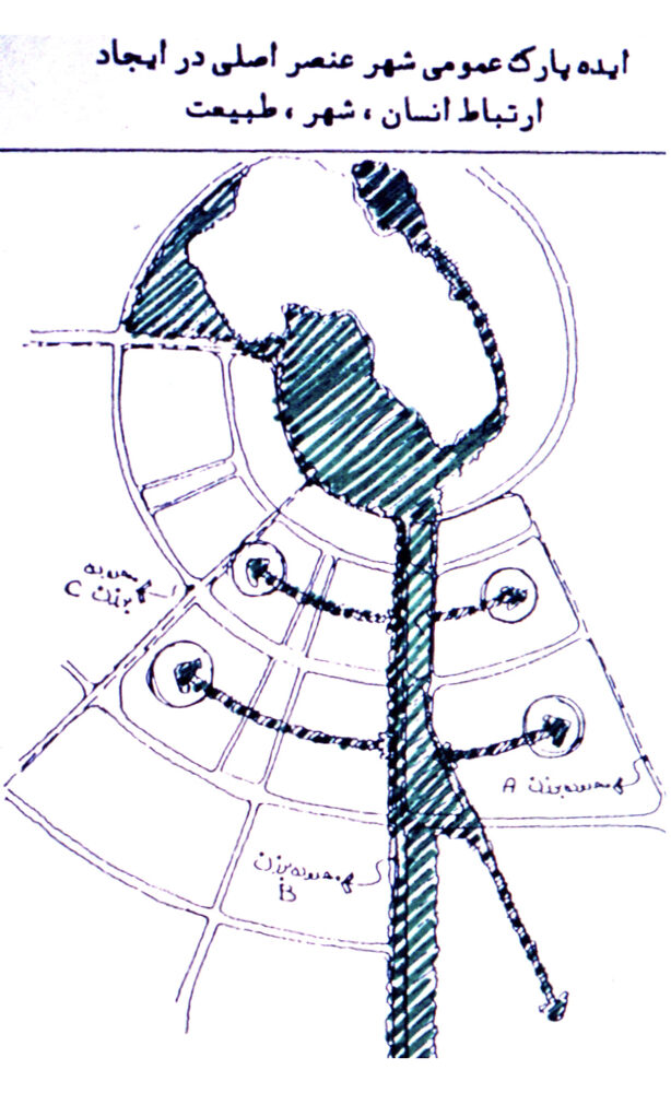
Summary of Ideas, Strategies and Solutions:
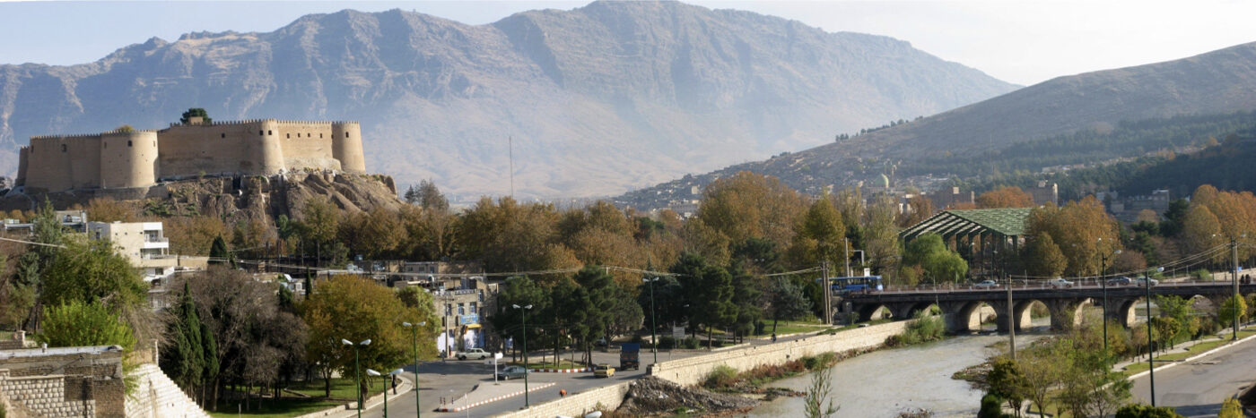
1. Restoring Khorramabad’s historical–natural identity at the metropolitan scale, with emphasis on the city’s three essential elements:
A. Kiu Hill in the north
B. Falak-ol-Aflak Citadel in the center
C. The Broken Bridge Arch (Tāgh-e Pol-e Shekasteh) in the south
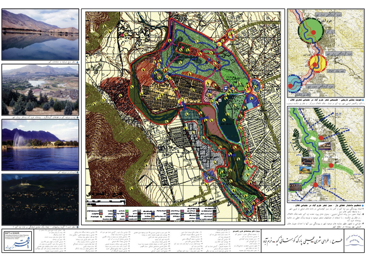
2. Structuring the city’s open and green spaces at the metropolitan scale:
A.Creating continuity between Kiu Hill and the mountainous green belt along the eastern and western slopes of the city
B. Establishing a north–south green axis linking Kiu Hill, Falak-ol-Aflak, and the Broken Bridge Arch by using existing tree-lined streets and developing a linear park along the Khorramabad River
C. Designing and equipping the outlets of the city’s springs and connecting them through a network of natural stream-like channels throughout the city
3. Proposed Projects of the Strategic Plan:
The collection consists of 64 projects designed to realize the overarching concepts mentioned above, including:
A. Expanding green spaces along the river,
B. Extending greenery from the riverfront into surrounding circulation networks and underused areas along the route,
C. Creating an interconnected system of new open and green spaces linked to the city’s existing tree-lined streets, with the goal of revitalizing the true meaning of “Khorramabad”—namely prosperity, vitality and the reconnection of people, the city and nature.
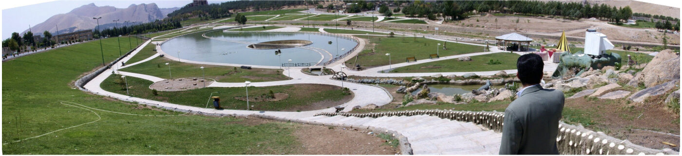
Project Impact – Outcome:
The plan was approved, and part of it—related to the river within the Kiu area—was implemented. However, the original proposal emphasized large-scale tree planting and garden-style landscaping, whereas the executed section mostly consists of lawn and fixed landscape treatments. Nevertheless, even this level of implementation is worthy of acknowledgment.
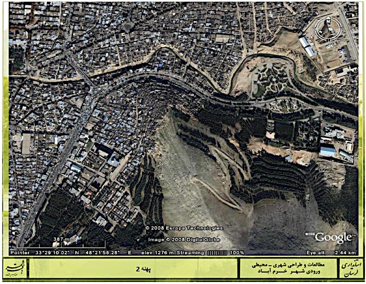
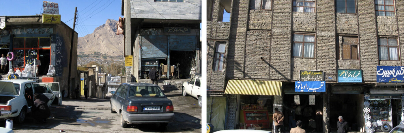
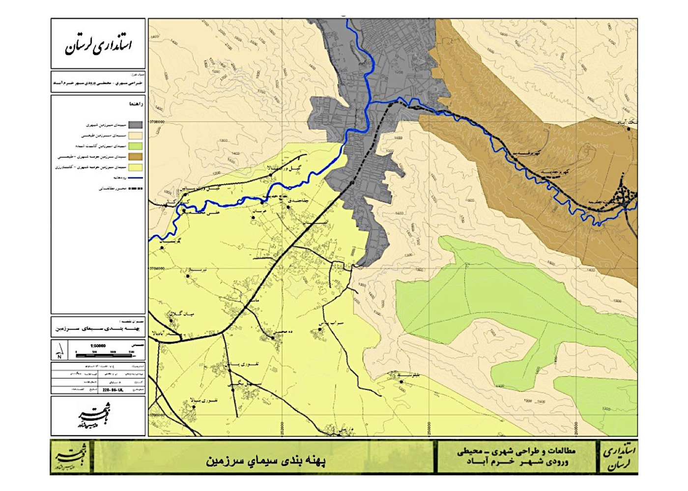
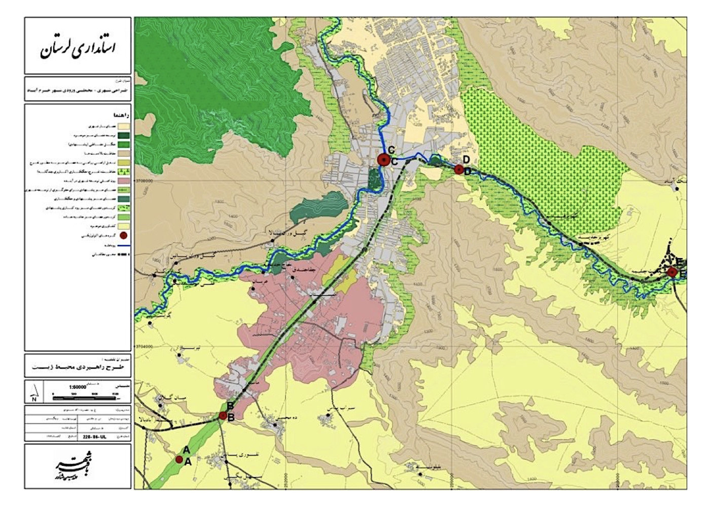
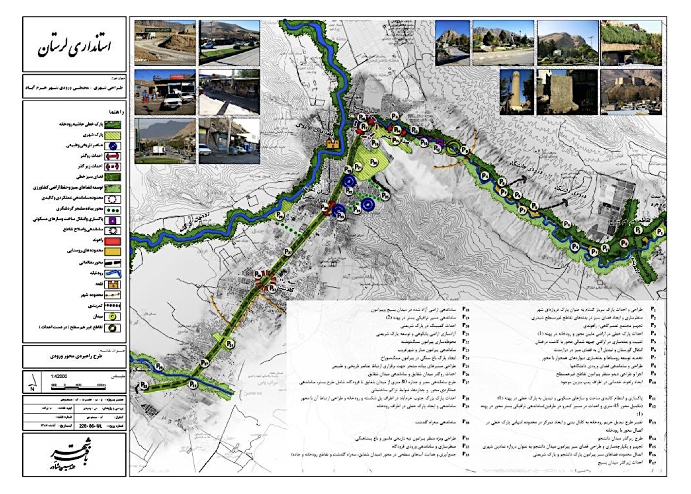
Khorramabad: Urban–Environmental Design of the City Entrance and Transit Corridor (Strategic, Design and Implementation)
Summary of Proposal:
Revitalization and reorganization of the corridor, transforming its function from roadside transport services into a vibrant urban street with pedestrian paths, trees, greenery, running water, and day-and-night activity. The design establishes structured connections with surrounding hillsides and key points of the city to enhance Khorramabad’s tourism potential—strengthening the bond between people, the city, and nature.
Background:
Khorramabad is an ancient city located in a valley in Lorestan. Its name reflects prosperity and liveliness.
The city forms a unique mosaic of natural elements—mountains, foothill plains, valleys, rivers, abundant springs, and centuries-old trees. With active protection (maintenance paired with nature-aligned use), Khorramabad could become one of Iran’s exemplary model cities.
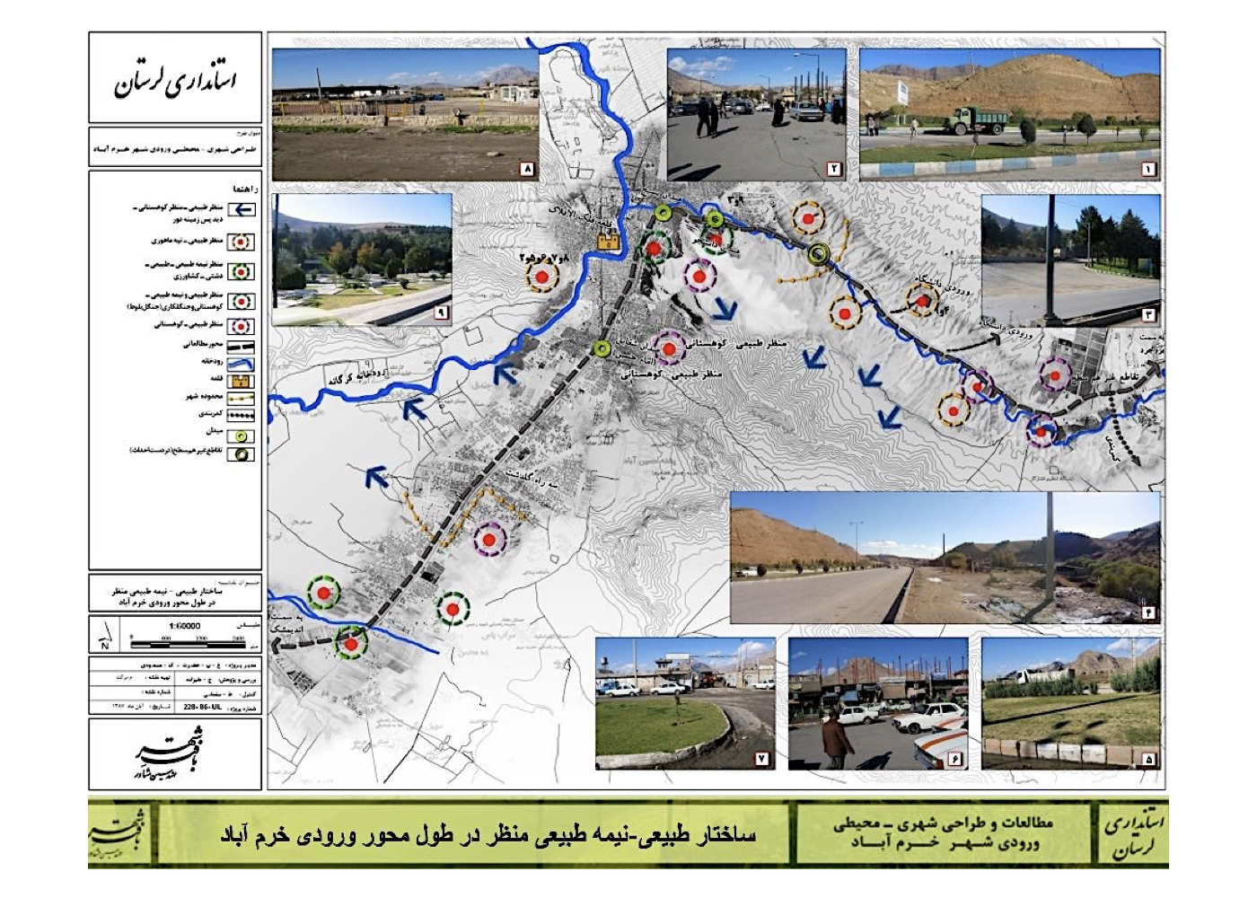
Situated along the national north–south route, the city’s main through-axis has unfortunately turned into a chaotic and unattractive service corridor for transportation. The designed section is 17 km long and 100 meters wide, extending up to the surrounding highlands and, within the natural environment, without strict width limitations where required.
Summary of Concepts, Strategies and Solutions:
1. Revitalization of the corridor base and façades:
2. Transforming the corridor’s land-use from transport services/repairs to tourism
3. Locating tourism-compatible activities along the route
4. Organizing the network of connections to the city
5. Creating a safe pedestrian network with bicycle and visually-impaired paths
6. Developing greenery and running water reminiscent of the city’s historic streets
7. Organizing and enhancing the urban landscape quality of façades
8. Designing functional connections between land uses and existing rock formations
9. Enhancing the visibility and prominence of historical buildings from the route
10. Organizing pedestrian paths to adjacent heights and urban routes
11. Integrating scattered vacant lands with pedestrian networks
12. Connecting parks and peripheral green spaces to the corridor
13. Incorporating a tramway route
14. Designating locations for installing historical sculptures
15. Attractive nighttime lighting design
Project Impact – Outcome:
The implementation plans have been approved, and part of the project has already been carried out at Shaghayegh Square. The full execution of the project is being undertaken by the municipality.
It is hoped that, once fully completed, this project corridor will become one of the enduring assets and identity landmarks of the city of Khorramabad.
Kish [ 1 Project ]
Kish: Eastern Coast Revitalization – 22 Sea-Perpendicular Axes (Strategic)
Summary of Proposed Plan:
Reconnecting the city and commercial areas with the sea and developing day- and night-time coastal tourism (linking people, city, and nature).
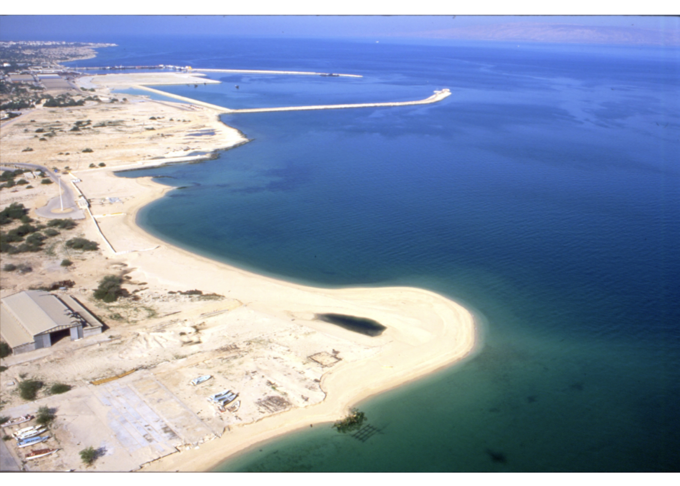
Background:
In the 1970s, Kish Island was planned, designed, and built as a recreational–touristic center for affluent social groups. After the changes following the Revolution and the Iran–Iraq War, the area was designated as a free zone. This led to significant investment in new commercial complexes. Over three decades, the public’s increasing interest in tourism and extended stays on Kish resulted in new investments in residential complexes and hotels.
Despite the island’s natural qualities—its scenic landscapes and high-quality coastal waters—the first and second masterplans paid little attention to these environmental values. This neglect became so pronounced that even a wrecked Greek ship was promoted as the main attraction of the island’s shores.
To compensate for this oversight, the first major step was to plan the revitalization of Kish’s eastern coastline. In addition to providing strategies to improve the coastal environment, the plan sought to facilitate stronger, more direct connections between the city, its residents, visitors, and the sea.
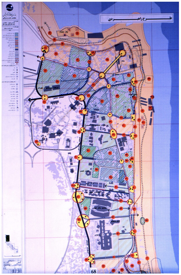
Summary of Strategies and Interventions:
1. Maximizing the release of coastal lands from buildings and activities incompatible with tourism
2. Creating connections between open/green spaces and the shoreline
3. Zoning marine activities and aligning the coastline with those uses
4. Identifying significant coastal and urban landscape viewpoints
5. Proposing the design and construction of landmarks at key nodes
6. Organizing suitable spaces for ceremonies and public events
7. Opening visual corridors from various points in the city toward the sea
8. Designing and improving the quality of the 22 axes perpendicular to the sea
Project Impact – Outcome:
If the plan is fully implemented, the city will be reconciled with nature (the sea and the shoreline), restoring the severed connection between the urban fabric and the natural environment—an outcome that will contribute to the sustainable development of Kish Island.
Following the approval of the plan, improvement and reorganization works were carried out along two streets perpendicular to the coastline.
Mashhad [ 5 Projects ]
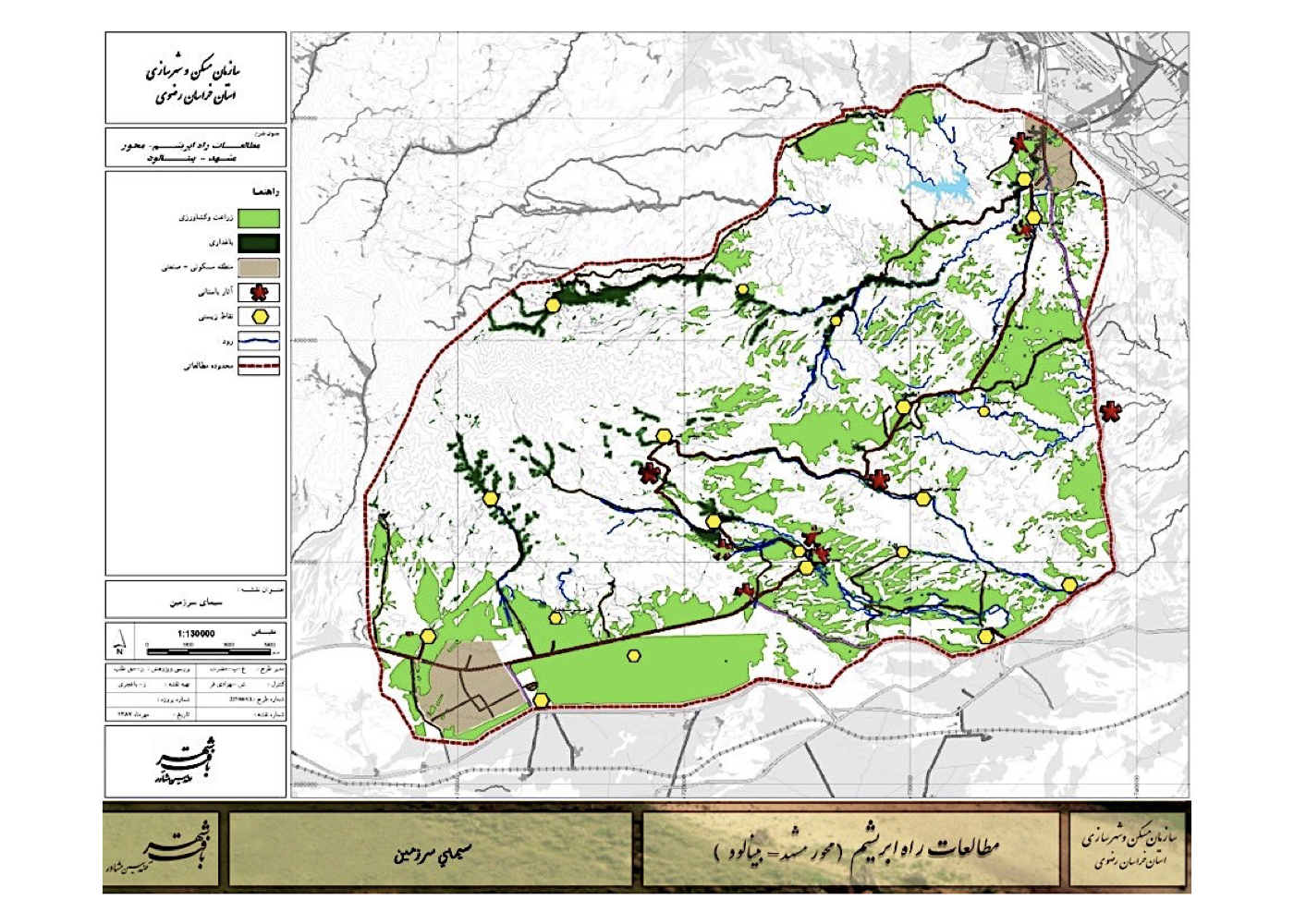
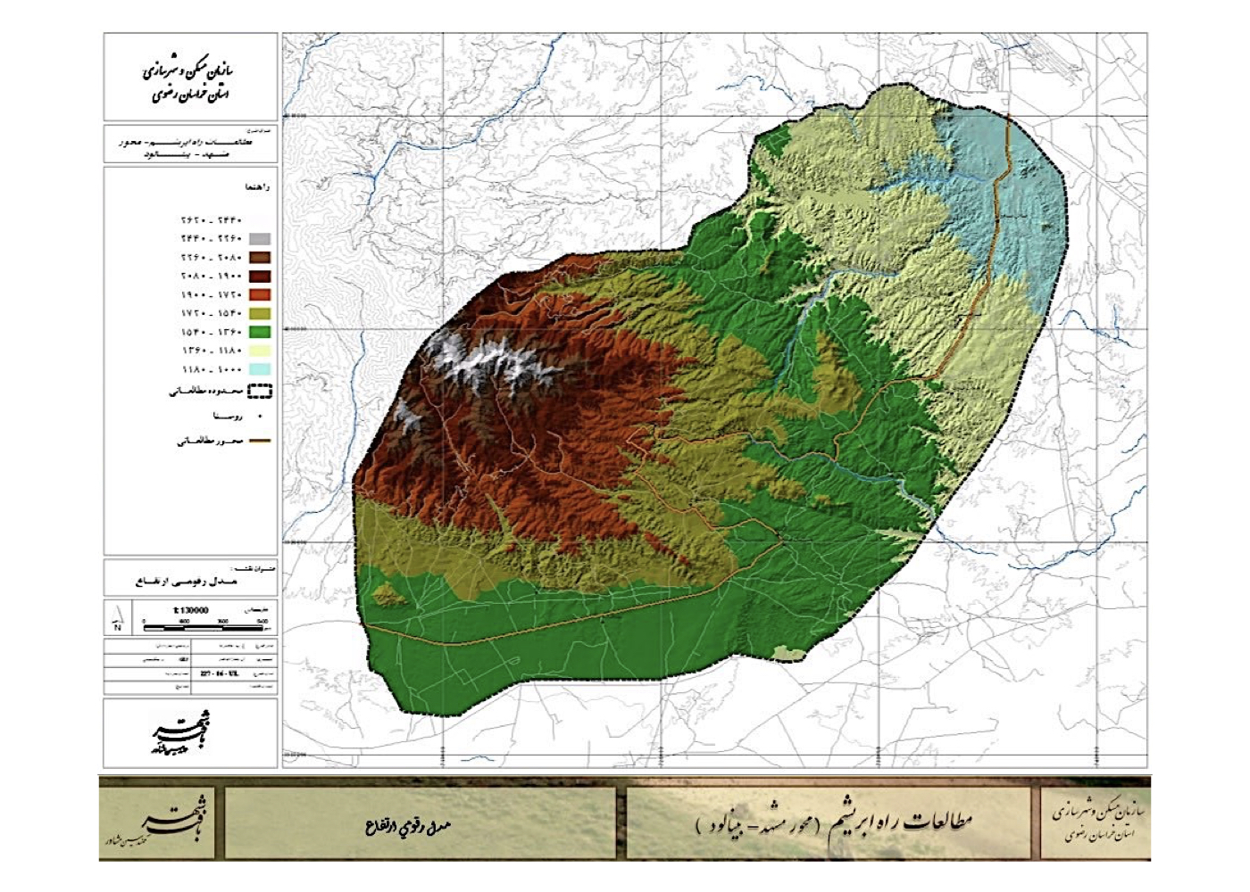
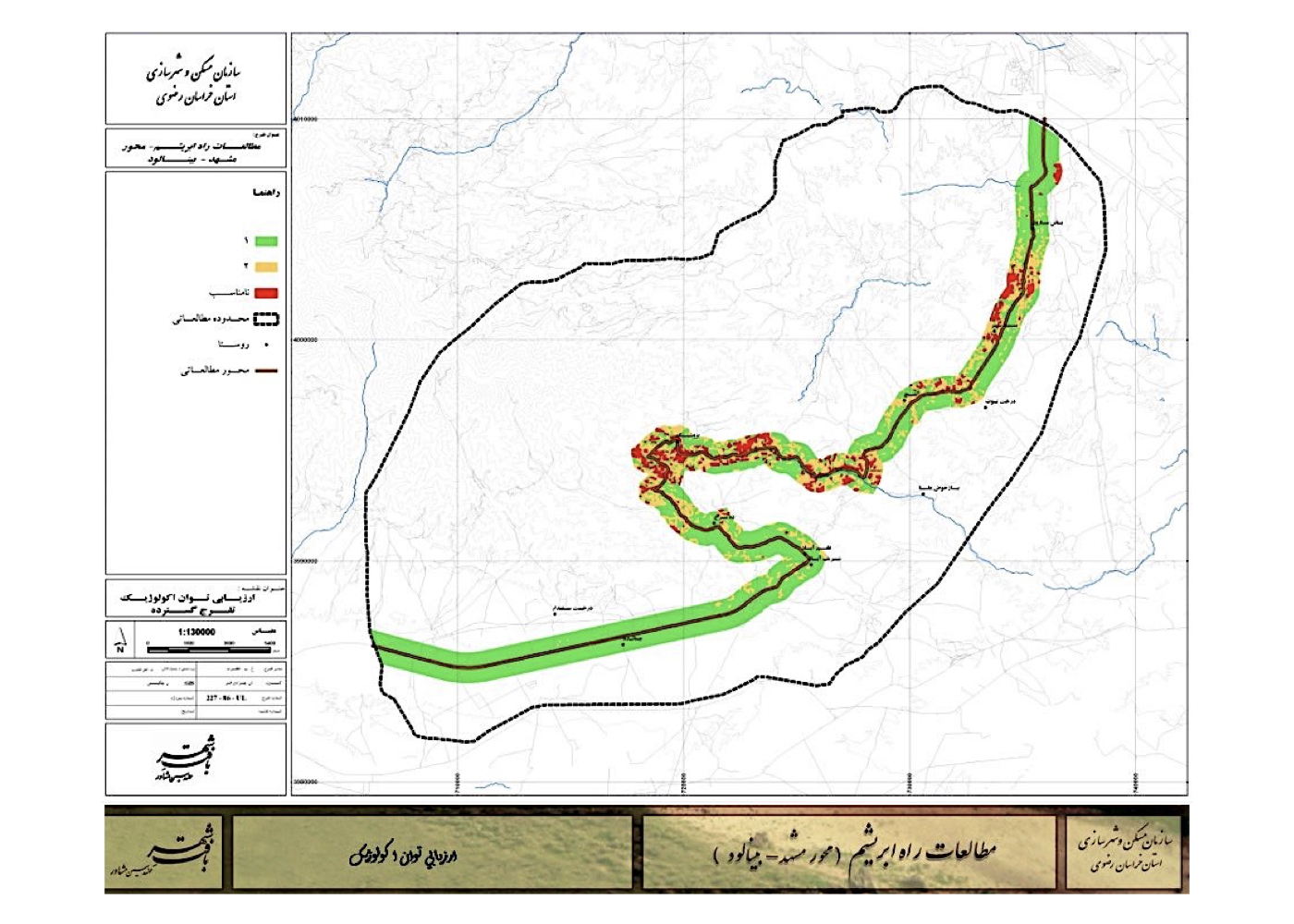
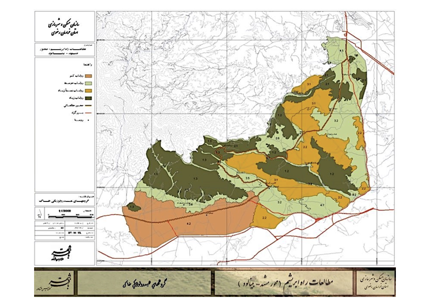
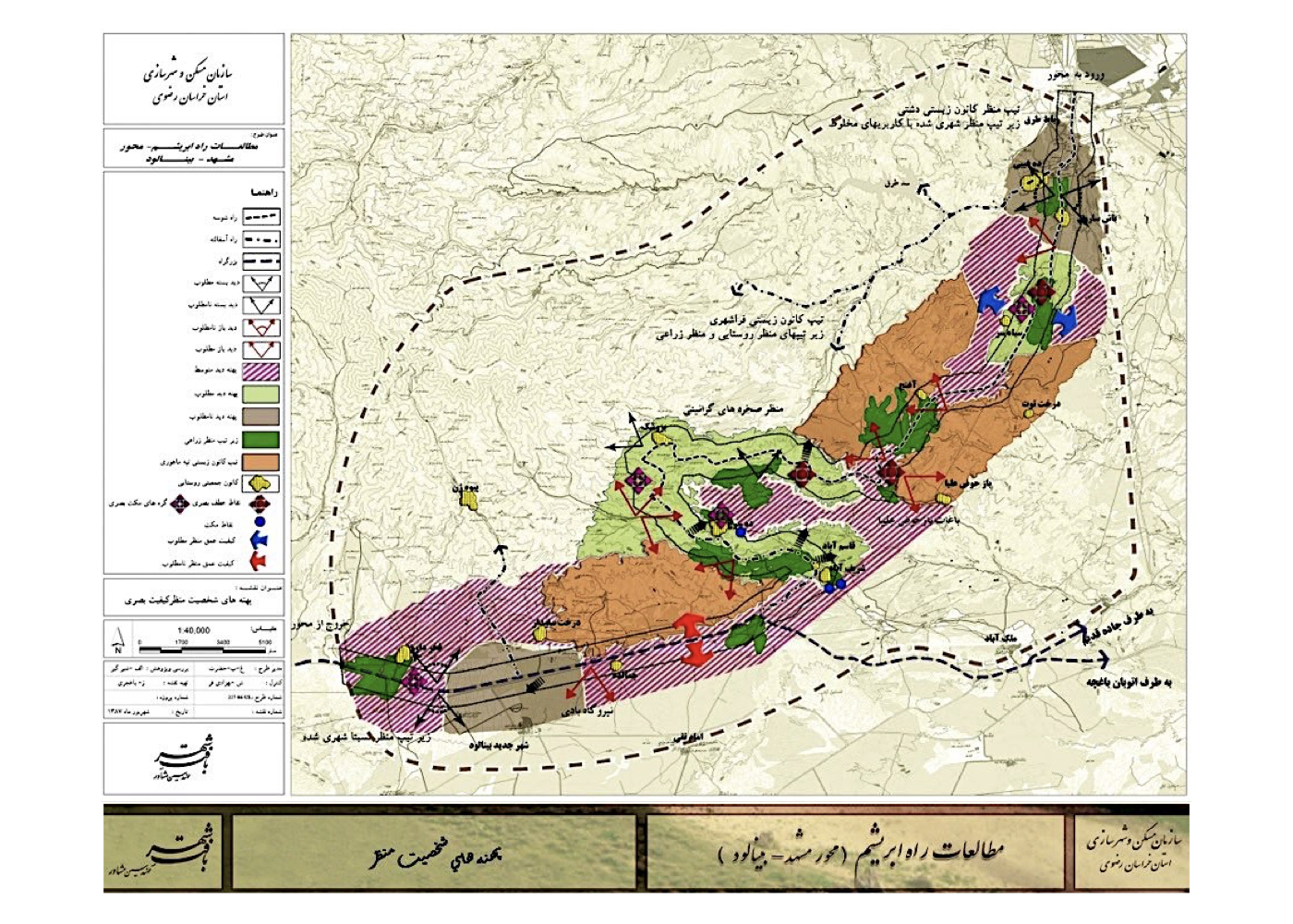
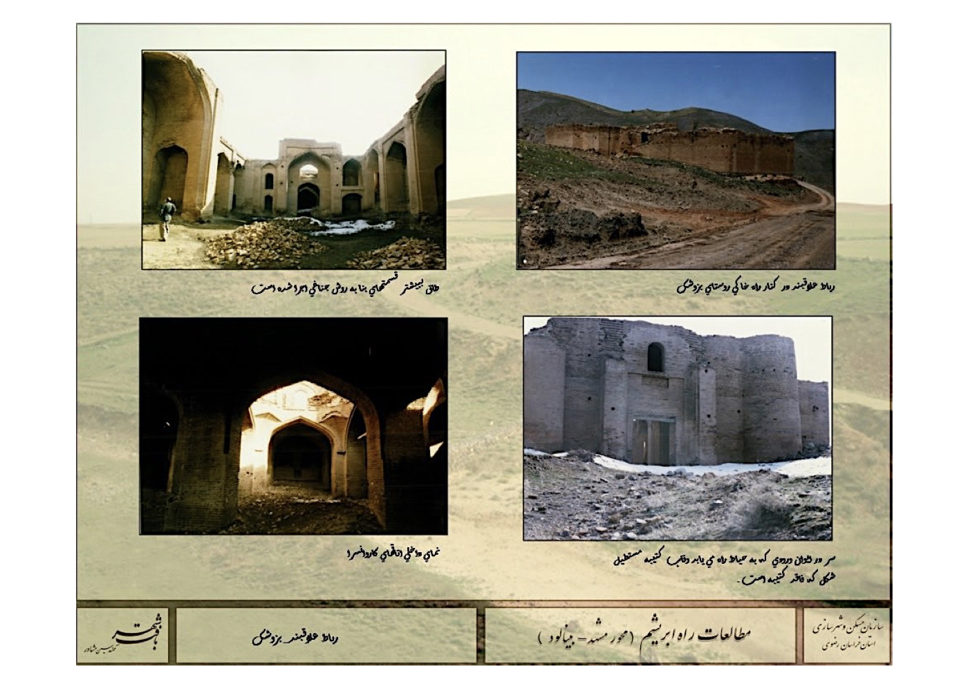
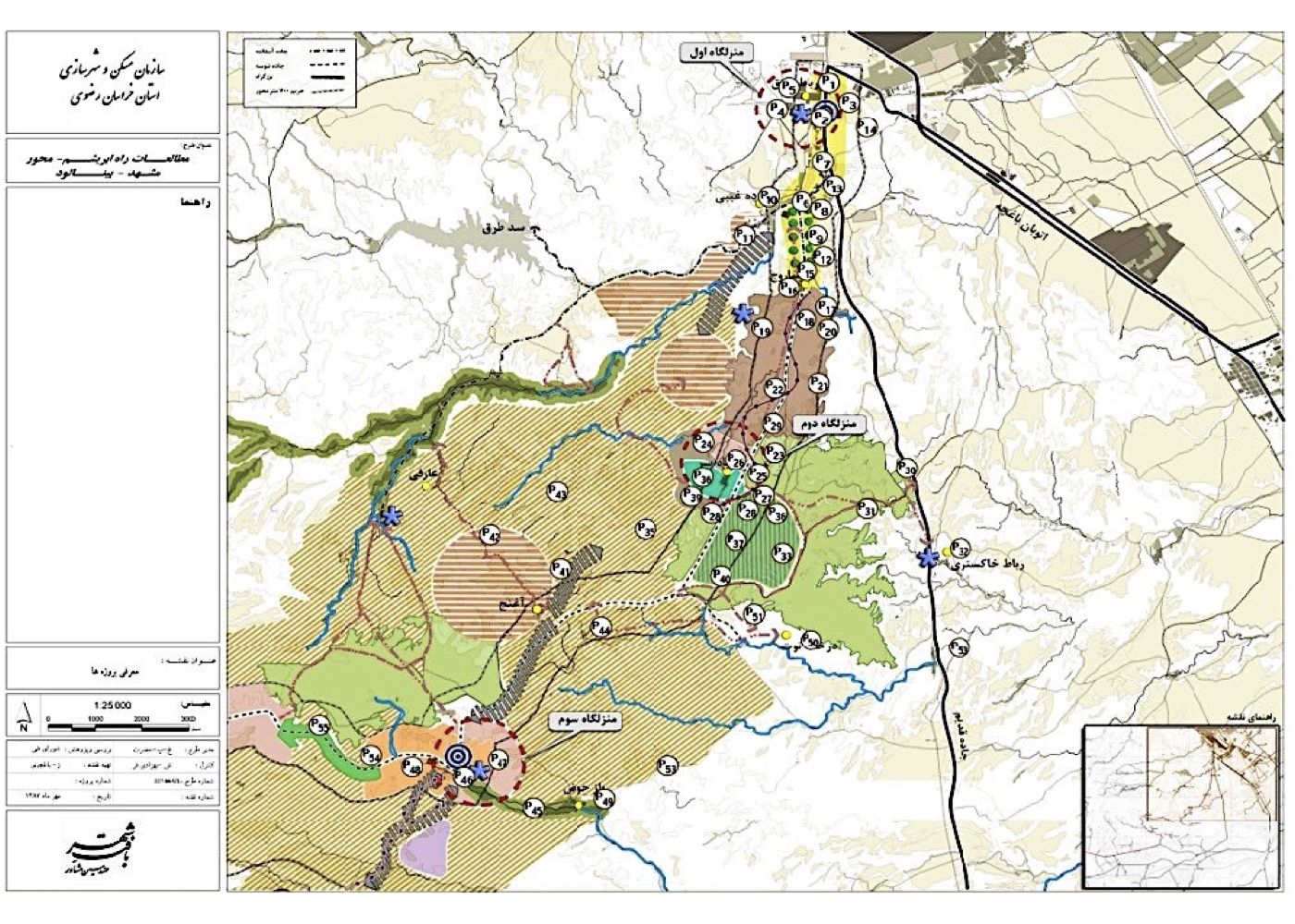
Silk Road Corridor Studies – From Mashhad to the New City of Binalud (Strategic)
Summary of Proposal:
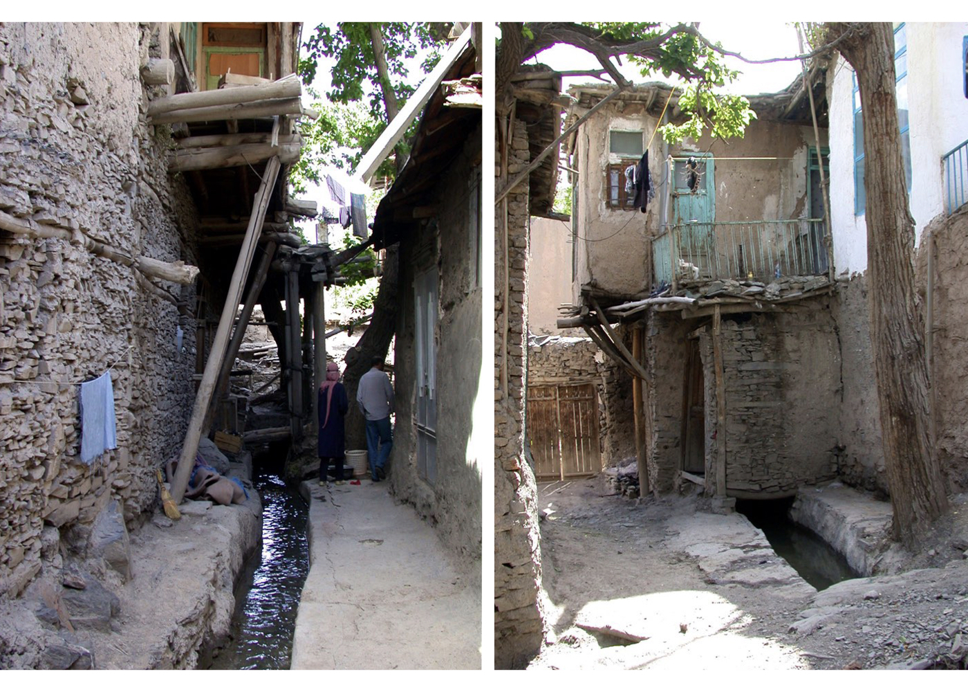
Revitalization and restoration of the corridor—enhancing the spatial quality of the historic Silk Road route, its villages and existing heritage structures—with the aim of strengthening the tourism capacity of the province, Mashhad and Neyshabur, supported by the new city of Binalud located midway along the route. Connecting people and cities with nature and history.
Background:
The Silk Road was one of the oldest routes connecting East Asia to Europe over several centuries, passing through the Tus–Neyshabur corridor in present-day Iran. In recent years, with China’s efforts to reconstruct these routes for political and economic purposes, significant activities have been undertaken by the countries along the path, which can contribute to the expansion of tourism.
The studies for this project—similar to other projects of this type—were carried out in the fields of environment, landscape and visual analysis, geology, soil science, vegetation, green spaces, hydrology, transportation, urban planning, architecture, history, sociology, tourism, economics, infrastructure, international case studies, and more.
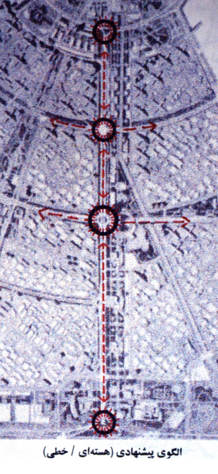
Summary of Concepts, Strategies and Solutions:
Two tourism-development models were proposed:
1. A tourism-based development structure with a policy of minimal intervention in the existing fabric.
2. A model based on the density and concentration of key tourism elements.
Project Impact – Outcome:
The full implementation of this plan can lead to an improvement in the quality of the villages and the connecting route. It will also contribute to the development of intercity tourism and may, within the framework of China’s Silk Road initiative, become part of an international tourism project. The plan has been approved and will be followed up by the Governor’s Office.
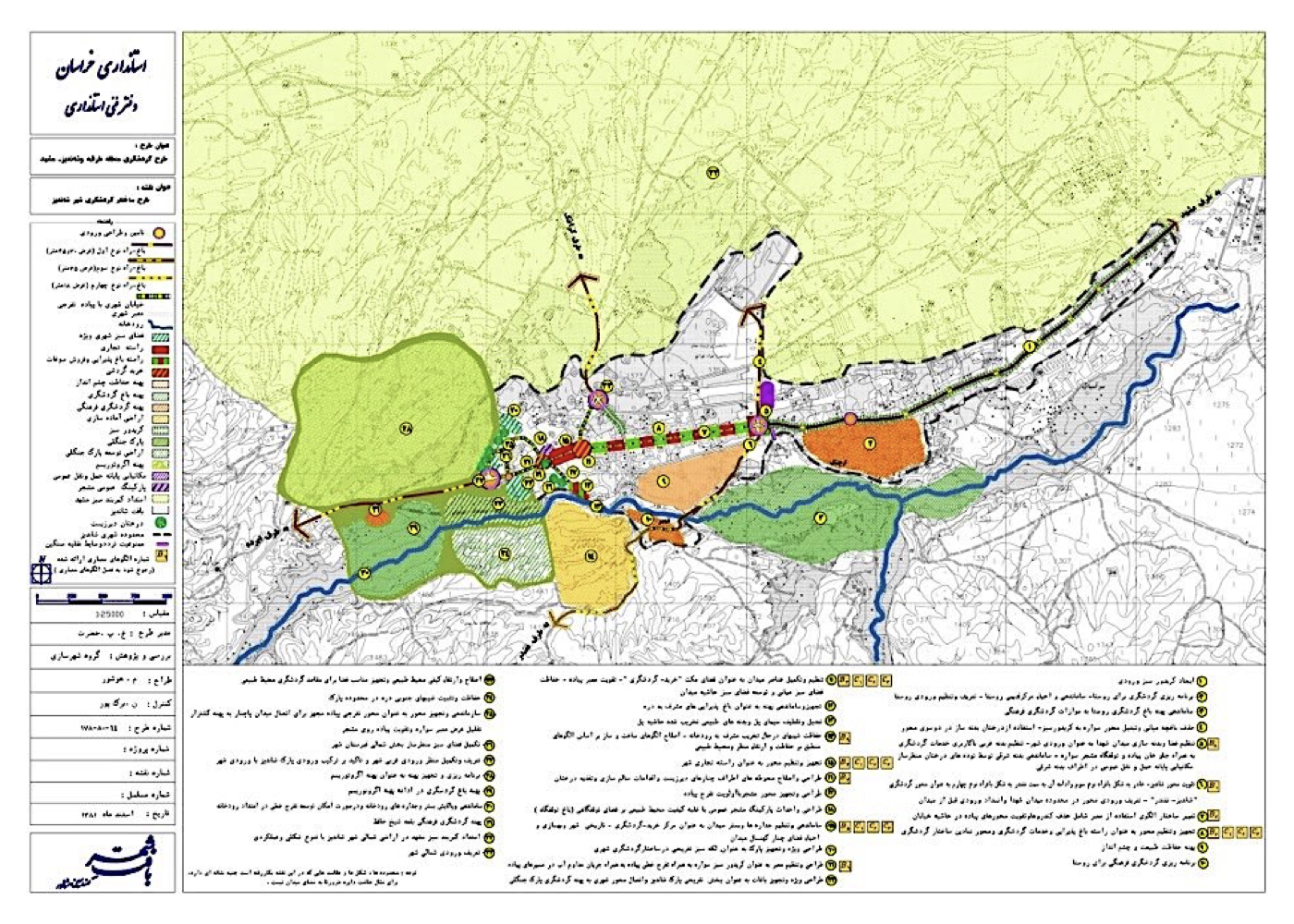
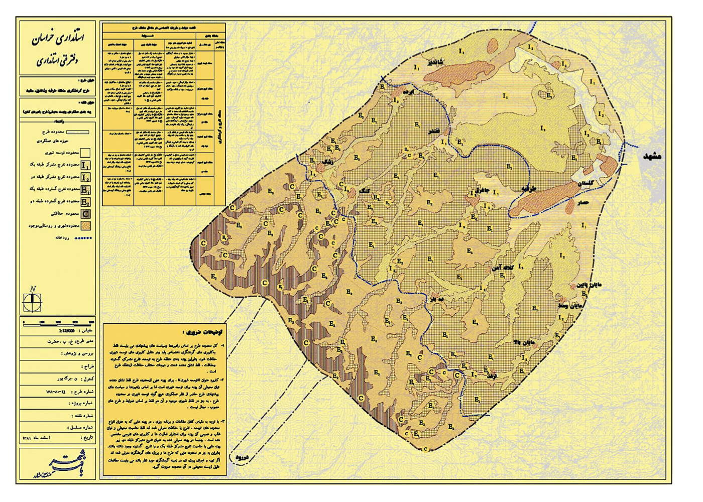
Mashhad: Tourism Development in the Valleys of Torghabeh, Shandiz, etc. (Strategic)
Summary of Proposed Strategies:
Tourism development studies were conducted for the Torghabeh–Shandiz valleys and their associated highlands, with the aim of restoring and preserving the natural values of these towns, rehabilitating river corridors, and safeguarding other natural, historical, and architectural assets as the foundation for sustainable development. In parallel, the study proposed equipping other valleys of the Binalud range for sustainable and nature-based tourism in order to reduce pressure on the Torghabeh and Shandiz valleys.
Additional objectives included the development of mountaineering and hiking activities through an equipped connection between the northern and southern valleys of the Binalud range (across the highlands), preventing environmentally incompatible construction—particularly within valley and highland areas—defining emergency actions within the framework of the plan, and emphasizing environmental impact assessment for medium- and large-scale projects.
Background:
Develop tourism within the Torghabeh–Shandiz valleys and surrounding highlands through the restoration and preservation of the area’s natural assets, revitalization of the rivers, and protection of historical, architectural, and ecological values. The goal is to establish a sustainable urban development model, strengthening the connection between people, the city, and its natural heritage. The capacities of each valley can also be used to support and complement one another.
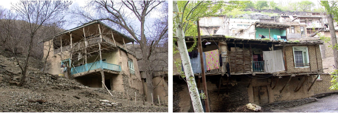
Torghabeh and Shandiz are well-known destinations for tourists and pilgrims visiting Mashhad. Beyond these two cities, several beautiful villages—such as Mayan, Zoshk, Ganegh, Abardeh, Maghan, and others—lie within Mashhad’s surrounding valleys along the northern slopes of the Binalud mountain range.
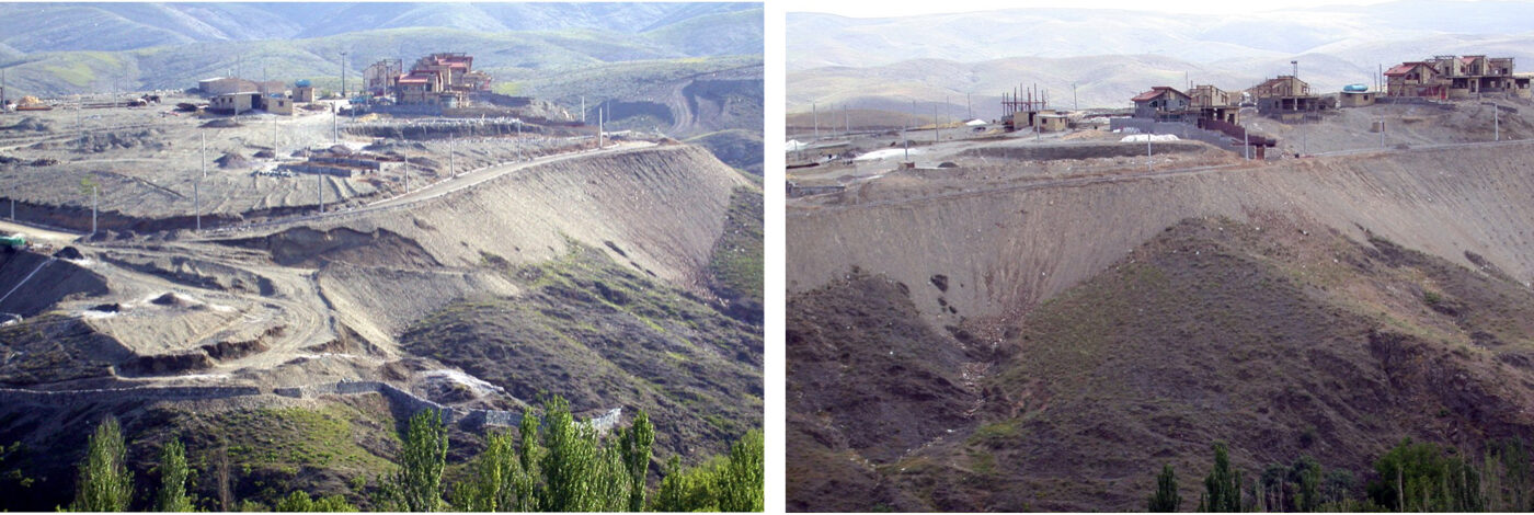
In recent decades, extensive construction by private investors within the valleys and on the overlooking slopes has caused significant environmental challenges. As a response, the Khorasan Provincial Government initiated a comprehensive strategic plan titled “Torghabeh–Shandiz Tourism Masterplan” to regulate development and guide sustainable tourism growth. The study area covers approximately 600 square kilometers (60,000 hectares).
Following extensive baseline studies—covering geology, water resources and climate, soil science, vegetation, landscape character and visual analysis, environmental conditions, ecological capability and carrying capacity*, tourism resources and attractions, architecture, economy, historical and cultural assets, tourism trends, organizational structures, and infrastructure—the existing conditions were analyzed. Current trends, opportunities, constraints, and threats were identified, and regional and supra-regional goals and strategies were formulated. Detailed objectives and policies were then developed.
The strategic masterplan included:
1. the core structure of the transportation network
2. environmental and functional zoning
3. areas designated for extensive and intensive recreation
4. conservation zones
5. strategic planning sectors
6. a list of 34 major design and development projects with defined implementation priorities
7. In addition, regulatory guidelines were drafted and an environmental impact assessment was conducted.
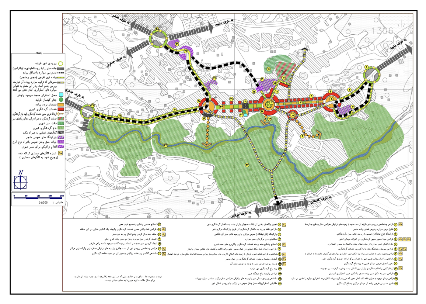
At the mid-scale planning level, a tourism framework for the cities of Torghabeh and Shandiz was developed. Along with this, architectural, urban design, civil engineering, and landscape architecture guidelines—tailored to the local environment—were provided for ongoing development activities. Recommendations were also proposed to balance tourism flows among the various valleys surrounding Mashhad.
Note:
In plans of this nature, ecological capability assessments, carrying capacity analysis, and environmental considerations must be the foundation of all decision-making. Ultimately, each proposed project should undergo an environmental impact assessment to prevent major mistakes—such as the “Padideh Shandiz” project, which was built without proper evaluation and stands in direct conflict with sustainable regional development.
Project Impact – Outcome:
The plan has been approved and will serve as the operational framework within the designated area. If the proposed strategies, measures, and planned programs are fully implemented, sustainable tourism development within the project area will be achievable and will ultimately contribute to the sustainable development of three cities.
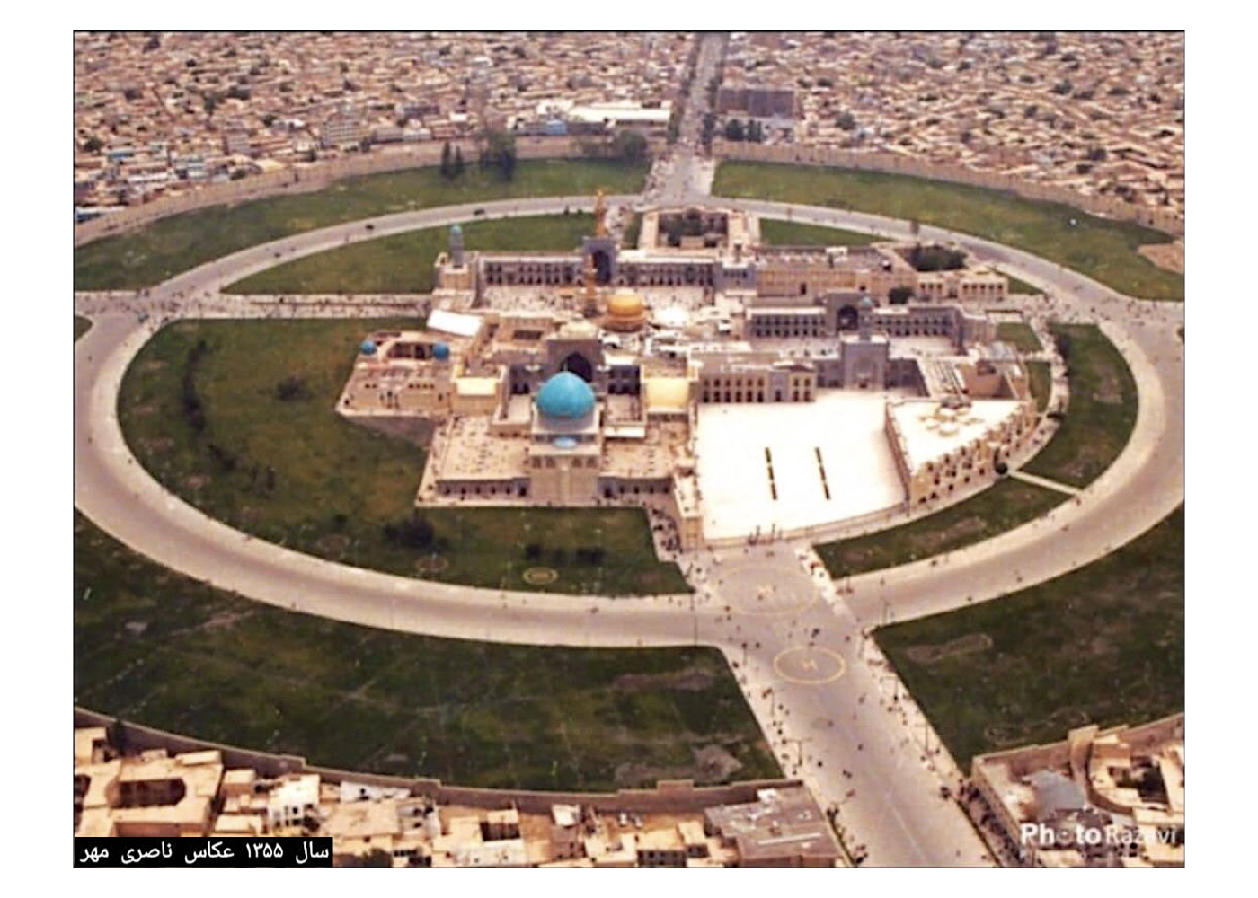
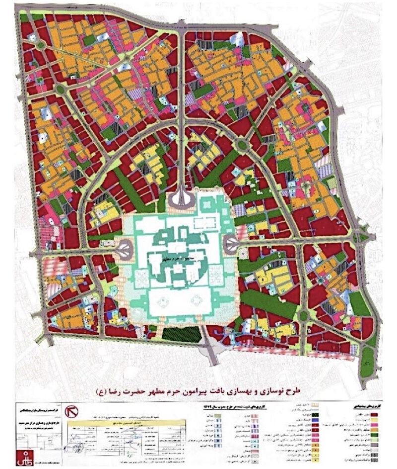
Mashhad: Urban Renewal and Reconstruction Plan around the Holy Shrine of Imam Reza – (Strategic Assessment)
Summary of Study Proposals:
Transition from Renewal to Rehabilitation
Background:
In the Urban Renewal and Reconstruction Plan around the Holy Shrine in Mashhad, the consulting engineer—working at a metropolitan scale in the heart of a historic city—proposed large-scale demolition and redevelopment. This study examines the resulting problems and offers solutions to address the current crisis.
Overview:
Throughout its centuries-long history, Mashhad has undergone numerous transformations. The most recent major intervention before the 1979 Revolution occurred within an area of roughly 50 hectares. Under the direction of the then-governor, Mr. Valian, the surrounding urban fabric was demolished and a tall perimeter wall was built around the shrine complex. This wall severely disrupted the historic relationship between the shrine and the city, functioning in some ways like the concrete barrier separating East and West Berlin. Historically, however, the relationship between the residents, the city fabric, and the shrine had always been deeply integrated.
After the revolution, certain measures were taken to manage traffic around the shrine, and in the 1990s a contract was signed with a consulting firm (Tāsh) to prepare a “Renewal and Reconstruction Plan around the Shrine.”
The plan, covering approximately 300 hectares, was completed and approved in 1996. The Municipality of Mashhad had the most direct involvement with the project, yet faced challenges in providing a comprehensive technical opinion. For this reason, the City Fabric Consultant was asked to review the plan.
As the Director of Urban Fabric Studies and Design, I assumed responsibility for this assessment and invited several experts from different disciplines to collaborate, including Ahmad Saeedi-Nia (Urban Planner), Fereydoun Dezhdar (Traffic Planning), the late Fariborz Raees-Dana (Economics), the late Mahdizadeh (Social Researcher) and Keyumars Masoudi (Social Researcher). In addition to reviewing the plan reports, we conducted field visits in Mashhad and held meetings with project officials, municipal authorities, and local residents. The conclusions were compiled into a detailed report submitted to both the municipality and the governorate. The findings were also formally presented in a meeting with the mayor and the governor.
A 12-page summary of the report was also prepared and made available. The core findings were organized into ten thematic areas and the recommendations were presented in section 11 of the report.
Section 10 – Executive Consequences of the Renewal Plan – stated:
A. During the 15-year implementation period, the central area of Mashhad would effectively turn into a massive construction and demolition site.
B. Weakening the municipality’s authority over development activities in the city center would intensify disorder and administrative uncertainty. With unclear revenue sources, the municipality would be unable to provide adequate services or maintain control—resulting in a negative national precedent in urban redevelopment.
C. The practical challenges of land consolidation would impose significant social and administrative burdens on both the municipality and the implementing company.
In the recommendations section, the following points were proposed:
1. Shifting the approach from “redevelopment” to “rehabilitation.”
2. Establishing a system of continuous evaluation.
3. Preserving the jurisdiction and authority of the responsible organizations.
4. Forming a council or commission appropriate to the national importance of the project.
Project Impact – Outcome:
Had the recommendations and proposed strategies outlined in the study report been implemented, and had the approach focused on restoration rather than redevelopment, the historic center of Mashhad would not be facing its current constraints and unacceptable conditions.
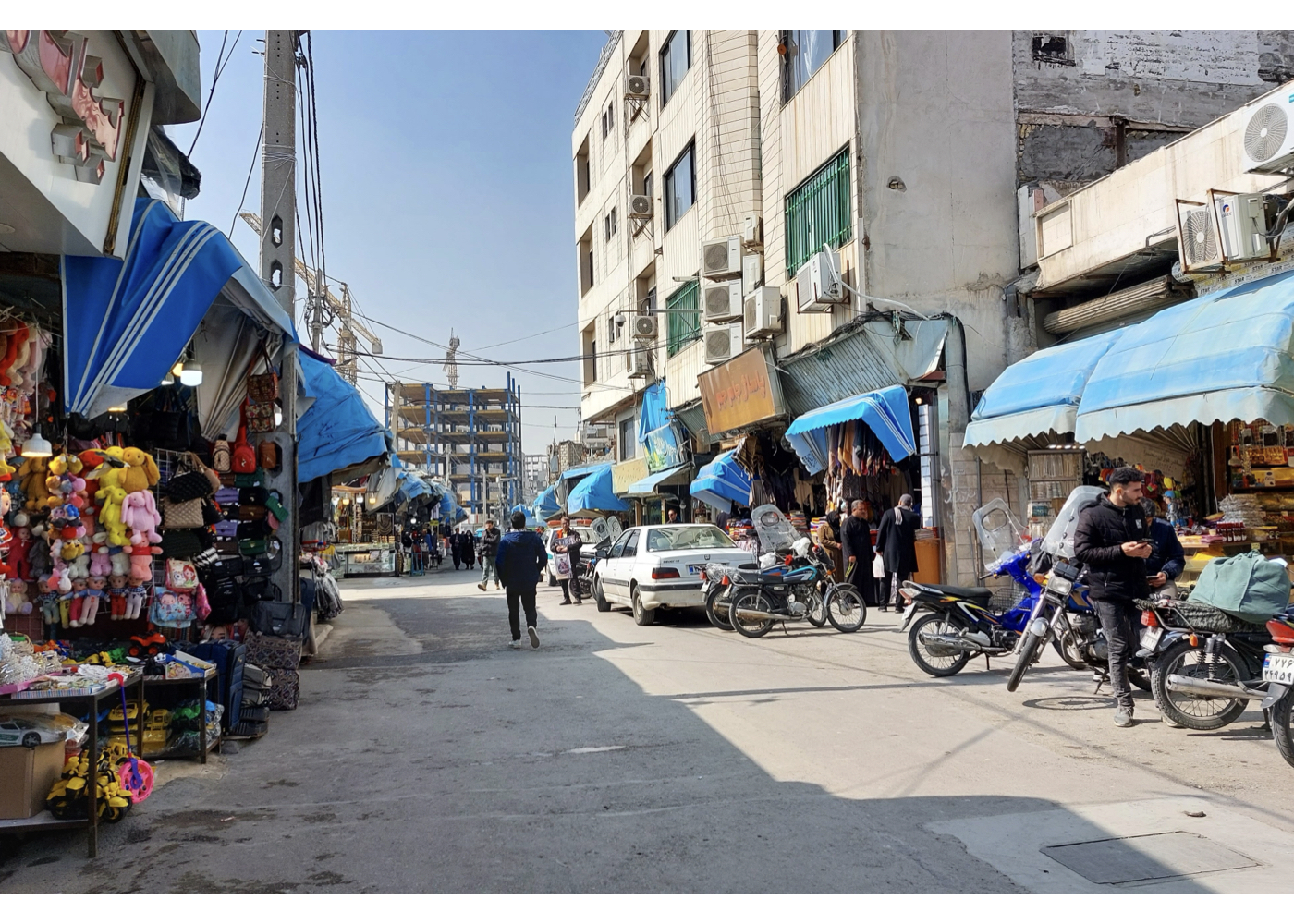
Unfortunately, the worsening of problems in the city center—repeatedly highlighted throughout the studies—continued unabated. Today, after nearly 30 years, and according to officials, experts, and residents, even after multiple revisions and adjustments to the consultant’s plan, the construction-site conditions of demolition and rebuilding still persist, and the project has never reached a satisfactory outcome. As a result, the identity of Mashhad’s city center has been severely damaged and, in effect, lost.
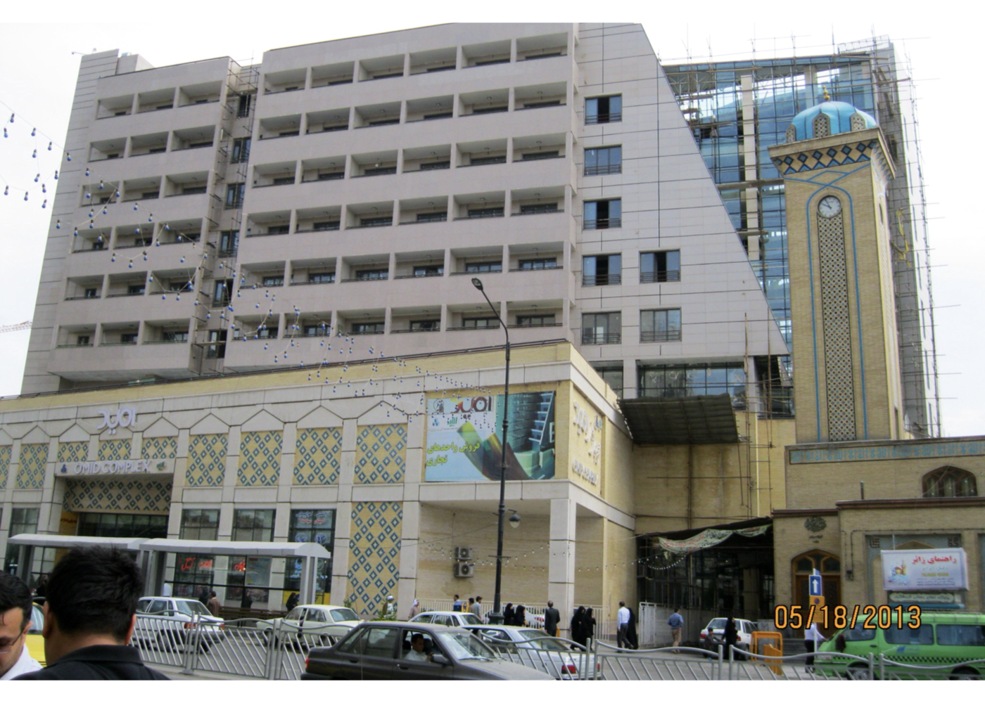
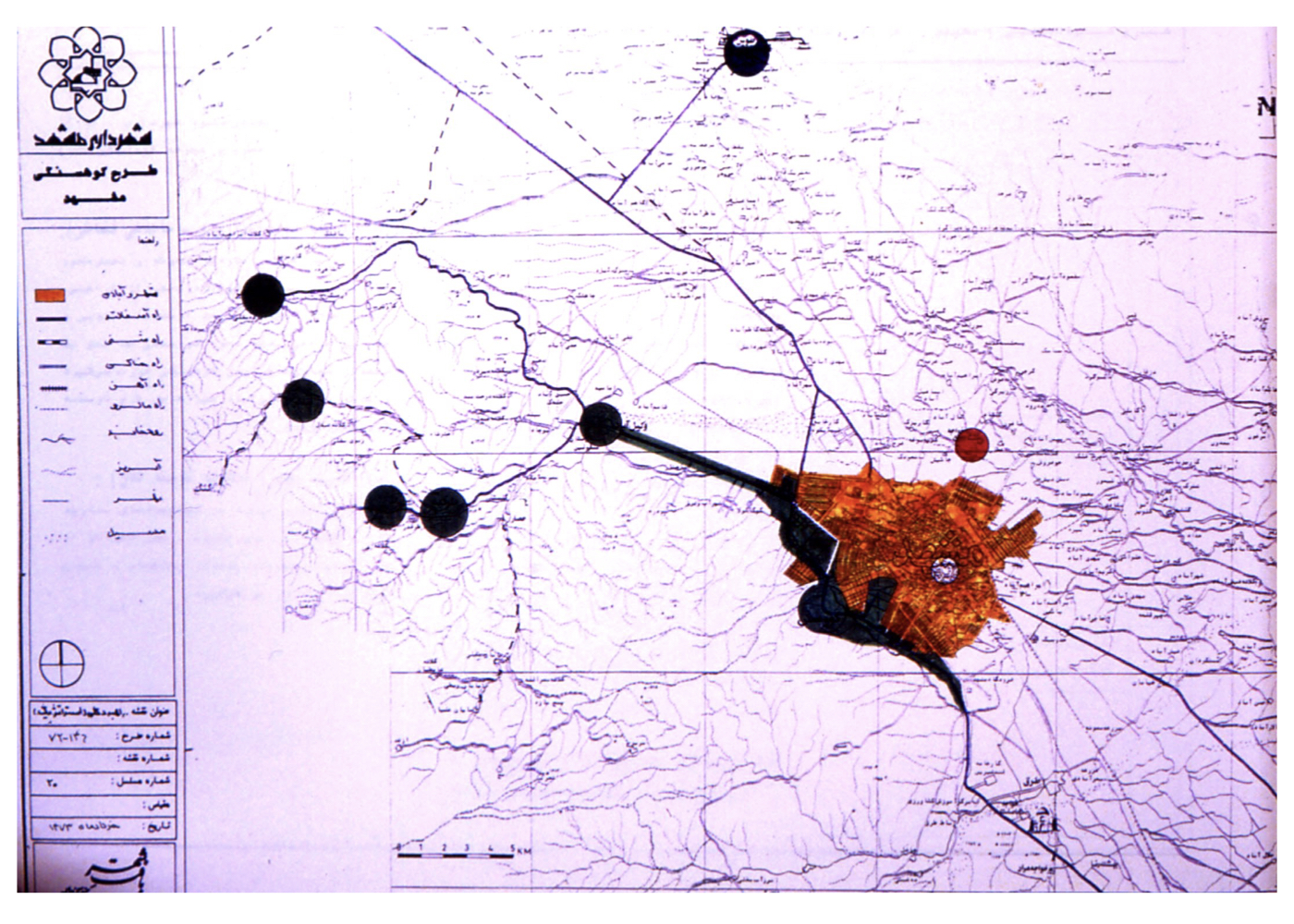
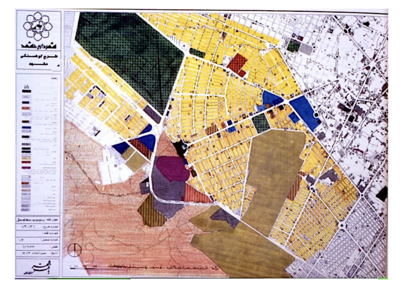
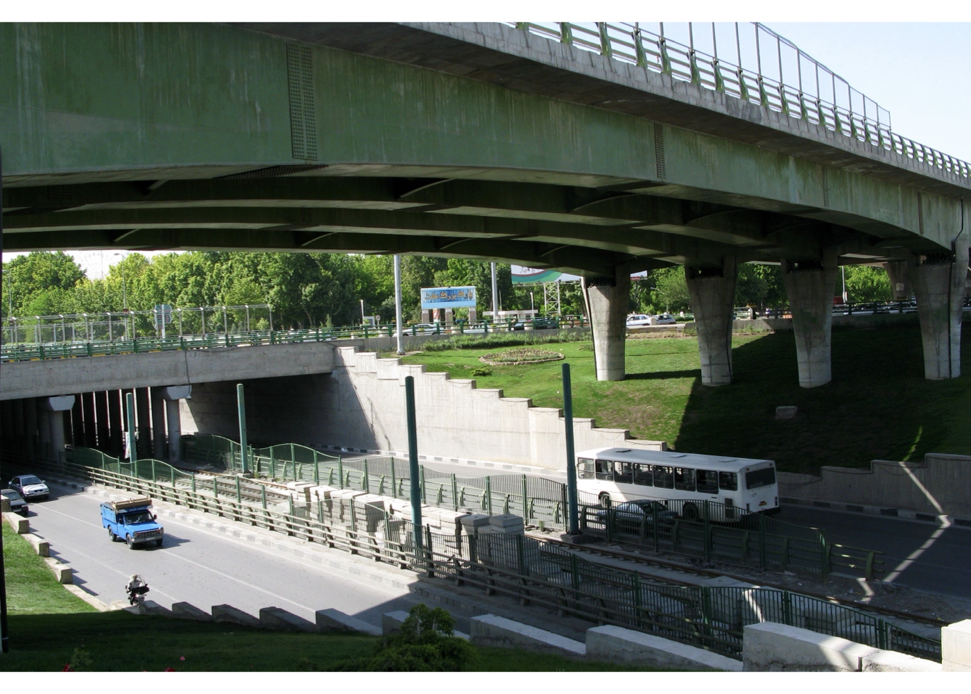
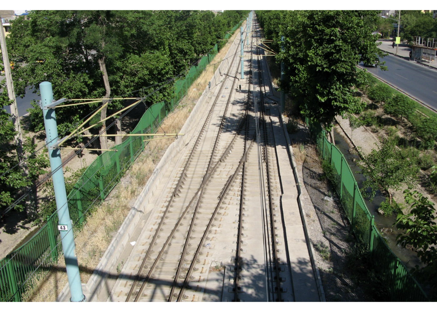
Mashhad: Kohsangi District Development Plan (Strategic)
Summary of Proposed Strategies:
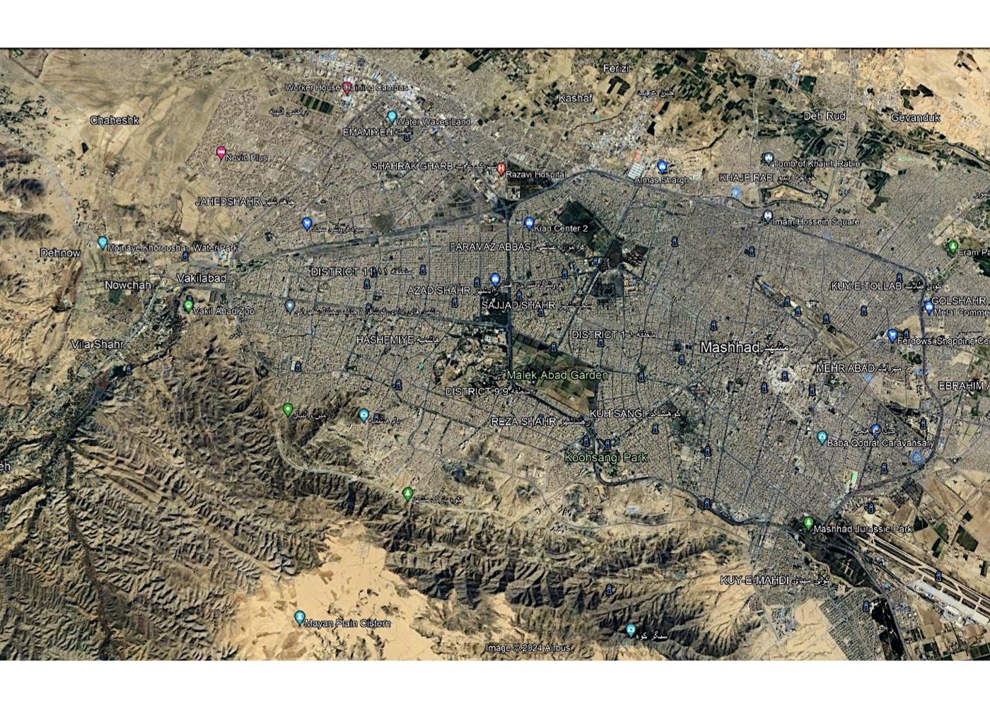
Considering the existing conditions, potentials, and constraints around the Kohsangi area, the proposal suggests forming a continuous green structure in southern Mashhad—extending from the airport to Vakilabad Garden. This green corridor would serve as a key natural asset supporting sustainable urban development, reconnect distant and fragmented spaces, and enhance their ecological resilience. It would also link the airport to the beautiful and well-known valleys of southern Mashhad, strengthening the city’s tourism appeal. A connection between people, the city and its natural treasures.
Background:
For many years, the Kohsangi area in southern Mashhad was considered outside the city limits. The construction of the Kohsangi Club and its large pool—which supplied irrigation water for many of Mashhad’s street trees—along with the creation of the tree-lined, scenic Kohsangi Boulevard during the Reza Shah era by the late Mr. Asadi, gradually led the city’s development toward this area. Later, with the construction of Mashhad’s southern ring road behind the two rocky Kohsangi hills, various urban infrastructure uses were established there, and portions of the land were allocated to military barracks.
A macro-scale study of the area showed that several major green spaces in Mashhad could be linked together, forming an integrated green structure throughout the southern part of the city. From west to east, these spaces include:
1. Vakilabad
2. Kaseh-e Partavi
3. Vakilabad Road (historic recreational route with old mulberry trees and qanat water flowing for decades towards southern valleys)
4. Mellat Park
5. Mashhad University Campus
6. The 200-hectare Malek Garden
7. Television Garden
8. Kohsangi
9. The 88th Division Barracks (planned for future evacuation)
10. Green areas south of Mashhad Airport
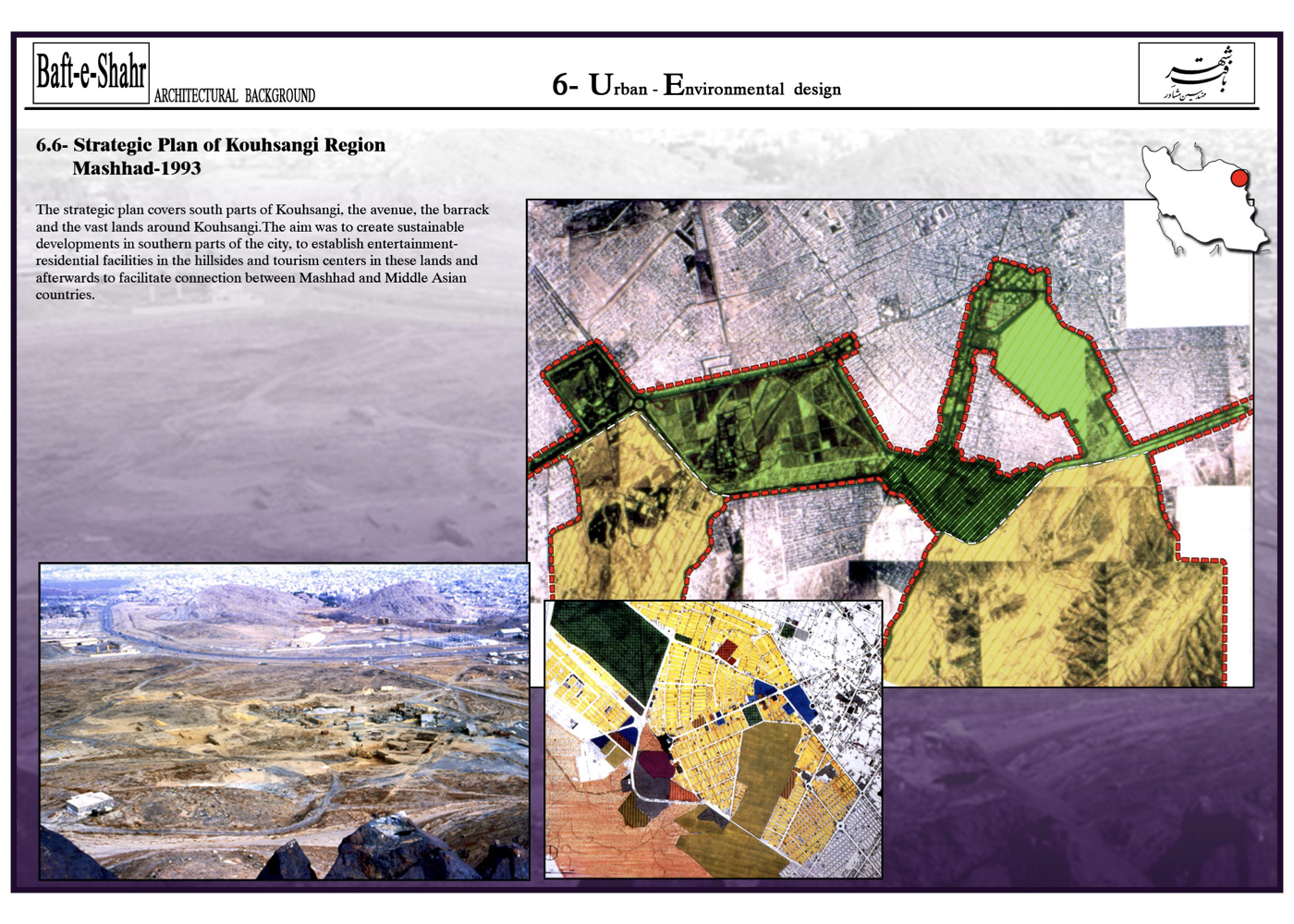
Project Impact – Outcome:
The proposal recommends connecting these large, scattered spaces through Vakilabad Road and, beyond Malek Garden, through the Television Garden and Kohsangi. Once the military barracks are vacated—releasing approximately 200 hectares—a continuous green corridor would emerge. This corridor would strengthen the ecological capacity of each independent green space and create the longest green tourism axis in Iran, stretching over 30 kilometers from the airport to Vakilabad.
Vakilabad Road once had the potential to preserve its historic recreational function. It could have been designed as a central corridor dedicated to pedestrians, cyclists, horse-drawn carriages, and sports activities, with even a tourist tram line planned along its length. In this way, one of Mashhad’s key tourism assets would have been protected and enhanced, while the existing green corridor would have strengthened the connection between people, the city, and its natural treasures, contributing to the city’s sustainable development. However, with the construction of the surface-level metro, traffic speed and volume increased, turning this route into a fast-moving traffic axis with several grade-separated intersections, thereby reducing its recreational and tourism capacity. Nevertheless, even under current conditions, the implementation of the “Green Corridor” concept remains an important and viable necessity for the future of the city.
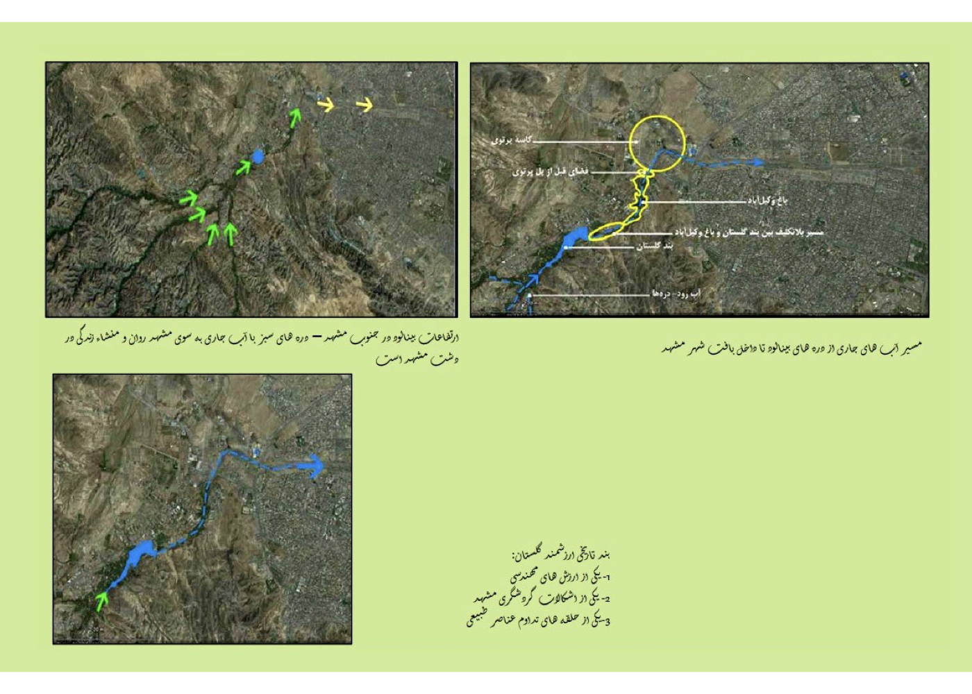
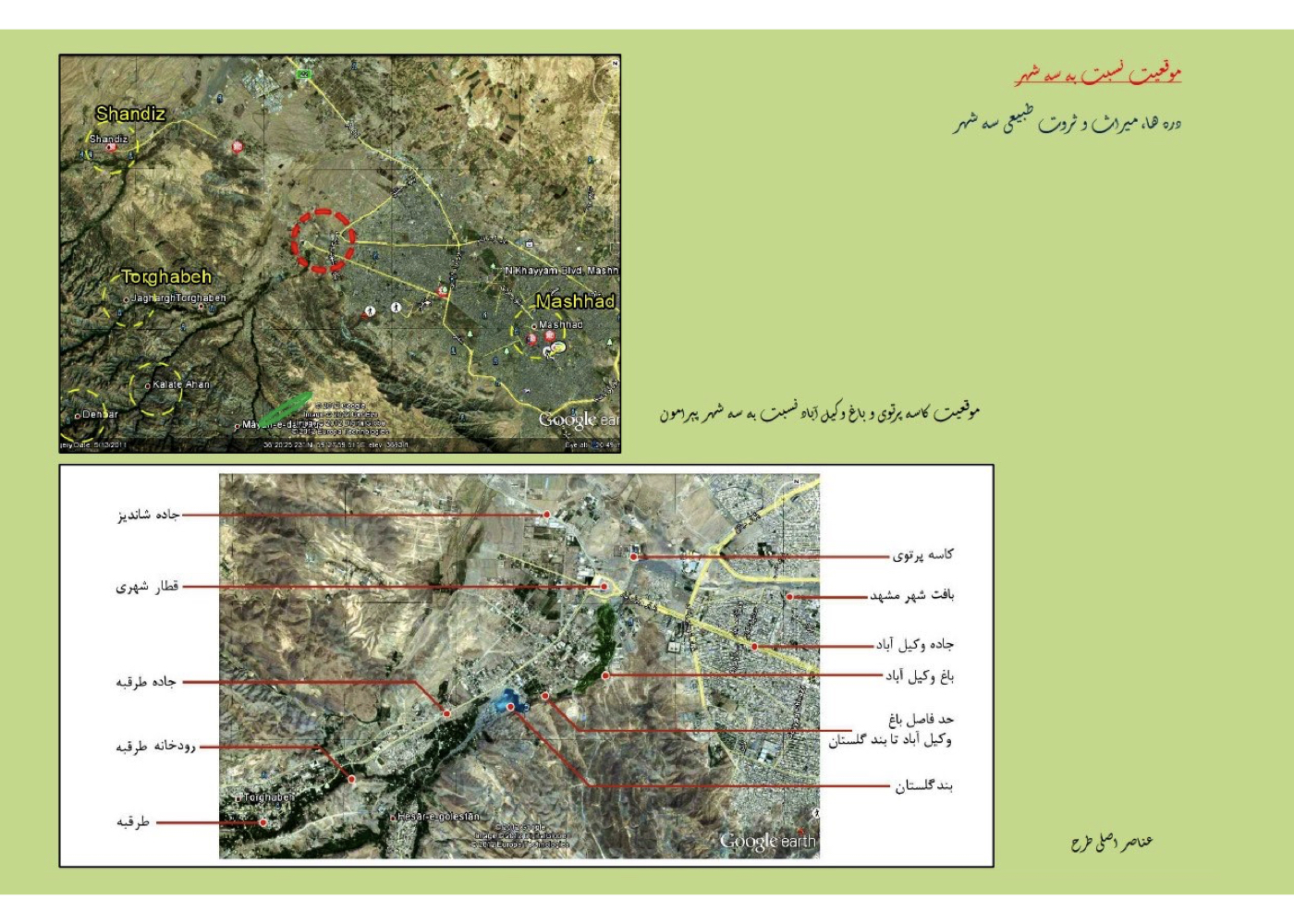
Mashhad: Vakilabad District (Strategic)
Summary of Proposed Strategies:
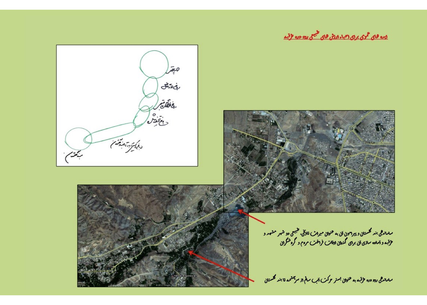
Exploring the possibility of connecting the scattered natural assets along the Torghabeh river–valley to create a continuous green and stream corridor from the Binalud highlands into the urban fabric of Mashhad—linking Band-e Golestan, the Vakilabad Garden–Valley, the Partavi Basin and Kal-e Chehel-Baazeh. Reconnecting people and the city with nature.
Background:
Vakilabad Garden, covering approximately 70 hectares, was endowed to the public by the late Hossein Malek and transferred to the Municipality of Mashhad. The garden is located at the end of the Torghabeh Valley, at the threshold where the valley enters Mashhad, and benefits from the Torghabeh River’s water. A series of qanats were constructed to supply water to the garden, entering the site at two elevations; however, parts of this water are unfortunately being illegally diverted by local residents along the way.
The project was studied and designed at two scales:
A. Strategic / Macro Scale: Understanding the influence of the region on the entire city of Mashhad—and vice versa—including the connection from Band-e Golestan to Kal-e Chehel-Baazeh.
B. Design and Implementation Scale: Design of the garden and its terminal landscape zone known as the Partavi Basin, covering approximately 30 hectares.
Summary of Concepts, Strategies and Solutions:
1. Organizing and stabilizing the Torghabeh River corridor as it enters the urban fabric of Mashhad.
2. Creating continuity of the natural landscape from Band-e Golestan to the end of Kal-e Chehel-Baazeh.
3. Designing a corridor for walking, cycling, recreation, tourism, and light transport, linking the city to the natural landscape.
4. Restoring and organizing the slopes of the historic Band-e Golestan and transforming it into a nature-based tourism destination.
5. Designing the river route from Band-e Golestan to Vakilabad Garden as part of a continuous natural chain and preventing land encroachment.
6. Preparing a conservation-based plan for Vakilabad Garden to support sustainable recreational use without environmental degradation.
7. Restoring the qanat system and optimizing existing water resources for irrigating the garden’s trees.
8. Designing the Partavi Basin as a stone garden and as a transition zone from the city toward Mashhad’s summer pastures (Torghabeh, Shandiz).
9. Creating a linear park along the Kal-e Chehel-Baazeh riverbed to connect neighborhoods with natural areas such as the foothills of Binalud.
Project Impact – Outcome:
Kal Chehel-Bazeh (the dry riverbed) was one of the key segments in the concept of “Connecting Nature,” intended to link the Binalud Mountains and the Taghabe River to the urban fabric of Mashhad. This natural corridor includes the Taghabe River, Golestan Dam, Vakilabad Garden, Portevi Basin, and the Kal Chehel-Bazeh channel. The concept was approved in a meeting attended by the Mayor of Mashhad.
1. Several parts of the project were implemented despite changes in mayoral administrations.
2. The main design for Vakilabad Garden was prepared and executed.
3. A portion of the qanats was dredged, though the work was not fully completed.
4. The “Portevi Basin” design was approved; however, during implementation, it underwent changes due to disregard for design features and the personal preferences of contractors.
5. The continuation of the linear green corridor I proposed in the “Strategic Plan for the Vakilabad Area” for the Kal Chehel-Bazeh riverbed was prepared by two other consulting engineers—one after the other—and parts of it were executed. Nonetheless, due to technical issues and ownership disputes, the project has faced significant challenges.
POLADSHAHR [ 1 Project ]
Poladshahr: Urban – Environmental Design of the City’s Central Axis
Summary of Proposal Recommendations:
Enhancing the environmental quality of the city’s service axis by strengthening its connection to nature and the adjacent mountain (linking people, the city and nature).
Background:
Poladshahr, located 20 km from Isfahan, is a new town designed to house the employees of the Isfahan Steel Plant and has been gradually under construction. The project area is the city’s main axis, which ultimately connects to the nearby foothill.
This proposal was prepared for an urban design competition. The consultant received second place by a margin of one point and declined the client’s request to develop a joint proposal with the first-place winner. The essential concepts of the design—based on the characteristics of Isfahan—are summarized below.
Summary of the Main Design Ideas, Based on the Climatic and Cultural Characteristics of Isfahan:
1. Flowing water along the sidewalks of the main axis(transforming the existing hazardous water canal into a safe, calming stream integrated with pedestrian walkways)
2. Strong, shade-providing green spaces along the main pedestrian axis (a contemporary echo of Chaharbagh)
3. Extending the green corridor of the main axis up the mountain slope (creating a continuous “green line” linking the city to the mountain)
4. Strengthening the connection between the mountain and the city by extending the tree-lined, stream-side pedestrian walkway all the way to the mountain summit (enhancing the bond between urban life and nature)
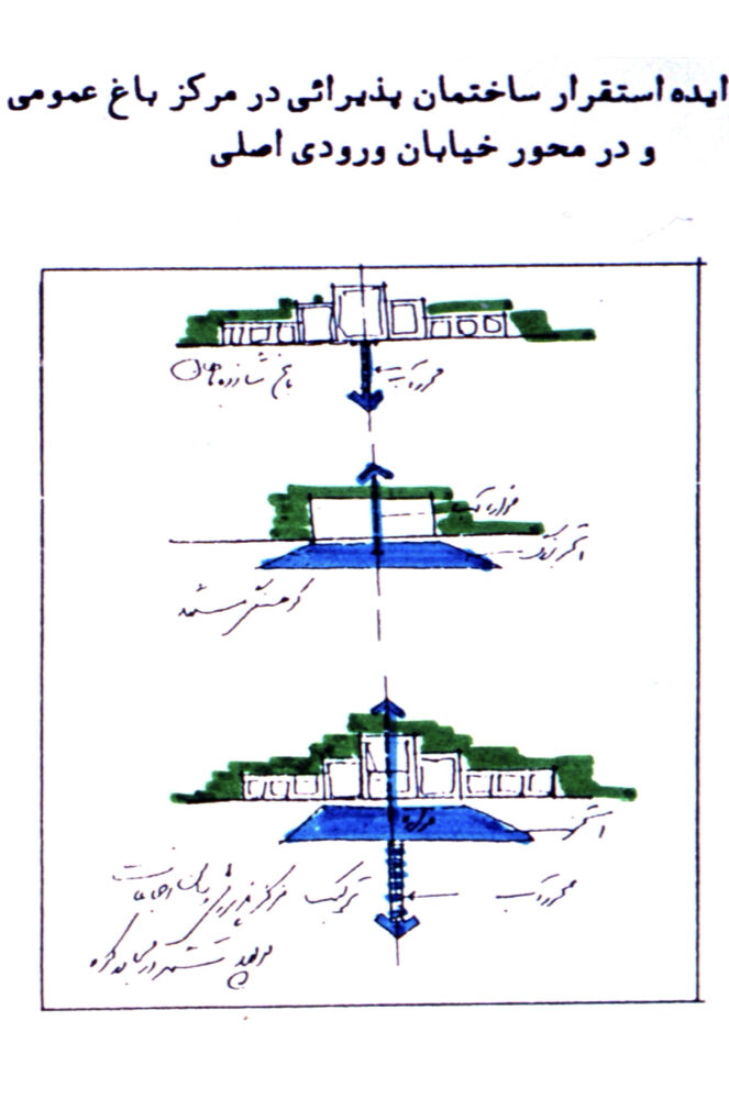
5. Creating a large terrace platform with necessary services atop the mountain (a gathering place and meeting point for the public)
6. Establishing a hospitality building for residents and visitors, connected to the mountain terrace (for daytime and nighttime use)
7. Creating an urban campus/parkland (a system of interconnected public gardens) where the city meets the foothills.
Project Impact – Outcome:
The proposal received second place in the competition for the best urban design plan for the center of Poladshahr, missing first place by only one point. Nevertheless, its core ideas were highly appreciated, and the authorities suggested that two consulting teams jointly prepare the final plan. Due to fundamental differences in the conceptual foundations of the two proposals, this joint arrangement was not accepted.
If implemented, this plan will provide Poladshahr with a linear, green commercial–recreational center featuring a stream (Garden–Bazaar), a campus at the foot of the mountain, and a revitalized, landscaped hillside. The summit will become a welcoming space for gatherings, interaction, and community life in nature—both day and night—contributing to the long-term sustainability of the new town of Fooladshahr.
Qazvin [ 1 Project ]
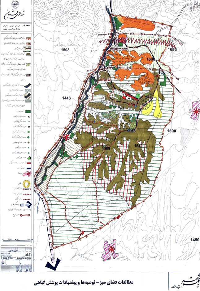
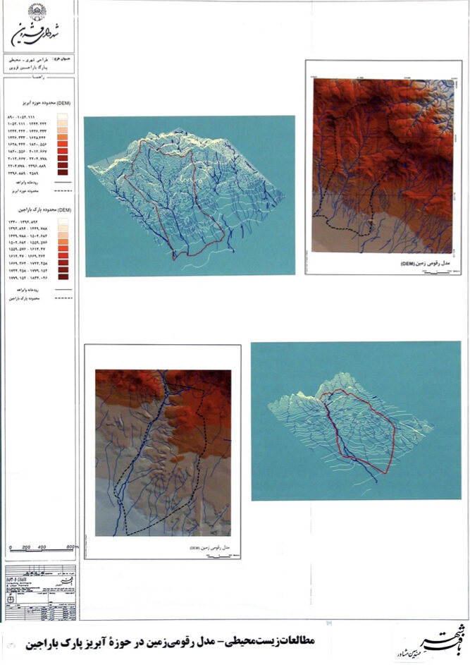
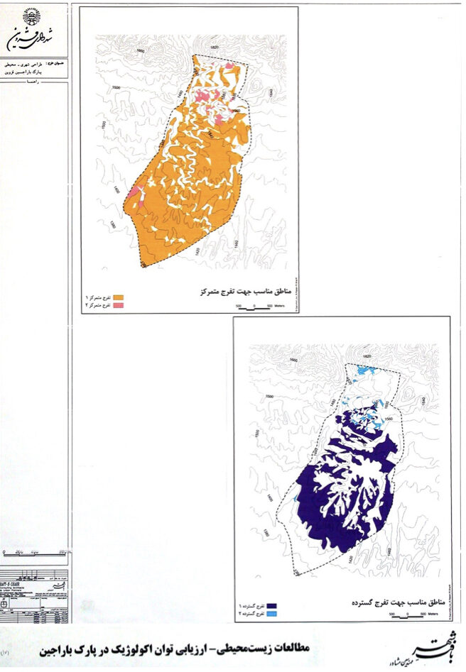
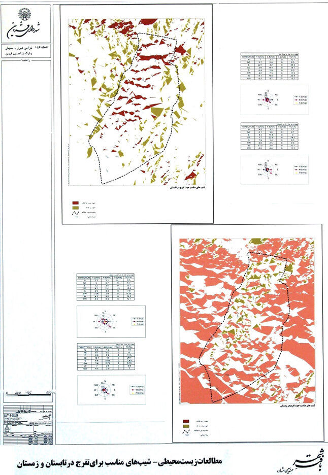
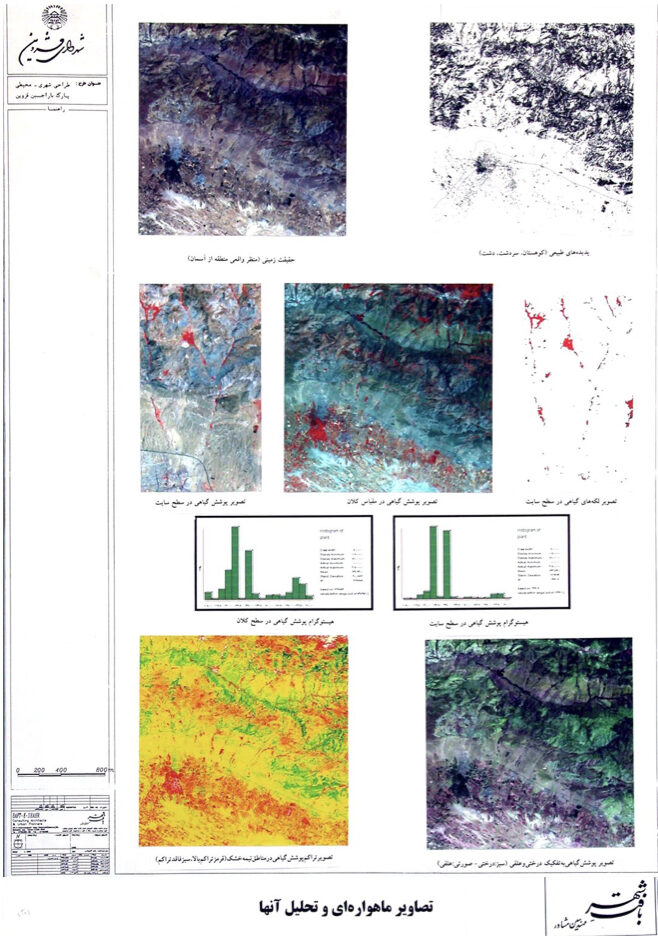
Qazvin: Urban–Environmental Design of Barajin Highlands (Strategic)
Summary of Proposed Strategies:
A governmental proposal to establish a “Science City” in the Barajin area was carefully studied and ultimately rejected due to natural, geological, and urban constraints. Instead, the proposal recommends developing a “natural–urban campus” that builds upon the striking landscape of Barajin, ensures safe connections between the city and the highlands, strengthens the relationship between the city and its natural surroundings, establishes land-use zones based on environmental capacities and limitations and creates a framework for public access and enjoyment, Connecting people, the city and nature.
Preface:
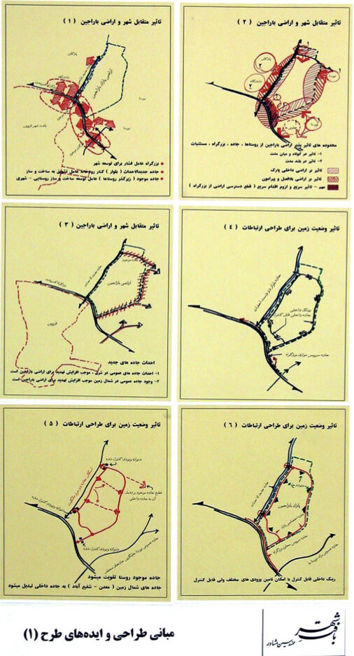
The foothill and steep lands of Barajin lie to the northeast of Qazvin, overlooking the city from across the Tehran highway. Because these lands are directly connected to the adjacent mountain ranges, their surface and groundwater feed a significant portion of the historical gardens of Qazvin—gardens that unfortunately have been disconnected from the city due to the construction of the highway.
During initial project meetings, it was noted that the government intended to build a “Scientific City” on these lands. It should be mentioned that Barajin is separated from the nearby Islamic Azad University campus by a shallow geological depression.
Study Findings:
Extensive studies across urban, environmental, and natural fields demonstrated that, due to the topographic dominance of the site, its crucial role in supplying water to the city’s gardens, the presence of an active fault line, and other geotechnical issues, establishing a Science City in this location would not be advisable.
Before the study results were presented, local authorities were anticipating approval of the project and had already undertaken several preparatory steps. However, the presentation day—attended by the provincial governor—became an exceptional moment in the recent urban planning history of Qazvin. The scientific and field-based nature of the findings surprised and disappointed many. The governor eventually accepted that the earlier decision required reconsideration and that the matter should be readdressed by the central government.
As an alternative to the Science City, the consultant proposed transforming Barajin into a “natural–urban campus” in accordance with the land’s capacities and limitations. In subsequent sessions, the consultant’s strategic plan was approved.
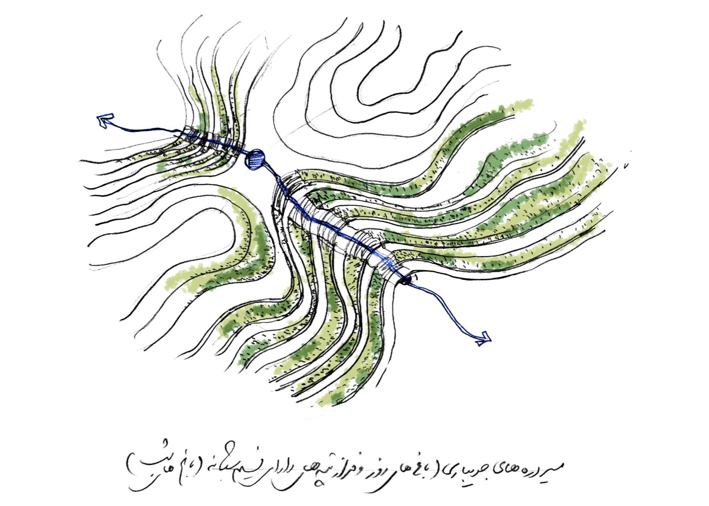
Strategic Plan:
Within the strategic framework of the natural–urban campus, a comprehensive master plan was prepared based on the land’s ecological capacity. Activity zones were defined, the green-space structure was designed according to environmental quality, and—anticipating phased implementation—various patterns were proposed for road networks, pedestrian and recreational trails, retaining and protective walls, green spaces suitable for soil and water conditions, and models for service buildings.
For the first time in Iran, considering the many hills and valleys of the area, the concept of “day gardens” and “night gardens” was introduced: using slopes and elevations influenced by prevailing winds for daytime use, and utilizing the cooler and naturally shaded valley areas for nighttime spaces. Strategies for connecting opposite sides of the numerous valleys were also presented.
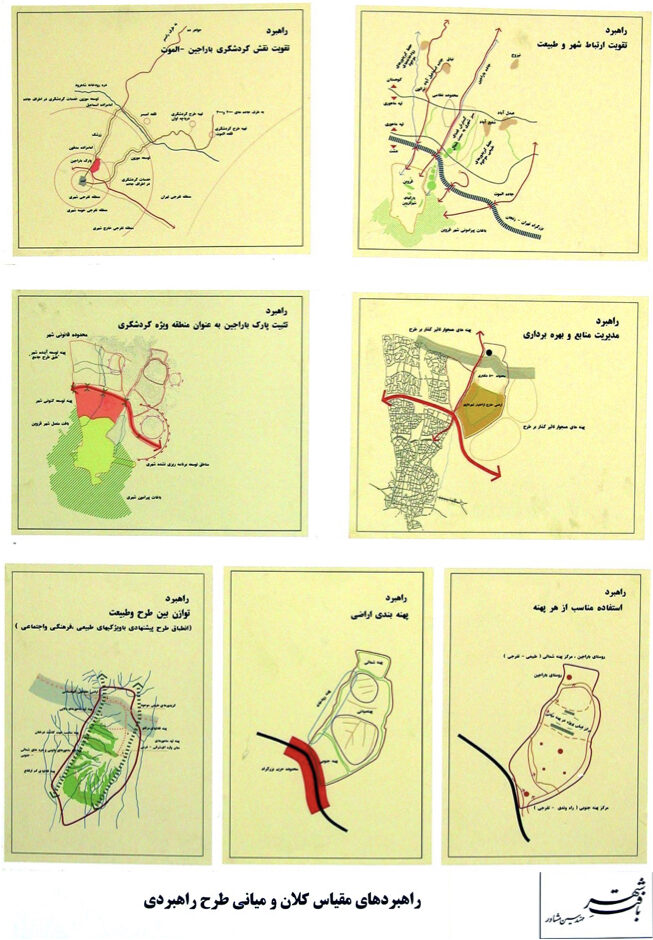
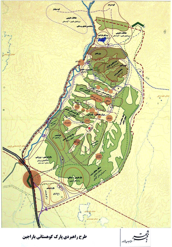
Project Impact – Outcome:
If fully implemented, the foothill and rugged upper terrains of Qazvin will be transformed into a semi-mountainous campus of interconnected gardens, positioned according to natural features and environmental considerations. To ensure public safety with respect to blind spots—especially at night due to the area’s varying elevations—the complex has been designed as a system of “day gardens” and “night gardens.”
This landscape complex can safeguard the natural values of the upper terrains and support the sustainable development of Qazvin. The project was approved, and the responsibility for pursuing the next stages was assigned to the municipality.
Ramin New Town [ 1 Project ]
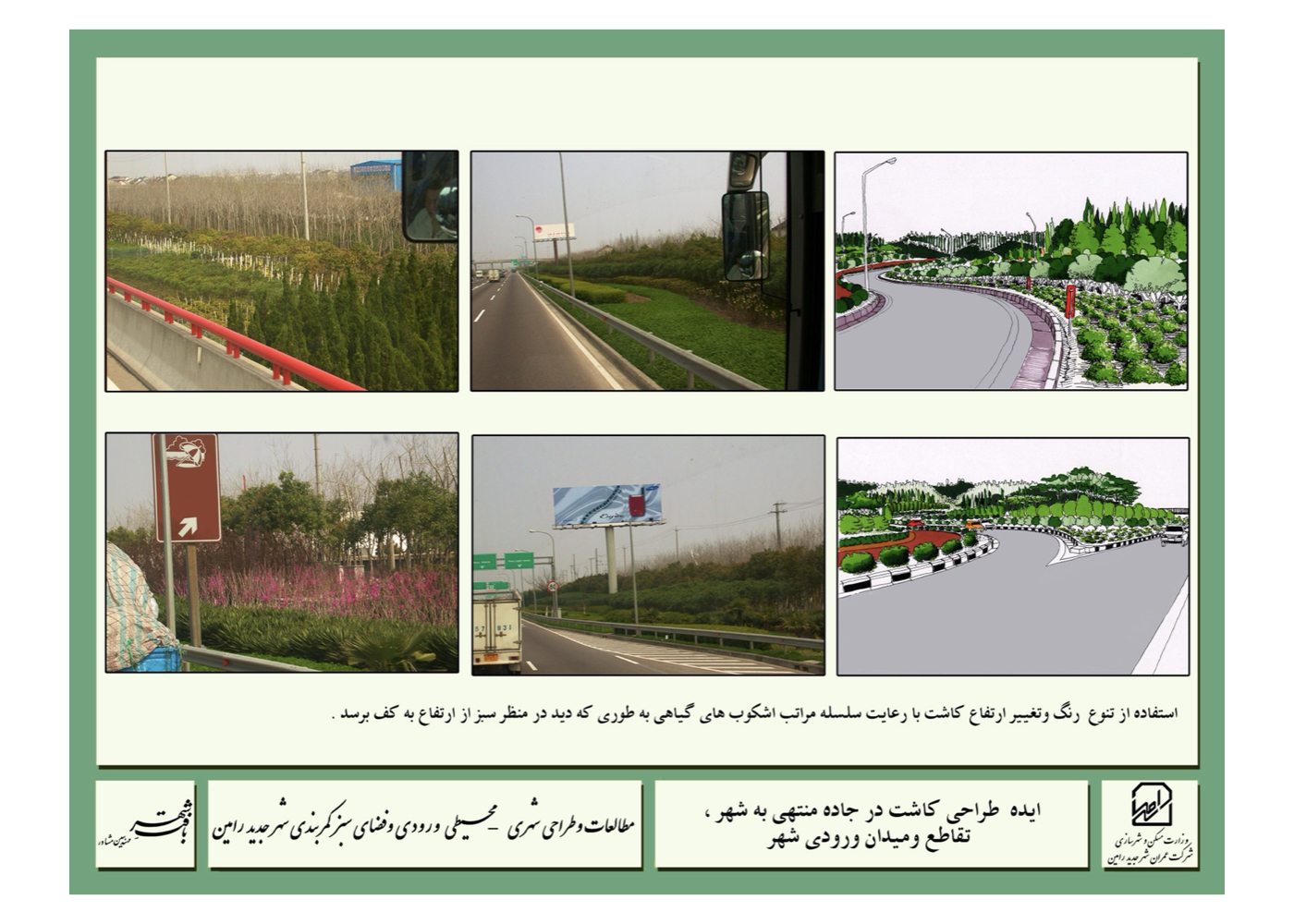
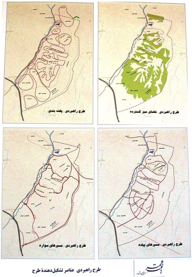
Ramin New Town: Urban–Environmental Design of the Gateway and Green Belt
Summary of Proposed Strategies:
Enhancing the safety of the green belt, improving environmental quality, and—where feasible—introducing land uses compatible with green-space functions. The proposal also emphasizes strengthening socio-environmental safety by fostering a deeper connection between people, the city, and the natural landscape.
Background:
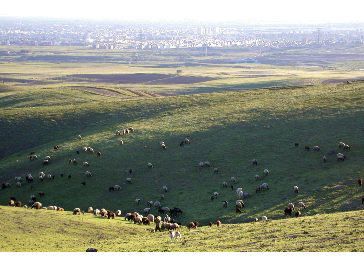
The New Town of Ramin is located in Khuzestan Province. Its master plan includes a green belt of appropriate width, designed to protect the town from external environmental impacts.
Peripheral green spaces in cities often lack adequate safety for several reasons: insufficient protective personnel, the presence of blind spots caused by dense vegetation or uneven terrain, and limited lighting—particularly at night. The unfortunate incidents that occurred in Lavizan Park in Tehran stand as evidence of such vulnerabilities.
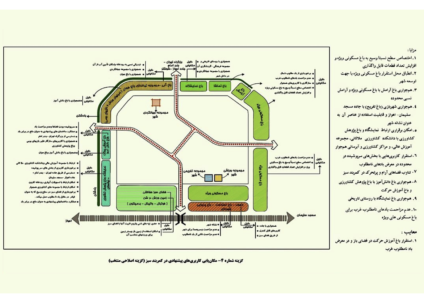
One of the most effective strategies for improving the safety of these areas is the introduction of environmentally compatible land uses within green spaces. In this project, such compatible uses have been proposed. These uses are not only environmentally appropriate, but are also designed to harmonize with adjacent urban land uses. This compatibility helps reinforce surrounding urban activities, enhances economic efficiency, and significantly contributes to the safety of the environment. It also facilitates the safe presence of people in natural areas and supports the sustainable development of the new town. The map and detailed explanation are provided in Section 5.
Project Impact – Outcome:
Urban fringe areas typically experience lower levels of safety, and afforestation around cities—especially at night—can intensify this challenge. With the full implementation of this project, the urban edge will not only become safer due to the proposed activities within the afforested zones, but will also develop a closer and more meaningful connection with nature. These activities will make both the forest and the urban periphery safer, creating a strong foundation for linking people, the city, and the natural environment. Ultimately, this approach will contribute to the sustainable development of the new city of Ramin.
Sadra New Town [ 1 Project ]
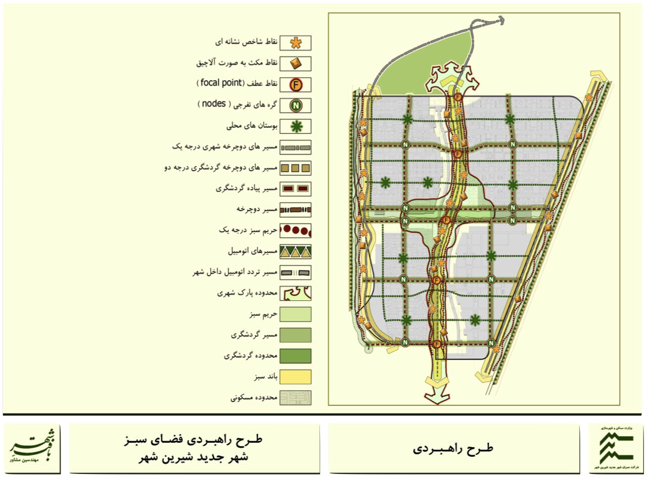
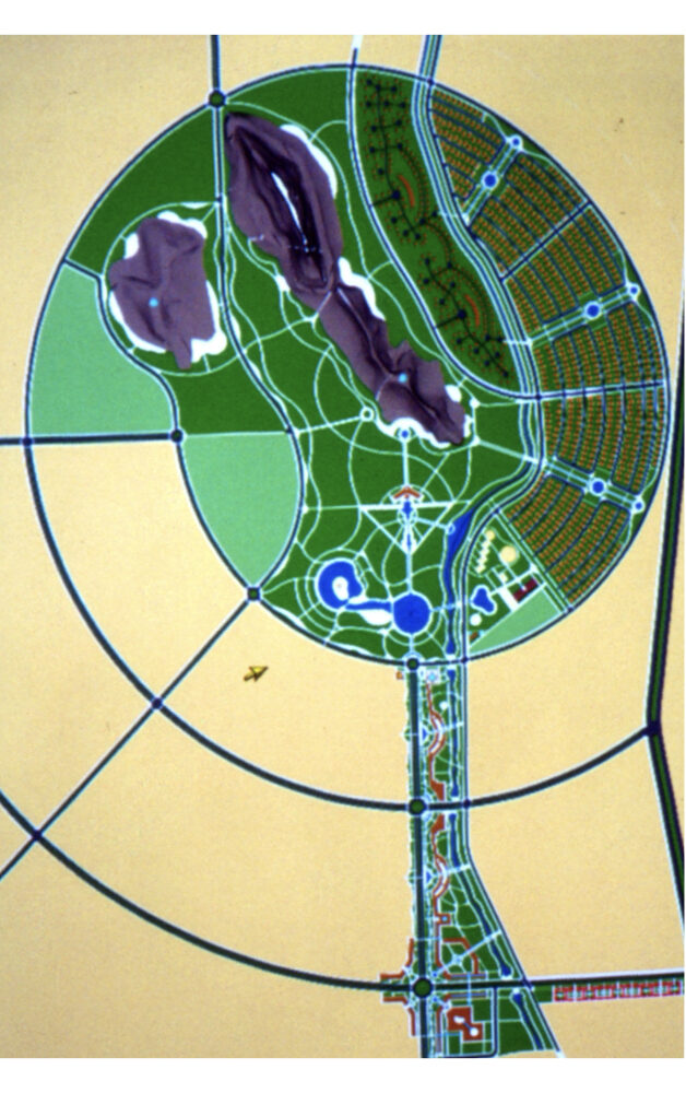
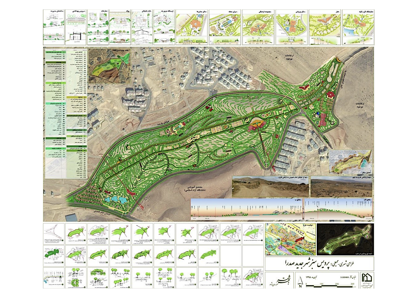
Sadra New Town: The Green Paradise of Sadra
Summary of Proposed Strategies:
Land zoning and the definition of optimal land uses for areas intersected by a national oil pipeline running through the city.
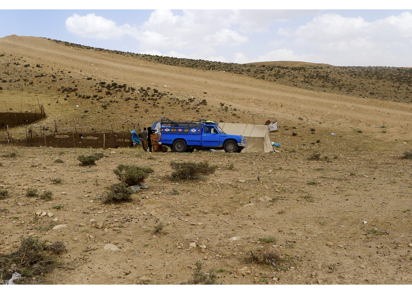
Background:
A national oil pipeline traverses the New Town of Sadra.This not only disrupts urban continuity, but also imposes restrictions on construction and tree planting, while spatial organization along the pipeline corridor remains a challenge.
A sloped area of approximately 60 hectares along the pipeline was designated by city management for public green space development.
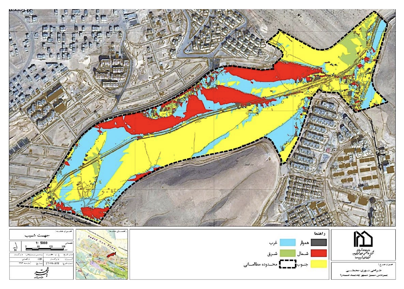
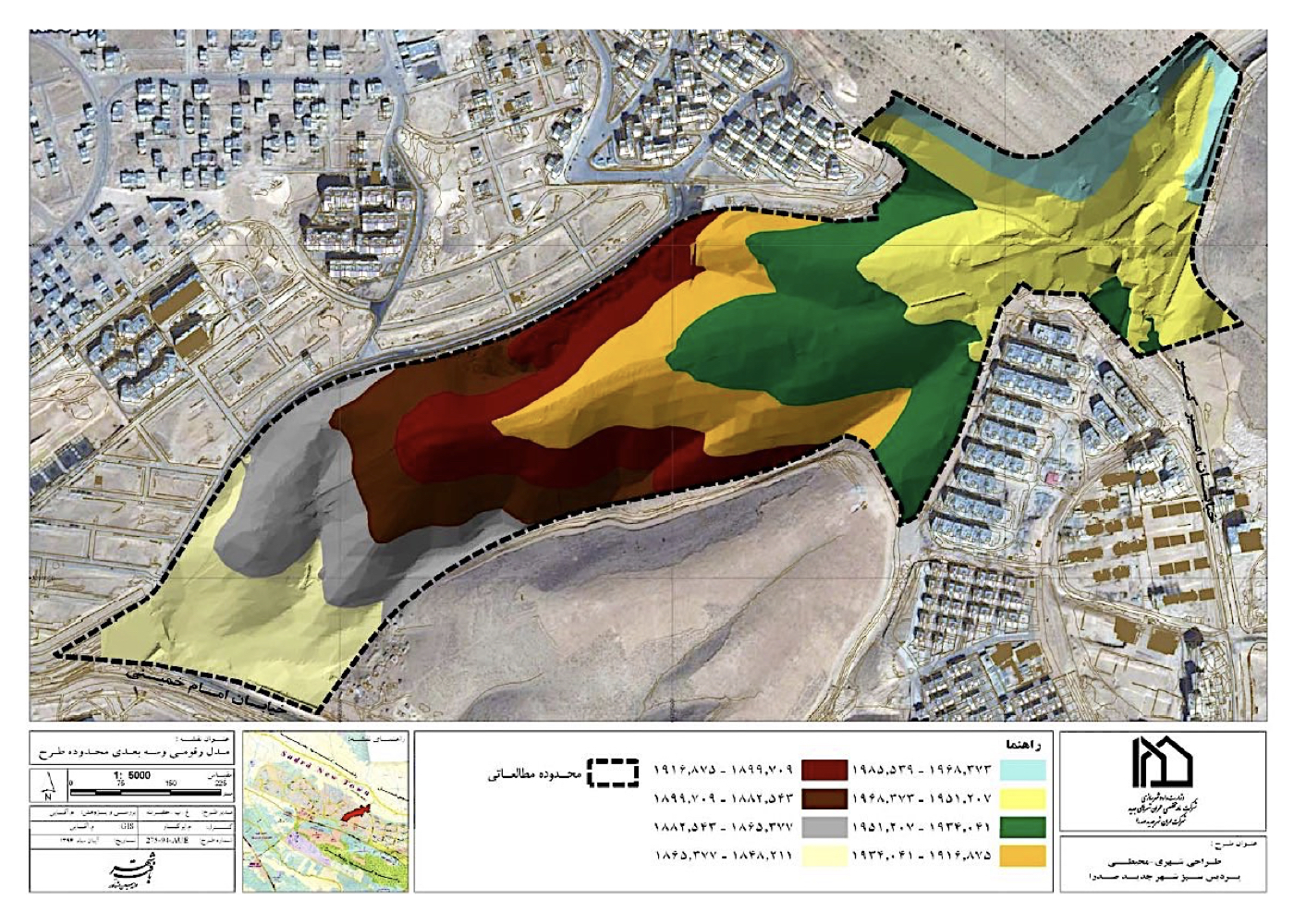
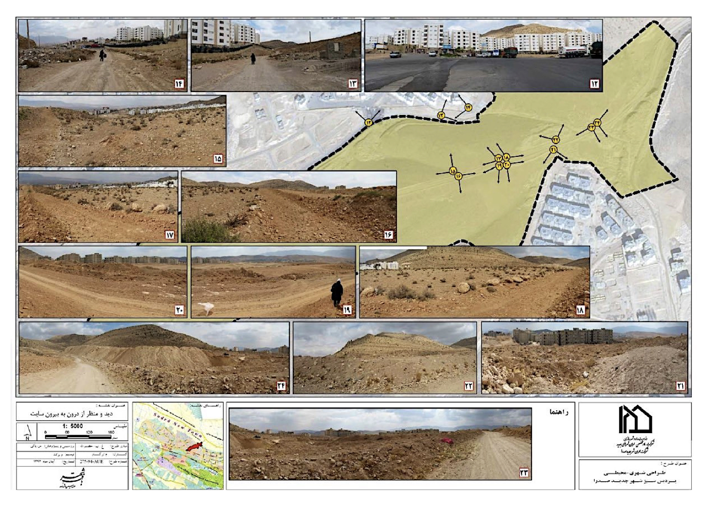
The consultant assessed all relevant factors, including soil quality, slope conditions and sun exposure, prevailing winds, planting restrictions along the pipeline, adjacent residential structures and their needs, bordering streets, water scarcity, etc.
It was proposed that the land be developed as an urban paradise — a system of interconnected gardens.
The conceptual framework includes thematic gardens titled as follows:
1. Flowers
2. Unity Neighborhood (North)
3. Morning Promenade
4. Evening Promenade
5. Night Garden
6. Youth (sports complexes along the pipeline)
7. Sacrifice Neighborhood (South)
8. Culture
9. Children and Nature
10. Hospitality and Recreation
11. Notables Garden
12. Nature Residency
Project Impact – Outcome:
With the full implementation of this project, a long and problematic corridor within the city and its vacant lands — which had previously caused fragmentation within the urban fabric — will be transformed into an efficient space for sports, walking, recreation, and leisure. This corridor will reconnect the previously disconnected urban areas, strengthen the relationship between people, the city, and nature, and ultimately contribute to the sustainable development of the new city of Sadra.
Shiraz [ 1 Project ]
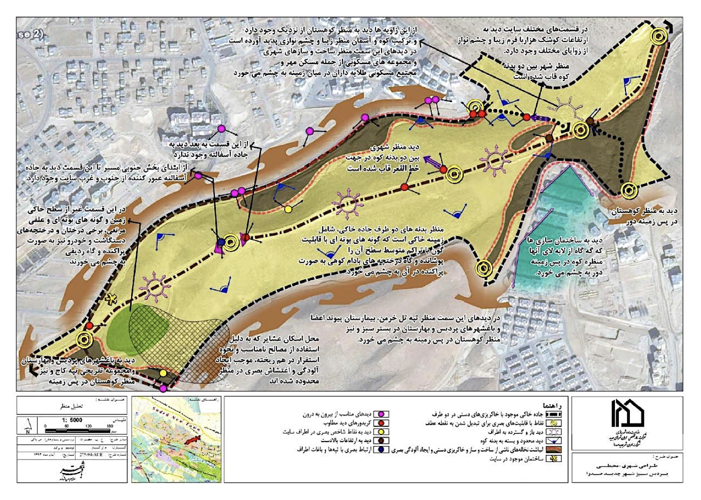
Shiraz: Urban–Environmental Design of the Northern Highlands (Babakoohi)
Summary of Proposed Strategies:
Emphasis on protecting the natural landscape; preserving the integrity of the mountain range as the city’s natural heritage; prohibiting any development without prior environmental assessment; zoning the mountain according to its ecological characteristics; and facilitating public access to the highlands—strengthening the connection between people, the city, and nature.
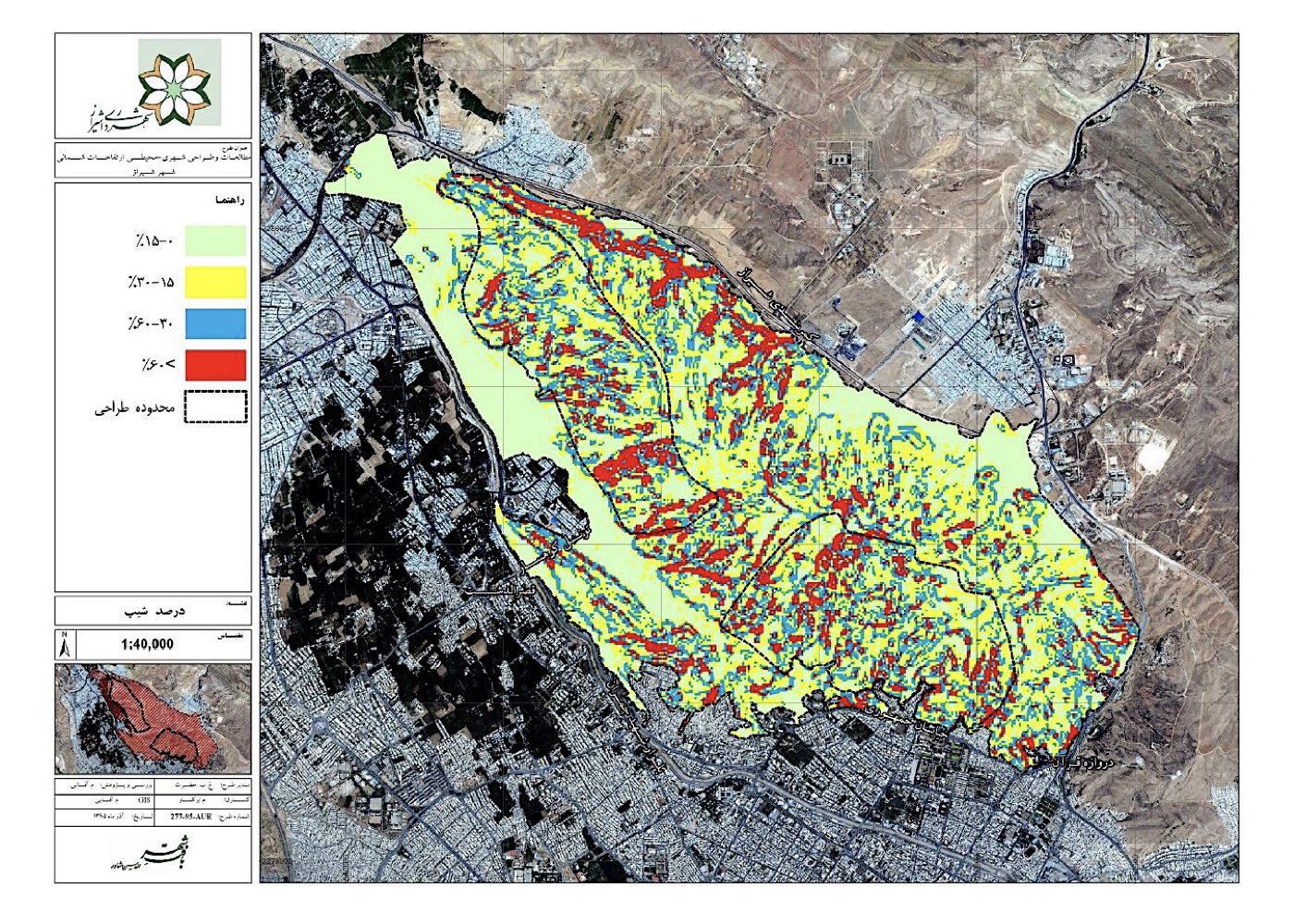
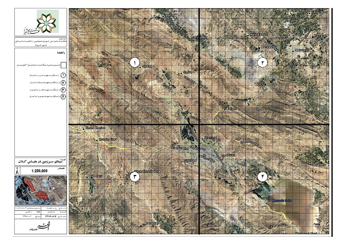
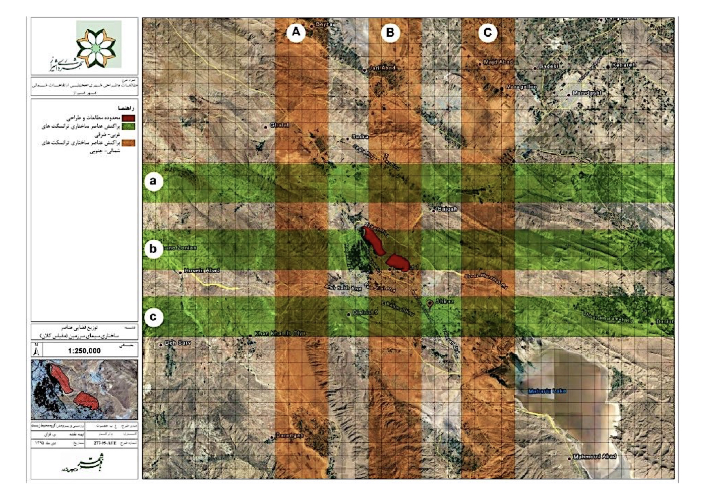
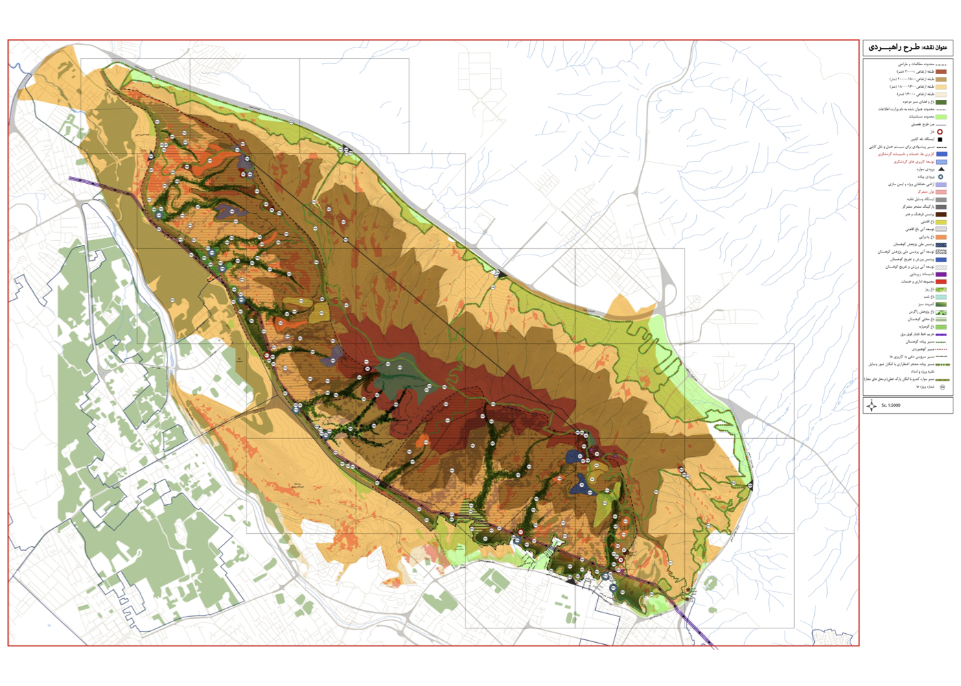
Background:
The Bābākoohī highlands are located north of Shiraz. The total study area covered approximately 3,700 hectares, with a strategic planning boundary of about 1,180 hectares and a preliminary design area of 100 hectares. As with similar projects, the studies were carried out within the framework of Urban–Environmental Design theory, at a macro and strategic scale.
During the study process, a large portion of the central land was transferred to a government ministry. Nevertheless, due to the importance of maintaining the continuity of the mountain ecosystem north of Shiraz, the entire highland area was studied comprehensively, and the findings were submitted to the municipality. However, following changes in municipal leadership and planning policies, the continuation of the project was halted, and issues arose regarding payments—even though the majority of the research had been completed.
Project Impact – Outcome:
The studies covered all urban and environmental aspects with an approach based on “active conservation” and the enhancement of natural environmental quality. The project aimed for land-use practices aligned with the ecological capacity of the area, the development of sustainable tourism, and the establishment of a balanced relationship between people, the city, and nature.
Had the project continued to completion, Shiraz could have become a leading model for mountain-campus developments similar to Ferdowsi Garden in Tehran or Koohsangi in Mashhad.
Due to an unknown reason the budget was cut and the project was halted and left unfinished.
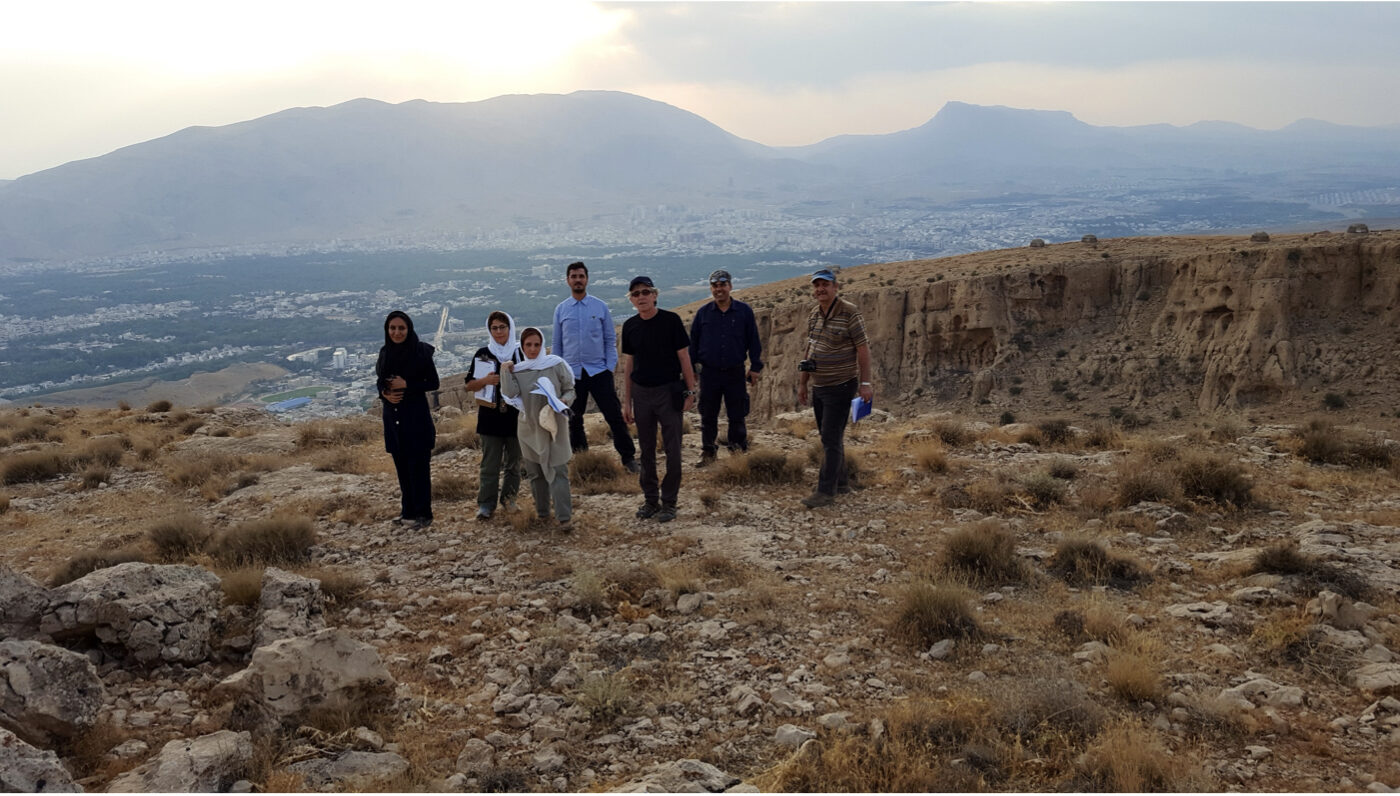
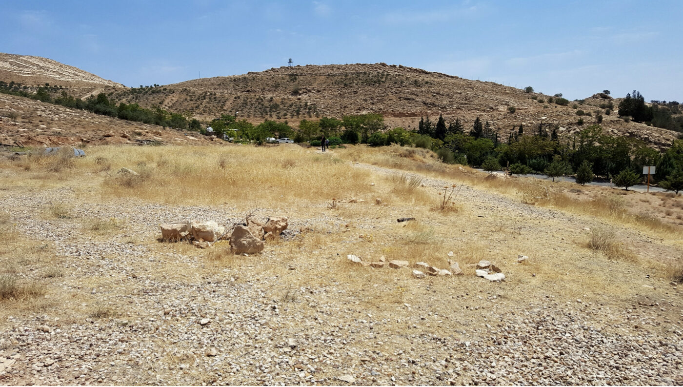
Shirin Shahr New Town [ 1 Project ]
Shirin Shahr New Town: Urban Green Space and Recreational – Tourism Complex (Strategic)
Summary of Proposed Strategies:
Creating a sustainable network of urban green spaces with ecological linkages between internal and peripheral green areas, aligned with the region’s environmental conditions, economic realities, and comfort needs.
Background:
Shirinshahr is located west of the Karun River, adjacent to the Sugarcane Agro-Industrial Complex, and 46 kilometers from Ahvaz. The city covers 6,500 hectares and was designed to accommodate the population overflow from Khuzestan’s cities—particularly Ahvaz—with a portion allocated to employees of the sugarcane industry.
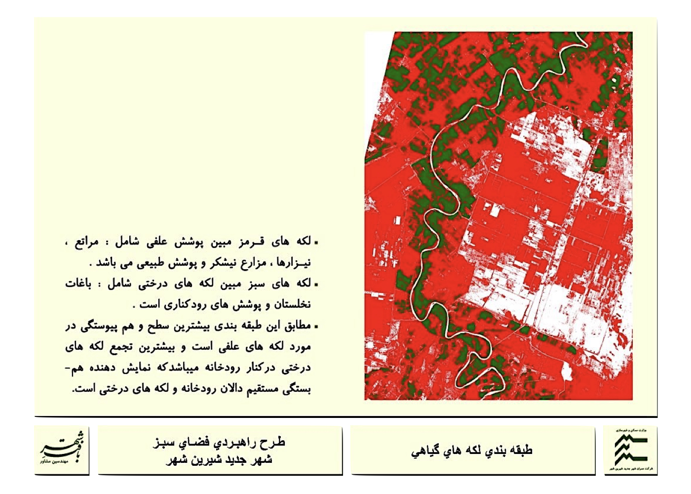
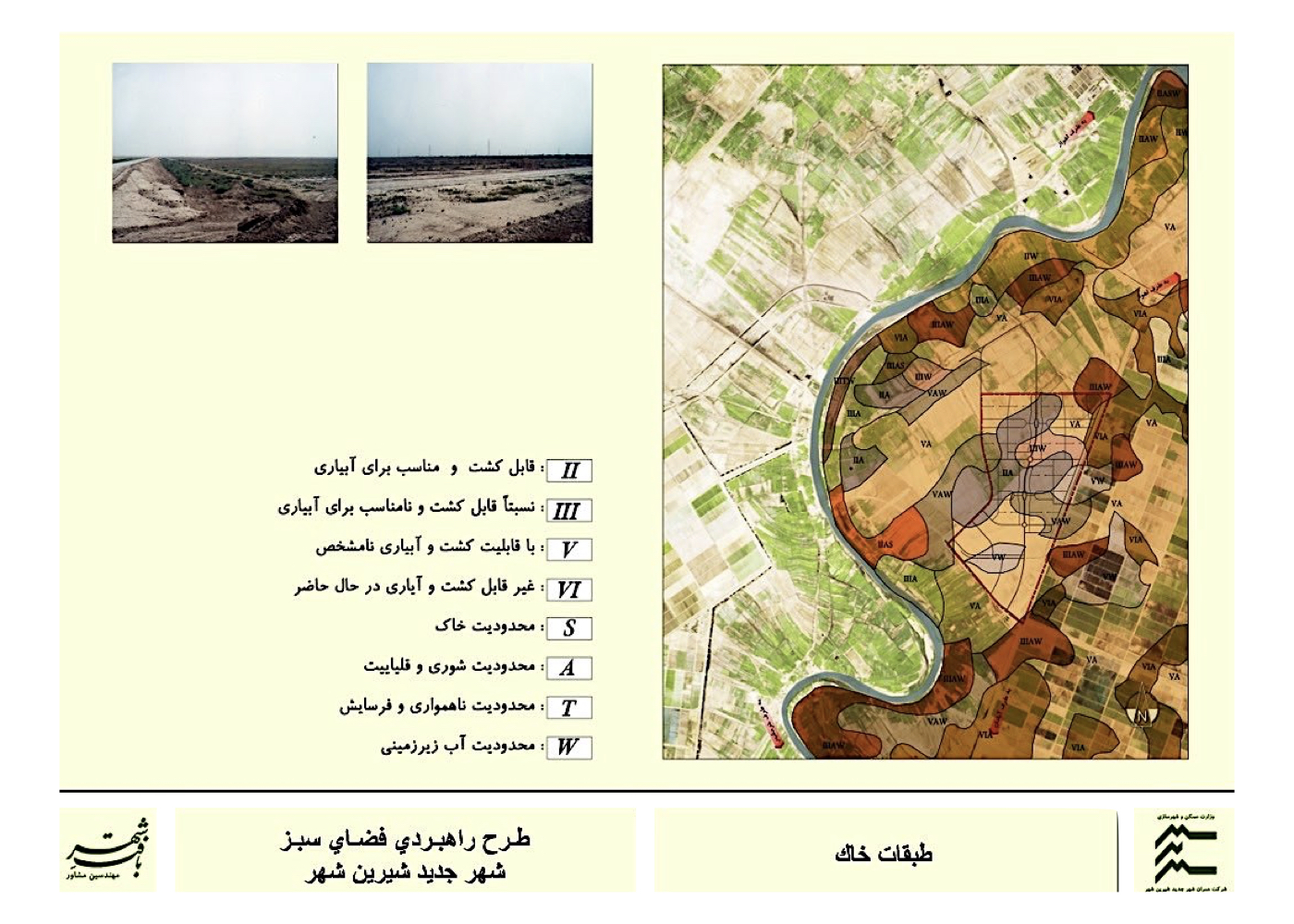
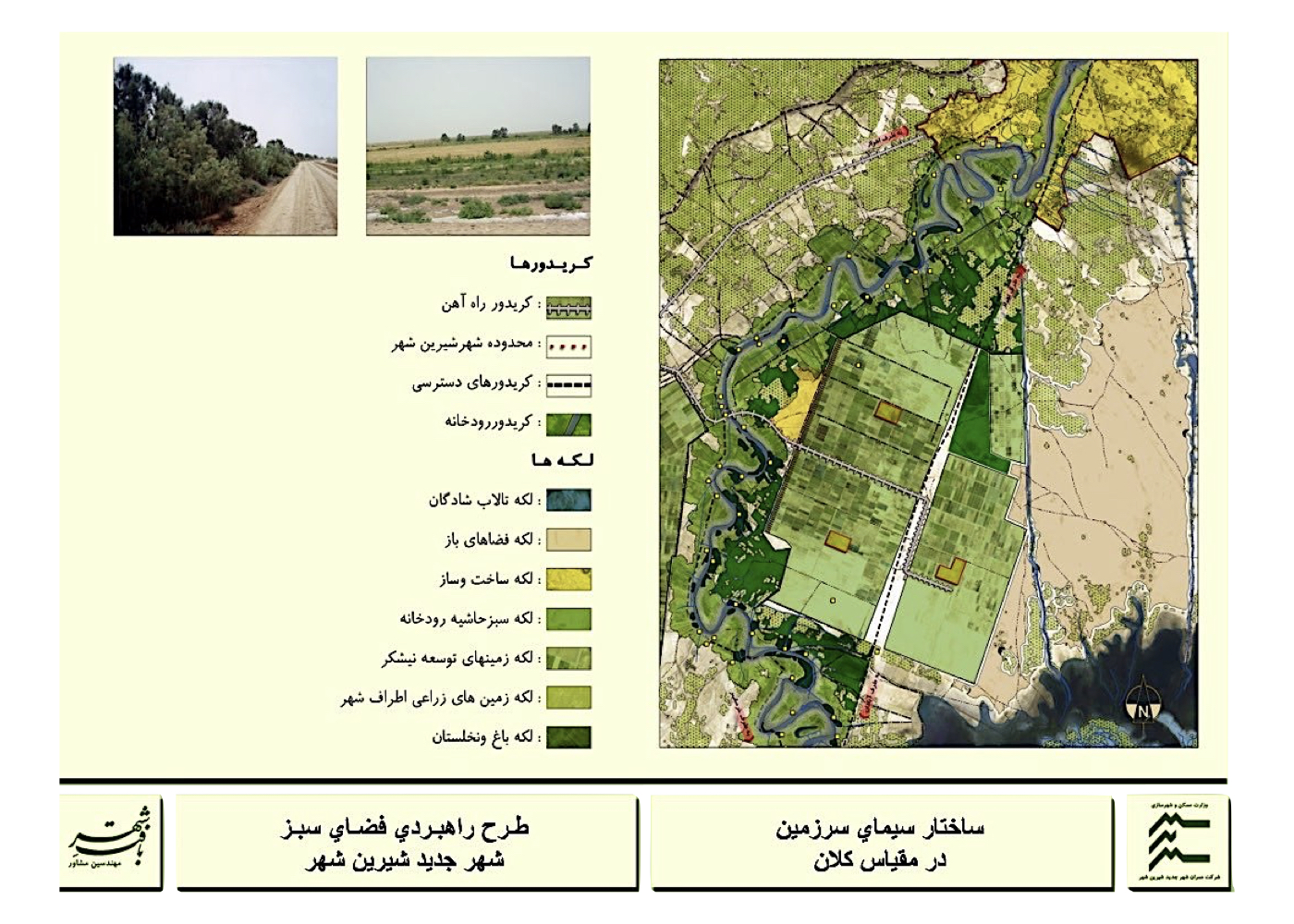
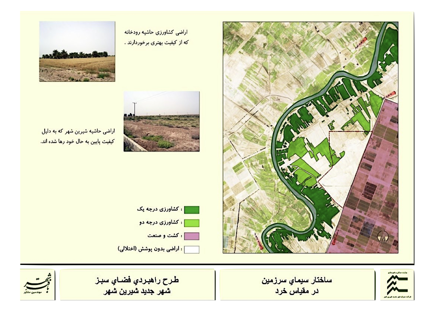
Due to the lack of base maps for the area, IRS satellite images with processing capability were used. Subsequently, using a GIS platform, maps and informational layers were prepared and analyzed in the fields of climate, topography, soil, vegetation, wildlife, landscape, environment, urban utilities and city structure.
The project reports and documentation are presented in three volumes:
1. Base Studies for the Strategic Green Space Plan
2. Strategic Plan Report
3. Tourism–Recreational Complex Report
Given that the full set of studies spans several hundred pages, only a concise 10-page summary of the main headings from the Strategic Green Space Study is presented here.
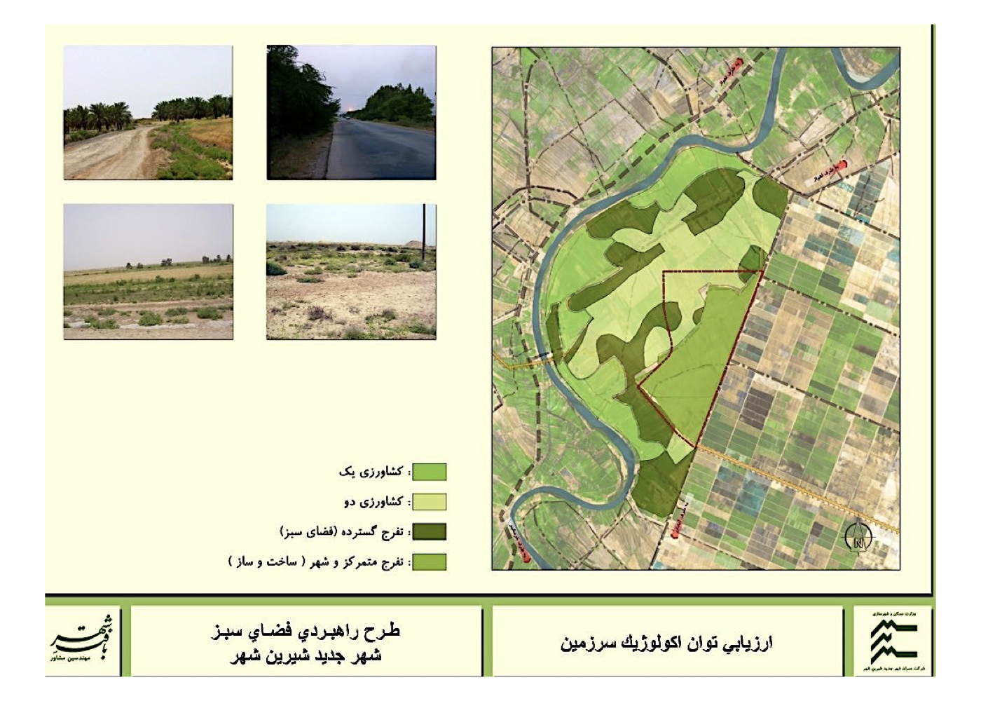
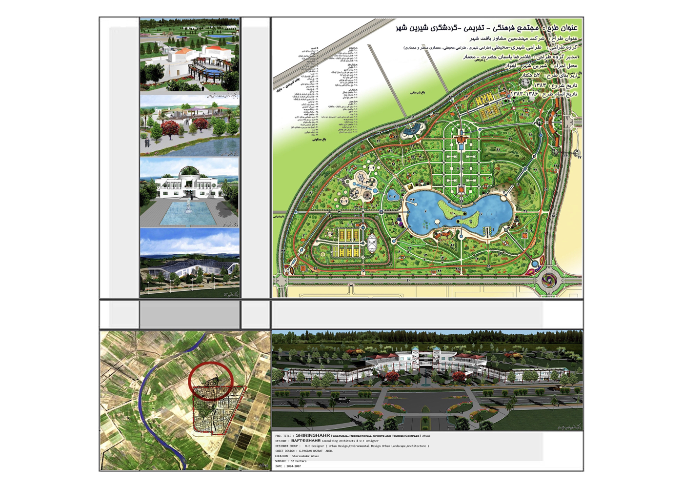
Summary of Concepts, Strategies and Solutions:
1. Harmonizing the green space network with groundwater resources, soil, and other natural assets to ensure ecological sustainability.
2. Enhancing the quality of the urban environment to improve residents’ quality of life.
3. Leveraging environmental assets to elevate spatial quality and attract tourism.
4. Reducing the costs of planting and maintaining green spaces through a sustainable management approach.
5. Establishing ecological linkages between existing green patches, future development zones, and the natural green areas surrounding the city to create an integrated and resilient network.
Project Impact – Outcome:
With full implementation of the plan, the city’s environmental problems will be reduced and its urban landscape will become more organized. By creating continuity between the green spaces inside and around the city and increasing their capacity and efficiency, air purification and overall environmental quality will improve more effectively. This new and integrated green-space structure will strengthen the connection between people, the city, and nature, ultimately contributing to the sustainable development of the new city of Shirinshahr.
Tehran [ 10 Projects ]
Tehran: National Oil Company Garden
Summary of Proposal:
Preventing the gradual destruction of the existing historic garden and its qanat by designing an educational–hospitality complex for the National Iranian Oil Company (a dynamic conservation strategy for a natural gem).
Background:
This small garden—containing qanat water, old trees, and a fragile building—was owned by the National Iranian Oil Company (NIOC). In the initial discussions regarding the change of land use, it was agreed that the garden’s function should be adapted to activities needed by NIOC.
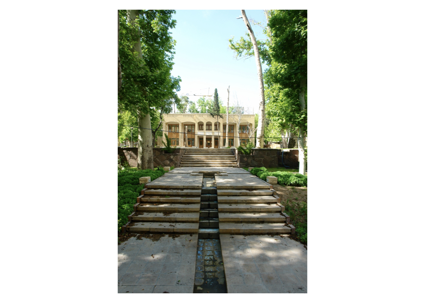
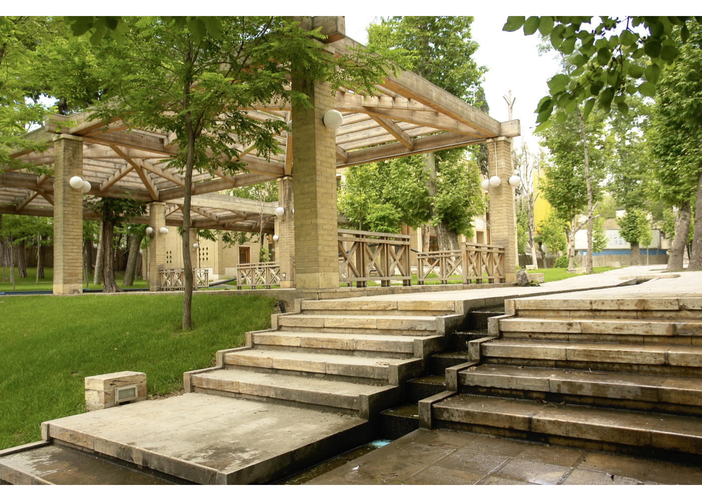

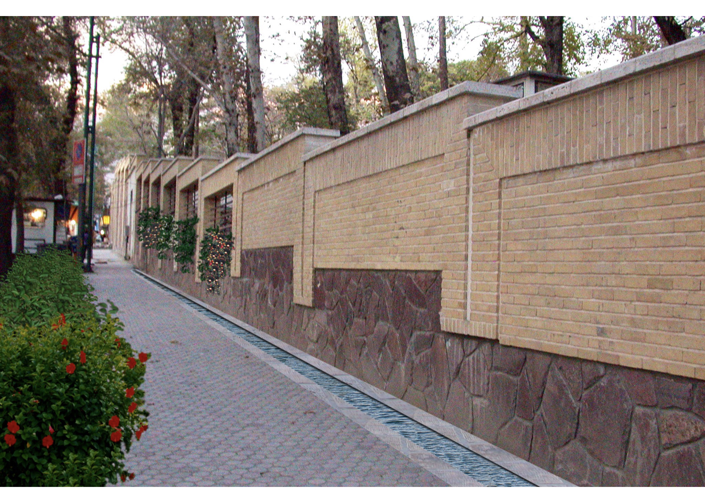
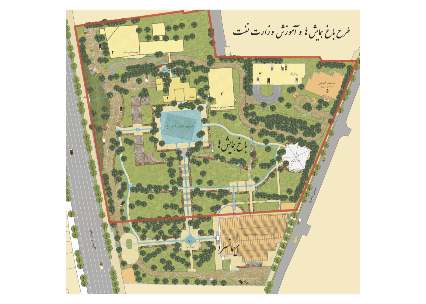
After preliminary studies, in a meeting attended by the Minister of Oil at the time, among all feasible land uses—those capable of positively contributing to the preservation of the garden—the educational–hospitality function was selected. This included:
1. Hosting NIOC guests
2. Providing training for NIOC managers
3. Signing NIOC contracts
Accordingly, the design included:
1. Revitalizing the garden grounds
2. Restoring the qanat and its outlet
3. Strengthening and upgrading the old building
4. Constructing a hospitality building
5. Building a set of educational classrooms and a conference hall
6. Providing the required parking facilities for NIOC
Project Impact – Outcome:
A noteworthy aspect of this project was the realization of one of the proposed models for preventing the destruction of an old garden—achieved by selecting a land use compatible with the garden’s ecological capacity and placing it under the ownership of a stable and reputable institution capable of covering its maintenance costs.
Unfortunately, after the project was completed, the Tehran Metro Company began constructing a station along the path of the garden’s qanat, disrupting its water flow.
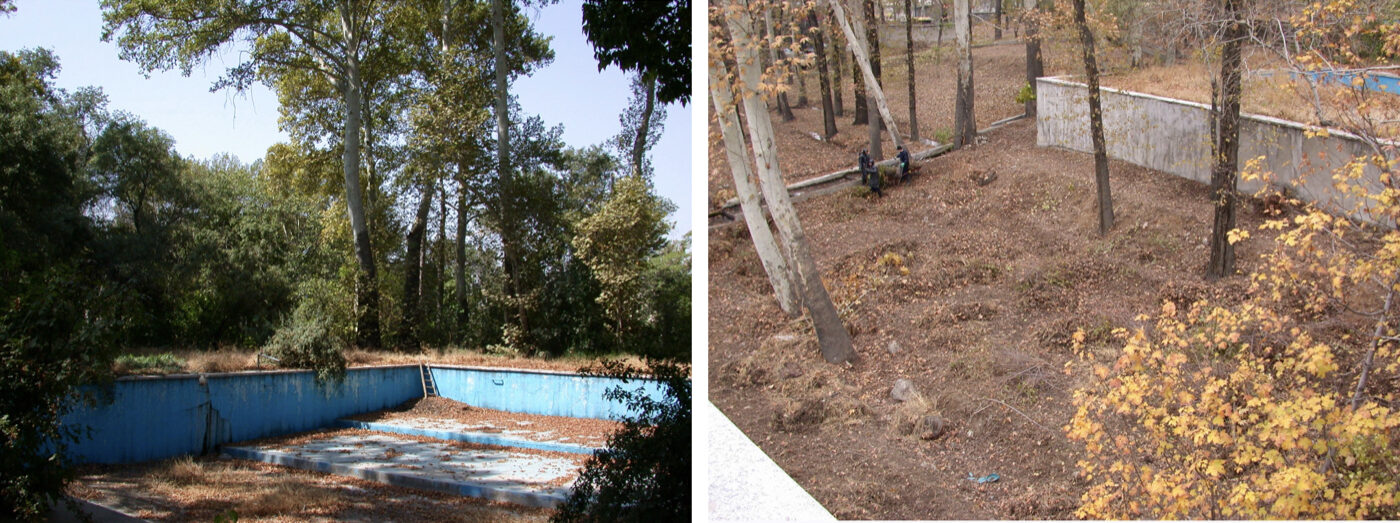
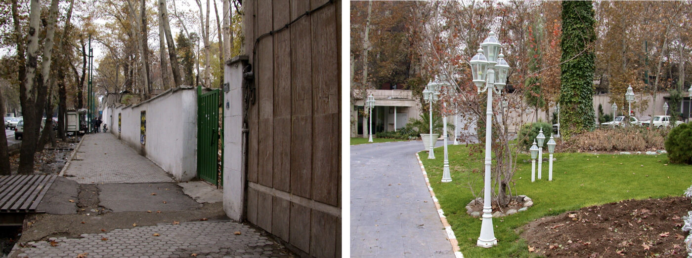
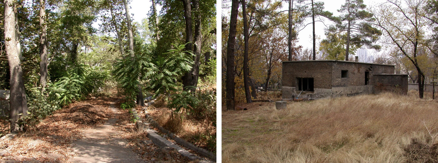
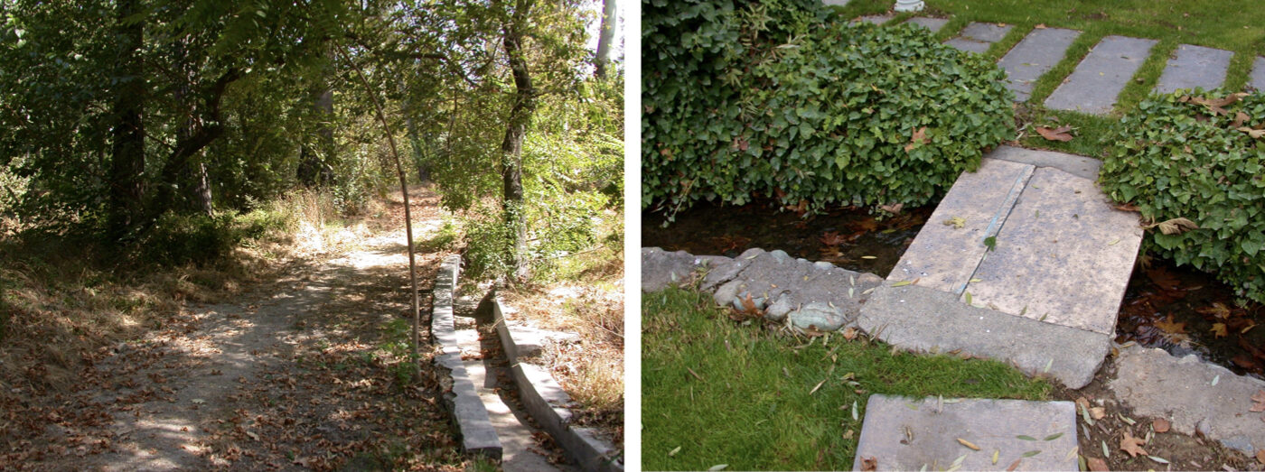
Tehran: Plan for the Protection and Management of Gardens and Agricultural Lands (Strategic)
Summary of Proposal:
Formulating policies and strategies for the protection and management of gardens based on environmental baseline studies and the environmental zoning of Tehran, with the purpose of strengthening the relationship between people, the city, and its natural heritage.
Background:
Since the 1960s, the preservation of existing gardens has remained a recurring challenge for municipalities across the country—such as Tehran, Mashhad, Tabriz, Shiraz, and others. Recommendations made through Master Plans, Detailed Plans, and subsequent thematic plans have also failed to achieve meaningful results. One key reason seems to be that proposed solutions were developed predominantly from an urban-planning perspective.
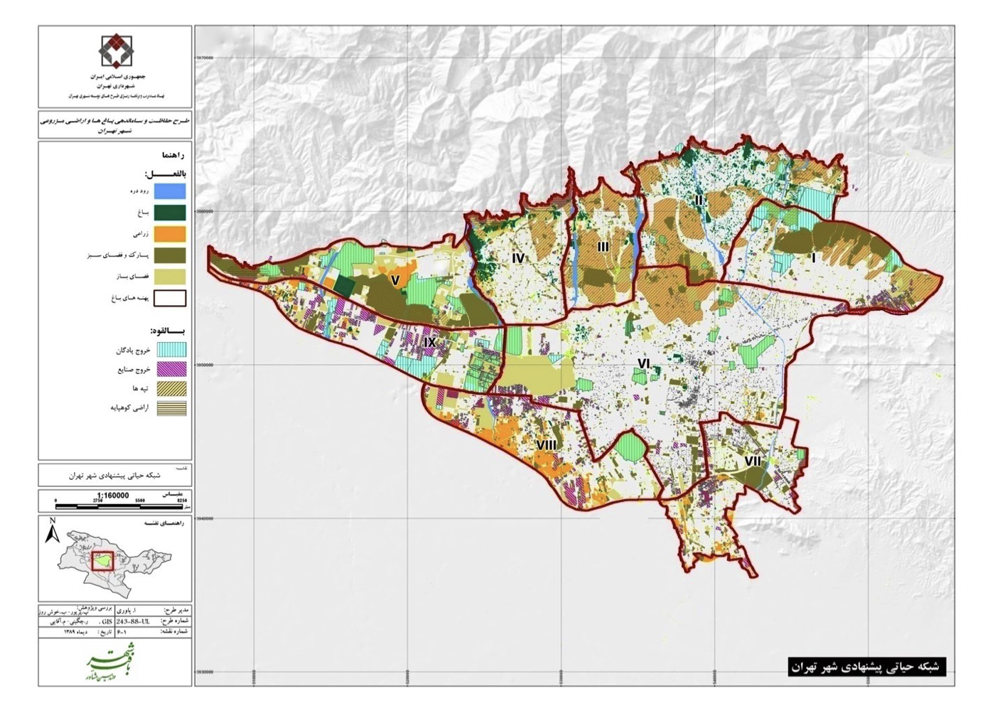
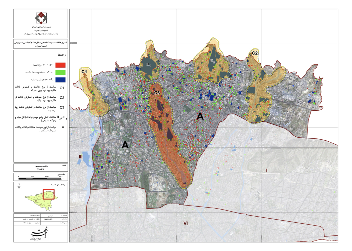
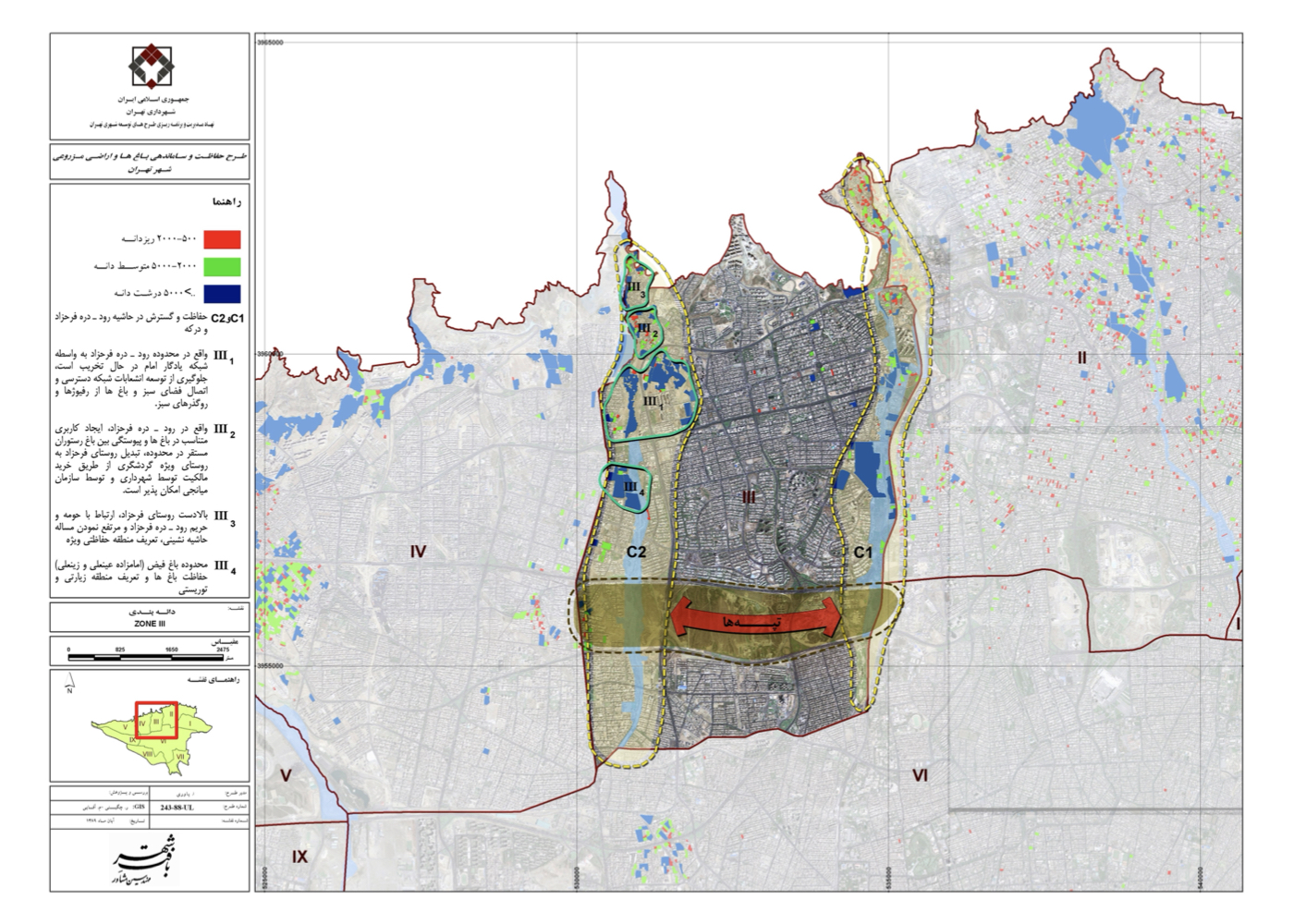
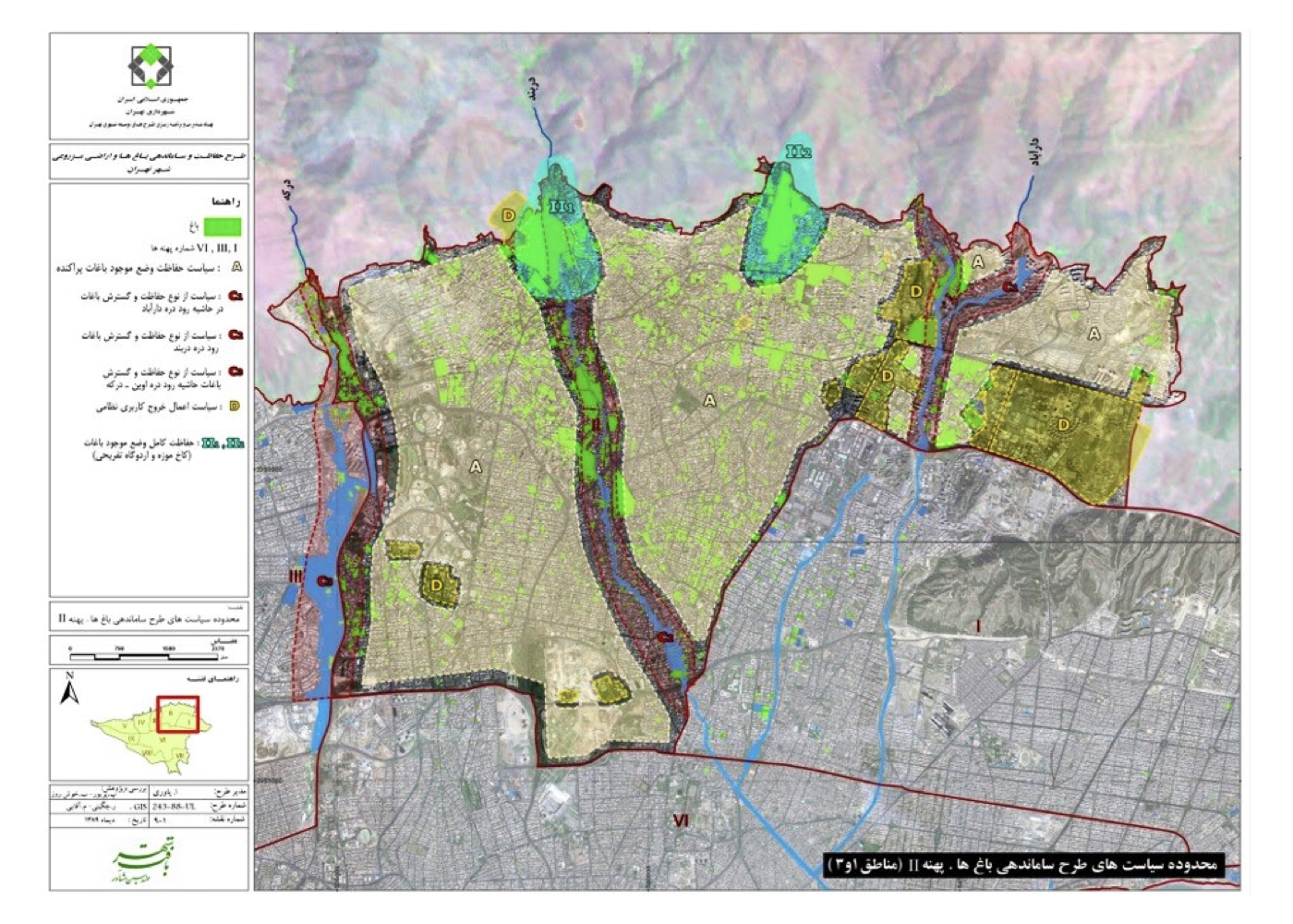
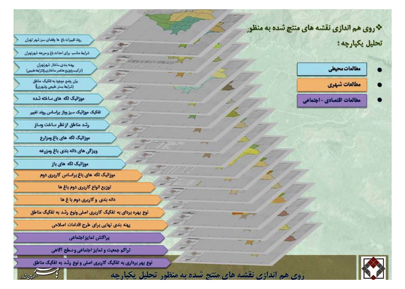
Summary of Concepts, Strategies and Solutions:
In response, the Municipality of Tehran entered into a contract with Moshevar-e Baft-e Shahr (Urban Fabric Consultants). Interestingly, the legal studies revealed that despite the thousands-year-old tradition of gardens in Iran, there is no unified definition of “garden” across laws, regulations, urban planning, architecture, land registry, environmental legislation, landscape architecture, customary practice, or religious law.
Drawing on prior experience and earlier projects, the new approach was framed as an “urban–environmental design” methodology. Baseline studies in environmental science, landscape architecture, and botany—combined with urban planning frameworks, existing regulations, urban economics, and vested rights—formed the basis for analysis and strategic decision-making.
Due to the large number and dispersed locations of gardens and farms—and the difficulty of conducting fieldwork because of landowners’ reluctance or distrust—Dr. Ahmad Reza Yavari, the technical director of the project, proposed an innovative solution: for the first time in an urban planning project, environmental and landscape studies would be conducted through satellite-image analysis.
After acquiring the required satellite data, initial analyses were carried out by remote-sensing experts. By overlaying the information layers, the consolidated results became the foundation for landscape, environmental, and urban planning assessments.
Tehran’s 700 km² area was then classified into nine environmental zones, each containing multiple sub-zones and special areas. A strategic plan was subsequently prepared and approved.
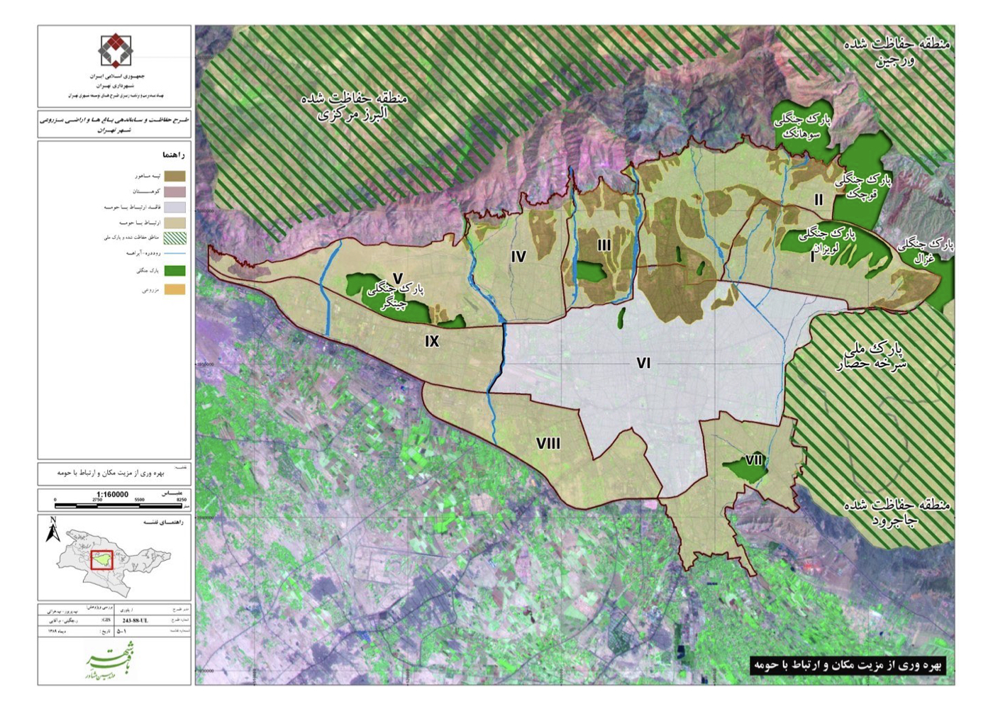
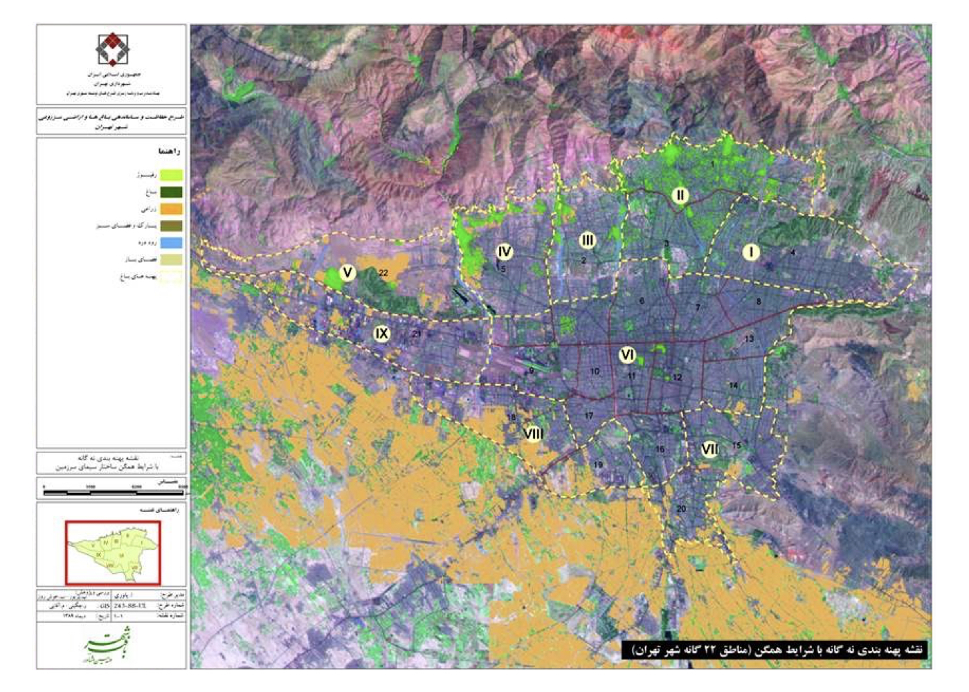
Project Impact – Outcome:
In this project, the issue of protecting the existing gardens—precious inheritances from the city’s ancestors and public environmental assets—was addressed for the first time not through urban planning regulations (which had proven ineffective in safeguarding them), but instead through a comprehensive set of studies including environmental baseline assessments, environmental planning and design, landscape analysis, climate, geological and subsurface conditions, economic factors, building density, open and green spaces, and various forms of pollution. These studies were conducted using satellite imagery and extensive field surveys. Based on environmental criteria and standards as the primary decision-making framework, the remaining required analyses were completed as well. Ultimately, the environmental zoning of Tehran was prepared in nine categories, and the plan was approved.
Naturally, following the completion of the strategic phase, the next step—namely the formulation of area-specific strategies for each zone, sub-zone, and special district—should have commenced. However, a change in municipal management brought this process to a halt. Had the studies continued into the subsequent phase, detailed action plans would have been developed for each of the nine zones, and the protection of Tehran’s gardens and farmlands could have been implemented in a realistic and operational manner, thereby contributing to the achievement of sustainable urban development in Tehran.
At present, one of the project’s experts—who also teaches at Tarbiat Modares University—is continuing the research under a contract with the university, and it is hoped that valuable results will emerge.
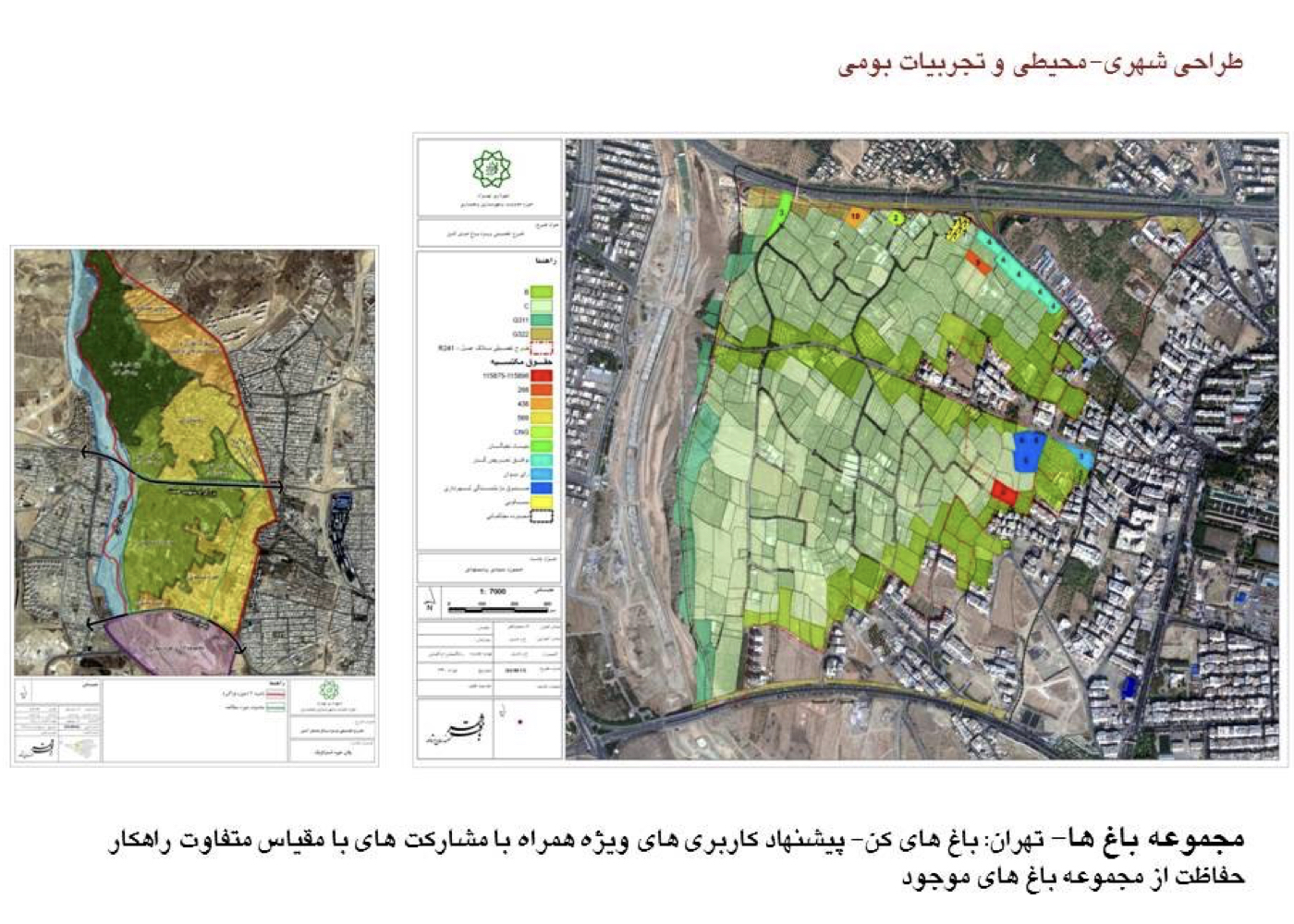
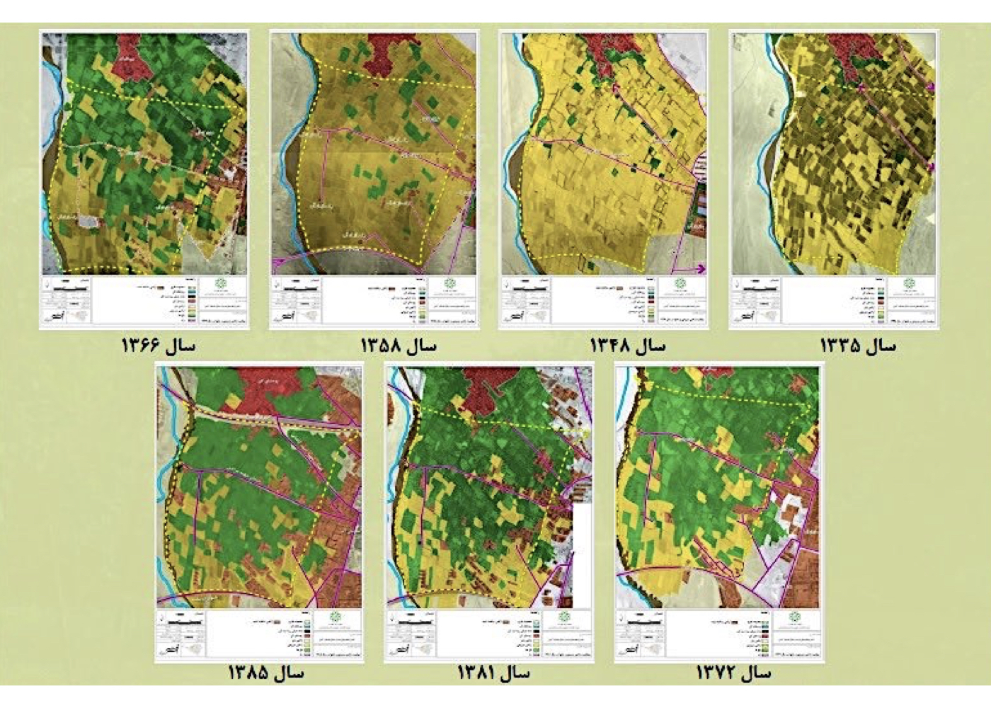
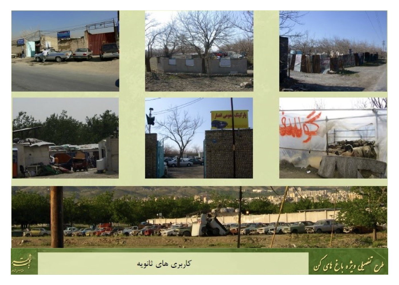
Tehran: Kan Gardens Special Plan (Strategic)
Summary of Proposal:
To ensure dynamic support and active preservation of the existing Kan Gardens, a set of realistic strategies, guidelines, and recommendations was developed. These were based on fundamental studies in environmental science, green space planning, environmental design, as well as the findings and requirements derived from these fields, in addition to studies in urban planning, economics, and other relevant disciplines.
Background:
Kan Gardens are among the oldest cultivated orchards on the southern slopes of the Alborz Mountains within the Tehran region. The total area of the northern, central, and southern sections exceeds 600 hectares. Located in western Tehran and adjacent to the Kan River, these gardens represent the last large surviving cluster of historic orchards within the city.
The construction of Hemmat Expressway through the heart of the gardens has had severe destructive impacts and accelerated land-use change. In addition to the expressway, the implementation of several new streets has intensified fragmentation and degradation. The study area of this plan covers approximately 200 hectares across the southern portion of the gardens.
Agreements to transfer sections of the gardens to the Municipality—and the issuance of construction permits for remaining parcels—have further contributed to their decline. Because Hemmat Expressway sits at a lower elevation, traditional irrigation flows and surface runoff that historically fed the southern gardens have been cut off and diverted toward the Kan River. This altered the natural subsurface irrigation patterns as well.
The plan’s studies analyze all threats, opportunities, capacities, and constraints across all relevant fields—particularly those affecting green space and ecological integrity.
The holistic approach emphasizes extending ecological protection and continuity beyond the study boundary through a landscape-matrix strategy. This includes strengthening ecological links to the Kan River corridor to the west and connecting the northern gardens with the open and fragmented lands to the east and south.
The main solutions of the plan include:
1. Re-establishing spatial continuity between the northern and southern garden sections as a unified landscape matrix
2. Redesigning and improving the Hemmat Expressway edge
3. Enhancing structural and functional connections to the Kan River
4. Shifting construction patterns toward river-oriented green development
5. Creating water-collection reservoirs to allow infiltration into upstream lands and strengthen groundwater resources
6. Reorganizing Andisheh and Ta’avon Boulevards with appropriate widths based on detailed urban planning guidelines
Priority areas in the plan are:
1. Securing sustainable water resources
2. Improving adjacent and internal access routes
3. Rational garden parceling and land-division patterns
4. Respecting acquired property rights
5. Enhancing ecological and structural quality of the gardens
6. Ensuring spatial and ecological continuity
7. Increasing vegetation density and diversity
Project Impact – Outcome:
The proposal was approved, and during a meeting, the mayor at the time committed to coordinating with the relevant authorities and securing the necessary funding for its implementation.
Had the next phase—preparation of the executive plan—been completed, this collection of gardens would have been saved from destruction and could have contributed significantly to the sustainable development of Tehran.
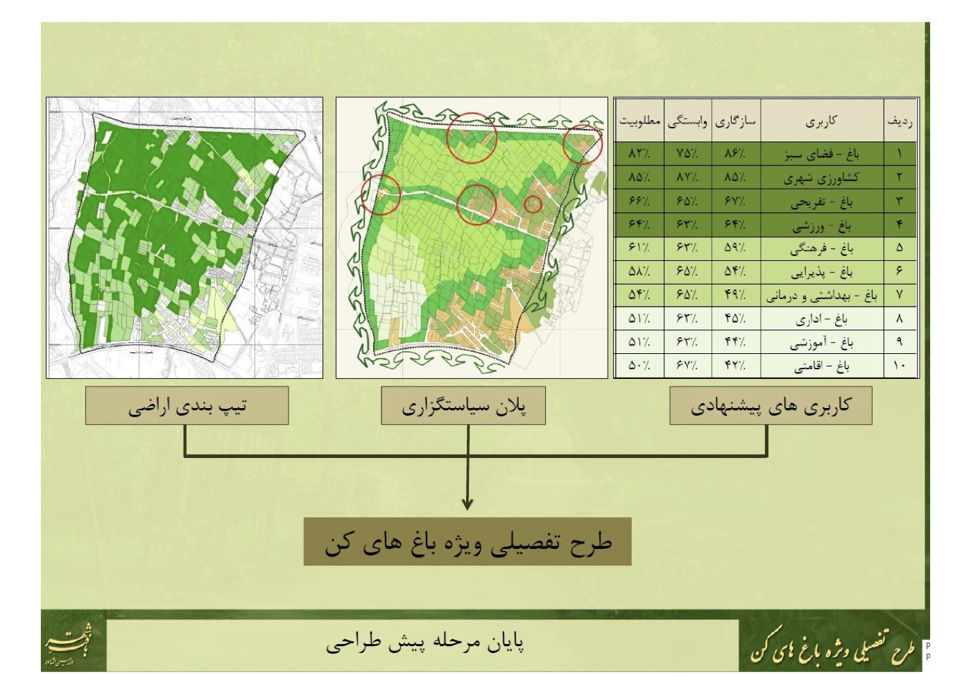
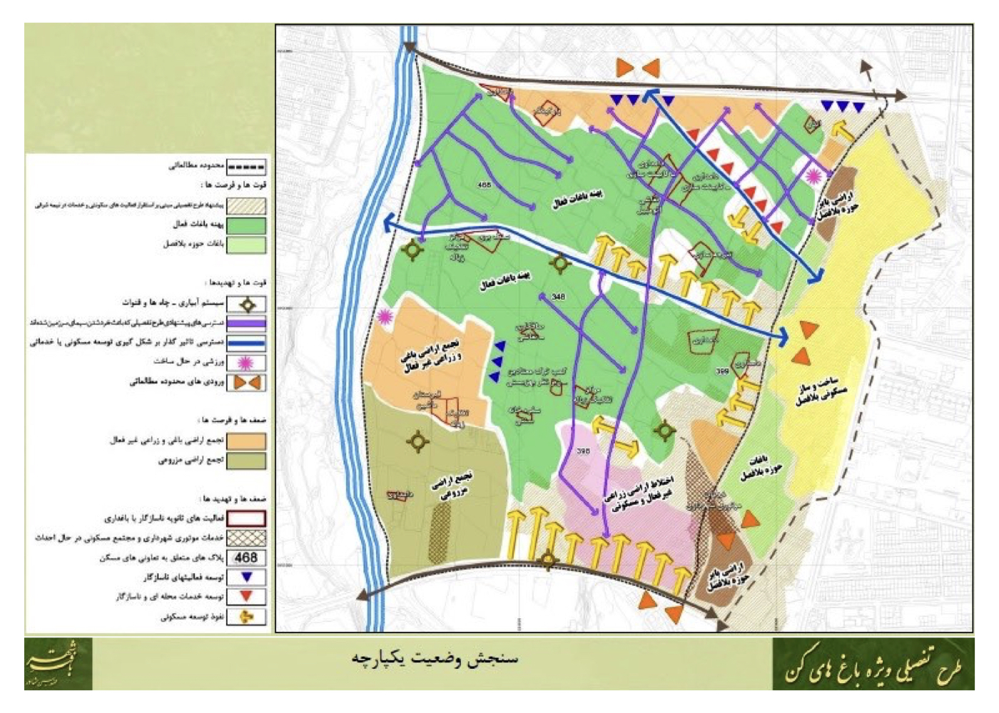
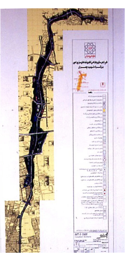
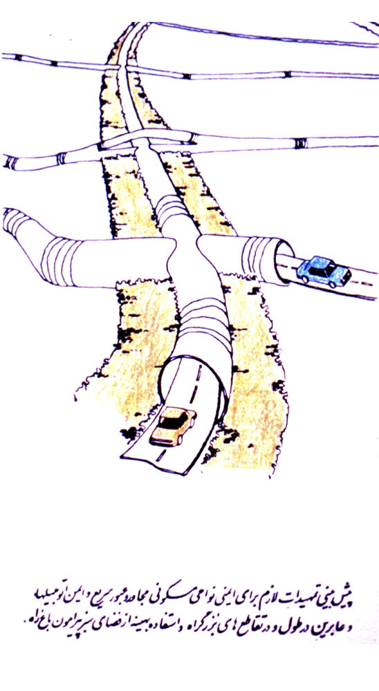
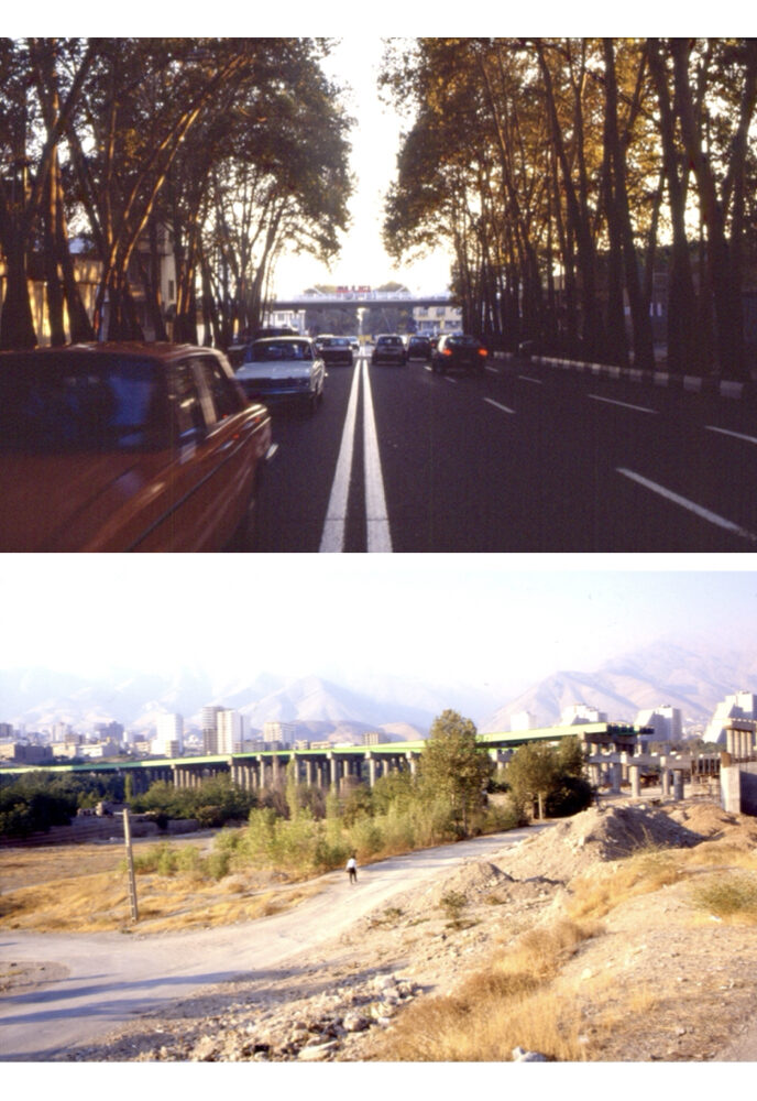
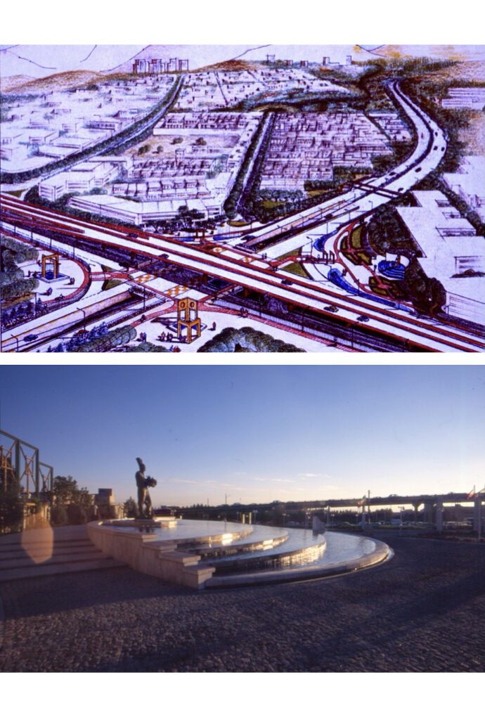
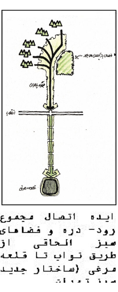
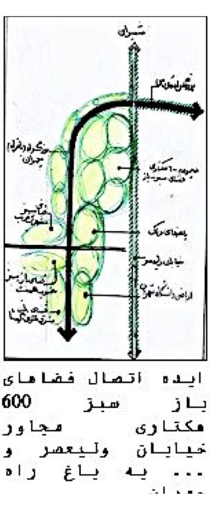
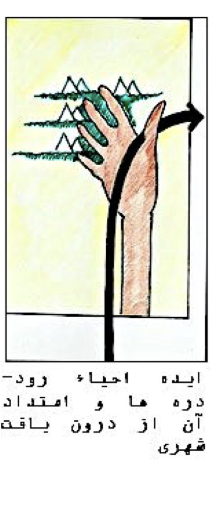
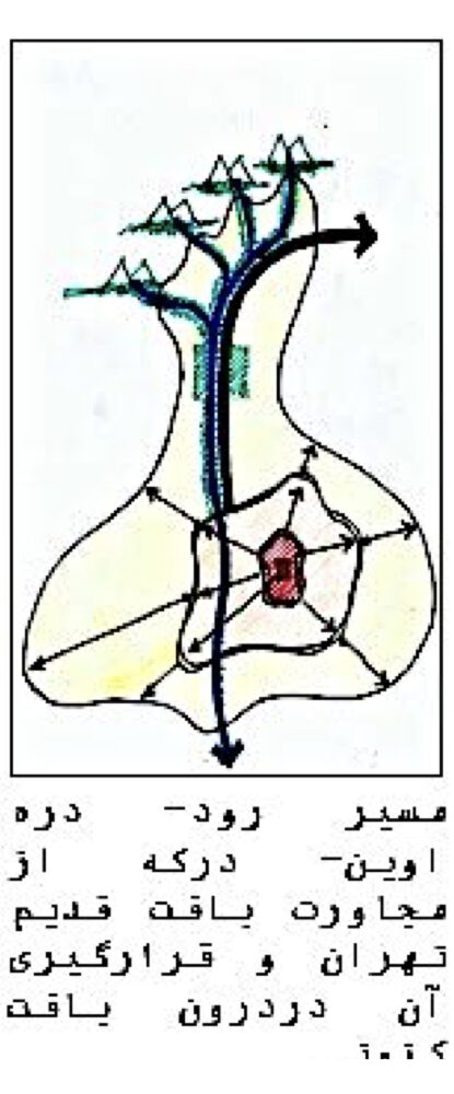
Tehran: Safety Enhancement and Physical Design of Chamran Expressway Corridor – Strategic, Design and Implementation Phases
Summary of Proposal:
Restoring the “garden-route” character of the corridor and extending the green landscape of northern Tehran into the urban fabric of the southern districts; linking hundreds of hectares of scattered green spaces to improve ecological continuity; and connecting the natural systems of the Alborz foothills and its river-valleys through a designed green corridor extending southward to Ghal’e-Morghi, transforming it into an urban park. This strategy aims to reconnect people and the city with nature—mountains, river-valleys, gardens, plains, and the southern desert edge of Tehran.
Background:
Chamran Highway, built in the 1960s, functioned for decades as a key north–south axis known as “Park-Way.” The name likely referred to the Vanak gardens at its midpoint and the Evindarakeh gardens at its northern end.
According to early regulations, highways were to include a 35-meter setback on each side. However, for Chamran Highway this buffer was set at 100 meters, causing challenges for surrounding residents, particularly near historic gardens. The consultant was tasked with conducting detailed studies to ensure safety and organize the lands on both sides of the 12.5 km corridor across several municipal districts. Before tools like Google Earth existed, such studies required helicopter flights and aerial photography, complemented by field surveys and analysis of upstream masterplans.
Due to the complexity of issues and differing views among officials, the corridor was divided into five zones, each assigned an executive manager.
Summary of Key Ideas and Strategies:
1. The highway, once located at the urban edge, gradually became a major internal artery as the city expanded.
2. For much of its length, it runs alongside a major natural system—the Evin–Darakeh river-valley—both influencing and affected by it.
3. Because of its proximity to historic gardens and the river, the corridor must retain a garden-route identity.
4. At its southern junction with Valiasr Street, the highway meets a unique 600-hectare cluster of state, municipal, exhibition, and hospital gardens. With proper integration, this cluster could connect to the Vanak gardens, creating new opportunities for walking and urban tourism.
5. Integrating this metropolitan green zone with the Vanak gardens and adjacent areas would allow the spirit and landscape of northern Tehran to extend southward to Towhid Square.
6. With proper planning, this system could continue from Towhid Square to Ghal’e-Morghi along both sides of what later became Navab Highway, linking neighborhoods to a continuous north–south green line.
7. The 200-hectare Ghal’e-Morghi Airport could be transformed into a multifunctional green complex (urban campus) using the abundant waters flowing from northern Tehran.
Coordinated implementation of items 4–7 would give Tehran a continuous green structure—from the gardens north of Chamran to the Vanak gardens, Evin–Darakeh river-valley, Amirabad open spaces, Imam-Khomeini Hospital, the green edges of Chamran and Navab, and finally Ghal’e-Morghi. This would create a varied green corridor stretching from the Alborz foothills to the edge of the southern desert—reducing pollution from western winds and industries, preserving gardens, and becoming a pillar of sustainable development.
A major conceptual proposal was redefining Tehran’s seasonal riverbeds—not as “flood channels” (masil) but as “river-valleys.” This shift would elevate them from negative urban spaces to valuable ecological organs, capable of carrying natural elements—trees, shrubs, springs—down from the mountains into the urban fabric, linking central and southern neighborhoods with the Alborz ecology. The result would be several unique north–south green corridors unmatched globally.
The river-valleys of Darabad, Golabdareh, Evin–Darakeh, Farahzad, and Kan all possess this capacity.
Notes:
1. The strategic plan and phases I and II were approved by the Ministry of Interior and Tehran Municipality. However, changes in municipal leadership and construction of interchanges and exhibition facilities led to major deviations.
2. The project depended on proper integration with the Navab corridor design—such as tunneling the highway or lowering it below grade to allow green and pedestrian routes—but these were not adopted, resulting in uncomfortably narrow pedestrian paths.
3. Ghal’e-Morghi was fortunately transformed into Velayat Park, but without the Navab green corridor, the north–south ecological connection remained incomplete.
4. Overall, the proposal was largely ignored, and new highways such as Hemmat and Hakim cut across river-valleys, significantly damaging their natural structure. A future administration may revive the concept.
5. The accompanying sketch simplifies the foothill structure as “fingers” and the river-valleys as the depressions between them, which were intended to be organized individually or collectively toward southern Tehran.
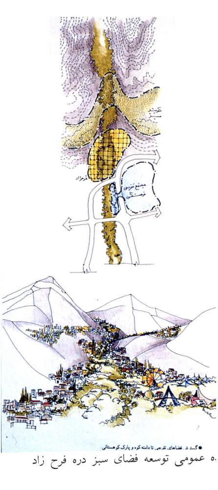
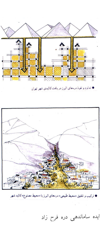
Project Impact – Outcome:
Had the project been fully implemented, it would have significantly enhanced both the quantity and quality of green spaces surrounding the highway. Scattered gardens and open green areas would have been connected to one another through the highway corridor, strengthening their resilience against constraints, threats, degradation, and land-use changes. The project would also have reduced highway pollution, revived the spirit and identity of the historic “Garden Route” (Park-Way), and extended the natural landscape of Tehran’s northern valleys deep into the urban fabric all the way to the south of the city.
In addition, the plan aimed to reconnect neighborhoods that had been divided by the highway and to create a continuous pedestrian promenade and sports cycling path from north to south along a newly developed green corridor. Altogether, these measures were designed to contribute meaningfully to the sustainable development of Tehran.
The first and second phases of the plan were prepared and approved. To remove implementation obstacles and prevent damage to residents, a committee composed of experts from the Ministry of Interior, the Municipality, and the consulting firm “Baft-e Shahr” inspected all existing parcels along both sides of the 25-kilometer corridor. Each parcel was reviewed on-site, corrected, or completed as needed, and the final executable plan was incorporated into the detailed master plan.
The first section of the project was implemented in the northeast of the Gisha intersection (Pakban Park). At the same time, however, the Municipal Executive Office—within the project boundary and adjacent to Gisha—constructed the International Flower and Plant Exhibition without any coordination (an exhibition built along the highway, lacking proper entrances and the required parking facilities). In subsequent stages, additional traffic bridges were built by other municipal departments; with proper coordination, these structures could have achieved higher efficiency and reduced their negative impact on the highway and on the project as a whole.
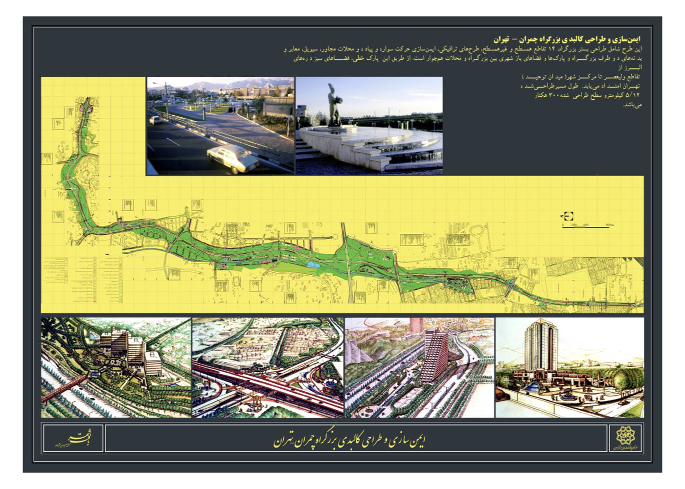
Tehran: Urban–Environmental Design for the Kolakchal Valleys of Tehran (Strategy)
Summary of Proposal:
A comprehensive zoning framework for the northern heights of Tehran—from the urban fabric to untouched mountain peaks—and a set of strategies to protect the mountains and valleys from the city’s rapid expansion. These strategies include establishing a northern green belt, safeguarding valleys and foothill lands, facilitating public access to the mountains, and implementing an active, dynamic protection system for the natural habitat, with the aim of reconnecting people, the city and nature.
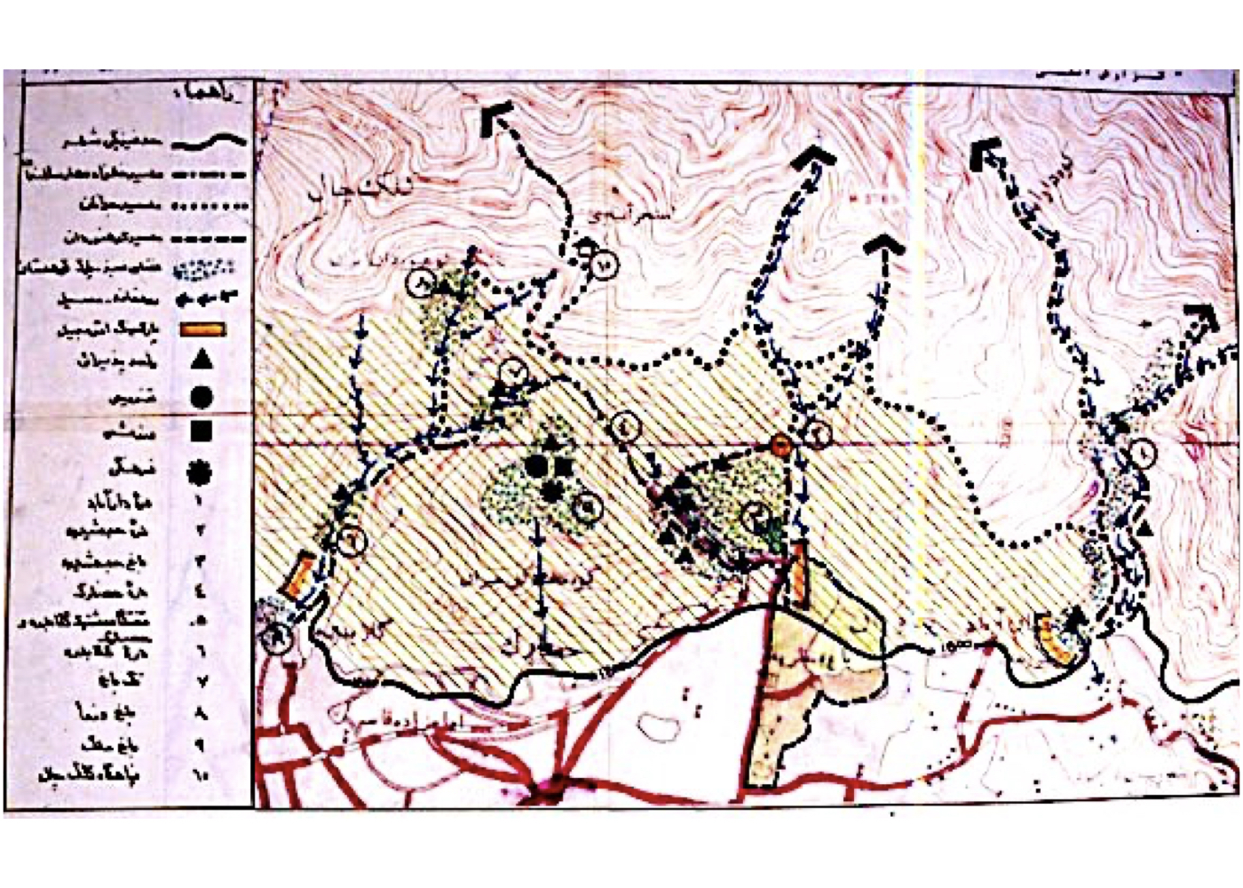
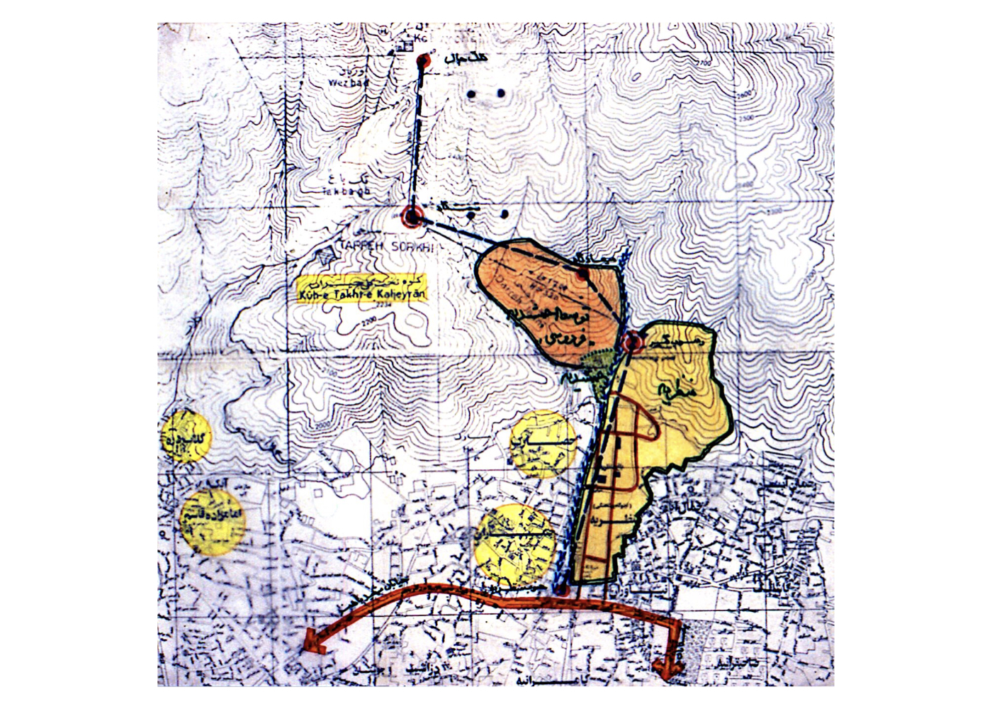
Background:
The explosive urban growth of Tehran and other mountain-adjacent cities in Iran—such as Mashhad, Isfahan, Shiraz, Tabriz, and Arak—has led to the encroachment of construction into the surrounding highlands and valleys. Consequently, mountains, valleys, and foothill areas—natural assets and heritage of these cities—are being pushed toward destruction, depriving future generations of these invaluable resources.
During the contract negotiations for the design of Ferdowsi Garden in Tehran, it was proposed to the municipality that a parallel, comprehensive environmental study be carried out for the surrounding area, including the four valleys connected to Kolakchal (Koolakchal). The goal was to develop not only a model for mountain landscape design but also environmental and safety guidelines for the highlands and valleys overlooking Tehran. Accordingly, the four valleys of Shah-Abad (Darabad), Jamshidiyeh, Tang-e Hesarak, and Golabdareh—together with their adjacent highlands, covering approximately 12 square kilometers—were placed under an integrated environmental study.
Key findings:
1. Developing and equipping pedestrian routes between the city and the mountain foothills
2. Accelerating implementation of the Northern Green Belt (Zoning Area No. 2)
3. Restricting movement within the mountains to designated, planned, and properly equipped trails
It is noteworthy that Ferdowsi Garden in Tehran, as the first component of this urban–environmental plan, was fully studied and implemented; its completed section opened to the public in 1996.
Summary of Concepts, Strategies, and Solutions:
1. Zoning of the mountains and foothills into four distinct areas:
A. Urban fabric
B. Mountain green belt
C. Active conservation zone
D. Pristine natural zone
2. Preventing urban expansion toward the mountains by establishing a pedestrian-level emergency corridor between the city and the green belt
3. Creating a protective green belt within Zoning Area No. 2
4. Valley conservation measures:
A. Repealing the building permit regulation allowing construction up to 1800 meters, which has resulted in valley degradation
B. Drafting a new regulation to stabilize the northern urban edge in accordance with environmental conditions
C. Establishing public gardens at the entrances of valleys—such as the Ferdowsi Garden model—to prevent urban intrusion and provide a planned starting point for mountain access
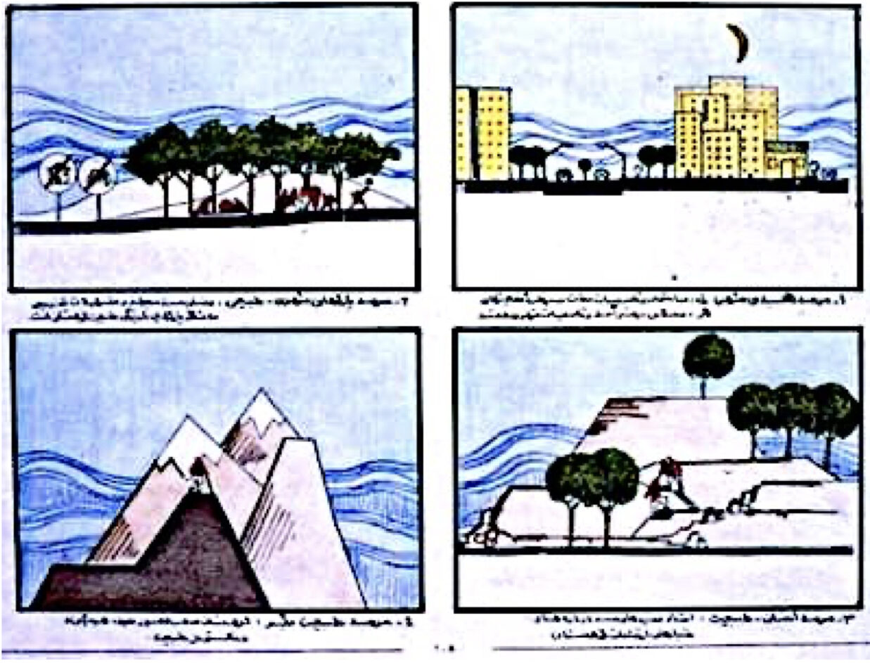
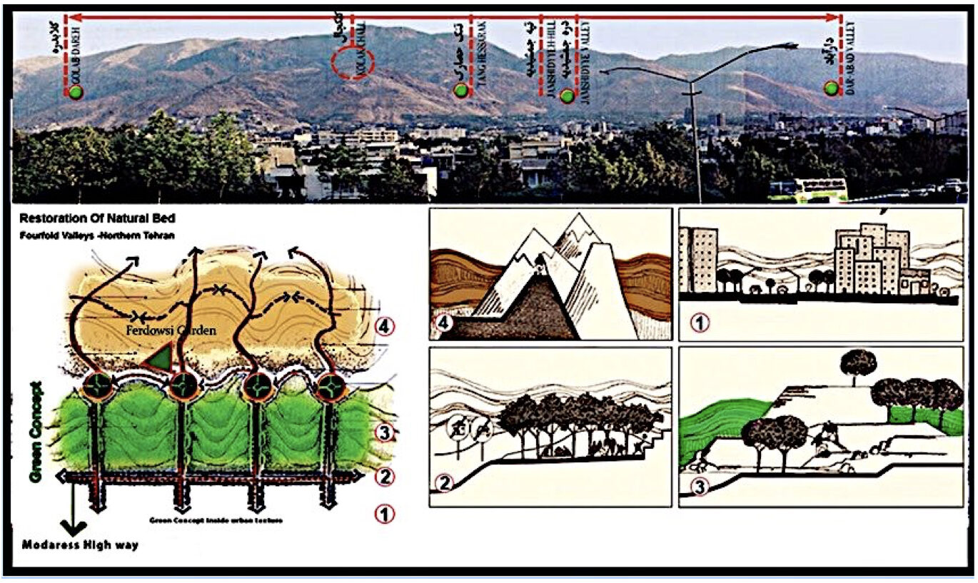
Project Impact – Outcome:
The strategies, solutions, and recommendations developed in this project can be applied not only to northern Tehran but also to all cities across the country that are connected to mountainous or foothill landscapes—such as Mashhad, Isfahan, Shiraz, Tabriz, Khorramabad, and others.
Following the approval of the project, a portion of it—covering approximately 30 hectares and located in the Tang-e Hesarak valley and the northern highlands of Jamshidieh—was selected as a pilot area, designed, and subsequently constructed (Ferdowsi Garden). This section was completed and opened to the public in 1996.
Tehran: Urban–Environmental Design for Tehran Railway Station and Planning for Suburban Lines and Stations (Strategic)
Summary of Proposal:
Development of a strategic master plan for the central Tehran railway station, its surrounding lands, and the new suburban stations required for the coming decades.
Background:
Tehran Railway Station, inaugurated in 1939, was nearly 70 years old at the time this project was initiated. During these decades, railway stations and networks in many countries—particularly in developed nations—had undergone major transformations aligned with technological advancements, while Iran’s railway system and its stations had remained largely unchanged.
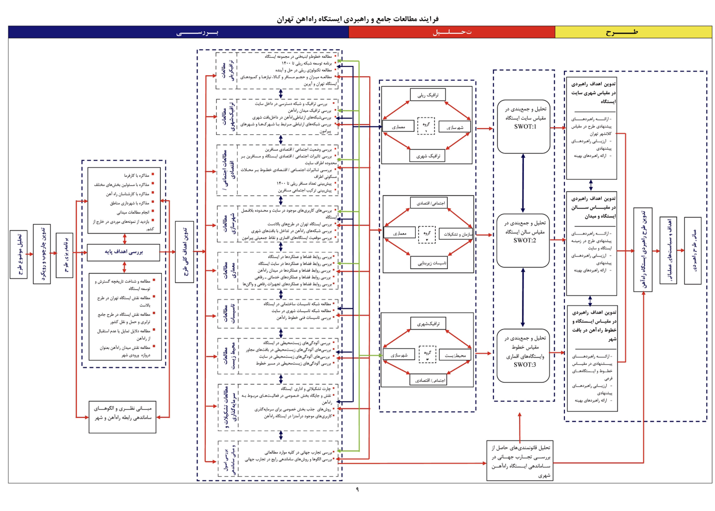
The Islamic Republic of Iran Railways selected the consulting firm Baft-e-Shahr to manage the modernization of the central station and to determine the new suburban stations and rail lines. After visiting and evaluating railway stations across Europe, the consultant proposed partnering with a well-established German company specializing in future railway technologies to jointly prepare the final strategic plan. The arrangement was that Baft-e-Shahr would conduct all foundational studies, and based on current conditions and projected technological developments, the future configuration of the Tehran station and its rail lines would be defined and approved. The final strategic plan for the entire complex would then be completed collaboratively.
Project Impact – Outcome:
Baft-e-Shahr completed all baseline studies within one year, employing a sustainable development approach across all relevant fields. Alongside this, it presented its assessment of existing conditions as well as its initial recommendations on the number and locations of the suburban stations required for Tehran’s future growth.
Unfortunately, following managerial changes at the railway organization, the new administration failed to meet its foreign-currency commitments to both the German partner and the Iranian consultant. As a result, the project was halted at this stage.
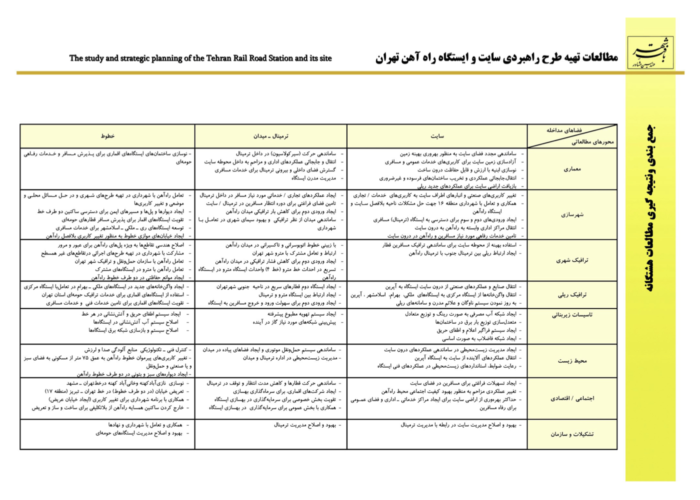
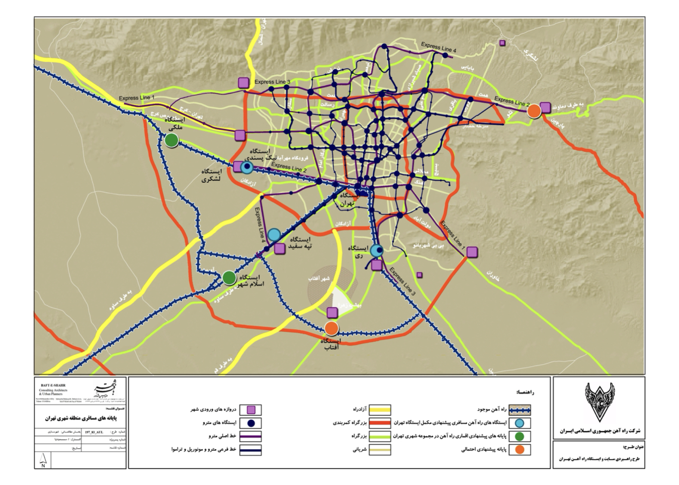
Tehran: Redevelopment of Soleymanieh Lands – South Tehran (Strategic)
Summary of Proposal:
Revitalization of the abandoned brick-kiln excavation pits and transforming the area into a cultural, sports, and arts center for the southern districts of Tehran, aiming to reconnect people, the city, and its natural assets.
Background:
In the southern part of Tehran, southwest of Khorasan Square, a vast area of more than 500 hectares—known as the Soleymanieh Lands—was transferred to the Municipality of Tehran. The City Fabric Consultant was commissioned to prepare a development plan tailored to the unique conditions of the site.

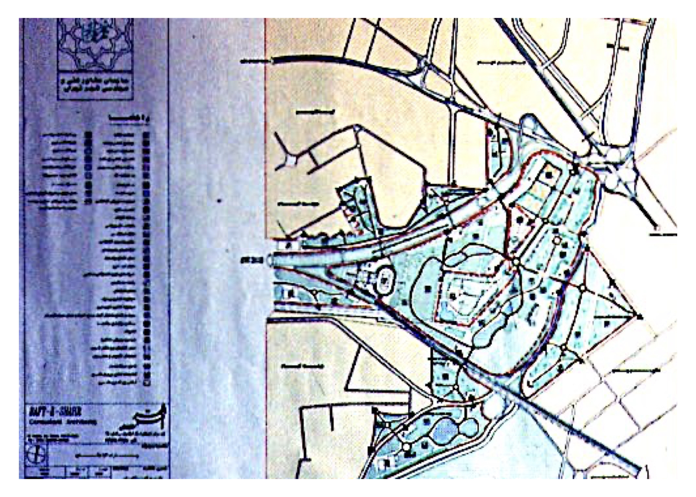
The land presented a wide range of critical challenges, including:
1. Numerous deep pits created by soil extraction for historic brick-kiln industries
2. Waterlogging in several sections due to rising surface water
3. Proximity to existing highways
4. The likelihood of future highways crossing the southern part of the site
5. Adjacent location to the polluted Sarveh-Hesar drainage channel
6. A significant number of high-voltage power pylons and transmission lines
7. Ownership claims made by one of the institutions
…and various additional constraints.
Summary of the Proposal’s Key Concepts and Strategies:
Following comprehensive studies and an assessment of all constraints, the proposed ideas and strategies were formulated as follows
1. The alignment of a potential future highway to the south—previously undefined and outside the consultant’s obligations—was designed and approved based on the position of existing high-voltage pylons and cables.
2. After incorporating all setback requirements for highways, high-voltage power lines, qanat routes, and surrounding urban plans, the land was divided into several functional zones.
3. Four small green spaces adjacent to the highways were designated, each with distinct dimensions and forms, to serve as neighborhood- and district-level public gardens (parks) for areas such as Moshiarieh and other surrounding communities.
4. Creation of a major urban park (Urban Campus) with an approximate area of 250 hectares.
5. Defining the function and role of each park in response to the needs of neighboring districts and ensuring alignment with local urban fabric and internal circulation networks.
6.Activity zoning of the Azadegan Urban Campus to meet the needs of the city as a whole and particularly the southern regions of Tehran.
Project Impact – Outcome:
The strategic plan was approved. Areas that had previously been separated by highways were allocated to green spaces serving the surrounding residential districts and complexes—such as the Moshiariyeh area. The central zone, known as “Azadegan,” was also designed and approved as an urban campus (a system of interconnected gardens). Portions of the plan were gradually implemented, and the results are presented in the “Urban Campuses” section.
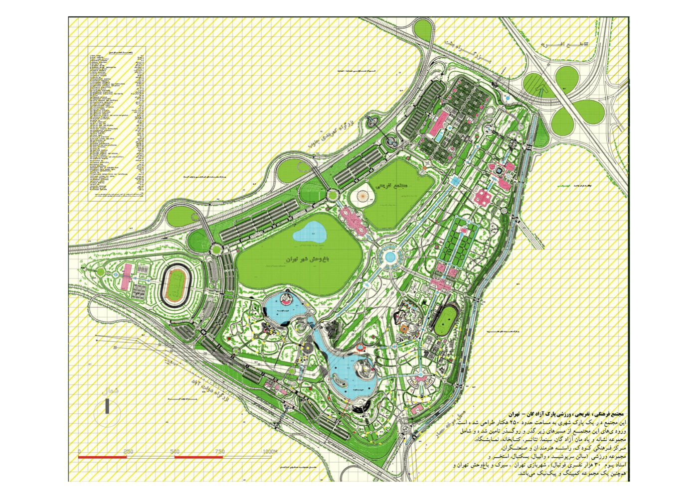
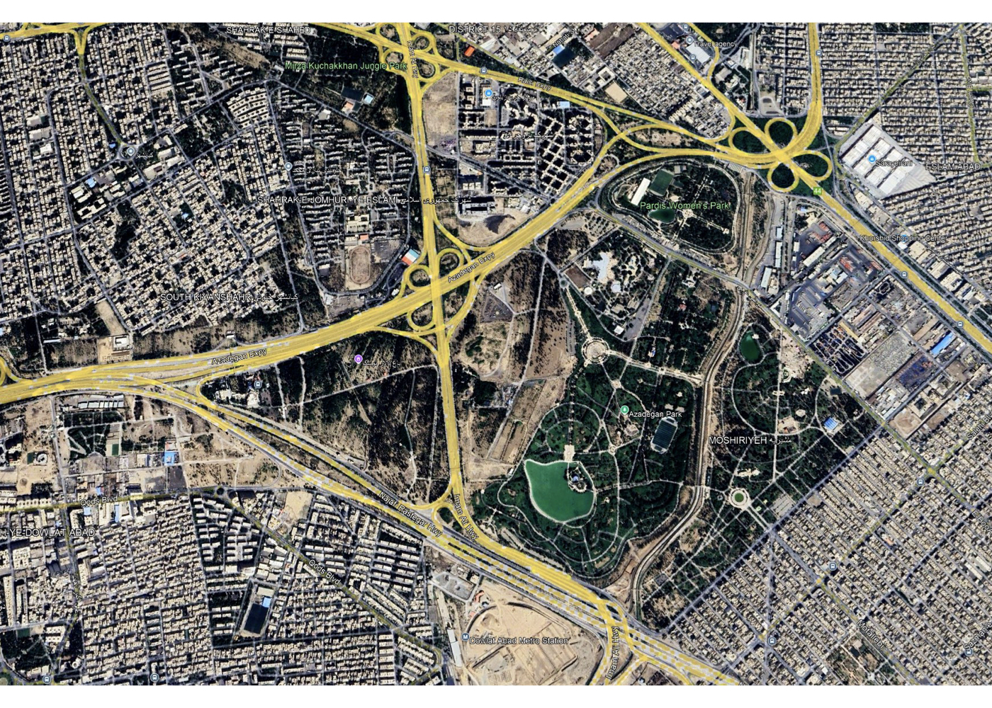
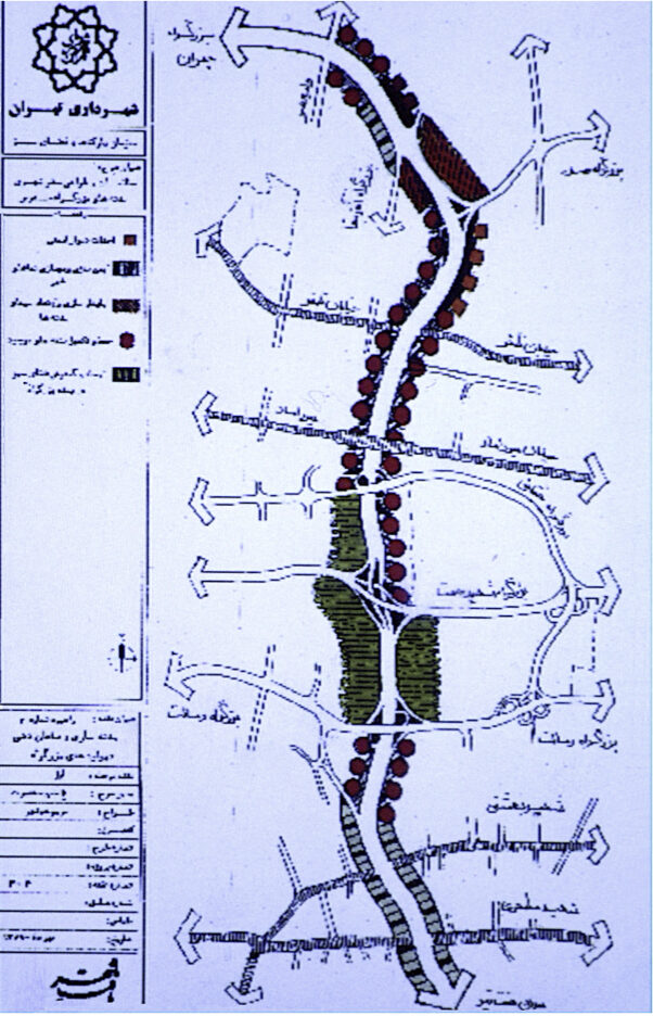
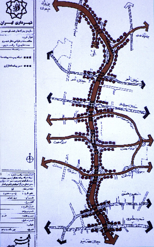
Tehran: Urban–Environmental Design of Modarres Highway (Strategic – Phase I – Implementation)
Summary of Proposal:
Reviving the spirit of a greenway and extending northern Tehran’s natural landscape into the central urban fabric
Background:
Modarres Highway is one of Tehran’s major north-to-central transportation corridors. It is flanked by a mix of residential, administrative, religious, and service-based land uses, and because it traverses steep terrain, its edges have significant elevation differences from the roadbed.
Before this project, the standard method for treating urban highway slopes was to install stone or concrete retaining walls, resulting in cold, monotonous, and lifeless scenery along both sides of the highway. Modarres became the first urban highway in Iran designed under the “green corridor” concept.
Summary of Design Ideas and Executed Measures:
1. The highway should not function merely as a vehicular passage but as an integral, livable urban element.
2. Its slopes offer opportunities for expanding urban greenery and tree cover.
3. Due to water scarcity, drought-tolerant plants and drip irrigation were recommended.
4. The corridor should maintain scenic and spatial variety.
5. Tree placement must avoid obstructing drivers’ visibility.
6. Plant species should be low-maintenance due to slope safety risks for gardeners.
7. Avoid tall concrete or stone walls; instead, follow the natural contours of the land.
8. Integrate leftover triangular or fragmented plots into the highway’s green slopes where feasible.
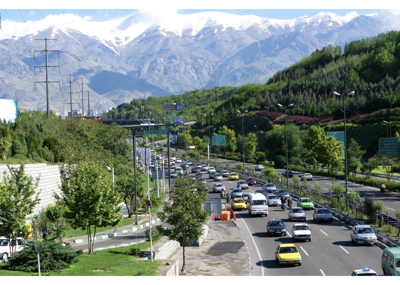
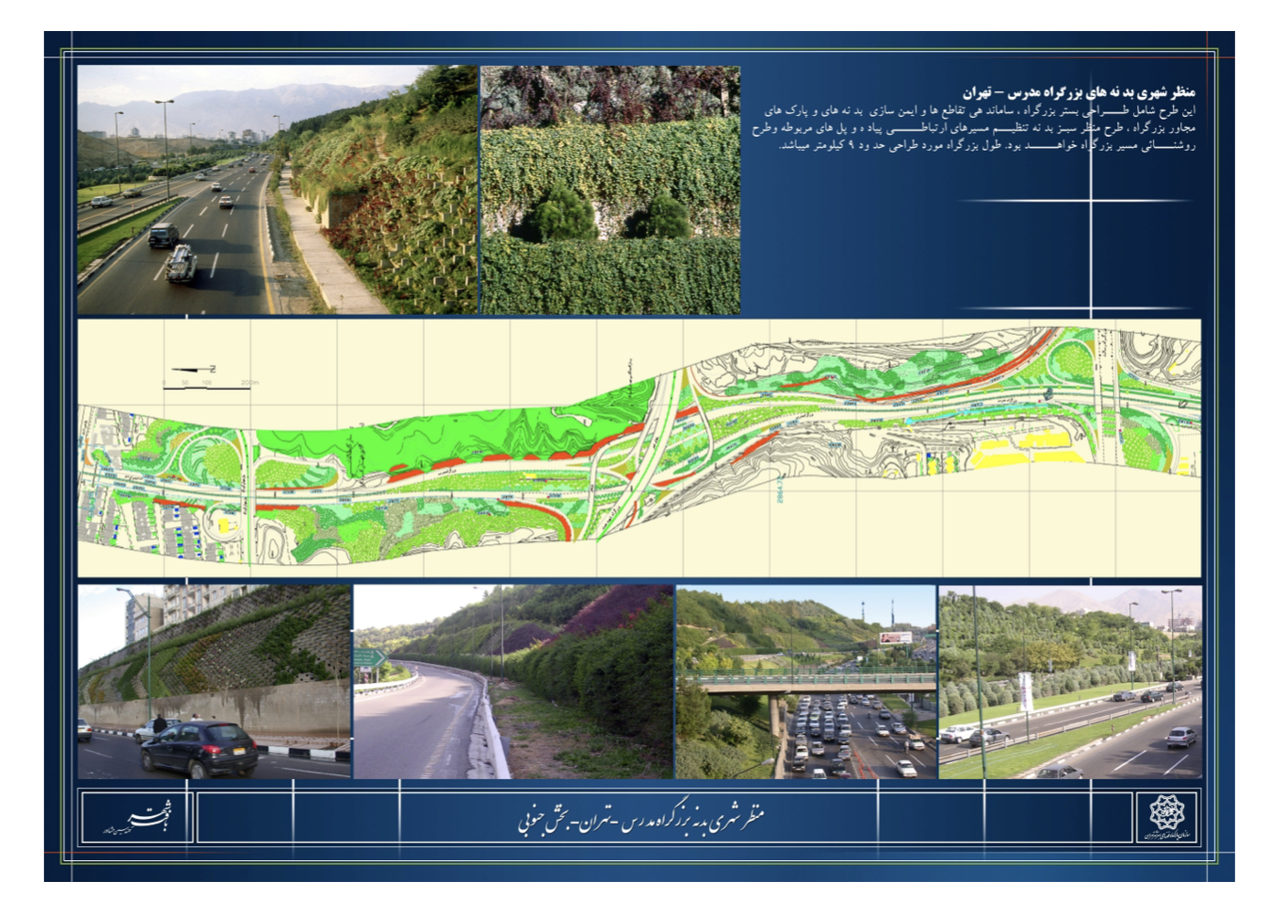
Initial Implementation Outcomes:
Although the project was not fully implemented, the executed portions significantly cooled the highway corridor compared to adjacent neighborhoods in summer and created a more pleasant visual and environmental experience.
Other Implementation Notes:
9. Billboard installations followed safety and aesthetic guidelines suited to traffic speed.
10. Median trees were selected to be leafless in fall/winter, reducing snow and ice hazards.
Project Impact – Outcome:
The implementation of part of the project presented a distinct and appealing model for organizing the surrounding areas and enhancing the landscape quality of urban highways in cities across the country. Despite the concepts proposed in the design, the Parks Organization — as the executing body — chose, based on its own operational policies, to use lawn instead of trees, shrubs, and drought-resistant species. As a result, sprinkler irrigation was installed instead of drip irrigation, which in some cases created problems for passing vehicles and also led to negative public perception regarding water waste.
Tehran: Tehran: Urban – Environmental Design of Streets in District 12 (Central Tehran)
(Strategic – Phase I – Implementation)
Summary of Proposal:
Enhancing safety and tranquility in the historic core of the capital; creating a pleasant public environment; reviving the Iranian “Garden–Bazaar” spirit; improving the urban and environmental quality of central Tehran’s streets; and reconnecting the city center with its natural heritage (linking people, city and nature).
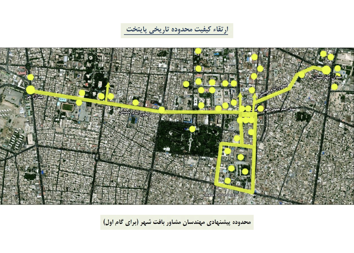
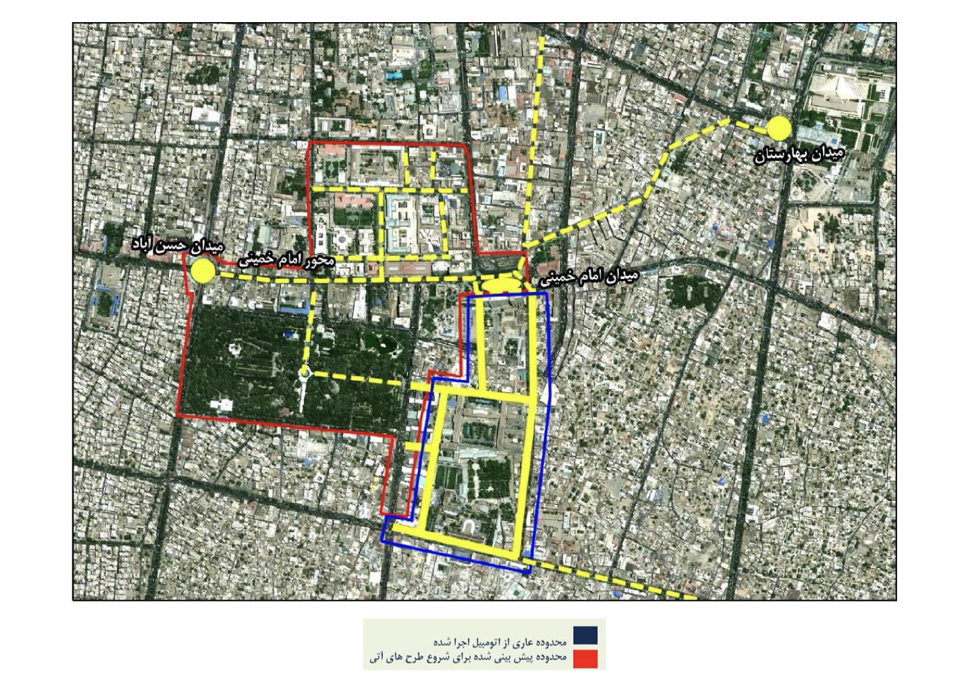
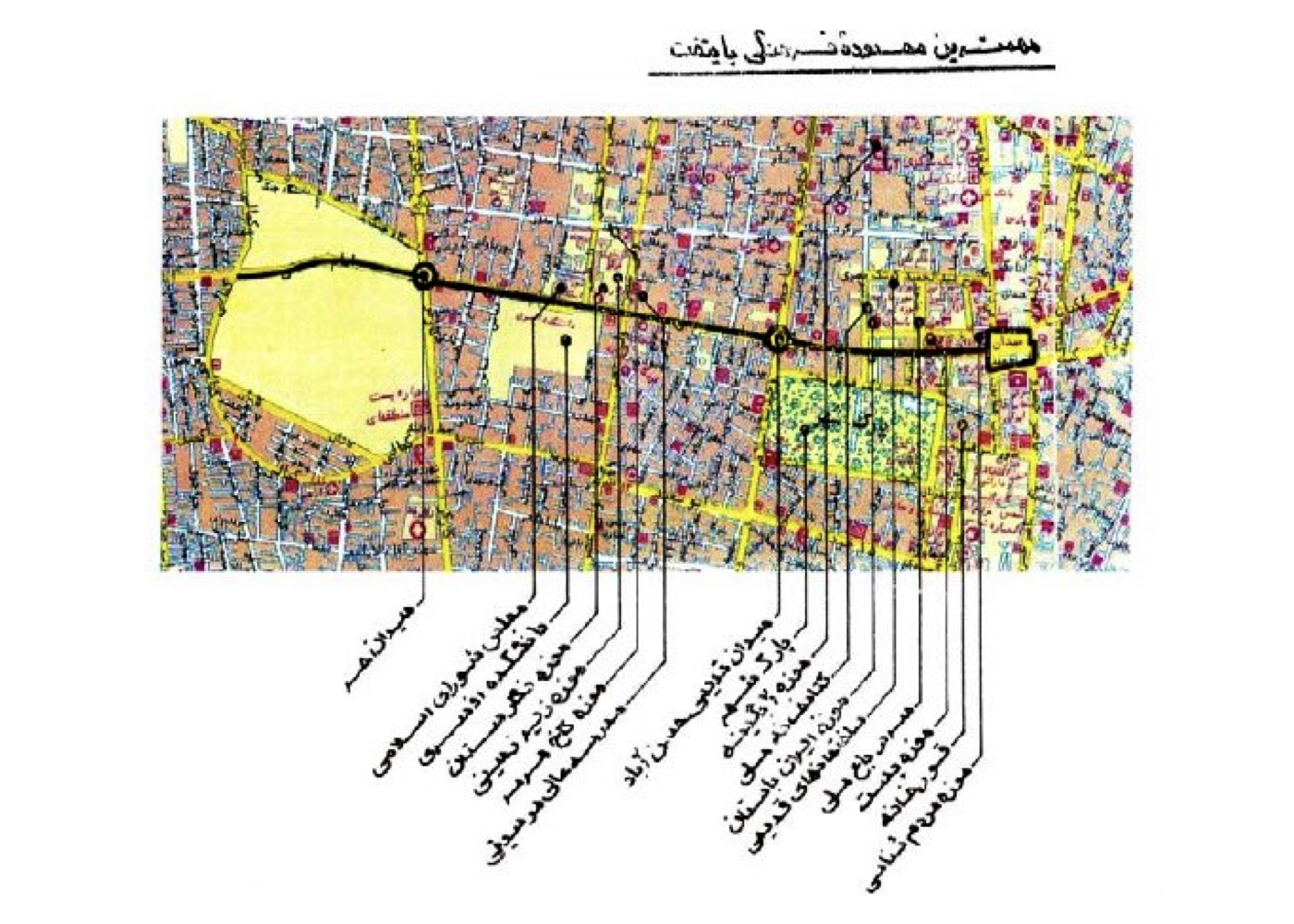
Background:
For many years, unlike major cities around the world, the historic streets of central Tehran had been neglected. Severe traffic problems, the overwhelming presence of motorcycles, and the resulting congestion created unsafe conditions for residents, visitors, businesses, and surrounding neighborhoods, leading to a gradual decline in public activity, shopping, and footfall.
The district municipality planned to replace the pavement surfaces of the streets to address these issues, but the process created new problems that led to complaints from residents, institutions, governmental bodies, and various guilds. At that point, the municipality asked the consultant to reorganize and resolve the existing issues within a short timeframe.
Prior to the project, I had notified the Technical and Executive Deputy of Tehran Municipality that Imam Khomeini Square, Imam Street, and the surrounding streets comprise the largest concentration of cultural buildings and institutions in the city. Therefore, this entire area needed a unified quality-enhancement plan so that Tehran could have a meaningful and identifiable urban core.
The project began with extensive field studies on the threats, opportunities, constraints, and potentials of the area, while construction simultaneously continued—day and night—in four streets where the pavement had already been demolished.
Alongside the implementation of Bab-e Homayoun, Naser Khosrow, Davar, and Sūr-e Esrafil streets, additional areas such as Koucheh Davar-e Kuchek, 15 Khordad Street, 15 Khordad Square, Koucheh Mehran, and Berlin Street were also designed. One of the major challenges was securing agreement and coordination from 36 organizations, institutions, ministries, and guilds—an effort that was ultimately successful.
Public surveys later identified this project as the most successful and most satisfying among municipal initiatives.
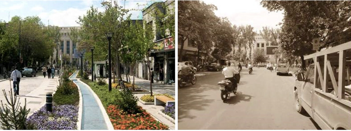
Key Ideas and Design Approaches:
1. Respecting each street’s historical value and the socioeconomic characteristics of residents
2. The project is not merely a change of paving materials
3. The goal is to prepare the foundation for long-term qualitative transformation
4. Enhancing public space and social interaction is a catalyst for positive change in the city center
5. Reviving the cultural and spatial values of historic passages
6. Drawing from global urban-environmental best practices
7. Ensuring the design aligns with major surrounding functions
8. Restoring the diminished presence of nature in the urban core
9. Reconnecting pathways disrupted by car congestion
10.Increasing the per-capita allocation of green space
11. Integrating unused surrounding spaces into the movement network
12. Prioritizing pedestrians in movement, rest, exchange, and overall experience
13. Minimizing traffic within the area through coordinated planning and timed distribution
14. Creating safe and livable nighttime conditions in the capital’s center
Note:
Although the project was later challenged by a new municipal administration and was not fully completed—and while subsequent mayors altered some land uses and spatial functions—the portion that was implemented brought significant and positive transformation to central Tehran.
This improvement was so substantial that the Iranian Cultural Heritage Organization was able to rely on the project’s results and the restored calm of the area to achieve the successful UNESCO World Heritage inscription of Golestan Palace.
In addition, press coverage was highly favorable, and a survey conducted by a reputable research institute (commissioned by the municipality) showed that this project earned the highest citizen satisfaction among all municipal urban projects.
Project Impact – Outcome:
The portion of the project that was implemented demonstrated how, without altering or demolishing historic buildings and structures, it is possible to revitalize an aging urban fabric simply by redesigning and improving the pathways and reconnecting them with natural elements (water, flowers, vegetation, trees, etc.). This intervention transformed unsafe and congested streets into a garden-path and garden-bazaar, and with a reasonable budget, turned these same routes into inviting spaces for leisure, commerce, and social interaction—bringing a sense of calm back to the citizens in the heart of Tehran. Altogether, the project made a meaningful contribution to the city’s sustainable development.
Although the project achieved the highest level of public satisfaction, its final stages coincided with a change in the district municipality’s management. As a result, several impactful actions remained incomplete, including the proper connection of water wells to the stream network and the installation of the statue of Mirza Taqi Khan Amir Kabir in front of Dar ul-Fonoon and the statue of Qaem Maqam Farahani near the entrance of Golestan Palace.
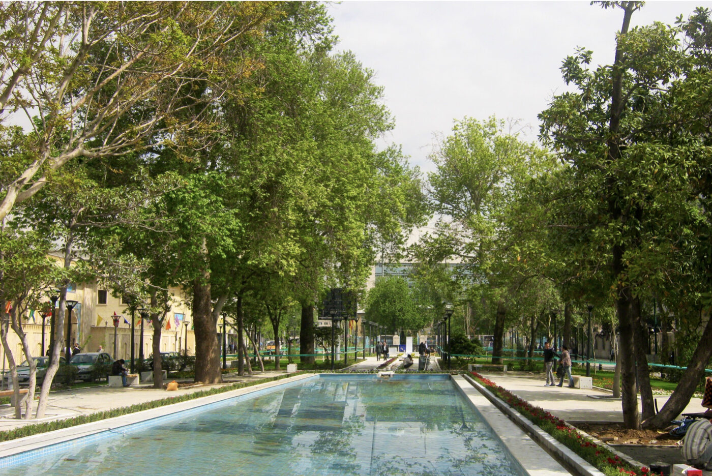

Tehran: Urban – Environmental Design for Velenjak Valley (Strategic)
Summary of Proposal:
Protecting and securing the river-valley corridor, enhancing environmental quality, and extending the mountain landscape into the lower urban fabric
Background:
Velenjak Valley is one of Tehran’s northern central valleys, originating from the Alborz Mountains. The valley remained largely untouched for decades, but in the past 40 years, unchecked urban development and embankment on the valley’s slopes have caused significant ecological degradation.
Project Objective:
To assess risks and reorganize the valley floor and slopes to ensure both safety and landscape quality and enable human access to the upper natural zones via walking and cycling infrastructure.
Summary of Ideas and Interventions:
1. Designing the riverbed and valley slopes to safely channel mountain runoff
2. Extending the mountain’s natural landscape down into the urban edge (up to Chamran Expressway)
3. Slope stabilization designs based on:
A. Soil type (natural or filled)
B. Slope gradient and shape
C. Street and building elevations nearby
4. Creating pedestrian connections across the valley
5. Designing green cover on both slopes, considering:
D. Soil quality
E. Water flow dynamics
F. Elevation difference between upper and lower sections
G. Visual coherence with the surrounding landscape
6. Providing site-specific sketches and photographic documentation to guide staged implementation
Project Impact – Outcome:
If fully implemented, the project will transform the Velenjak Valley into a safe green corridor with a natural and ecological structure—an organized and well-designed green environment for the residents of the neighborhoods on both sides of the valley. This corridor will serve as a connector between people, the city, and nature, ultimately contributing to the sustainable development of Tehran.